|
|

|
|
Blaenau UchafStanding Stone / Menhir
|
||||||||||||||||||||||||
|
|
|
Images (click to view fullsize) |
|


|
Fieldnotes |
|
|
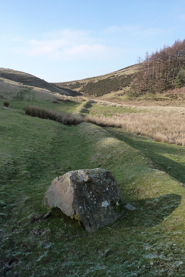
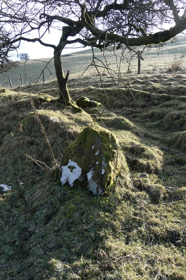
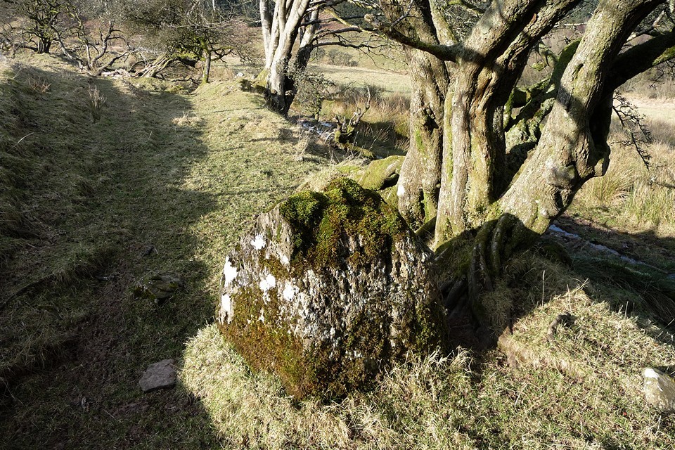
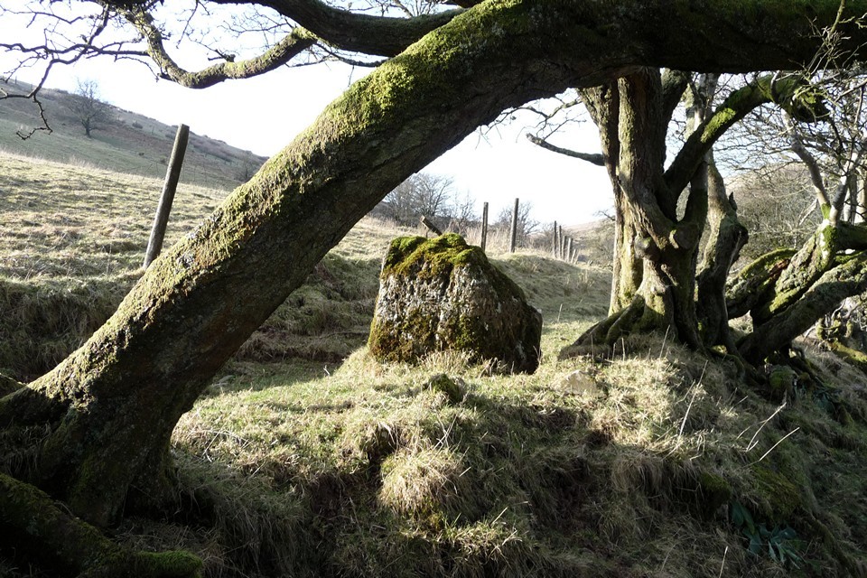
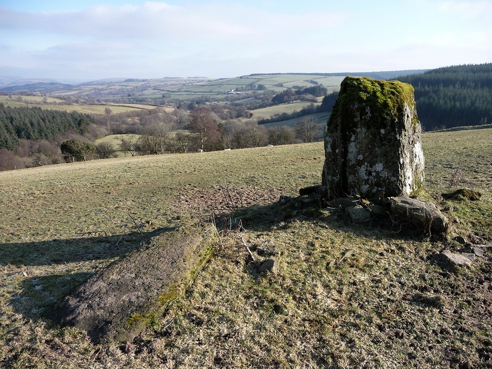
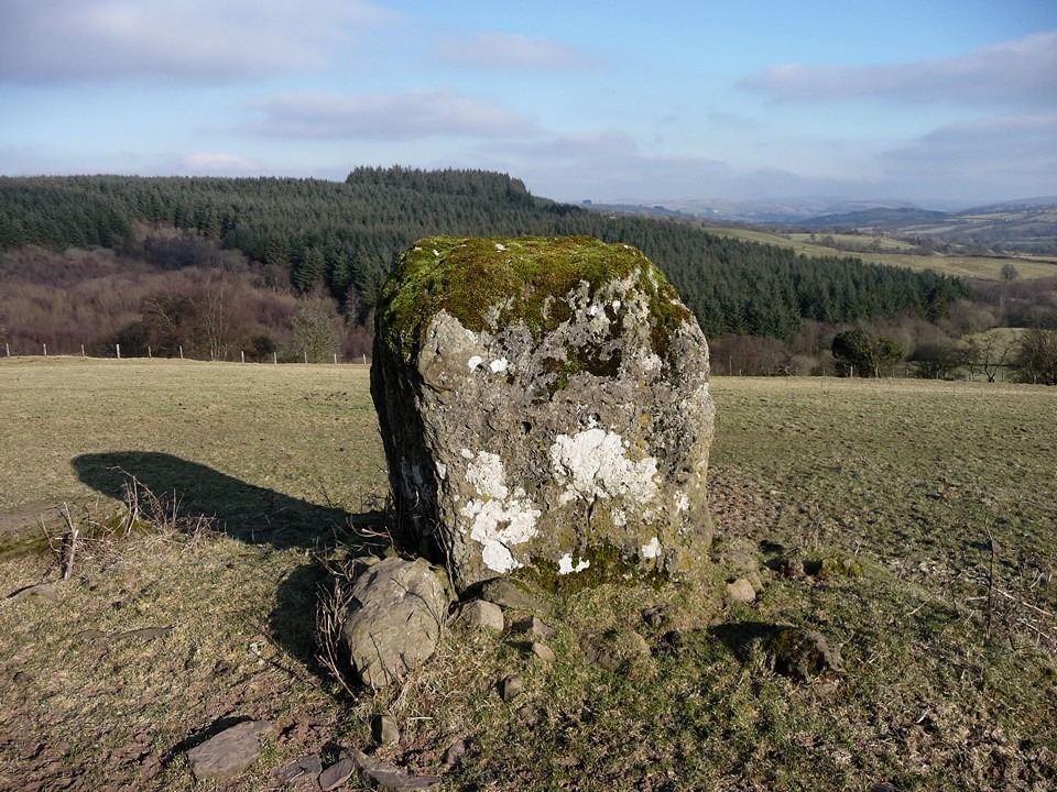
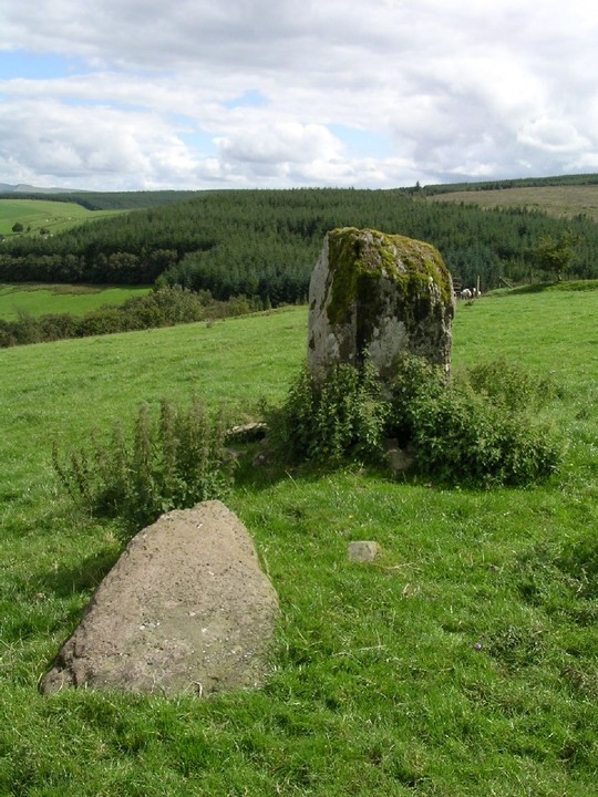
Visited 29.1.2011. The bus dropped me next to Crai Reservoir, and the five miles from there to here took forever, meaning that I'm panicking a bit as times are tight to get back for the last bus at Glyntawe. Still, the sun is shining and it's a beautiful day as I cross the stream at Blaenau Ichaf - "Highest Summits" - and head uphill along the bridleway that will take me towards Nant Tarw. The path climbs upwards and then, wonderfully, the stone is visible on the crest to the left. The sense of panic drains away as I cross the frozen field to the stone. This is, after all, what it's all about and why I put myself through these early mornings. It's a neat block, slightly taller than it is wide, packed at its base by a load of small stones. It sits overlooking a valley running west-east, and the most expansive views are to the NE, away from the daunting (but out of sight) Camarthen Fans/Y Mynydd Du. The countryside stretches away across fertile farmland and impenetrable conifer forest. Next to the stone is a recumbent, pointed slab, which would be a similar height to its companion if it were erect. I'm not aware of that many paired stones in this part of South Wales. It's too cold to stop for long, and my bus-related worries are starting to resurface at the back of my mind, so I press on past the inquisitive sheep that have overcome their initial alarm and are now wondering what the sais is doing in their field. I rejoin the bridleway and continue west. A couple of hundred yards further, as I climb a slight bank to avoid a muddy-looking patch, I see another very similar (albeit smaller) moss-covered limestone block protruding from the bank to my left. It could be natural, but I am wondering if a route is being marked out before me, towards the twin circles at Nant Tarw. Hmm. A few yards further on, and another possible stone sticks out from the bank. Is it part of an old wall? A natural feature? I don't know. The bridleway passes into Access Land and opens out into grassy slopes on either side. A low bank runs alongside on my right, clearly not natural but probably the remains of an old field boundary. Next to it, right in my path (and not incorporated into the bank) is another low, square-ish block. This one could easily be a natural feature, but by this time I'm seeing a processional way taking me to the circle! However, I'm now approaching the Nant Tarw brook, for which the stone circles are named, and head off the bridleway upslope to avoid the wetter valley floor. Perhaps another time, with more time, I should go back in search of any more possibles for this waymarked route. [I notice when I get back and look at TMA, postie has posted a picture of another low block alongside the Nant Tarw, near the circles themselves. My suspicions are well and truly awakened...] |
 Posted by thesweetcheat
30th January 2011ce Edited 2nd February 2013ce |
|
OS map required On Mynydd Illtyd 8km west of Brecon and 1.6km Southwest of Brecon Beacons National Park Mountain Centre. Situated in the gap between the two halves of Glasfynydd Forest. Middle of nowhere. In 'Prehistoric Breconshire' by Children and Nash, Logaston Pr. the name of the stone is given as: Troed Rhiw Wen. At the farm buildings Caerllwyn, head up the single lane tarmac track with a no through-road sign. About 1km west go through a gate across the road, 200m later go through another gate. Over the small bridge and through a gate into the yard of Blaenau Uchaf farm. A bridleway runs up along side the farm house (access through a gate). Follow the bridleway in an uphill curve to the left. When near the top look into the field up to your left and the stone will be in the upper field 100m or so away. The stone reminded me of a smaller version of Maen Mawr (6km or so to the south), a large block of sandstone stood on its longest side. It appears to be raised on a grass covered stone cairn. (Dimensions given as: height 1.68m, breadth 1.3m and thickness 0.94m) |
Posted by elderford 6th August 2003ce Edited 14th August 2003ce |
Miscellaneous |
|
|
Coflein notes this is a "stone pair", the second stone being the triangular recumbent next to the upright block: Troed Rhiw stone pair are a monolith, measuring 1.67m high by 1.3m by 0.94m and set in a 3.0m diameter cairn; with a recumbent stone, measuring 1.7m by 0.81m by 0.4m, lying at its foot, all being set on a cultivation terrace. There are more, possibly placed, blocks along bridleway line running westwards from here along the valley in the direction of Nant Tarw, but these are not listed on Coflein. |
Posted by thesweetcheat 30th January 2011ce |