|
|

|
|
Nottingham HillHillfort
|
||||||||||||||||||||||||
|
|
|
Images (click to view fullsize) |
|


|
Fieldnotes |
|
|
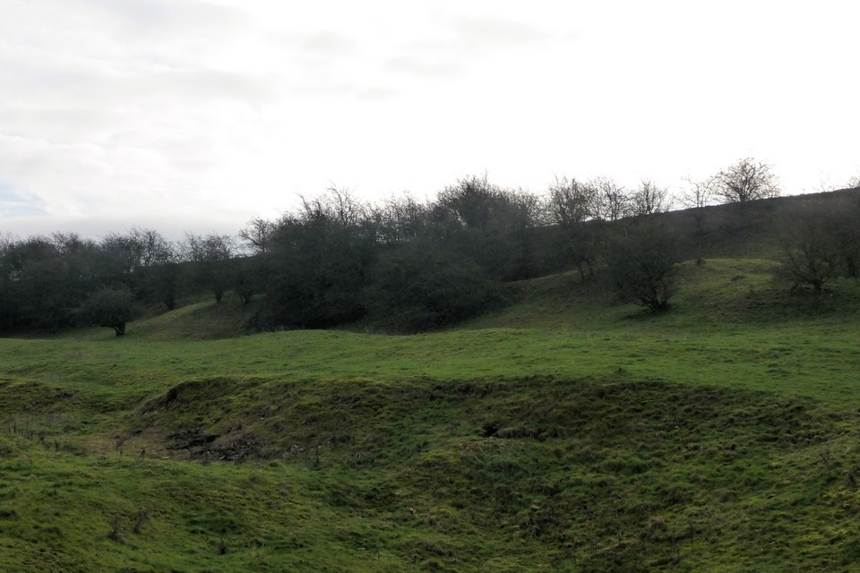
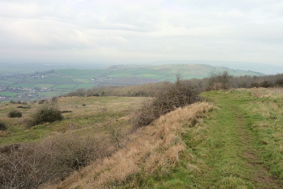
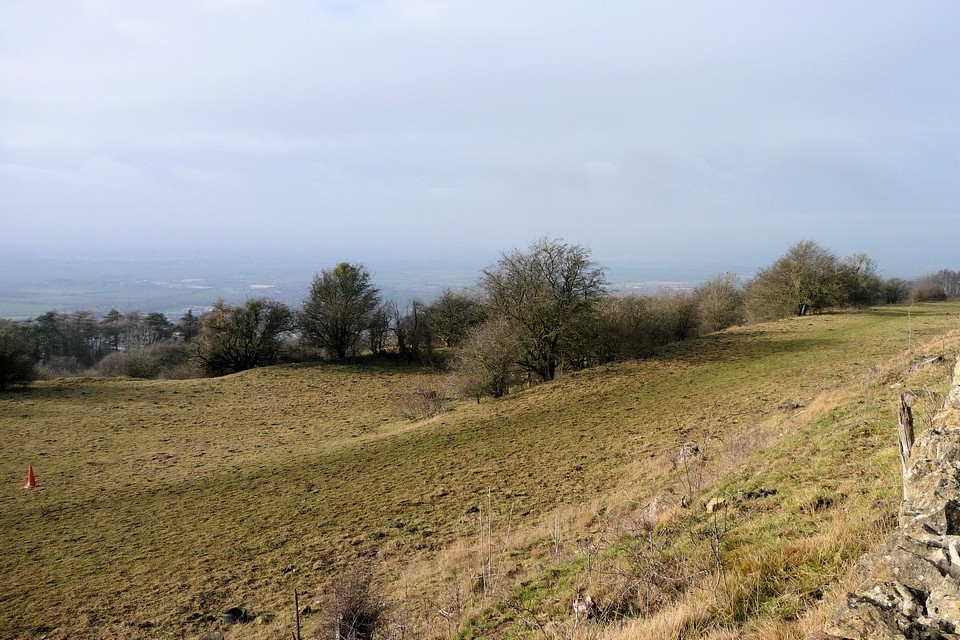
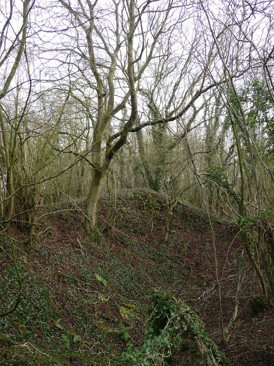
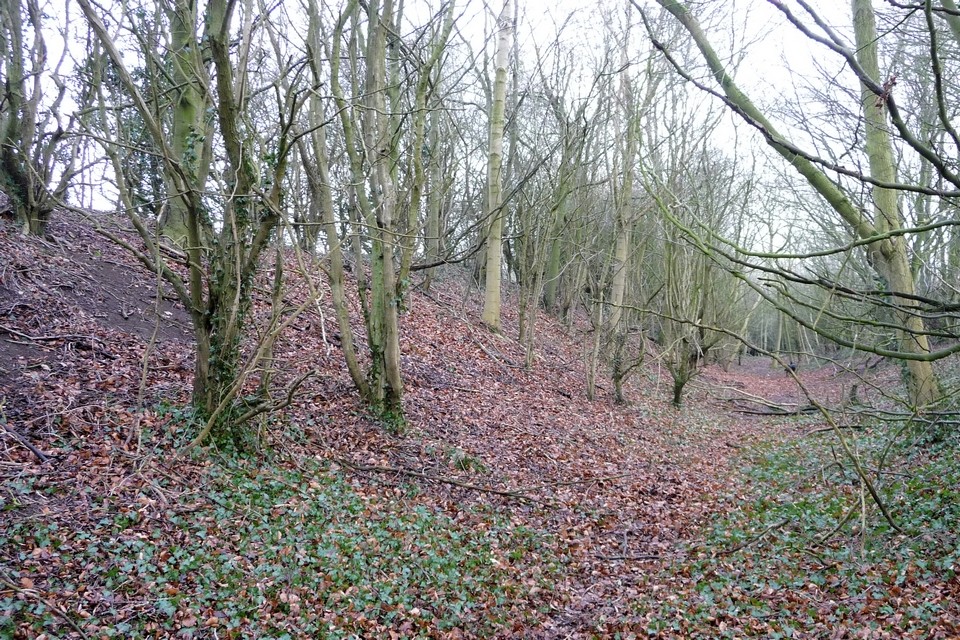
Visited 5.5.12 Access to the site is very easy (for a Hillfort!). Just north of Woodmancote via a minor road off the B4632. There is a free parking area a short walk to the south of the Hillfort and a public access track takes you right through the middle of the site. However, when I visited this track was extremely muddy so be warned. Karen Stayed in the car park with the sleeping Sophie while myself and Dafydd walked up the track. Dafydd was doing his usual ‘faffing’ so I walked on ahead. I soon reached the ditch and bank at the southern end of the Hillfort and was pleasantly surprised to see the ramparts still standing to a height of about 2.5m. This section of the Hillfort is covered in trees although the interior is open grass. At this point I heard the cry ‘Dad – help!’ I looked around to see Dafydd stood in the middle of the track up to his ankles in mud. ‘Come on’ said I - ‘I can’t’ said Dafydd. ‘Why not?’ I asked? - ‘I can’t move, I’m stuck!’ came the reply. I walked back down the track and luckily had his plastic sword I had just bought. I was able to reach over and pull him out without getting covered in mud myself! This is a good place to visit but unless we are in a drought – bring your wellies! |
Posted by CARL 11th May 2012ce |
|
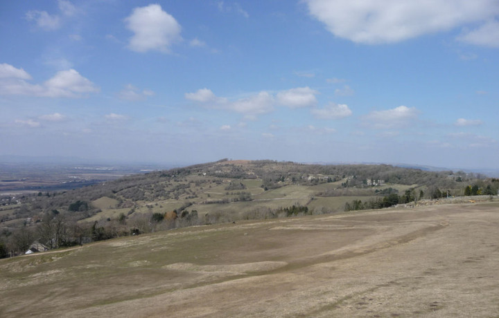
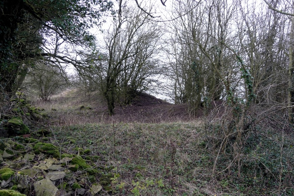
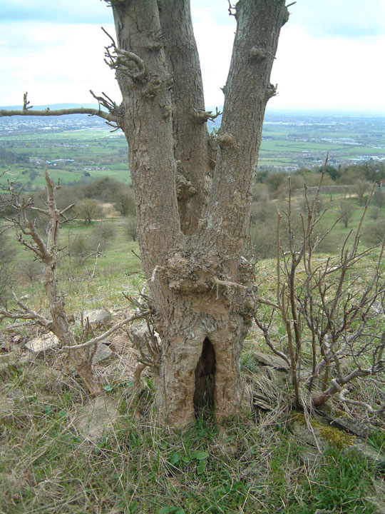
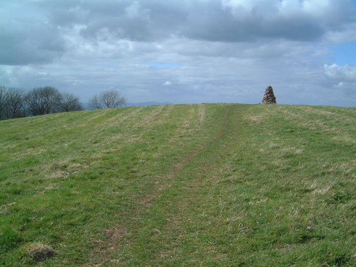
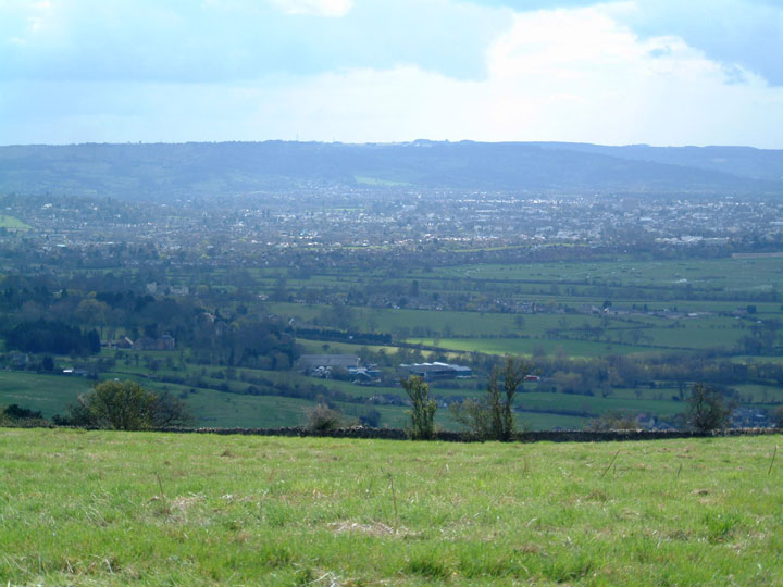
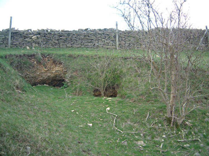
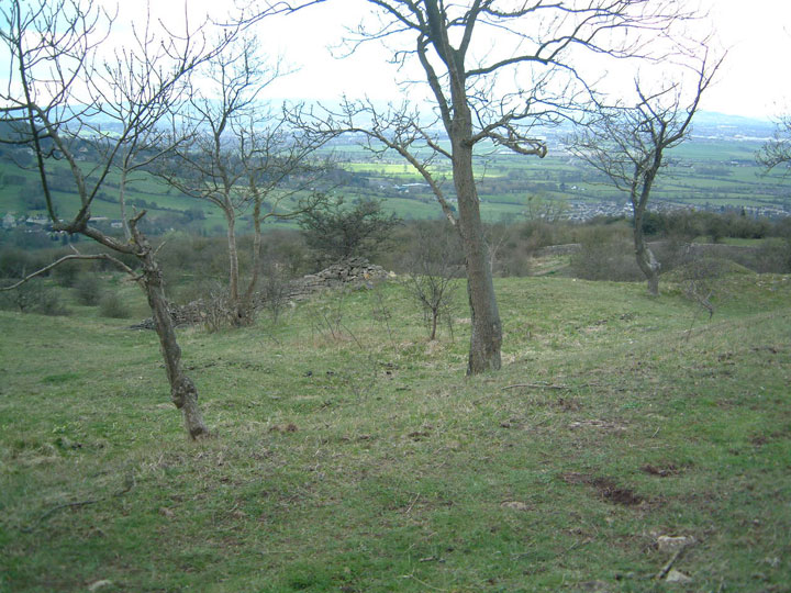
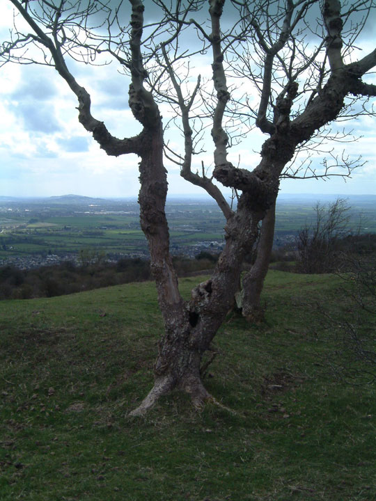
A little off the beaten track and much less visited than its neighbour Cleeve Hill, Nottingham Hill is a spur off the main Cotswold ridge a few miles outside Cheltenham. The whole of the top of the hill is fortified, but the shape of the hill along with various field boundaries make it impossible to see the enclosure in its entirety. But there are some double banks and ditches, and no shortage of interesting things to look at. The slopes are covered with lumps and bumps from stone quarrying ... some of which are ancient and colonised by some strange and wonderful trees. The highest point of the hill is an open field with a cairn at the top (not of any great age, but nice) and a fantastic 360° panoramic view covering the Malvern ridge, Bredon Hill, Cleeve Hill, the Cotswold ridge, various other local hills and distant Welsh mountains. Our ancestors certainly knew a good fort site when they saw one. Nottingham Hill seems to have escaped attention in guide books and is one of Gloucestershire's better kept secrets. I'd venture to suggest there's a bit of a goddessy thing going on there. The earth is full of holes, dips and openings. The lower slopes (particularly on the N and E sides) are liberally dotted with springs, some of which are the sources of local brooks and streams. Most of the trees around the fort are elder, hazel or thorn. There's also a very strange grove of trees on the southern edge just below the fort, where almost all the trees are hollow or have holes in them, growing in the dips and hummocks left by quarrying. Some are small finger-sized holes, some cup-shaped holes with grass and violets growing in them, some large oval holes right through the tree. With gorgeous views over the Severn Valley to go with it, it's an incredibly evocative place. |
 Posted by Rebsie
24th April 2006ce |
Links |
|
Nottingham Hill on BRAC UpdatedNottingham Hill on BRAC |
Posted by markj99 4th January 2021ce Edited 4th January 2021ce |
A few Rock Art locations in Gloucestershire |
 Posted by rockartuk
30th October 2008ce |
A Cup-and Ring-Marked Stone from Nottingham HillWhat a remarkable thing! A cup and ring marked stone? In Gloucestershire? Written up by that stalwart of the Scots CnR fraternity R.W.B. Morris? In 1983? Apparently so. A tidy account of this OOPPRA* provided courstesy of the Bristol and Gloucestershire Archaeological Society. Via the University of Gloucestershire website. (*out-of-place-portable-rock-art. I just made that term up. It's utter tosh really, as the stone found was made of local oolite, so it's not out of place. Which actually makes it seem all the more remarkable as you do not get CnRs down south. everyone knows that...) |
 Posted by Hob
20th January 2007ce Edited 26th February 2011ce |
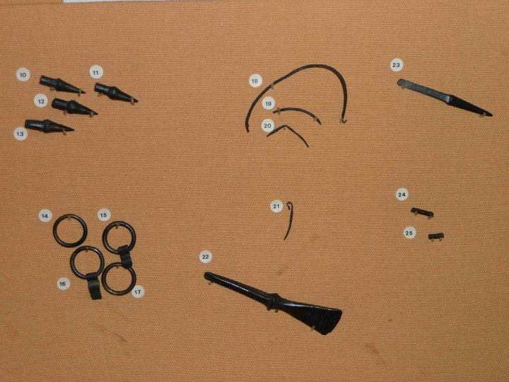
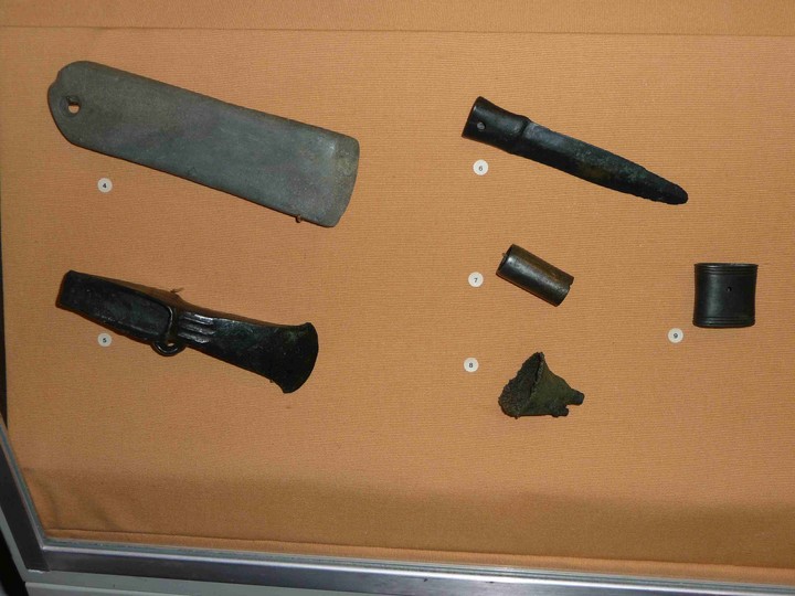
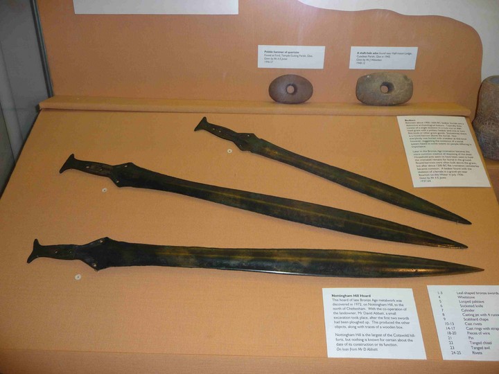
Cheltenham Art Gallery and MuseumVarious items from a Bronze Age metalwork hoard found on the Hill. |
 Posted by Rhiannon
30th June 2006ce Edited 2nd September 2009ce |