Showing 1-50 of 4,331 posts. Most recent first | Next 50 
Below Craid Phadrie is the detached hill called Tomnahurich, or the Watchman's Hill, some of the fields adjoining being called Balliefearie, or the Watchman's Town, and which, besides being thus a "ward hill," was also celebrated in the olden time, according to local belief, as the favourite and chief resort in the north of the tiny race of fairies, and was further used by grosser mortals as a great moat, or gathering hill, on various occasions of public importance. The magistrates of Inverness used also in ancient times to patronise horse-races run round its base. Page 13 in volume 14 of the Statistical Accounts of Scotland (1845).
|
With Easter, the Feast of the Resurrection, the period of abstinence and self-denial is brought to an end. The interrupted pleasures of life are taken up once more, this time in the pleasant setting of spring. On Easter Day itself, the celebrations of the ordinary people began at (or before) sunrise, when in many districts crowds climbed to the summit of a nearby mountain to see the sun 'dancing' in honour of the Resurrection of Christ.
The Rev. John Williams, Glanmor (1811-91) remembered the inhabitants of Llangollen, Denbighshire, ascending Dinas Bran on Easter Day to greet the rising sun with three somersaults, a peculiar variation on this custom {From Bye-gones, 11th December 1895}. In other districts it was usual to take a basin of water in order to see the reflection of the sun dancing on the horizon. It is almost certain that behind this observance was the widespread belief that Christ rose from the dead at dawn on Easter Day; while, further removed from medieval practice, there lurks the hint of an earlier, pagan rite. The custom is also recorded in many English counties and in the Isle of Man and Ireland. p84 in 'Welsh Folk Customs' by T.M. Owen (1959).
|
It is unclear why the two cairns were built together, but local folklore provides its own interpretations. One tale is that one of the mounds is the burial place of a great chief who owned the surrounding land. Each summer he went on a raiding mission with his men, bringing back gold, cattle and slaves. One summer he did not return when expected, but in the autumn the ships sailed slowly into the bay. The body of the chief was carried ashore on his men's shields to be buried in a huge grave, while in the bay below, his galley was ritually set alight.
Another legend holds that the mounds are built on the site of the last battle between the MacDonalds and the MacLeods, two rival clans in Skye. A thick mist descended during the fighting, resulting in carnage so complete that only women and old men were left to bury the dead. All that could be done was to make two piles of bodies, one for each clan, and cover them with stones. In 'Prehistoric Scotland' by Ann MacSween and Mick Sharp (1989).
|
Haven't found a story. But this is quite cool:Remains of what were undoubtedly British trackways connecting Musbury with Hochsdon and Membury and also with more distant camps, no fewer than twelve of which are visible in ordinary weather, and, of course, could be communicated with at night by means of the beacon-fire, can be distinctly traced.
The camps include those at Woodbury, Sidbury, Blackbury, Dumpton, Hembury, Belbury, and Stockland, in Devonshire; Neroche, in Somersetshire, to the north; and Eggardun, in Dorsetshire, to the east. The panoramic view of the Valley of the Axe is one of the best throughout its extent, and the eye ranges far beyond that lovely tract - over hill and dale, with water, timber, and all the other accessories of a perfect English landscape. p. 750 in "The Book of the Axe" by George Pulman (1875).
|
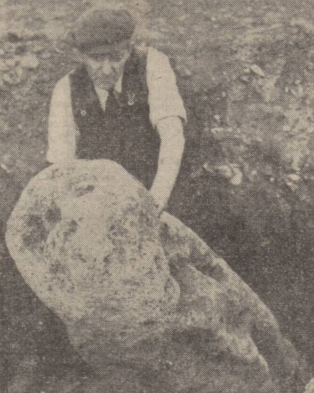
The Cradle Stone.
Serving as a link with the distant past, and once known to every boy and girl in Crieff, the Cradle Stone lies on the south-east shoulder of the Knock. This massive stone, believed to be of Druidical origin, at one time weighed 30 tons and had a circumference of 80 feet, but it has been suggested that during a thunderstorm it was struck by lightning and split in two.
IN days gone by the Cradle Stone was regarded with suspicion by the natives, and it was even suggested that a treasure of great value lay hidden underneath. The story is told how a simple-minded youth named James McLaren, who lived at Barnkittock, was convinced by a few wags of the immense wealth the Stone concealed. One night they persuaded him to excavate beneath the boulder, and while thus engaged the miscreants, who were secretly assembled nearby, set off a number of fireworks bursting around him. Trembling like a leaf and paralysed with fear, the demented youth jumped from the trench he had dug, dashed down the hill and never stopped running until he reached his home at Barnkittock.
A story once told to the children of Crieff by their parents was that they all originated from the interior of the Cradle Stone. (This, perhaps is the reason it acquired such a fascinating name!) Such an enchanting fairy-tale, however, has long since been refuted and it would be a very talented person indeed who could convince the modern child that he or she came from the inner recesses of the Cradle Stone. In fact, I wonder how many children today know where to find it?
Viewed from the Indicator, one of the most magnificent panoramas in the country lies open to the visitor. Extending from the Sidlaw Hills in the east, it includes the full range of the Ochils in the south, and away to the west can be seen Ben Ledi and Ben Voirlich and beyond the twin peaks of Ben More and Stobinian. And to complete this comprehensive picture, the first range of the Grampians outline the northern horizon. On a plateau at the end of the road leading to the "View of Monzie," once stood the "Wishing Tree." Very little is known of this legendary tree, which stood in absolute isolation at one of the highest points of the Knock. In days not so very long ago it became the object of veneration by the maidens of Crieff imbued with the spirit of romance, who would secretly reveal their innermost thoughts in the ardent hope that their longed-for "wish" would be speedily granted. From 'The Knock of Crieff and its Environs' by J.B. Paterson, in the Strathearn Herald, 7th August 1965.
|

|
Local gardener finds ancient landmark.
Mystified by the appearance of a stone pillar protruding slightly through the earth as he was preparing a new layout for the lawn in front of the premises, Mr C.J. H. Lucy, of Teddington Cross Hands Garage, consulted an old ordnance map and realised he had made a discovery. When the earth around the column was removed to a depth of six feet - as yet it is not known how far the pillar is still further embedded - it was seen that the stone was 56 inches in circumference at the top and 70 inches lower down, and was deeply pitted with holes indicating that it may have borne projecting signs at an earlier date.
According to the map, it is named "Tibble Stone," and Mr D.W. Herdman, curator of the Cheltenham Museum and Art Gallery, who has made a careful examination, states that local folklore records that a giant at the back of Dixton Hill is said to have thrown this huge stone towards the Severn at Tewkesbury. His foot slipped, says the legend, and the mark remains on the side of Dixton Hill, the stone falling at Teddington Cross Hands.
Mr Herdman told the "Chronicle": "Mr Lucy is very anxious that the discovery should be dealt with sympathetically and I have suggested to him that the stone should be kept exactly in situ and raised so that it may stand prominently in the centre of what is to become the lawn in front of his garage."
[...] On reference to Bryant's Map of Gloucestershire, published in 1824, the theory [of the stone as boundary-stone] is confirmed as the stone is at the boundary of Tibaldstone Hundred. From the Cheltenham Chronicle, 17th April 1948.
Why does this look much bigger than the existing stone (if it does?)?
|
About one mile south of the town of Barrhead is Duncarnock Hill which was once the site of an Iron Age fort. The hill, which is nearly 700 feet high and precipitous on three sides, is shrouded in legend. According to local folk-lore, it and the nearby Neilston Pad were formed when two prehistoric giants scooped up huge handfuls of earth and threw them at each other. The Craigie, as the mighty mound is sometimes known, is also reputed to have been the site of human sacrifices offered by the Druid priests of the Iron Age Celts to their nature gods. In an article about the Glanderston Dam disaster in 1842 in the Paisley Daily Express, 11th December 1989.
|
Description of the monument.
|
How Thetford Got Its Hill.
It requires no inventive novelist to provide Thetford and its neighbourhood with ghostly company. According to legend indeed, this spot early made its acquaintance with beings of the other world, for local folk-lore (a field amazingly neglected by many investigators), has it that the Devil presented us with Castle Hill, cleaning his spade at Thetford after digging Fendyke, near Weeting.
The writer of this article was one day amazed to be accosted in King Street by an old countryman who, without a smile, asked to be directed to "where the Devil scraped his spade!" A blank look of interrogation brought forth the fact that the Castle Hill was the object of the old fellow's search, and he was sent happily on his way to gaze upon what he firmly believed to be literally a diabolical addition to local scenery.
Another legend attaching to the hill, and associating it with the devil, is that his Most Satanic Majesty at midnight on All Hallow E'en (the eve of All Saints Day), is wont to ride furiously round the hill twelve times on a white horse. Many motorists have thought that one-way gyratory traffic was the invention of the devil! In the Bury Free Press, 11th June 1932.
|
A comeback to ward off the gremlins.
(Story: Neil Churchman)
Superstitious managers at Hinkley Point Nuclear power station are hoping a 2 1/2 foot pixie will stamp out gremlins at the plant. Problems have plagued Hinkley Point for some time and last month the station was put out of action by floods. Part of the station was once a Bronze Age burial site and a mysterious mound, known as Pixie Mount has been left there overgrown and untouched.
A model pixie handed over when the plant was opened in 1966 was removed when Prince Charles toured the station 18 months ago. But now officials have decided the pixie should be brought back - just in case he was responsible for the floods on December 13. "Pixies don't like to be moved," said station manager Mr John Outram. "I don't think we will be moving him again." From the Western Daily Press, 6th January 1982.
|
Babcary Tout or Wimble Toot.
A question with regard to the traditional battle of Babcary was asked [in this newspaper] in February 1934 by a reader, who said it was believed that a battle was fought in the valley around Babcary where the trenches and a burial mound are still to be seen.
Nothing definite with regard to any such battle appears to be known, but one reader replied that "two fields at Foddington are called 'Peace' for there the peace was signed.
"The burial mound, 45 yards by 25 by 3 yards high, has fourteen large trees on it. One has fallen, but the wood is not alllowed to be used by order of the Graves Commission. Within the memory of residents there was an iron fence and gate, but they have been somehow mislaid. This big mound... has the name of 'Wimbletout.' "
[...] the word 'piece' frequently enters into field names. Is it not more than possible that the name of the fields at Foddington is 'Piece' and that this has become confused with 'Peace' and so given rise to the tradition mentioned by the correspondent quoted above? - M. In the Taunton Courier, 30th October 1937.
|
Excavations of Cursus at Tormore
Archaeologists have been excavating the recently-discovered 1.1km long cursus on the island of Arran. The article in The Scotsman shows the Lidar scans that alerted them to the parallel mounds (now merely 30cm high). Few examples are known from the west coast of Scotland.
|
You can see a picture of the Porosphaera beads (mentioned above by Gladman) in this article by Christopher Duffin: 'Herbert Toms (1874–1940), Witch Stones, and Porosphaera Beads'. Herbert Toms collected lots of folklore about naturally perforated stones. It's in Folklore v.122, April 2011.
|
"Bervie Brow," so called, is a promontory on the north side of the Bervie stream, and its very existence seems to bar any extension of the railway to the north. Another name of the "Brow" is "Craig Davie," based on the tradition that King David II landed here from France under shipwreck. This King turned the hamlet into a Royal Burgh in virtue of a charter granted in 1362, which charter again was renewed by James VI in 1595. In connection with the King David Charter a rather curious story may be related. The Royal patronage, it is said, was given on account of the kindness the inhabitants extended to the ruling monarch when his vessel struck the rocks referred to above. The tradition is that the King on reaching "terra firma" met a party of fishermen, who were cooking fish on the beach. On soliciting a share of their repast, one of the fishermen gutted a couple of fishes and put these on the fire. Another fisherman shouted out "Gut three." The King noticing this generosity addressed the former speaker in doggerel rhyme thus:
"Then Gut-three
Your name shall be."
And henceforth, it is said, the man was known as "Guthrie", a surnamme now quite common all over N.E. Scotland. From the Montrose Standard, 22nd April 1921.
|
There is a standing stone about four miles away from here. It stands in a field on the right hand side of the road as you go to Derry. The ground on which it stands belongs to William McDaid, who purchased the land a year ago from a man named Johnson. It is situated in the townland of Ardmore, Muff, in the parish of Iskaheen, Co. Donegal. It consists of a rectangular block of regular shape and is about seven feet high, four feet wide, and about two feet deep. It stands exactly on its end. The side facing the South is indented with little cup-like insertions, with a sort of rings or halo around them and about two inches out from them.
The late Mr Hart who lived at Kilderry Castle (once the residence of Sir Cahir O'Doherty) employed a number of men and got them to dig around the stone to see if they could unearth a grave or other, which might account for its being there. The earth that they dug out was carefully examined, but nothing was found, only two large iron balls resembling cannon balls but much larger. Collected by Hugh C. Byrne, for the Schools Collection of folklore in the 1930s.
|
Replies To Queries. 496 - The Golden Valley.
The origin of this name goes right back to the days of the Druids - indeed, farther than that. At Upton Cheyney in the Golden Valley may be seen some stones called Druidical stones. Their tops are lichen-covered and the weather of centuries has smoothed their surface here and there, and stunted them, leaving them inviolate and deserted, sole survivors of a pagan temple.
There is a tradition that somewhere near them lies buried a golden calf. Here then is a remnant of the rite of Mithras. My father came from this district and he has told me of several attempts made to discover this golden calf.
I believe the Bath Archaeological Society found some remains here many years ago. The valley where the golden calf was worshipped many centuries ago thus keeps its name in the present name of "The Golden Valley." - S.W. Hayward, Westmead, N.S.W. Bath Weekly Chronicle and Herald, 13th February 1937.
|
The field on which the [annual ploughing match of the Moulin Agricultural Association] took place was a nice slope below Baledmund House, on Pitfourie Farm, kindly granted for the occasion by Mr Charles McLauchlan, tenant of the farm. At the south end of the field stands an old monolith which has long been an object of historic interest and conjecture. This large upright block is believed to be a very old Druidical stone, which probably marked the burial ground of some ancient Pictish chief.
The ground in the neighbourhood of the stone was at one time the site of Moulin Market, which lasted for a week, and this stone was known in Gaelic as "The stone of the bargains," as when a bargain was concluded it was usual to shake hands across the stone, no doubt following some custom that has been lost in the mists of antiquity.
A little to the west of the stone is a knoll on which a few larch trees are growing, and which is known in Gaelic as "The knoll of the cattle," where the cattle were herded on the occasion of a market. An examination of this knoll, however, a few years ago showed that it was chiefly artificial, and that it had formed the site of an old fortified dwelling. The artificial mound is about ten feet high, having a breadth of about forty feet, and the top had at one time been surrounded by a palisade. The 'Carn a' Mheanbh-Cruidh' is marked on Canmore's map, though there's no recent investigation of it to fix a date to it. I'd like to think the origin of the name is a bit more ancient and romantic than just sticking cows on it on market day (surely a trickier plan than popping them in a pen on flat ground). Mentioned in the Perthshire Advertiser, March 4th 1914.
|
From all I have seen myself of that kind, or read, or heard of, I know not a more singular [Rocking Stone] than that which I am describing. It stands at Castle Treryn, a promontory, consisting of three distinct piles of rocks, near the southermost part of the Land's End. On the western side of the middle pile, in a very elevated situation, lies this immense stone, so evenly poised, that a hand, nay a finger, may move it.
And what is still more singular, not any force, however applied in any mechanical way, can remove it from its present situation. It was on a holiday, not long ago, that a vast number of miners and peasants assembled together, for the purpose of hurling this prodigious rock into the sea. Every effort was exerted, and all their force applied to no purpose. The vast orb moved as if to mock their toil, but still retained its equilibrium. The people beheld it with astonishment: they concluded it was retained by superanatural agency, and returned venerating the stone.
Those who are hereafter to visit this place, and have not yet beheld this almost miraculous spectacle, will rejoice that it still keeps its centre, and resists every effort to move it. Yet if it was to fall, I much wish to be a witness of its overthrow. So huge a mass precipitated, like the stone of Sisyphus, and rolling with prodigious ruin from precipice to precipice, over rocks into the sea, must afford a very striking spectacle. As my favourite podcaster says, "Be careful what you wish for." I'm glad they put it back up though; I think very fondly of my visit to see it and would recommend it to anyone. From E.D. Clarke's 'Tour through England and Wales in 1791.'
|
Oldest decoratively carved timber in Britain
Historic England show off the most ancient decoratively carved piece of wood yet found in Britain - recently carbon dated to around 4620BCE, about 500 years older than the oldest previously known example. The Mesolithic timber was found in peat not far from the River Lambourn, by Derek Fawcett, about four years ago. You can spin a 3D model around on the link. (Don't expect anything too decorative about the markings(!) but you can indulge in some wonder that someone made them 2000 years before Stonehenge was built).
|
Near Steeple Barton is another ruined cromlech, also called the "Hoar Stone," which is now only a confused heap of small stones, having been broken up by an ignorant farmer. Some fifty years ago it was much more perfect, and two of the side stones were standing about four feet out of the ground.
"They used to say that whenever they tried to drag them two pebbles away with horses, they would roll back of their own accord. Them two pebbles growed out of little uns; at least that's my way of thinking."
- From George Nevill, of Yarnton, aged 74, March 1901. Stray Notes on Oxfordshire Folklore by Percy Manning, in Folklore v13 (September 1902).
|
... The figure is not always visible; he is most often to be seen in bright summer mornings and evenings, or during the winter, when there is a hard frost, or a slight fall of snow. Sometimes you may see the giant distinctly half a mile off, but on approaching the spot the turf appears as smooth as on the adjacent hills.
[...] We may add that this remarkable figure is about to be restored, and that the vicar of Glynde, near Lewes, Sussex, is treasurer to the Restoration Fund, which has been headed by the Duke of Devonshire. Small subscriptions of half-a-crown are solicited in preference to larger sums, so as to excite a widely-extended interest. The first sod for the restoration has already been turned by Mr Phene, but the work has been suspended for a time to allow persons interested to see it in its original condition. The Graphic, 7th February 1874. The campaign seem to have progressed at some pace, as the newspapers in April report that the outline had been completely restored (with white bricks).
|
White Horse Hill, Berks, 1780.
The Scowering and Cleaning the White Horse is fixed for WHIT MONDAY, the 15th Day of May, on which Day, a SILVER CUP will be run for, near the White Horse Hill, by PONIES that never started for any Thing; and to be the actual Property of Persons belonging to the County of Berks; the best of three Two-Mile Heats. To start at Ten o' Clock.
The same Time, A THILL HARNESS will be run for by Cart Horses, &c. in their Harness and Bells, the Carters to ride in Smock Frocks without Saddles. Crossing and jostling, but no Whipping allowed.
A FLITCH of BACON to be run for by ASSES.
A good HAT to be run for by MEN in SACKS; every Man to bring his own Sack.
A WAISTCOAT, 10s. 6d. Value, to be given to the Person who shall take a Bullet out of a Tub of Flour with his Mouth in the shortest Time.
Several CHEESES to be run for down the White Horse Manger.
SMOCKS to be run for by Ladies; the second-best of each Prize to be entitled to a Silk Hat.
CUDGEL-PLAYING for a GOLD-LACED HAT and a Pair of BUCKSKIN BREECHES, and WRESTLING for a Pair of SILVER BUCKLES and a Pair of PUMPS.
A JINGLING MATCH by eleven blindfolded Men, and One unmasked with Bells, for a Pair of BUCKSKIN BREECHES.
A GRINNING MATCH through a Horse's Collar for Five Shillings.
An APPLE to be taken out of a Tub of Water for Five Shillings.
Riding down the Hill upon Horses Jaw Bones, for 2s 6d.
And sundry other Rural Amusements.
(The Horses to be on the Hill, and entered by Nine o'Clock. - No less than four Horses, &c. or Asses to start for any of the above Prizes.) Oxford Journal, 13th May 1780.
|
Cairnconan's Famous Pictish Dwelling. A summer evening ramble. (From a Correspondent).
[...] Cairnconan Hill is by far the highest point in the district. Looking backward from the top of the hill the sea, the steeple, the water tower, and the chimney stacks of Arbroath stand out against the horizon. The Law Hill, Parkhill, and Lunan Bay can easily be traced, and still further eastward we can trace Bolshan Hill and the braes of Rossie. From the top of the hill on a clear day portions of no fewer than five counties can be seen, the range extending as far as the Firth of Forth with the faint outline of the Lammermoor Hills in the far distance. From the same point the Grampian range of mountains seem but a short distance away, but the light is deceptive and in reality they are a long way off. Dark Lochnagar is far away dimly outlined against the northern skyline. [...]
The farmer of West Grange related an amusing story to us about the ancient dwelling place. Almost every year it is visited by many more or less interested visitors. The interior of the weem or house is concave, the stones overlapping each other. The entrance at the top is very narrow only allowing the entrance of a sparely built man, and the depth of the floor of the dwelling is about 8 feet from the door or opening.
One day a number of years ago a visitor of rather small stature rather imprudently ventured to descend into the cavity. When it came to the getting out he found to his consternation that it was quite impossible for him to reach the top. He howled himself hoarse, and might have stayed there for a long time as the "house" is seldom visited and is at a considerable distance from the roadway. However by means of piling up a quantity of loose stones that had fallen down into the interior of the dwelling place he managed to scramble out.
The moral of all this is - don't visit the "Pict's house" at Cairnconan unless accompanied by friends and don't venture into places that you do not see some way of getting out of.
Mr Garland also informed us that the "house" is now very much diminished in size from its original state. It was at one time connected with another chamber by a long narrow passage covered with flagstones, but this interior chamber is now filled up and is not open to visitors. Arbroath Herald, 23rd July 1920.
|
As country folk will tell you, that bird called the oystercatcher, boldly dressed in black and white with a long straight bright red bill, has largely taken the place of the once-common lapwing, or "peesie-weep" in our fields. It's a bird with several names - sea pie, mussel-picker, and "the bird of St Bride."
A reader tells me that when he was up Kingennie way recenty he noticed a small flock of oystercatchers busily feeding in a newly-ploughed field. 'I thought it was something of a coincidence that what are called 'the birds of St Bride' should be so near that ancient structure near Kingennie house called St Bride's Ring. The name St Bride's Ring suggests a religious site, but this is in fact a strongly-built circular hill-fort, defended on three sides by steep rocks, and I have often wondered how it came to be associated with St Bride.'
---
Replying to a query about St Bride's Ring (Kingennie), our Diarist says it is not known how St Bride became associated with what is really a hill or a headland fort. In its earliest form Kingennie is given as Kingaltenyne, and translated from the Gaelic this means "headland enclosure."
The fort, with its ring of ponderous stones, has steep rocks on three sides, and a small stream at its base. This, incidentally, is the Monifieth Burn, which has its source in a nearby quarry.
Dundee Courier, 1st March 1988 / 15th June 1992.
There's lots of tales about St Bride on Brigit's Sparkling Flame including that when someone was after her on the Hebrides, some oystercatchers kindly covered her with seaweed to hide her (and since then they are 'Gille-Bhride', servants of Bride, and even call her name). She was imprisoned by the Cailleach in Ben Nevis, and was rescued on February 1st, releasing Spring. There are many features in the Scottish landscape named after her.
|
A legend survives in connection with the storming of Entons Castle [at Capel], which relates that the Danes, having captured the stronghold, carried away the castle gates and bell to Anstiebury Camp, whither they also took the female captives accumulated in the course of their victorious progress through the Hundred of Wotton.
The women one night contrived to admit a number of Saxon warriors, who overcame the garrison and afterwards hung the recovered castle-bell in Capel church steeple. Walter Moore in the Dorking and Leatherhead Advertiser, 24th June 1905.
|
David Lyons' photo of the very fancily-decorated Bronze Age pot found inside the Glebe Cairn.
|
No I don't know if this happened at the Round. But if local military pixies were going to live anywhere, you'd think it would be here. I suppose he might have meant they were wearing red clothes, like soldiers - this is a comparison you read elsewhere.An old man at Newquay told me that a Farmer Lane, who lived near Colan about forty or fifty years ago, was riding his horse one night to his farm, when numbers of soldiers sprang up on the horse, all over it. The man said they were very small. I forgot to ask how they were known to be soldiers. - Miss Barbara C. Spooner. The Cornish Guardian quoting the journal of the Royal Institution of Cornwall, 28th May 1915.
|
Includes a photo of the round from 2008. I suppose the fact the road goes through it suggests it's the original route to the round?!
|
There is a way up from the beach to the mainland part of Trevelgue Island earthworks that is like a ship's gangway, between walls of rock. Up this, Bill Pierce said, the invaders drove the cattle they stole. They pastured them on the island, waiting for the ships to come that were attacking other parts of the coast. When the ships came they embarked the cattle and sailed off. I asked where he got this from, and he said, "Old history books." - Miss Barbara C. Spooner, Coombe Bank, Kingston-on-Thames. The Cornish Guardian quoting the Journal of the Royal Institution of Cornwall, 28th May 1915.
|
[Bill Pierce of St Columb Minor] said that there is another Piskey Ring near the barrows in the Newquay fields. The men who fought there took their last stand fighting in a circle, back to back, and their blood, falling to the ground, formed the Piskey Ring. I asked Pierce why it was called Piskey Ring, hoping to hear more, but he didn't know! I remember hearing, about six years ago, though I do not remember if the source was reliable, that people had seen the battle fought in the air, over the Newquay fields.
The same man, Pierce, told me that if anything was thrown into a Piskey Ring at or after midnight, it would be found flung on to the grass outside before daybreak.
Barrow Fields, Newquay. My uncle says he has heard that a headless horseman rides through the air over these fields at midnight, carrying his head under his arm. He did not know who the horseman was, nor that he had even been seen as well as heard. Horses are also heard rushing over head.
Miss Barbara C. Spooner. The Cornish Guardian, quoting the Journal of the Royal Institution of Cornwall, 28rh May 1915.
|
I [spoke with] an old man of St Columb Minor, called Bill Pierce, who saw Copeland Borlase open the Trevelgue barrows. On the high cliffs, at an equal distance from each of the two Trevelgue tumuli, is a Piskey Ring, with thistles growing here and there on the outer edge. Of this ring he said that it was always there no matter how much the cattle trampled on it. Indeed, I do not remember a year in which I did not notice that Piskey Ring in the same place; I certainly have seen it each summer of ten consecutive years.
The same man, Pierce, told me that if anything was thrown into a Piskey Ring at or after midnight, it would be found flung on to the grass outside before daybreak.
Miss Barbara C. Spencer, Coombe Bank, Kingston-on-Thames. The Cornish Guardian (quoting the Journal of the Royal Institution of Cornwall), 28th May 1915.
|
It is surprising what interesting things one may come across in the countryside. I was talking to a farmer acquaintance, Lionel Smart, who, apart from a brief spell as a Fleet Street journalist, has farmed all his life in the Stanton Drew area. A few days before meeting Lionel, I had been in the village and decided to walk round the lanes and across the fields. Near the end of my walk I turned right at the quaint, thatched tollhouse and noticed the sign indicating the stone circles, or the Druids' Stones, as we have always called them. [...] Lionel then told me a strange story. No matter what time of year you pass by the stones, whether it is the hottest or coldest day, or night, one always encounters a cool breeze. Of course this could have been happening even before the stone circles were put there, but, there again, it could be due to the mystery behind them, of forces there beyond our comprehension. Brian Woodham reports sceptically in the Somerset Standard, 15th November 1974.
|
A group of students, working through the night on the Sussex Downs, north of Brighton, have cut a 200ft reclining figure of a woman in the chalk face of Wolstonbury Hill, which overlooks the main London to Brighton road. The students used shovels, picks and garden tools to cut the figure in the turf.
One of them said today :"The famous Long Man of Wilmington, near Eastbourne, was getting lonely so we thought it time to provide him with a mate."
The students hold their annual rag day at Brighton on Saturday. Devon Echo, 14th October 1959.
|
In the same district, near to what must be the most delightfully situated racecourse in the land is the Trundle Hill, Goodwood, which takes its name from an ancient British earthwork on the summit, where is buried Aaron's golden calf, upon which His Satanic Majesty keeps a paternal eye. To quote Clare Jerrold:
"People know very well where it is - I could show you the place any day."
"Why don't you dig it up then?"
"Oh, that is not allowed; He would not let me."
"Well, has any one ever tried?"
"Oh, yes: but it is never there when you look; He moves it away." Hastings and St Leonard's Observer, 1st August 1936.
|
The legend of the Bodach Dhu. How much is traditional I don't know! The inhabitants of Braemore - the valley on the Caithness side of Morven - have for generations made their livelihood by farming, but in those seasons when winter comes on before its time, their crops do not ripen, and any saving they may have effected is spent in the purchase of winter necessities. On one occasion, when they were thus chagrined by a lost harvest, a big, strong, lazy-looking man, whom they had often previously seen, came a-begging for help. In contradiction of proverbial Highland hospitality he everywhere met with a point-blank refusal. "Well if I'll get nothing to eat," said he to the inmates of the last house in the glen, "you folk will have little pleasure in your eating," and he went straight to their meal-mill, and carried off the upper grindstone on his shoulders.
For a long time after this the people of Braemore were missing cattle and sheep from the hills, and if they happened to bring home any money or valuables they soon mysteriously disappeared. The stock for miles around was frequently examined, and a watch was kept on all passing valuables, but no trace of the robber could be found. The native "wise women" were consulted, but their replies were given so oracularly that suspicion began to point to some of their own friends as the evil-doer; but they, to prove that the robber was no friend of theirs, charmed a considerable number of men so that they might be able to see him should the thief be a person in league with the powers of the nether deep, and therefore able to make himself hid to ordinary eyes.
Thus charmed, the band watched the hills, and many days had not elapsed ere they saw the gentleman who they knew to be the hero of the millstone, and whom they had learned to call Bodach Dhu, come stalking down the hill, knock over one of the best of their cattle with his first arrow, and then, swinging it over his shoulders, make for the mountain again. They gave chase, and away he fled up the hill. As they neared him down came such a mist cloud as to this day comes often and suddenly over Morven, and the Bodach was effectually shielded from them. They stayed until the mist had rolled away, but the Bodach was not then to be seen, and they had to return home to tell their tale. The story gets really verbose. In short, he's really hard to catch, but eventually they go out on the seventh day of the seventh month, and they find his den which has the millstone in front of it as a door. He shoots lots of arrows at them through the hole in the millstone and then runs off. They look through the millstone and see all the collected treasures, then leave an arrow in the ground to mark the spot and run off after him. The arrows they fire don't seem to touch him. Eventually he's caught in a hair tether (something with witchcraft connections) and they try to burn him on a pile of heather. Then they go back to find the arrow and the treasure - but there are arrows everywhere.Numbers of tourists climb Morven every year, and those who have never heard this tale, tell when they come down that they saw well up the mountain side a large millstone, and then, in their simplicity, ask how it got there. The story is told them, and they at once confidently volunteer to lead anybody to the place. They set off, and after much searching learn the oft-repeated experience that those who have seen it once and heard the legend can never see it again. It was last seen on Jubilee Day, when a number of tailors ascended the hill by different routes, and on meeting at the top one told he had seen a millstone. The story was told, but is it to be wondered at that after deeply pledging the Queen's health in genuine mountain dew even the sharp Messrs Snip were unable to find it? The Graphic, 25th May 1889.
|
Excavation work began on the Brough of Birsay last week. Mr Drever is again in charge of the operations, and most of the workmen who worked there in previous seasons have been re-engaged. A good area has now been excavated on this site, but there is still a considerable area to explore, and one never knows what discoveries may be brought to light. It is an old belief that the treasure of Maeshowe was carried off in a north-westerly direction and hidden in some secret place, and, if there is any truth in the old legend, that treasure still remains to be discovered. A weirdly geographically specific tale from the Orkney Herald, 23rd June 1937.
|
On Dunsinane Hill between Perth and Dundee, Macbeth is supposed to have hidden a kettle full of gold when fleeing from his castle. It is predicted that the finder will be a woman with auburn hair, the seventh child of a seventh child.
For those eligible, the following clue has been handed down - "When the sun shines on Milnton Wheel, it shines on the lid of the kettle." The "Milnton" is presumably Milton, two miles north-west of the hill. In the Dundee Evening Telegraph, 4th January 1950.
|
I wonder if you can throw any light on the following experience I had some 12 or 14 years ago? I had taken my family on Mendip Top, somewhere near Castle of Comfort, and we were picnicking, having boiled our kettle with pine chips, I remember, when a roughish man, driving a rougher horse, attached to a vehicle, half cart, half trap, harness mainly rope, made me feel a foot taller by suddenly asking, 'Would you like to rent a couple of hundred acres of shooting?'
I was a town dweller then, and renting that enormous-sounding acreage of shooting associated itself in my mind with house parties, keepers, and beaters and 'bags.' But I remember the description or specification of this 200 acres included 'They do say there be a king of the Romans buried there, buried in a golden coffin.' What do you know of this, or have you unearthed it? Is it popular legend? I cannot believe the individual who uttered it originated the story.
Yours faithfully, E.A. Davies, Portbury. In the Western Daily Press, 22nd August 1936.
|
The island seems to feature in one of Gladman's photos. And "the ancient burial ground" referred to must surely be the chambered cairn? I don't see anything else that fits the bill really.Ghostly Happening.
Sir, I am writing to let you know of a strange experience I had in 1940 when travelling around Argyll on my bicycle. I always loved the beautiful lonely places and had no fear whatever at that time, travelling and exploring on my own. I came to Ardfern, there was a pleasant villa (the first house I came to) with a "Bed and Breakfast" sign. I booked in for the weekend. Directly opposite was an island and at low tide there was an easy approach. So I determined to go to it and explore.
So on Sunday morning I borrowed a walking stick and set off. The sun was shining and the 'island' looked lovely. I decided to climb to the top and admire the view down the loch. As I began my climb I was increasingly aware that the one thing I wanted to do was to get off that island. This seemed absurd, there I was in full view of the houses of Ardfern, in a state bordering on fear.
I had never experienced such a sensation before. I MADE myself climb to the top, had a brief glimpse of the lovely loch, ran all the way down and got off with a feeling of relief.
On my way back I met my landlady. "You weren't very long on the island," she said. "No," I replied, and paused. "I have been in my house for 12 years. I was once on the island. I will never go back," she said. We left it at that.
Now, with your knowledge of local history, do you know of any happenings, so awful that they would leave an "impression" behind? I did note from my maps that opposite was an Ancient Burial Ground, and wondered if there might be any connection with the island. As the houses in Ardfern are modern there might be very few there, if any, at the time the burial ground was used. [...] If any place is in need of exorcism that area definitely is! So if you go "with candle, with book and with bell" let me know and I'll join you!
I am etc. Annie L.K. Green, Bonnington, Peebles. A letter in the Oban Times and Argyllshire Advertiser, 23rd April 1987.
It sounds like classic outdoor Pan-ic to me?
|
The Puzzle of Stonehenge.
It is stated that persons who visit the extraordinary Druidical remains at Stonehenge never succeed, however careful they may be, in counting the stones twice alike, and the corresponding marks with which they are in many places covered seem to be a sure proof that attempts have frequently been made to ascertain the number correctly. We never heard that the same party, either on a second attempt or on a second visit, could make his numbers tally, and it is a pretty general opinion in the neighbourhood that "old Gooseberry" is somehow mixed up in the affair, and thus frustrates their endeavours.
But some few years ago there lived at Salisbury a baker, who was considered a very clever fellow, and his own opinion fully justified him in making a heavy bet with some friends that he would (by a scheme of his own) go round the stones,a nd on two occasions make the numbers to correspond. Of course very much interest was manifested for the result; and on a certain day the baker proceeded to put his scheme into execution, for which purpose he supplied himself with two basketsful of penny rolls, and started for Stonehenge, confident of success.
He carefully placed a roll upon each of the masses of stone, thus emptying his baskets, just sufficient to cover the whole, with the exception of one; he then cautiously examined them, and feeling quite sure that he was correct that each stone had got its roll, commenced collecting and counting them, and when he had finished he as carefully wrote down the number taken off, and adding the one omitted, became elated with the certainty of winning his wager.
He then began placing the rolls the second time on the stones, taking the same round, and proceeding exactly as he had done at first; but judge of his astonishment when, after the most minute examination and considerable time spent in walking round every direction of the ruins, he not only found that this time every stone had its roll, but that there was positively one left in his basket.
This was a clincher - the poor baker became so impressed with the mysterious part of the business (which he was never able to fathom), together with his losing his wager, but more especially by receiving the jeers of his plain-dealing friends, who had never any inclination to try their luck in such a way, that he became a changed man, and never after ventured to visit Stonehenge, or to make wagers on such dark and unaccountable proceedings. Dundeed Evening Telegraph, 12th January 1884. "Old Gooseberry" is a new one on me. I'm not sure what connection the Devil has with gooseberries?
|
Builders defy dark omen.
A major modern housebuilder faces a dark omen from an ancient civilisation of the past. Barratt Developments (Scotland) Ltd. of Ellon want to build in the town's Ythan Terrace. But local folklore has it there was a Pictish stone circle in the Ythan Terrace development area, and the superstition is that anyone who tampers with the stone is in for bad luck. In fact, the last time the stones were moved - more than 40 years ago - to make way for the Market Garden, the then landowner died of cancer. He had been warned by the locals that bad luck would befall him, according to Mr Robert Chalmers, secretary of the Ythan Amenity Trust. Mr Chalmers recalls the strange superstition in a letter to Gordon District Council's director of planning about the proposed Barratt development.
The trust hope the stone circle, known as the Pinkie Stones, will with the co-operation of Barratts - be resited as near their original site as possible. Five stones were arranged in the cardinal points with a central stone. The trust say there appears to be a "vacant lot" in the landscaping in Barratt's plan which would be the best and most obvious place to site the stones.
"I do not know whether either you or Barratts are superstitious, but local folklore had it that anyone who interferes with the Pinkie Stones will receive bad luck. I am of the opinion that those who return the stones to their original position will find favour in the sight of the gods. Speaking personally, who could not do with such help?" Mr Chalmers remarks. I'm taking it the powers that be felt it was best to leave them where they were. In the 'Aberdeen Evening Express', 31st August 1982.
|
As you can read, the people at Canmore didn't seem very convinced by the authenticity of this site back in 2011, but I sensed a more sympathetic view from their site visit of 2016. There is one quite large stone, 1.4m long by 0.8m broad and 0.6m thick. The stones were moved to the north bank of the river in the 1930s.
|
The Haunted Hill of Breedon.
Breedon Hill is a weird and uncanny place. Sensitive people, it is said, cannot stay there, but are glad to get away. From old days queer traditions hung about the height. It was a place of refuge from ancient times, but as the ages passed the place became solitary, even desolate, and as such the monks found it a haven of peace and there they founded a cell which depended upon the House at Nostell.
The monks were human. They did not seek to place the cell on the hill; they built it at the foot. But the morning after the first day of building the recluses were astonished and dismayed to find that their foundation had been dug up and the bricks laid out on the summit of the hill. Each accused the other of a silly trick, and they again essayed to build at the bottom of the hill. Alas! Every day the same thing happened. The bricks were carried up the steep declivity each night.
So the monks sought advice from a holy man. The natural assumption, for we are all prone to think evil, was that the Prince of Darkness was at work. The holy man, however, knew better. He explained that what they saw was a miracle. The monks were clearly enjoined to look heavenwards, not below in the valley! An Angel of the Lord had intervened in their affairs and it behoved them to regard the heavenly command. The monks took the hint, and so the edifice was built on the summit of Breedon.
More than one supernatural legend lingers about Breedon. The church is called "Breedon Cradle" by old wives of a generation ago.
On the north side of the hill is a field, in which there is entry to a cavern which is said to run under the hill. It is called "Hobbe's Hole," after a personage of whom singular tales are told. Hobbe was evidently a poltergeist. It was his regular custom every week to visit a neighbouring tavern and do the churning for the inmates. All the necessary utensils were placed in readiness before the landlord retired to rest. Unhappily, one night the maid left a linen apron instead of the proper linsey-wolsey one. The nocturnal visitor took offence and never again favoured the inn with his services. Offended by linen instead of linen-wool mix aprons? I can't imagine what a modern hobgoblin would think of modern fibres. Told in the Leicester Daily Mercury, 4th May 1929.
Hobbe's Hole is still marked on the map (it seems to be the field to the NW, off 'Squirrel Lane') but the area has been nibbled into by quarrying.
|
Vitrified Fort at Finavon.
[...] There is a popular legend to the effect that the remains of the fort are the ruin of the first castle which it was attempted to build at Finavon. The attempt was not allowed to proceed far; not further than the laying of the foundation. Anything more which the builders raised during the day was always knocked down by some demon-power in the course of the next night.
Watchers were set to protect the work, and to frighten away the mischievous spirit; but the result was that the watchers themselves were frightened. At midnight the spirit spoke thus to the watchers amidst the din of the tumbling wall built the previous day: -
Found even down into the bog
Where twill neither shake nor shog.
They took the hint and left the hill. From the 'Arbroath Guide', 29th December 1923.
|
A further spooky story connected with the vicinity of the camp.A Quantock Hills Ghost Story.
"Miss Williams, of Over Stowey, was returning home from Watchet late in the evening, and near .... her pony fell and hurt his knees so badly that she was obliged to walk. After proceeding some distance, finding it was growing dark, and still seven or eight miles from home, she engaged a young countryman at Putsham to accompany her. It soon became very dark, and as they were passing through a thick wood and the ground was very wet, and she felt very tired, she again mounted her pony. They had not gone far thus, when she found her pony become suddenly very restive, trembling exceedingly and trying to push sideways through the hedge as if to avoid something. Every effort to make him go on was useless.
After a little while a crashing sound was heard, lasting only a second or two (a kind of clatter like the trucks in Bristol loaded with iron rods). After a few minutes the noise was repeated, still more loudly. The pony was now so ungovernable that Miss W was obliged to ask the man to hold him by the head. On being asked what the noise was the man seemed much frightened, and said he had never heard anything like it. The noise was repeated a third time, and with such an overwhelming crash that Miss W felt unable to bear it, and stopped her ears. The man was perfectly overpowered with alarm, and sunk on the earth in an agony of fear.
Miss W then observed something black approaching, which passed close to her, having the appearance of a hearse drawn by four horses, but no one with them and not the slightest sound. On Miss W. asking the man what he had seen, he described exactly the same.
After this they neither heard nor saw anything, and the pony went on freely, indeed seemed to hurry homewards. In about half a mile they came to the public-house, called the 'Castle of Comfort,' where several men were sitting outside the house smoking. Miss W asked if they had seen anything pass. They said they had not, though they had been sitting there for more than an hour, and that there was no other way through the wood. They reached Over Stowey about eleven, and the young man declared nothing should induce him to pass through that wood again at night, so he remained till morning.
The story soon got wind, and some of the older people of the neighbourhood 'wondered how Miss W. could venture to pass through that wood at night'; it was so noted for extraordinary noises, etc., ever since a dreadful murder of a woman by her husband, who was hung on a gibbet near the spot. This happened about ten or twelve years since."
The above is the copy of a MS. to which there is no date; nor do I remember the handwriting so as to recollect who wrote it out, but, judging from the time I have had it, Miss W.'s adventure must have occurred about 1850. There are places on the map called 'Walford's Gibbet' near or in 'Skerage Wood', not very far from Danesborought Camp; possibly that is the gibbet and wood referred to. Perhaps some of your readers may be able to afford more accurate information. The Somersetshire hills are not unassociated with such stories. There is one in connection with Cutcombe-hill, also about a hearse, and a headless dog; perhaps someone will relate it, so as to help preserve these stories and traditions. - C.H. Sp. B. in 'Somerset and Dorset Notes and Queries.' 'West Somerset Free Press', 18th July 1891.
|
The Manifold Valley contains a series of caves which are of great interest to the geologist, the historian and the antiquarian. No one of these caves has had justice done to it from any of these sides. There has not been any persistent and systematic examination. The most thorough bit of work, was probably done by members of the Pennine Club, guided by Mr F.A. Holmes, J.P., some dozen years ago. Some days were spent in the now famous Beeston Tor cave by Messrs Holmes, Puttrell and party, and discoveries of some importance were made.
The public has had access to this cave all the time. Mr George Austin, of Grindon, told me, on Saturday last, that he took a party through part of the cave more than 40 years ago. Scores, if not hundreds, of people visited the spot during the past summer. The outer chamber shows the usual signs of the paper parcel, ginger-beer bottle tripper.
Among the villagers of Grindon and Weston, Beeston Tor and cave have an uncanny repute. In broad daylight and in company with others, many do not mind visiting the first chamber who would never dream of penetrating the inner recesses, and certainly not alone.
After spending many solitary hours in the more remote of these interior chambers, I can assure the timid that, apart from owls and bats and swarms of fluffy moths, with an occasional startled fox, there is nothing weird or frightful about these remote recesses. The Rev. G.H. Wilson reports for the Staffordshire Sentinel, 2nd October 1924, after he found Saxon coins and jewellery in the caves here.
|
Miss Lock may be interested to know that the Rev. C.W. Whistler, a former vicar of Stockland, Bristol, and one of the greatest authorities upon the traditions and folk-lore of the Quantock country, recorded the local tradition that Rodway Hill, between Cannington village and the "Park" near Combwich, is so named from the rood erected on it to protect villagers from the Devil's hunt. He recorded, too, the story of a man who was said to have met a great black spectral hound on this hill, and that it brushed up against him in passing and that he was paralysed ever after. Mentioned in 'Local Notes and Queries' in the Taunton Courier, 1st January 1936.
|
Long Meg is now 12 feet high. Camden said "15" but Mr Robin Collingwood reminds me that this was Camden's conventional figure; when he was in doubt as to an exact statement he put down 15. Various authors, not measuring for themselves, have simply followed him. Hutchinson's 18 feet I take to be a misprint for 15.
Todd, who first reduced the height to 12 feet, mentioned that the stone was hollow at the top, "like a dish or a Roman altar"; and Gough repeated this. What it really is like was found by Mr George Watson, who got a ladder and climbed up to see. He found a V-shaped groove running across the stone in a northerly direction, very broken and jagged, as if it had been struck by lightning. Possibly the stone was thus injured between Camden's time and Todd's - the greater part of a century. Probably, however, Camden overstated the height.
At any rate the stone was not hollowed at the top to serve as an altar, or to make the Danish King's seat less insecure. A reminder to do one's own research, even if it means remembering a ladder. From a report of a meeting of the Cumberland and Westmorland Antiquarian Society, in the 'Penrith Observer', 26th July 1921.
|
Naturally the Ring is haunted. Even on bright summer days there is an uncanny sense of some unseen presence, which seems to follow you about. If you enter the dark wood alone you are conscious of Something behind you. When you stop, It stops; when you go on, It follows. However swiftly you turn round to look behind, you are not quite quick enough to catch sight of It, whatever It is. If you stand stock-still and listen, even on the most tranquil day when no breath of air stirs the leaves, you can hear a whispering somewhere above you. No birds live in this sombre wood but a single pair of yaffles, and occasionally the silence is broken by a loud, mocking laugh. Only once have we been so bold as to enter the Ring on a dark night. My wife and I went there alone. We never shall repeat the visit. Some things are best forgotten if they can be, and certainly not set down in a book. From 'Go To The Country' by Philip Gosse (1935). He loves Chanctonbury though and could see it from his house. "The great hill was once a guiding beacon for the benighted wandered, when the Weald was one vast marshy forest of oak, and it is still a friend to welcome home the returned traveller - a friend which never fails and never changes in a changing world."
|
Showing 1-50 of 4,331 posts. Most recent first | Next 50
This hill, it has a meaning that is very important for me, but it's not rational. It's beautiful, but when you look, there's nothing there. But I'd be a fool if I didn't listen to it.
-- Alan Garner.
...I'd rather be
A Pagan suckled in a creed outworn;
So might I, standing on this pleasant lea,
Have glimpses that would make me less forlorn...
-- William Wordsworth.
Some interesting websites with landscape and fairy folklore:
http://earthworks-m.blogspot.co.uk
http://faeryfolklorist.blogspot.co.uk
|
|