|
|

|
|
ClouduhallStanding Stone / Menhir
|
||||||||||||||||||||||||
|
|
|
Images (click to view fullsize) |
|

|
Fieldnotes |
|
|
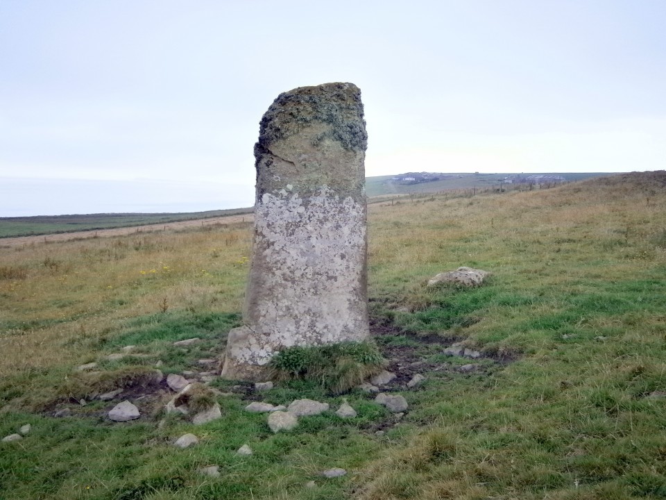
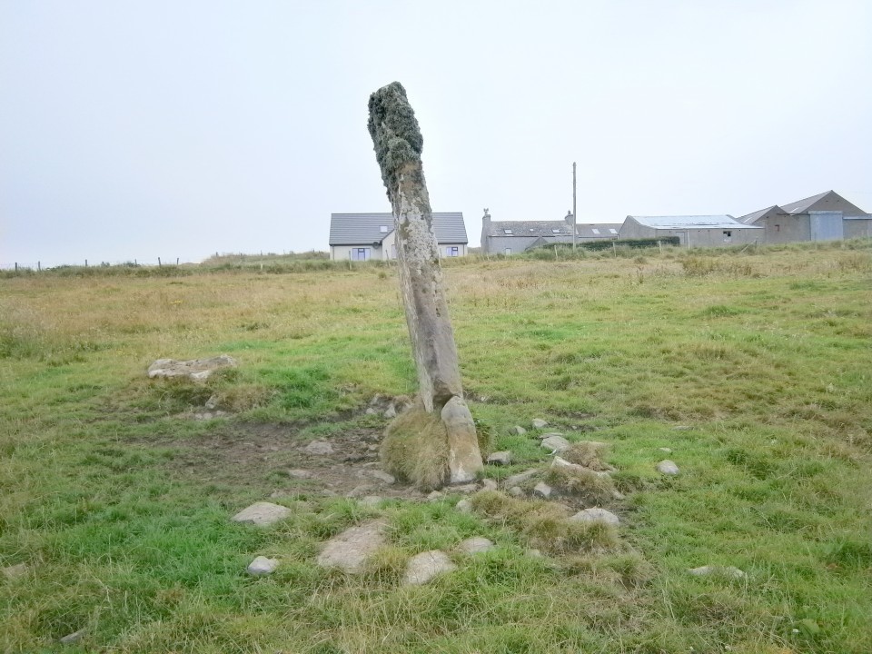
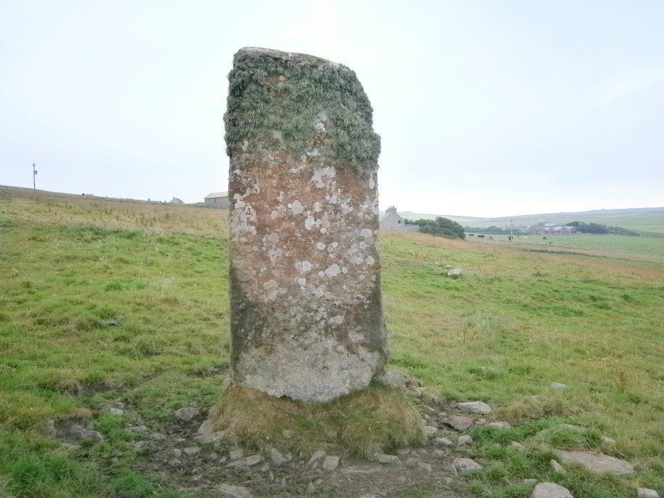
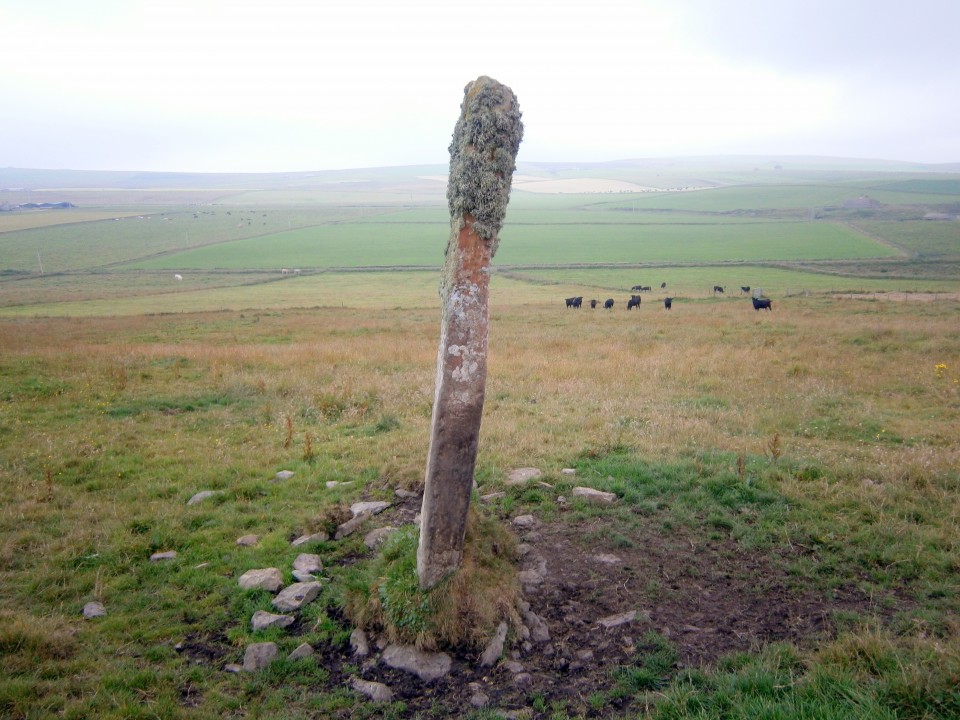
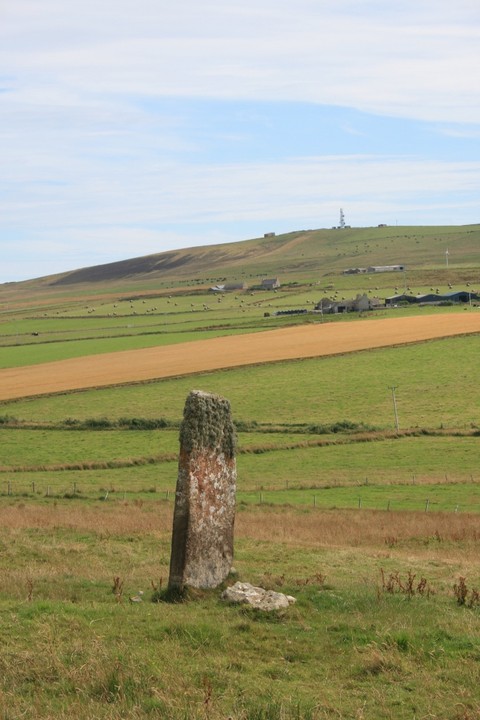
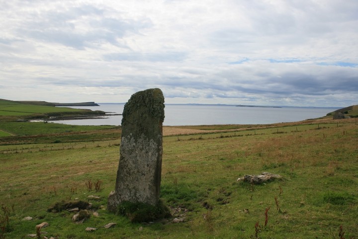
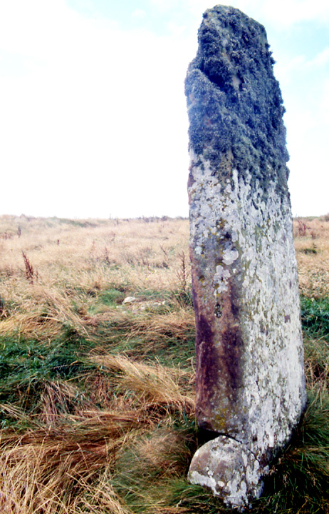
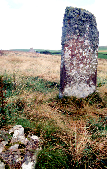
Visited 14th August 2013 After a quick visit to the Fossil Heritage museum on Burray (nice café by the way), we carried on over the barriers onto South Ronaldsay. Heading down the A961 the right hand turn to Sandwick is signposted, and as you head down the single track lane towards the sea the stone will soon become visible to your left. On such narrow roads parking can be a problem, we pulled in on the verge by the barn of Clouduhall farm (although beware of the concealed ditch if you do!), although if you carry on a little way down the road, and bear left at the first junction you come to, the road heads down toward Sandwick bay, and a small pull-in that can fit a couple of cars in at a squeeze. The first time I visited this site I couldn’t see an obvious way into the field, and the maddening proximity of the stone impelled me to hop over the relatively low barbed wire fence (just about keeping all my relevant bits intact!), before discovering that the gate into the field is actually to the north-east of the stone, and concealed by the slope of the hill. This time we took the sensible approach and walked back up the road the way we had come, before taking the first lane on the right (just past a garage with blue doors) which leads down past a nearby abandoned house, right to the gate which gives access to the field. The stone is a good hefty size, with the typical topping of sea moss so common in these parts. As I stand by the stone taking in the fantastic view, looking out down toward the island of Swona just out to sea, I think what a perfect place this is to site a stone. Last night we attended a lecture by the Orkney Archeological society which talked about the Norse settlers attitude to the megalithic sites they encountered, and the folklore that arose around these places, and it mentioned that standing stones seemed the most enigmatic of the monuments in that whilst other megalithic sites tended to be associated with spirits or beings that may dwell there, standing stones seemed to be associated as entities in themselves (as evidenced by all the tales of them nipping down to local lochs for a drink!). Standing here I can see the truth in it, megaliths sited close to the coast, in that liminal place where the shore gives way to the sea, seem to be the most enigmatic of all, staring out over the millennia as the sea gradually re-shapes the land, perhaps like our own native Moai. Perhaps though I’m romanticising too much, and with all my thoughts of the megalith as a petrified personification of Sandwick’s genius loci, I’m sure the prosaic answer behind it is far more mundane, but pondering on these things is what makes these visits so special, and the sublime loveliness of Orkney is ever a place to bring out my chimerical nature. Finally we walk down to Sandwick bay itself, where delightfully we see a small seal pup, only a few days old by the look of him, sheltering near the rocks. We sit on the beautiful sands watching him, whilst he stares back curiously at us, the stone of Clouduhall watching over us both from its perch on the slope above us. A magical end to a lovely visit. |
21st August 2013ce |
|
Visited 3.6.12 My 1000th field note! Like the nearby cairn, easily seen from the minor road to the north. The stone is approximately 2 metres high and thin looking. |
Posted by CARL 10th July 2012ce Edited 10th July 2012ce |
| Coming down from St. Margaret's Hope take the other end of the Herston road, the one marked Sandwick and Herston and the stone is very obvious just a little downhill from the road. Nice, clear and calling for a photo. Couldn't see a setting but there is a dark green grass ring about that might be more. Uphill slightly back from that annular mound is a large boulder, the one mentioned by the NMRS I guess, which I naturally forgot to measure. I think there is another such boulder hidden in the grass about the same distance downhill of the stone. Perhaps there are more. Of course these might have the same origin as postulated for the NE arc at Clouduhall Cairn. Methinks in neither case are these boulders merely thrown up by roadmarking, for surely this would have been from some structure that would have been remarked. |
21st August 2004ce Edited 6th December 2005ce |
Miscellaneous |
|
| 1920 news reports place the cist discovered then, slightly larger than that of 1926, at the back of an old stone stump. One report places it in the mound and the other disna, but this is because one sees the mound as 18' diameter whereas archaeologists 'extend' this to 18m (a 1903 report records that ~20 years previously the O.S knocked a huge chunk off the top of this howe because it was too high !). |
16th April 2006ce Edited 17th April 2006ce |
| RCAHMS NMRS record no. ND48NW1 at ND43538957 is 8'6" high, 4'2" wide and 8-9" thick and has evidence of a setting. A cist found a few feet from the W side is now thought to be a reference to the cairn many metres away. An earthfast stone, not from a cist, lies 2.8m WNW. |
20th August 2004ce Edited 7th September 2004ce |
Links |
|
Canmore ID 9537Clouduhall Standing Stone on Canmore |
Posted by markj99 29th June 2022ce |