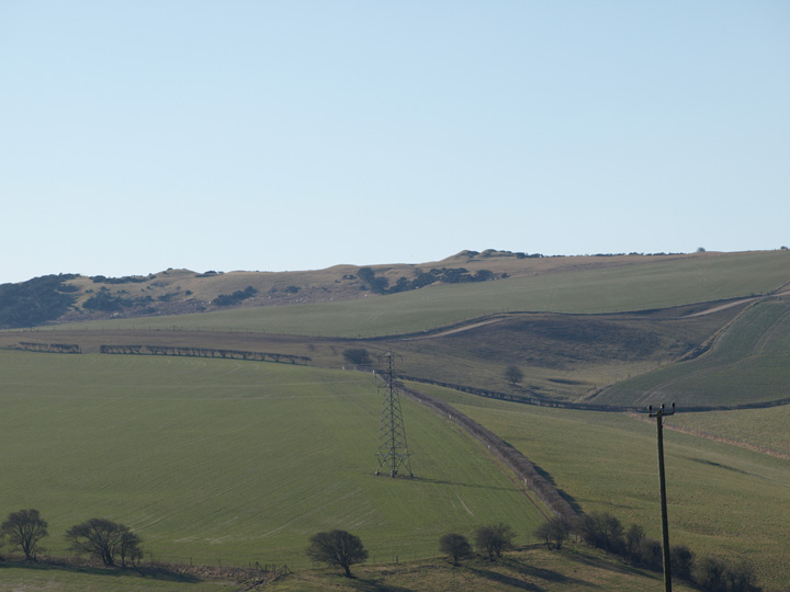
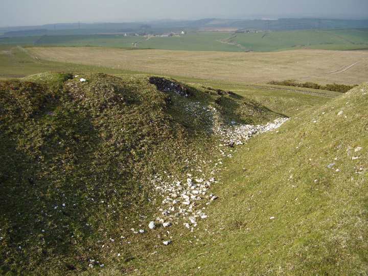
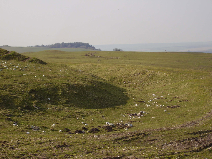
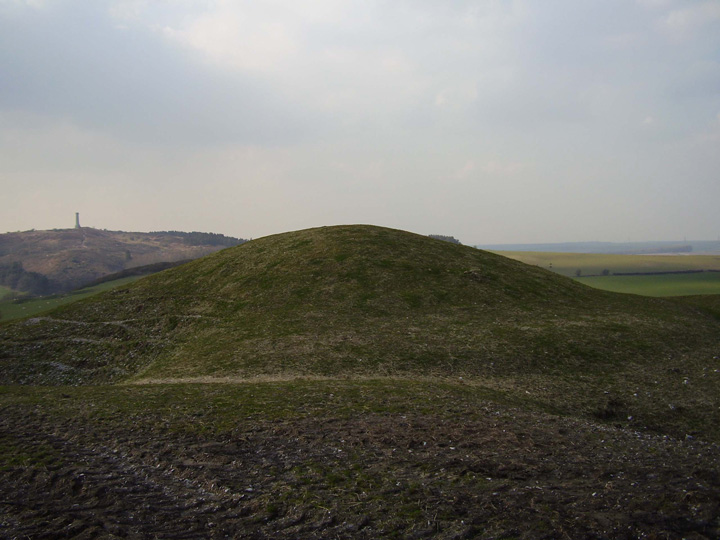
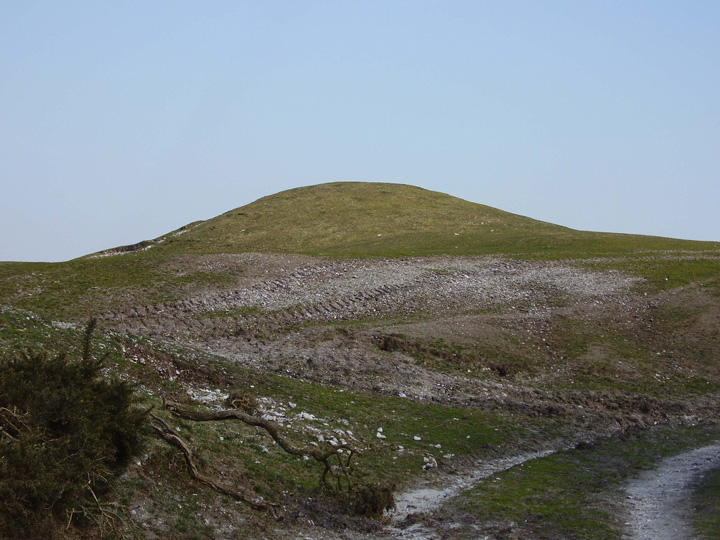
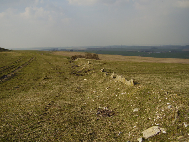
This whole hill is covered in barrows and holes in the ground. The barrows vary in size from tiny ( c.12 feet across) to the huge ( c.100 feet across). The biggest is a bell barrow with a robbed out middle, it appears to have been heightened by having the spoil from this hole piled upon the original mound. It has a ditch and bank surrounding most of it's circumference, the only break is where the farm track cuts through it. Some of the holes directly mirror their adjacent barrows in size , some look like pond barrows. Many other barrows can be seen from this hill and there is a great sign which points you towards Hells bottom. The inland coast path on which it lays has plenty more barrows upon it. There is a curious shallow ditch and bank lined on one side with small upright slabs of Portland type stone, it could be a field division, but this looks unlikely due to its position.
The holes are solution holes, acid has eaten away the underlying chalk to form a depression. The ditch edged with stones is known to be an Anglo-Saxon boundary.
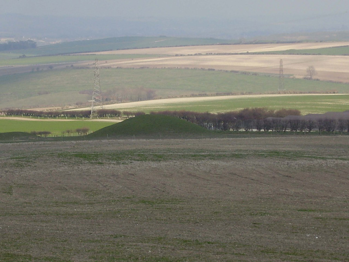
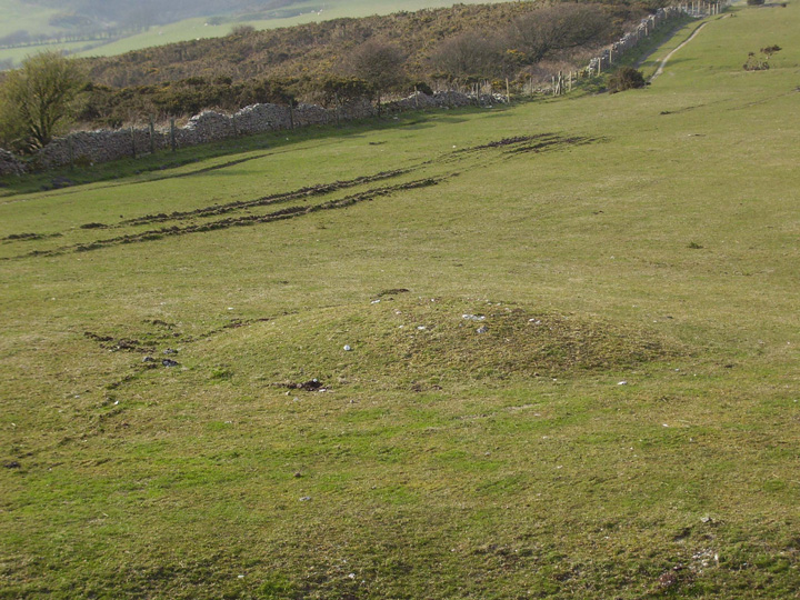
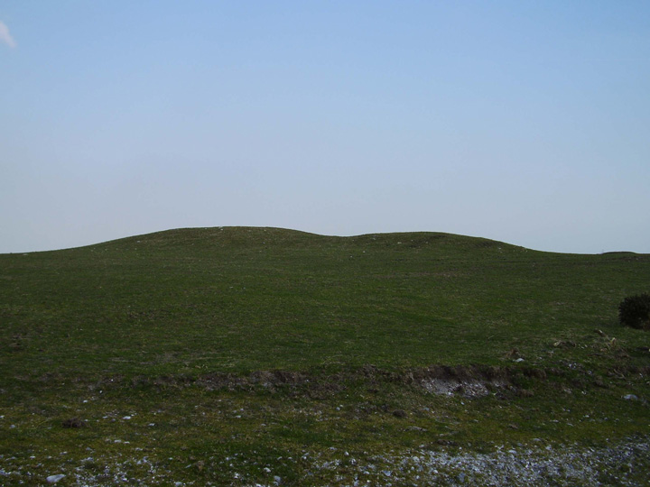
With reference to Rhiannon's entry, this set of barrows are aligned west to east, at both ends are medium sized bell barrows. She is correct in that if you stand on one of these end barrows, the central bowl barrow blocks the view of the barrow at the other end. This may not have been the case originally as the bell barrow seems to have been heightened during excavation. In the western cluster there is a pair of barrows, one larger than the other, almost touching each other. The holes are curious, some are sink holes as marked on the o.s. map, but some look like they have been scooped out and the corresponding barrow is their mirror image, this could be a coincidence, but it is odd.
Some words on the possible 'specialness' of the location and the deliberate siting of the barrows.
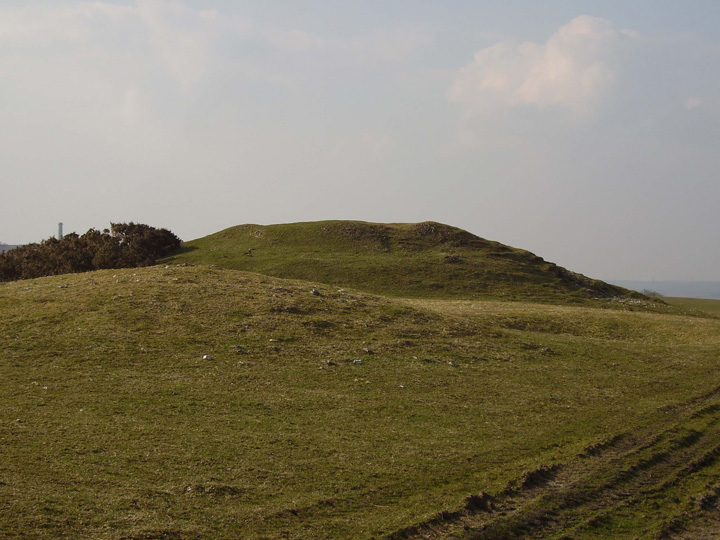
According to Christopher Tilley, the holes in this landscape are known as 'dolines' and they're little sinkholes where the chalk underneath has collapsed. He notes:
[They] are particularly striking not only because of their size and depth but also their close association and juxtaposition with the burial mounds, something that surprisingly has been completely ignored in the archaeological literature on the Dorset Ridgeway.
Standing near to some of the largest barrows it appears as if the barrows themselves have been thrown up out of the largest of the dolines. The dolines themselves may indeed have been enlarged or at the least have provided a ready source of building material for barrow construction. One is a transformation or inversion of the other..
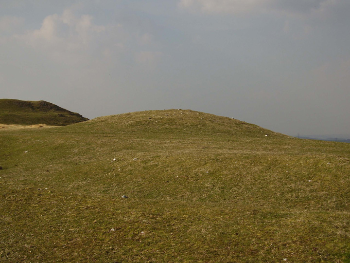
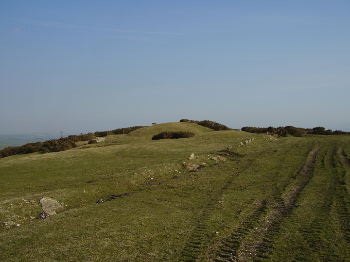
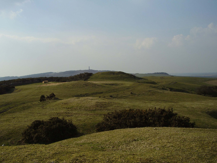
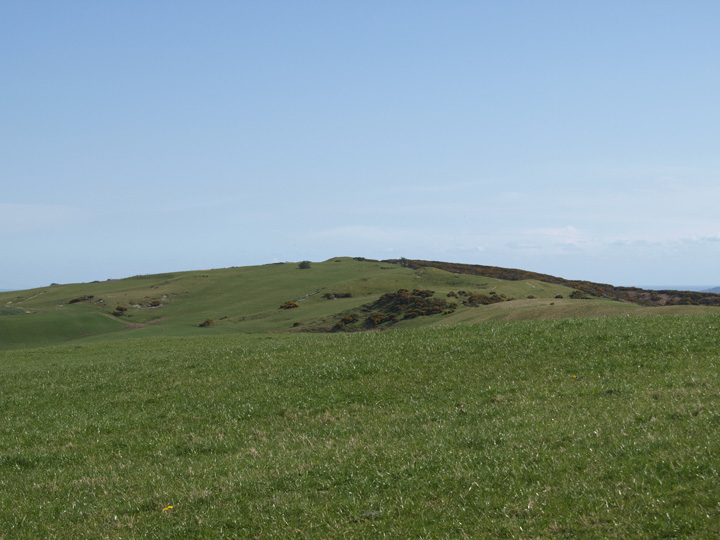
As Formicaant suggests, the way the barrows are laid out seems to show some deliberateness over their views: "it is only from the bell barrow at the highest point that the majority of barrows both to the west and east are visible" - inter-barrow visibility is very restricted at other points. The "finest and most extensive views of the Chesil Beach and the Fleet lagoon are obtainable from the vantage point of the largest and highest bell barrow on the summit of Bronkham Hill."
from 'Metaphor and Material Culture' by Christopher Tilley (1999) - a limited view is available on Google Books.
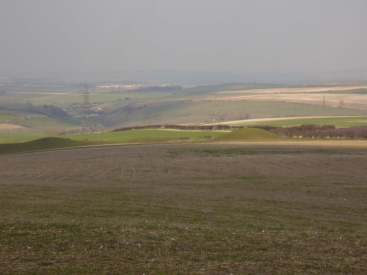
This is a major barrow cemetery on the south Dorset ridgeway, access is via the south west coast path, park at the nearby Blackdown or Hardy monument. This site is covered in barrows of various sizes, about 15 in all, although as it is part of an extended line of monuments many more can be seen from it. The isle of Portland, the Fleet and Chesil beach can be clearly seen from here, as can Maiden castle. Within a few miles of this site there is a rich variety of sites, stone circles, a cromlech, hillforts, long and bank barrows.


 Posted by formicaant
 Posted by Rhiannon