|
|

|
|
Churchdown HillAncient Village / Settlement / Misc. Earthwork
|
||||||||||||||||||||||||
|
|
|
Images (click to view fullsize) |
|


|
Fieldnotes |
|
|
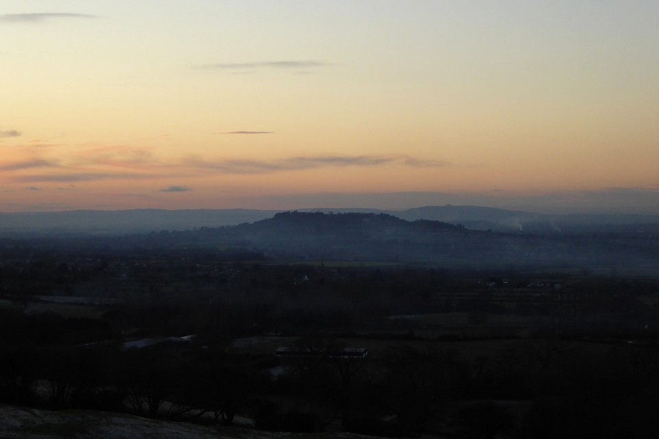
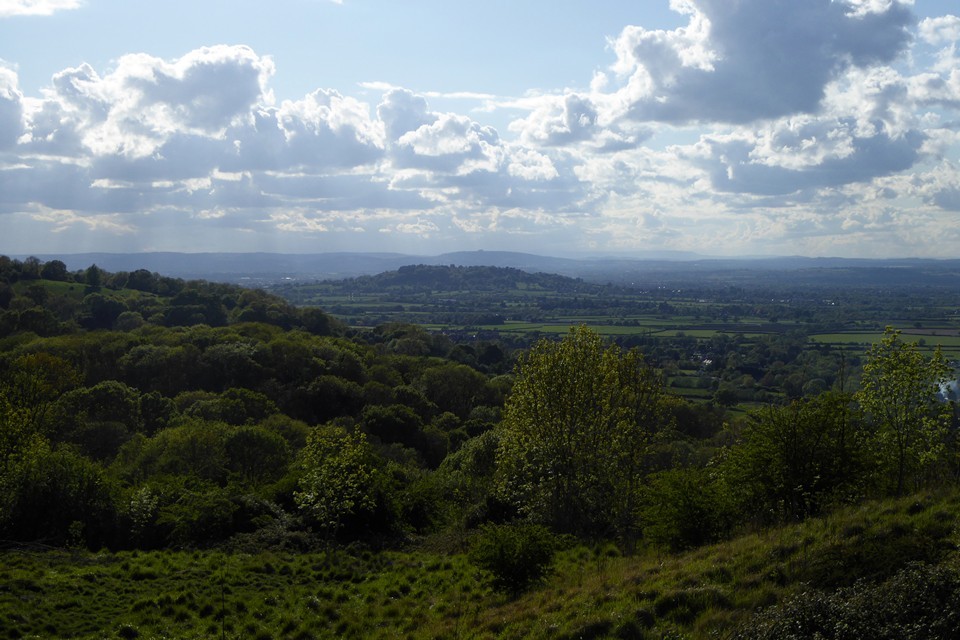
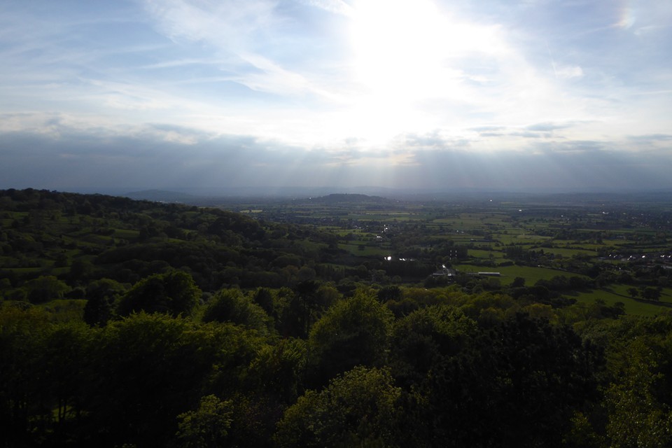
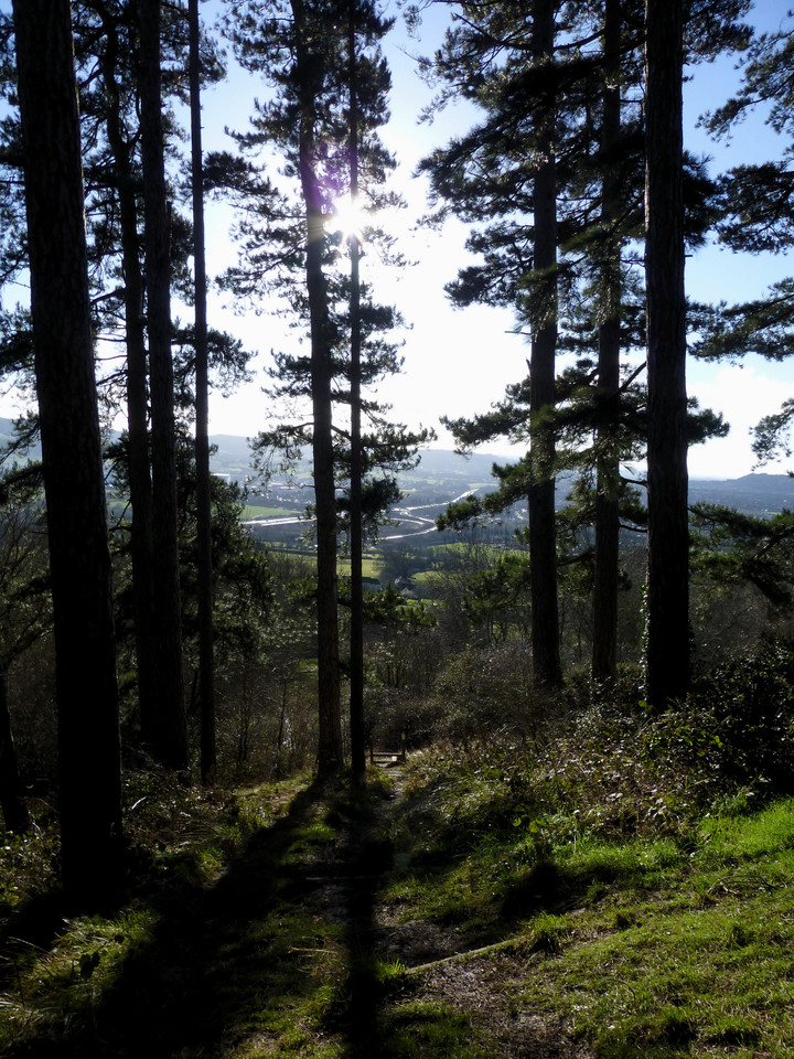
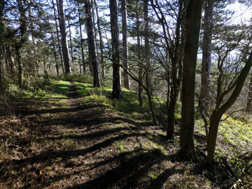
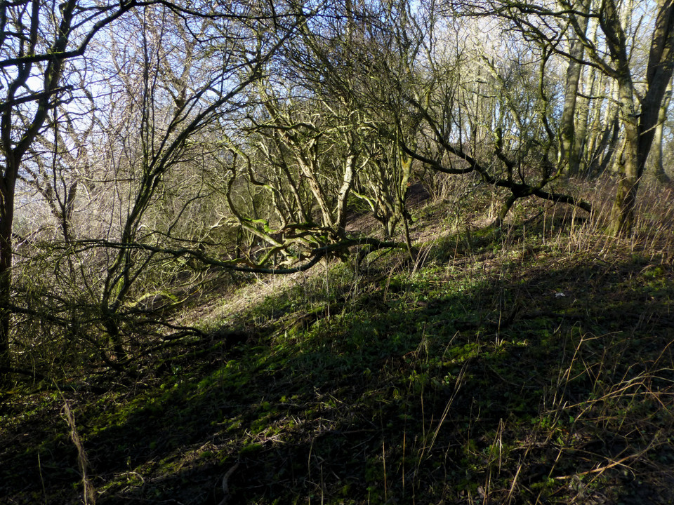
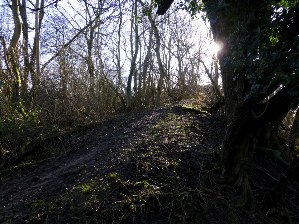
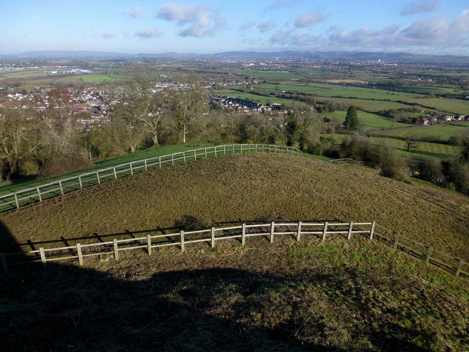
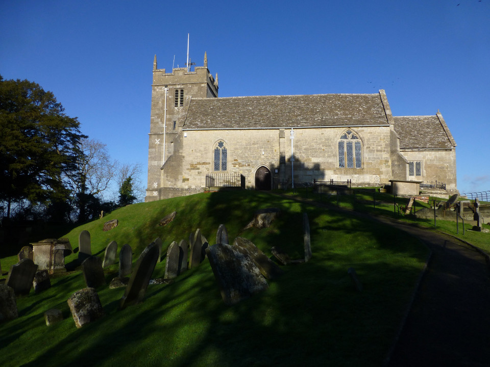
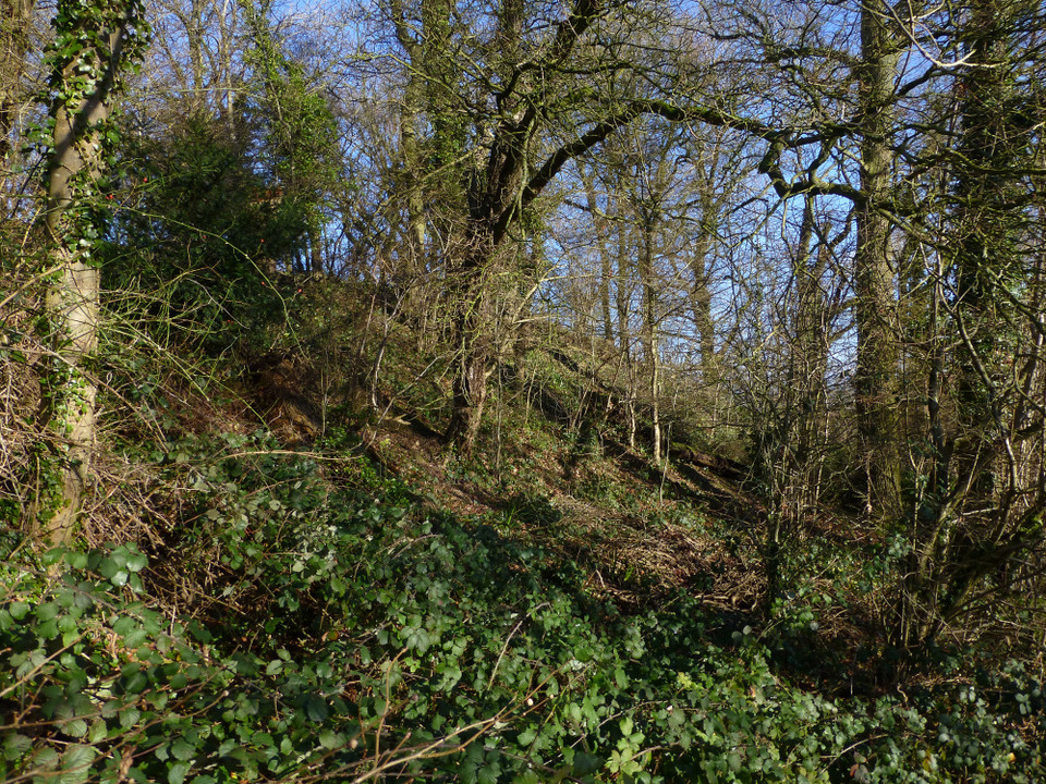
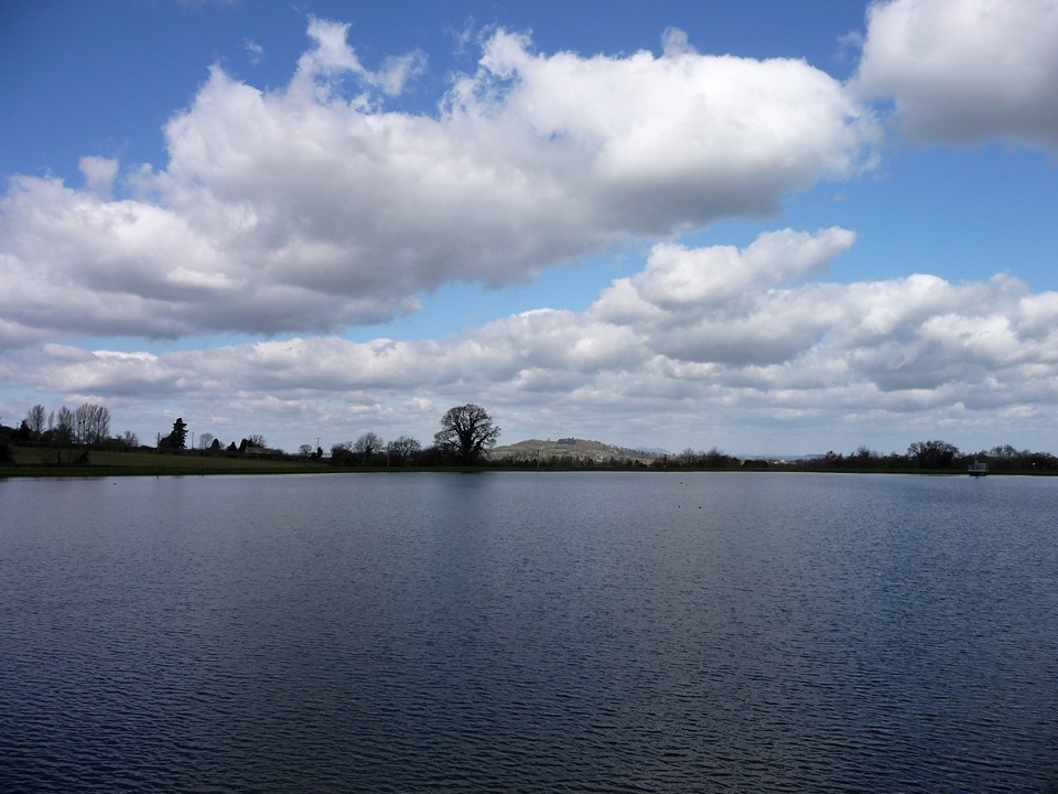
One of two unvisited sites within walking distance of my house, this has niggled and nagged away at me for a few years now. So a beautiful January Sunday (18.1.2015) finally gets me off the sofa to go and have a proper look. The walk up from Churchdown is straightforward enough, passing the wonderfully named "Criftycraft Lane" on my way. At Churchdown Green the ice makes the tarmac suddenly treacherous, but thankfully it's a short enough bit of uphill skating. Below the church, the lane is bordered on its right by what appears to be a large bank, the sort of thing that could suggest an inturned entrance to an Iron Age site. However, it could just be a natural crease in the hillside. Overgrown with brambles and scrub, it's not easy to investigate much further. The lane opens out to a vista of green banks. Not anything ancient unfortunately, just the grassed sides of one of several reservoirs that now fill the centre of the hilltop. Along with quarrying, these may well have destroyed much chance of establishing its prehistoric origins. Round the corner, the church is very striking, perched on top of a huge mound - natural? Hmm. The corner of the churchyard looks out over the Severn plain with the steep Cotswold escarpment forming its eastern edge. I can count more than half a dozen Iron Age forts and settlements visible from here, with more yet on the Malverns ridge over to the northwest. Leaving the churchyard and its super-friendly cat familiar, a little gate leads onto a footpath circumnavigating the rim of the hilltop. I'm soon into an area of hideous Cotswold mud, the kind that clings to your boots and adds several pounds. The ground drops fairly steeply, and there appears to be a slight embankment along the top, perhaps suggesting some counterscarping has taken place. Round to the west the walk would be lovely, under a spacious canopy of deciduous woodland, if it weren't for the continuing hindrance of the mud underfoot. The highest part of the hill is at the southwestern corner, up a slope of particularly slippery mud. Here a toposcope points out the distant Black Mountains, as if their bright white snow covering were not enough today. The southern side of the hill is the steepest, and there is no obvious sign of anything that could be a man-made or enhanced earthwork here . It is a lovely spot though, as the sun filters through the slender pine trees. Although nothing about the visit today confirms categorically whether there was a fort here, it would certainly be a fine spot for one, with tremendous visibility in all directions and natural defences from its steep slopes. Iron Age finds have turned up within the site and I'm inclined to believe it more likely than not that it would have been occupied and probably fortified too. With one itch finally scratched, from here I head off to another one. |
 Posted by thesweetcheat
15th February 2015ce Edited 15th February 2015ce |
|
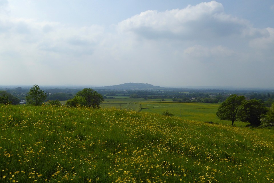
Visited 14.2.13 Directions: From Gloucester take the B4063 north. Take the turning right signposted Churchdown and then the first right. Follow the narrow minor road up hill signposted church/burial ground. At the top of the hill is a fairly large car park. Valentine’s Day – what to do? Well, after the obligatory flowers, chocolates, card etc we planned a ‘romantic’ day out without the children. As Karen has to put up with my places to visit most of the time, I gave her the choice of where to go. Karen opted for a visit to Gloucester (lots of charity shops!) followed by a meal in a nice old timber-framed pub (can’t remember the name). I of course couldn’t help but sneak at least one ‘old stone’ site as it seemed only fair. After all, Valentine’s Day is for both of us – isn’t it? It just so happened that my choice of place to visit included a cemetery!! After parking in the car park I followed the footpath around the perimeter of the undercover reservoir? The ‘reservoir’ had a sign which also gave the site its alternative name of ‘Chosen Hill’ which perhaps accounts for why the church was built up here – not an obvious place to build a church that’s for sure. This is clearly a popular walk judging by how muddy the path was – really ‘bog like’. I slipped and slithered my way around and at one stage slipped onto my side. The hillside was steep and I could see, through the trees, what appeared to be a rampart/ditch? running half way down the slope. (natural?) Churchdown/Chosen Hill is very prominent within the landscape and would make an obvious choice to build some sort of defended enclosure. After squelching my way back to the car I headed for the pretty church of St Bartholomew, and it’s surrounding grave yard. Unfortunately the church was locked up but the views of the surrounding area and out over Gloucester were very impressive and worth the trip alone. All in all a decent ‘return’ for having to suffer a few hours shopping. Happy Valentine’s day Karen!! |
Posted by CARL 15th February 2013ce |
Folklore |
|
... the high hill in the [Matson] neighbourhood was called Robins's Wood Hill... There is another hill at Church-Down, about three miles distant, arising in like manner in the midst of the vale; and these two are called Robin Hood's Butts.From 'Folk-lore of Gloucestershire' - County Folklore v1, 1895. |
 Posted by Rhiannon
10th June 2009ce |
In the village of Churchdown, about four miles from Gloucester, the church dedicated to St. Bartholomew is built on the summit of Churchdown Hill, - the ascent to it being steep and tortuous. The legend runs, that "the church was begun to be built on a more convenient and accessible spot of ground, but that the materials used in the day were constantly taken away in the night and carried to the top of the hill, which was considered a supernatural intimation that the church whould be built there."*From Church-lore Gleanings By Thomas Firminger Thiselton Dyer (what a name), 1891, p3. (partially online at Google Books). Arthur Cleveland was there and he "descried a hamlet, and a Church, which my friend pointed out to me as Chozen, at the same time informing me that it was spelt Churchdown." (Impressions of England, 2nd ed, 1856, p160) He calls it one of those quaint English things where you speak and spell a word differently. But is it just referring to the legend about the church? Or is it all tied up together. The local school is called 'Chosen Hill School' so people must still refer to it as that. So it must also be the site of this snippet from http://archive.worcesternews.co.uk/2001/10/26/300903.html from 'Folklore of Gloucestershire' by Roy Palmer (1994): "For the ghoulish or fey minded, the key chapter is the aptly named, Out of this World. We hear of a Churchdown man who, early in the last century, saw headless fairies on Chosen Hill." Aren't fairies on their own hard enough to believe? Why not tell your friends you saw headless fairies instead. |
Posted by Rhiannon 16th May 2007ce Edited 16th May 2007ce |
Links |
|
Transactions of the Bristol and Gloucestershire Achaeological SocietyThe Prehistoric Occupation of Churchdown Hill - H. Hurst. This article from 1977 suggests that Churchdown Hill was a fortified site in the Iron Age. This hill has been quarried and reservoired and generally messed with a great deal. The Woodland Trust now manages the woods around the hill: http://www.wt-woods.org.uk/churchdownhill/description.asp |
Posted by Rhiannon 16th May 2007ce Edited 16th May 2007ce |