From Robert Gladstone:
"I am the owner of this site. I welcome public access on foot, but would like to correct the website entry. Parking is not allowed at Bar Farm on the A702. This access and gate is in constant use by farm and timber traffic. Parking is possible at a laybye on A 702 200 meters to East of Ford farm roadend."
|
Heritage Lottery grant to restore Robin Hood and Little John
Castor Parish Council has received a Heritage Lottery Fund (HLF) Sharing Heritage grant to carry out archaeological investigations and restoration of some ancient standing stones in the Nene Valley near Peterborough.
This exciting project – Restoration of Ancient Standing Stones 'Robin Hood' and 'Little John' at Ferry Hill – led by Castor Parish Council, has been given £10,000. The current position of the stones will be established. The two stones will be then lifted and carefully and expertly reset. Improvement works to allow public access and viewing will then be carried out. Improvements will include an all-access pathway to an area immediately adjacent to the ancient protected stones and an interpretation board.
Castor Parish Council is keen to protect these ancient monuments for future generations and is equally enthusiastic about the opportunity to allow visitors and local schools to understand more about the importance of the area as a trading and strategic place since Neolithic times. There is extensive evidence of early human settlement in the area but much of it is buried beneath the remains of countless centuries of human activity. These ancient stones stand as tangible evidence of the distant past.
Commenting on the award, Neil Boyce, chairman of Castor Parish Council, said: “We are thrilled that Castor Council has been awarded this grant and we can’t wait to get started.
“We are looking forward to working with English Heritage and Dr Stephen Upex to find out more of the ancient history surrounding these stones which we would not be able to do without the support of the Heritage Lottery Fund.”
Neil continued: “We are really keen to enhance and protect Robin Hood and Little John standing stones, in accordance with the parish council’s commitment to protecting our community heritage, both archaeological and natural. We work closely with our neighbouring parish council of Ailsworth to protect the vast ancient history in the area and the natural wildlife that has benefited from this protection – we are all really excited about telling other people of our findings and sharing our heritage and history with the wider public.”
Robyn Llewellyn head of the Heritage Lottery Fund, East of England, said: “Sharing Heritage is a wonderful opportunity for communities to delve into their local heritage and we are delighted to be able to offer this grant so that Castor Parish Council’s restoration of the Ancient Standing Stones 'Robin Hood' and 'Little John' can embark on a real journey of discovery. Heritage means such different things to different people, and HLF’s funding offers a wealth of opportunities for groups to explore and celebrate what’s important to them in their area.”
Source: Press Release from Castor Parish Council. For further information, please contact Sarah Rodger at Castor Parish Council on 01780 435084, [email protected]
Sharing Heritage is for any not-for-profit group wanting to explore their community’s heritage. With a commitment from HLF of £3m each year, Sharing Heritage grants between £3,000 and £10,000 are available to groups who want to discover their local heritage. Projects can cover a wide spectrum of subject matter from exploring local archaeology and a community’s cultures and traditions to identifying and recording local wildlife and protecting the surrounding environment to managing and training volunteers, and holding festivals and events to commemorate the past.
|
Full copy of "Megalith Research in the Netherlands, 1547-1911" by Jan Albert Bakker (2010), including plans of many of the Hunebeds.
|
|
"If you would like to visit the stones, please contact us at [email protected], as we are the new owners and are happy for people to visit, but do occasionaly have animals grazing there, so would appreciate being contacted first. many thanks."
|
 
|

|
Originally posted by Lubin as caption to photo
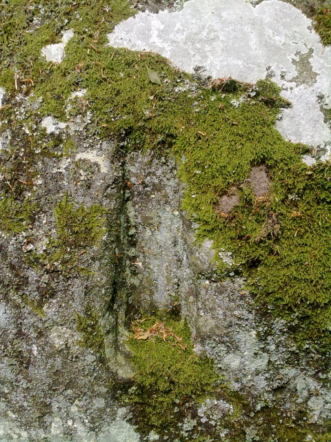
The kist is situated inside the newtake on the south side of the farm buildings. It is found by walking from Postbridge up the Drift Lane to where it joins the newtake wall.
From here follow the wall west then south west untill you come to a 90 degree corner. Follow south east to a leat [probably dry]. The kist is over the wall if you look north.
This is not the kist where the archer's wrist band was found, that kist is nearer to the farm buildings on Chittaford Down. This one is so called as it is in the newtake.
|

|
  
|

|

|
360° photos of Nympsfield Long Barrow. Thanks to David Bailey for sending the link.
|
360° photos of Uley, thanks to David Bailey of the BBC for sending the link.
|
Video clips of Summer solstice 2008.
Stonehenge revellers cheer solstice sunrise
Thanks to Sharon Watson.
|
castlewales/euryn.com is a good site with a full account of the hill fort and history. [posted by skins].
|
This seldom visited and moderately small Iron Age fort sits on the end of a promentary on the escarpment beneath the Ridgeway to the South and overlooking the plains around Swindon to the North. The nearest village is Wroughton about 3 miles East and the more famous Barbury Castle hill fort is about 3.5 miles away to the South-East. It can be reached by taking the A4361 South (Swindon to Avebury) then taking the turning to the right after passing the entrance to the Science Museum at Wroughton Airfield (on your left). There are limited places to park near Quidhampton Wood but it's only about a miles walk through fantastic beech woods till you come out at this amazing site with steep valleys on both sides and staggering views all around. Touchingly romantic and you only have to share it with a few cows.
[From a comment posted by A R Cane]
|
A report made following a 1933 visit to Castle Howe (contained in the National Monument Record) indicates that part of Castle Howe may be prehistoric: The lower chamber appears to be prehistoric, its walls survive to a height of 5ft. 3 ins; the stairs may be original..." A similar report following a visit to the site in 1964 makes no attempt to date the site. There is no certainty as to the age of this monument, but the NMR implies that part of it may date back to the Iron Age.
|

|
Rhind Lectures - 27th-29th April (Edinburgh)
Living in an age of stone - Gabriel Cooney
The Rhind Lectures for 2007. National Museum of Scotland, Edinburgh.
27.04.2007 to 29.04.2007
Free and open to all - no ticket required
This series of Rhind lectures will examine how people lived with stone during the Neolithic in Ireland and Britain, how they engaged with this remarkable material in all its diversity, using it to make new worlds, to establish, maintain and change cultural relationships and connections across geographical space and through time. Material and case studies from stone-using societies in different parts of the world will be drawn on to provide a wider context for the discussion. It will be suggested that looking at the processes of the working of stone, the creation of things, big and small, and their uses provides us with a way of linking objects and monuments which we often tend to see as unrelated phenomena with very different senses of scale and purpose. Focusing on the way in which people engaged and worked with stone provides a new perspective and insight into cultural knowledge during the Neolithic in Ireland and Britain. Free and open to all. No ticket required. For more information, contact [email protected].
added for
Erin Osborne-Martin
Society of Antiquaries of Scotland
|
Disputed Antiquity:
The Coflein record for this site says it is situated on an outcrop, and is "probably a collapsed megalithic burial chamber, but may be a natural feature."
|
milltut
This round barrow stands close to a bridleway, behind Greenway Secondary School, Southmead, Bristol. Although on the Ordnance Survey Map for the area, it is marked as a tumulus. Known as Milltut, it has alternative names of Badocks Wood Barrow, Southmead Barrow or Mill Tut. It is a Bronze Age barrow which was later used as the base for a windmill. In 1873 a passage was dug from the south and friable human remains were found near to the centre. A further investigation in 1922 produced bone, flint and pottery shards. In 2003, Bristol County Council commissioned a stainless steel sculpture, by Michael Fairfax. The hole at the top of the sculpture aligns with the peak of the burial mound, which is in keeping with the ethos of the times of alignment. Engraved on the sculpture is a commissioned poem by John Fairfax, which tells the history of the site. The last part of the poem reads:-
'wild hog rooted among trees'.
Milltut stands on a Ley Line which runs from a part of a Roman Road in the grounds of Blaise Castle Estate, across Hazel Brook, - Coll. Ninth tree. Divining. Magic. Bile Ratha. - The venerated tree of the Rath. Wisdom. August 5 - September 1. - on to a church that stands at Monks Park. This ley line does not seem to extend at either end.
The etymology of the name Milltut is not that hard to define. Mill - because of the mill that once stood there. Whereas, Tut - is Saxon for hill. But, before one can leave this theory as read. Let us take a closer look at the word Tut. Tut is a Common Pattern Word and also comes from the Altaic Languages. In Folklore it is the Lincolnshire name for a Hobgoblin. - A friendly spirit of the Brownie type. Shakespeare's Puck in 'A Midsummer Night's Dream', was of this type. At a traditional annual ceremony in Hungerford, 'tuttimen' carry six foot long staves. In recent years, the place-name elements of Toot and Tut have been looked at by investigators and is said to denote 'a hill of observation', a look-out place. The word derives from the Old English totian, 'to peep, look out, spy', or Middle English toten, 'to project, stick out'. But, 'to tote' in Middle English is 'to watch, to look out'. The word has also evolved into modern English 'tout', which meant a spy or lookout man. It would seem that at least some of these toot hills were artificial mounds, perhaps surmounted by watch towers. - Was there an older building stood on Milltut? This links to a whole group of Germanic words which can be traced back to the Old High German word tutta or tuta, meaning 'nipple'. In Old Norse, tuta extends its meaning to 'a teat-like prominence'. Medieval Dutch tote means 'apex, point'. - Giving the modern Dutch tuit, 'spout or nozzle'. Likewise, modern German tute means a 'cone-shaped container'. Other places with the name Tut are listed below:-
Tuters Hill. Staffordshire.
Tutman's Hole. Cumbria.
Tutnall. Hereford & Worcestershire.
Tutnell or Totenhull. Warwickshire.
Tutshill. Gloucestershire.
Tutthill. Kent.
Tuttington. Norfolk.
Tutts Camp. Berkshire.
Which leads to the suggestion that these 'look out hills' were less important as military observation points than as originating as ritual sites for observing the surrounding alignments of ancient sites.
It is no longer certain if Milltut was on an alignment with the long barrow close to Romney Avenue, Lockleaze and also nearby Star Hill - an astronomical sighting point/part of a bigger zodiac encircling Bristol. Close by, is Coldharbour Lane. Or its Obelisk - the second to stand on this spot. Erected in memory of the Duchess Dower , who was out hunting one day and fell from her horse and died. She is said to haunt the area. But, there is a ley line that runs from south of Glastonbury to the north of Bristol and comprises Priddy Circles, which are Bronze Age - c. 2200 - 800 BC. - earthworks, which have four circular banks with ditches. These are thought to be ceremonial henge monuments and the long barrow at Lockleaze.
There is also another round barrow in this area. Marked on the Ordnance Survey Map as a tumulus, this round barrow stood in the grounds of Over Park near to the Oak Covert, - Duir. The seventh tree. The tree of all the Thunder-gods. Fuel of the midsummer fires. When excavated, bones from a large human male were found and said to be those of Offa. Who was King of Mercia from 757 - 796 AD, when he died. During his time, he constructed an earthwork - Offa's Dyke - between Wales and Mercia. Not far from where the round barrow stood, can be found the remains of St: Swithen's Chapel and St: Swithen's Farm with its moat, denoting a much older site. St: Swithin's Day on July 15, is a Church Festival commemorating St: Swithin. It is believed that if it rains on this day, the rain will persist for the next 40 days. One mile from the round barrow is Knole Park Camp, conforming to the shape of the ground, which is nearly oval. The defences consisted of a mound and two ditches with an entrance at the north-east end. While the views embrace both shores of the River Severn and the district of the Silures.
British and Roman Roads cross through the area north of Bristol. Cribb's Causeway - named after the Bristol boxer Henry Cribb - is a portion of the Western Trackway and ran through Eagle Meadow in Patchway. There was also a road that left Cribb's Causeway at the top of Blackhorse Hill and lead to Peot's Enclosure - Patchesway - Patchway. Also an ancient trackway across the fields, which took the people of Patchway to Almondsbury. Another, runs across the Blue Bridge, Station Road, Patchway and is said to have been the original Gloucester Road. But, this was the territory of the Hwiccas - a Saxon people, allied with the Welsh - and the Dobuni - a quiet and peaceable people - where ancient trackways and trade were needed to survive.
Stewart Guy.
[thanks Stewart - moved from forum posts]
|
Disputed Antiquity
Men Scryfa is a scheduled monument because it is considered to be a good example of an early medieval memorial stone. However English Heritage's Record does add "It has been suggested that this memorial stone may be a reused standing stone as the early Christians often took over previously venerated stones and marked them with crosses."
|
Disputed Antiquity
The National Monument Record describes the inscribed stone as 'Early Medieval'. The dating of the stone row is very vague and open to interpretation.
|
Website of Native Woodland, who offer "Simple, natural burial sites througout the UK", including the site at Cothiemuir Wood.
[edited version of submission by NativeWoodland.]
|
The TMA Eds have received an email from Miles Johnson, the Countryside Archaeological Adviser for the Yorkshire Dales National Park Authority.
He wishes to remind people that the circle at Fancarl Top is on private land not covered by the CRoW open access Act. The landowner contacted him because people trespassing to get to the circle were damaging the surrounding drystone walls. The landowner was also unhappy that the stones had been 'inappropriately decorated' by people accessing the field without asking for his permission.
Although Mr Johnson wished us to remove the circle from the website, we would respectfully suggest that it would be better left on here with this note attached, in order that anyone using TMA to identify visitable sites will then know and understand the landowner's wishes (unfortunately this will not influence the trespassing of people who do not use this website).
TMA Ed.
|
The TMA Eds have received an email from the owner of the land on which this rock art lies. It is not on the land of Argrennan Mains, as may have been suggested below. He seems to be a friendly and accommodating chap and says he is happy to show the rocks to anyone who is interested, and he will be happy to escort you to them; indeed he says that the marks recorded for Park of Tongland are in fact some distance from the ones these photos show.
He would like to stress that he does not want people entering the fields on their own and pulling the vegetation from the rocks, exposing the marks to the weather.
If you want to visit this site, please have the courtesy to call at the farm first. Indeed this method applies to all sites on private land.
Thank you.
TMA Ed.
|
Disputed Antiquity
This site is not widely recognised as prehistoric.
|
Disputed Antiquity
The National Monument Record decribes a 'roughly oval' enclosure of unknown age on Willis Hill, but no mention is made of a barrow.
|
Disputed Antiquity
This site is not a Scheduled Ancient Monument and is not widely recognised as prehistoric.
|
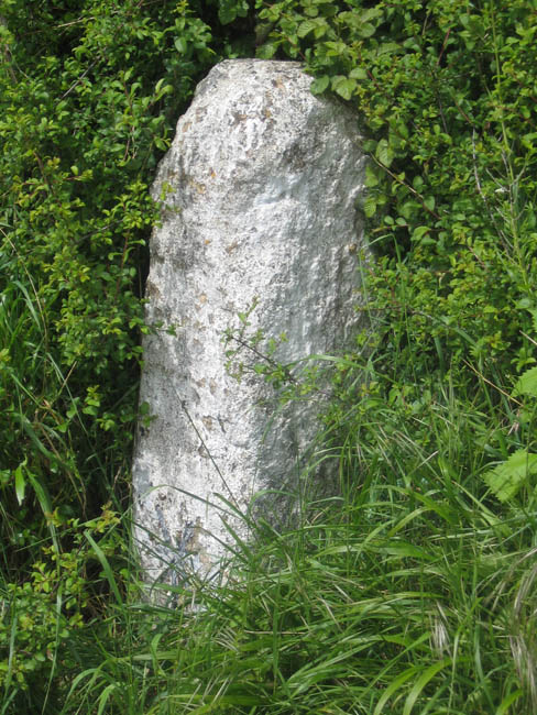
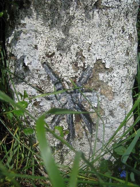
Disputed Antiquity
The Coflein record describes the stone as follows, and suggests it is post medieval in date:A lamp standard and mile post some 18 inches wide at the base and standing some ten feet high. It bears the date 1770, which is the date that it was probably first used as a mile stone.
(Source: RCAHMW Inventory: Denbighshire, 1914, s. 488)
J Hill 16/09/2004
|
Disputed Antiquity
Neither of these stones are Scheduled Ancient Monuments and neither are widely recognised as prehistoric.
|
Disputed Antiquity
This site is not a Scheduled Ancient Monument, but it is listed by Cambria Archaeology (Dyfed Archaeological Trust) as a possible milestone or standing stone.
|
Disputed Antiquity
This site is not widely recognised as prehistoric. The National Monument Record states that it is, "possibly Roman, although a medieval, or post-medieval dating would be more conventional".
|
Disputed Antiquity
This site is not a Scheduled Ancient Monument and is not widely recognised as prehistoric.
|
Disputed Antiquity
The National Monument Record (NMR) includes the following comment made after an Ordnance Survey visit to the site in 1966:This isolated stone is as described above. Its name is not known locally and there is nothing to suggest that it is an antiquity. This is not contradicted by any other information in the NMR (as available on-line at the time of writing).
|
TMA Ed hasn't added a profile
|
|