|
 
|
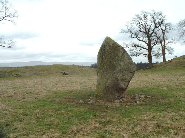
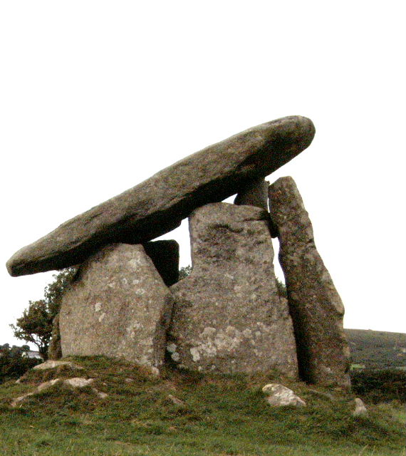
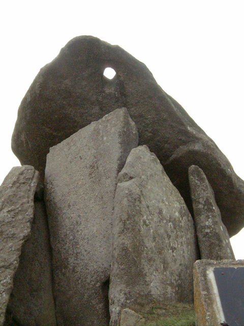
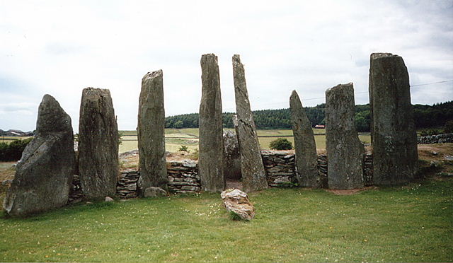
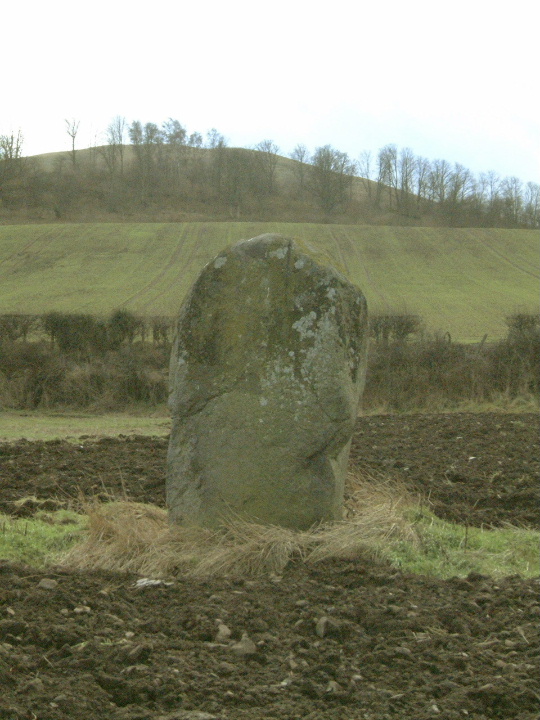
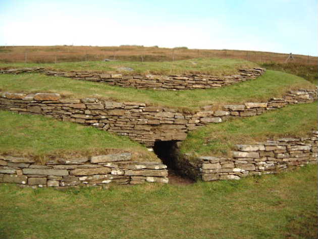
Amazing that this is still here, sliced on two sides by roads.
OK, so it's not intact, but still fairly impressive. Good to watch the cars going by staring at the idiot on the fence with the camera
March 2002
|

|

|
 
|
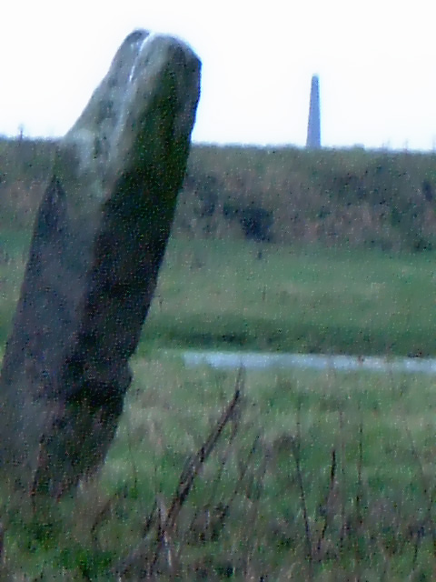
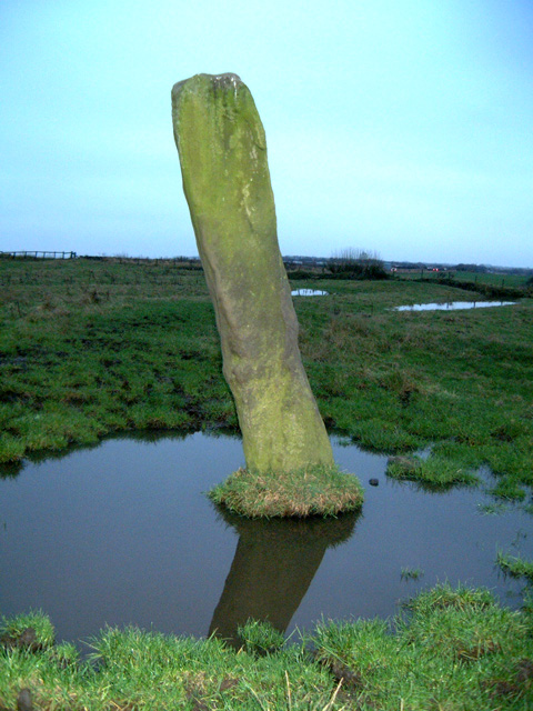
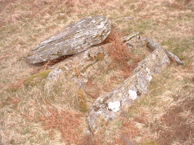
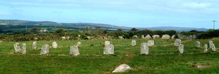
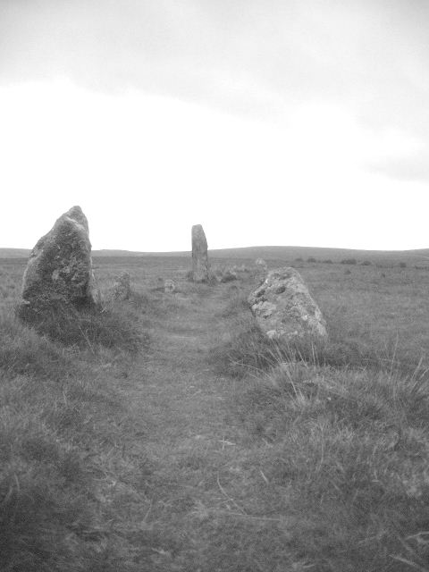
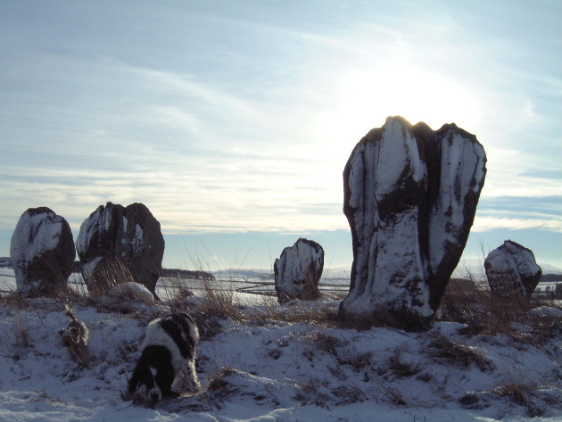
The Cist lies above Glenquickan Stone Circle roughly to the South West. It is close, but not visible from the circle. Watch out for the bog - you'll get sucked in & never seen again.
I didn't spot it the first time I visited Glenquickan, but it is easy to find as I found out this March. You get a great view of Glenquickan Circle from up there too.
This area has a wealth of Sites just waiting to be explored - I have to go back this summer.
Moey
|

|

|

|
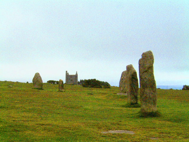
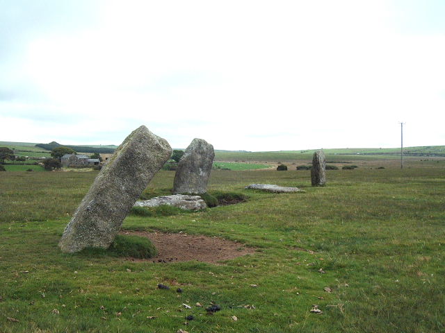
September 2001:
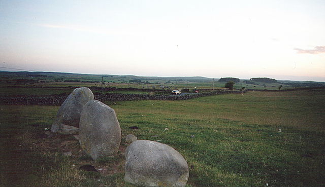
After visiting the Hellstone, an un-named circle (got lost!), and The Grey Mare we found ourselves here.
Stones laid flat in the field, so that's exactly what we did. Staring up at the clouds for ages.
Lots of flint in the soil turned up by the farmer.
Not the most visually impressive circle, but restful.
Oh yeah, careful when you go down there, lots of maize fields - I kept thinking we were gonna be part of a bad horror film with people jumping out - not paranoid at all :o)
Moey
|

|

|
 
|

|
 
|

|

|
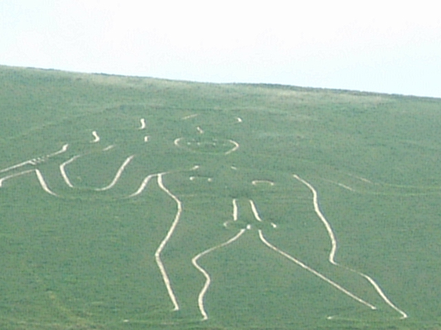
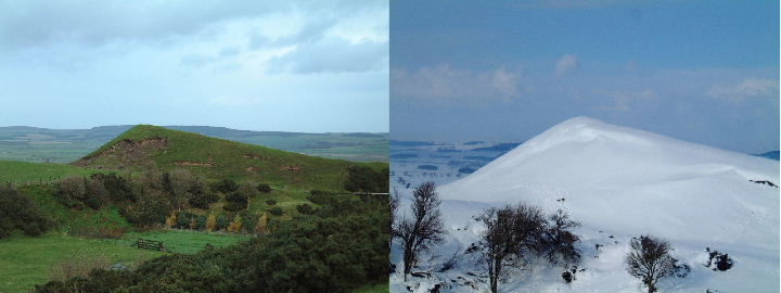
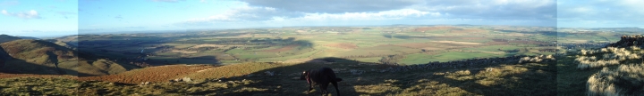
On a clear day you can see forever!!!!!!
Unrivalled Views and nosey cows - See Julio Geordio's pic for proof.
gotta go back.
|
Summer 2000
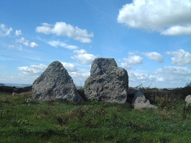
Carrying on my weird weekend, I came to Cairnholy 1&2. Up the narrow track, meeting some hoorahs in their 4WD on the way I eventually got out of the car in Brilliant Sunshine.
What nobody seems to mention is that Cairnholy 1 is in a fantastic position high above Wigtown Bay. The Sea was Sparkling Blue, a cool breeze lapped at me as I lay on the grass chilling.
Cairnholy II is further up the track in an equally cool location, but the nearby farm somehow spoils it for me.
A Cool place. Going Back soon!
|
 
|
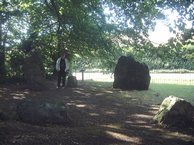
Dusk Falling, a warm summers evening in 2000.
The first circle at the start of a strange weekend in 2000. I decided to take myself off after work on the Saturday, not knowing where I was going. I phoned my parents to let them know where in the world I was. I told my mother I had set up camp at Newton Stewart just up the road from the Stone Circle. There was a silence atthe other end of the line.... I asked what was wrong and my mother said it was weird, they had spent their honeymoon at Newton Stewart...... 33 years ago to the very day.
I had no knowledge of that, I didn't even know it was their wedding anniversary.
I spent a couple of hours here reflecting, and left calmed - and ready for a chinese :o)
Moey
|

|

|

|
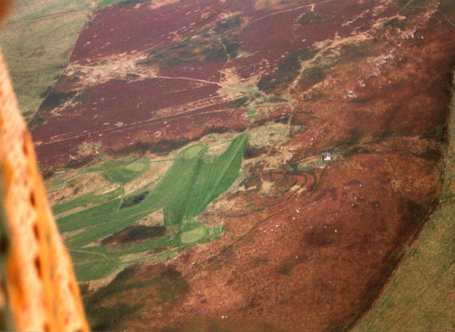
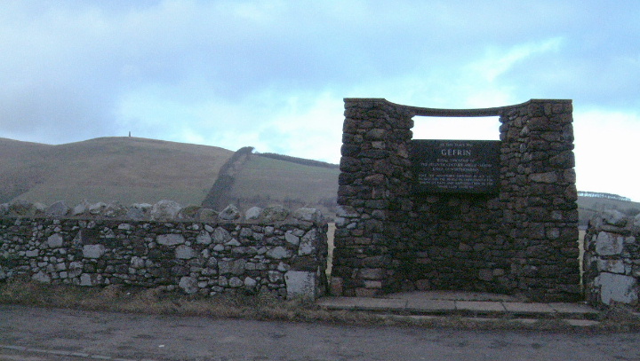
Gefrin was the Royal Township of the Seventh Century Anglo Saxon Kings of Northumbria.
The plaque tells how the missionary Paulinus preached Chritianity to the paople for 36 days and then baptised them in the nerby River Glen (or were they trying to end it all after 36 days of Jesus stuff being rammed down their throats.)
pretty low lying for a settlement from then. I guess the rich arable land and the full river were the draws.
Beautiful scenery near Kirknewton, pass this way to access the College Valley.
|

|

|

|

|
There are two tracks to threestone burn, the one we chose had us park at South Middleton and walk the three miles to the circle over bridleways and pathways.
To the left and right on the route there is a cairn and a remains of a fort. Looking backward on the way, you can see across to Old Bewick.
To reach the Circle you must walk through the garden of Threestone Burn House, so tread politely (no dogs seen or heard) cross the stream and follow the path towards the woods, the circle is on the left as you reach the woodland.
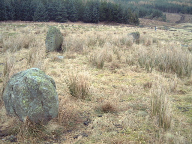
Overgrown in its surroundings, Burle states one of the stones is 5ft 6, but I dispute that. The northern end of the circle is closest to being intact, other stones are fallen or removed.
The modern landscape is blocked by plantations, but its proximity to Cheviot & Harthope suggest worship of the mother landscape.
Access is denied until June 2002 due to woodland operations
|

|
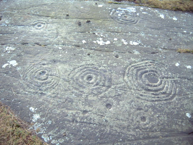
Up on the moor, turning off the Wooler to Chatton road at a 90º corner head up the single track road until you cross the first cattle grid. Park here and the rocks are on your right about 100yards away.
Stone markers have been left to show which rcoks are inscribed.
Our Neolithic friends had plenty of canvas to work on, but some of the largest & flattest rocks are untouched.
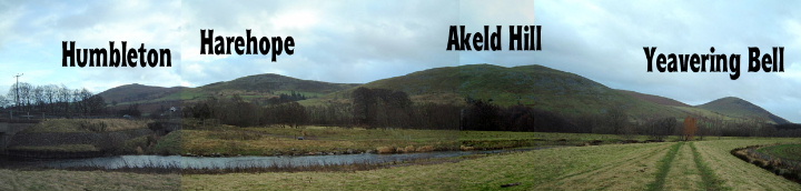
Looking at the views, maybe this is because of the carvings alignment with the surroundings. There are new trees nearby, but if you look to the South-West you can see the twin hills of Harthope and Cheviot.
A Sacred Landscape.
|
 
|
 
|

|
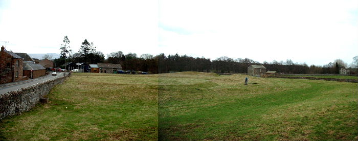
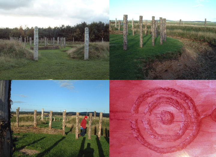
Maelmin is situated in the middle of the Milfield plain, part of the Till Valley. Today, it is a reconstruction of the Milfield North Henge. In the past it has been many things, Including a Royal Town.
Interesting to see beside the modern plantation, but step back and imagine how it must have looked, with the backdrop of the Cheviots - an awesome site.
The henge is 33 metres in Diameter with 21 outer posts and a ring of 30 inner postswith ditches and banks.
A reconstruction, with a short "timeline walk" but worth seeing. No dogs though which is disappointing for me. You can get info in the village of Milfield at the cafe
|
| |