|
|
The landowner told me that there was an old tale, not uncommon, of a giant throwing the large prostrate stone up on the hill from the cross near Killmeen creamery, a distance of about 2km. Not bad, across the wind.
|
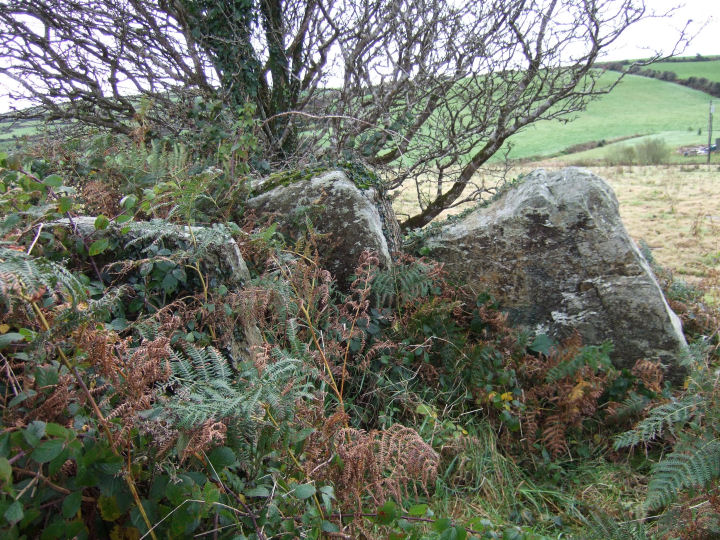
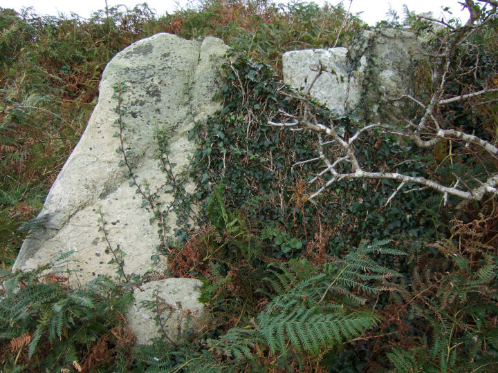
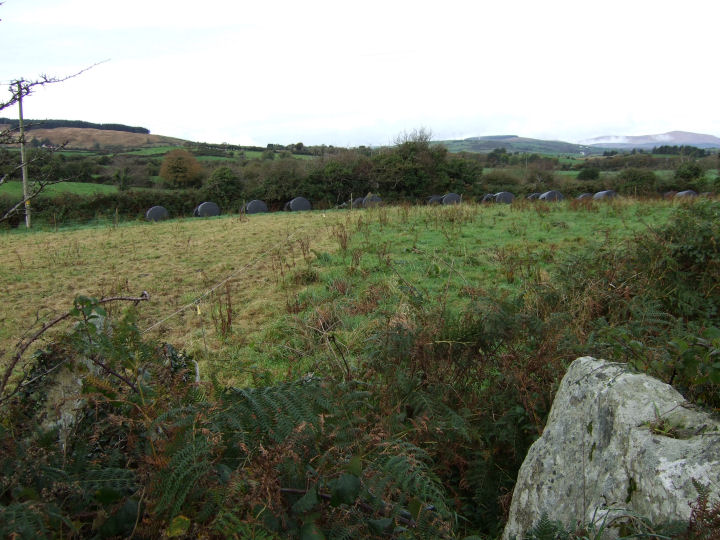
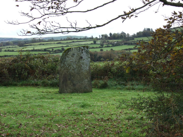
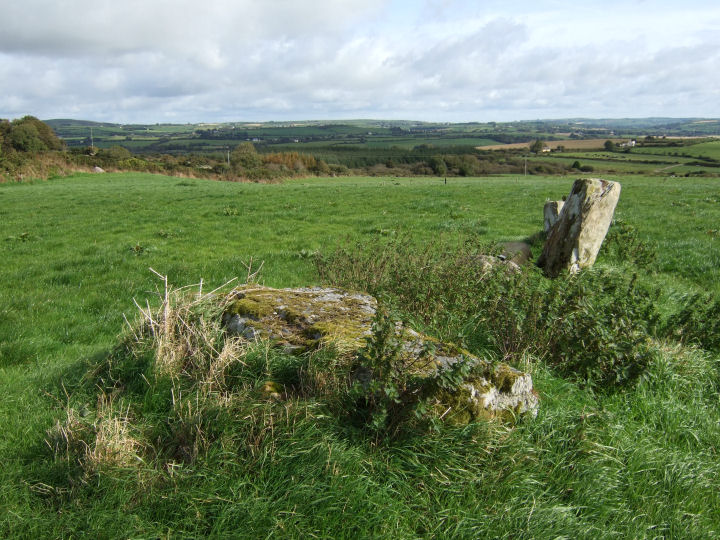
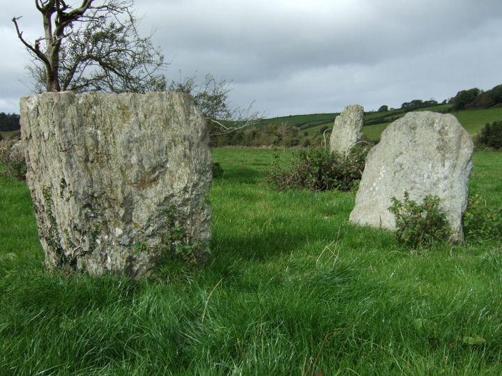
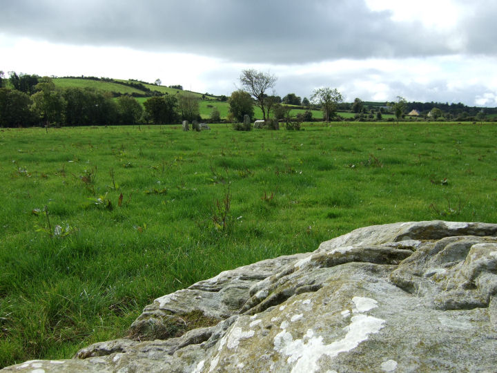
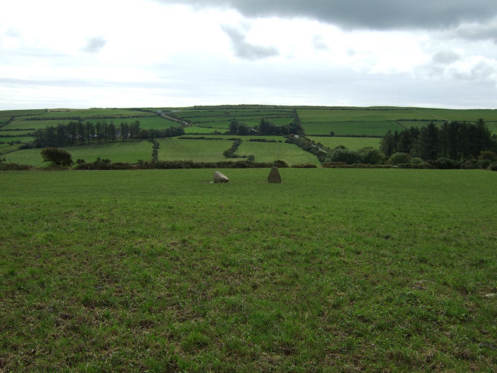
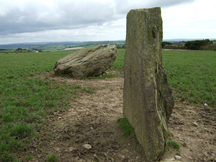
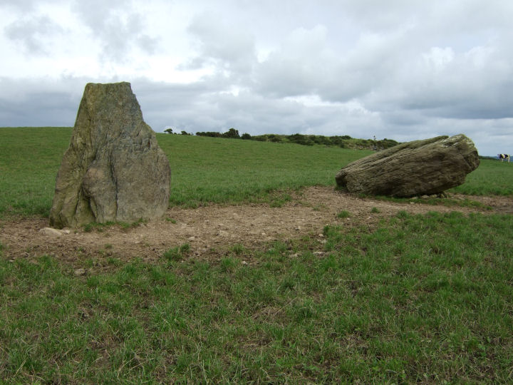
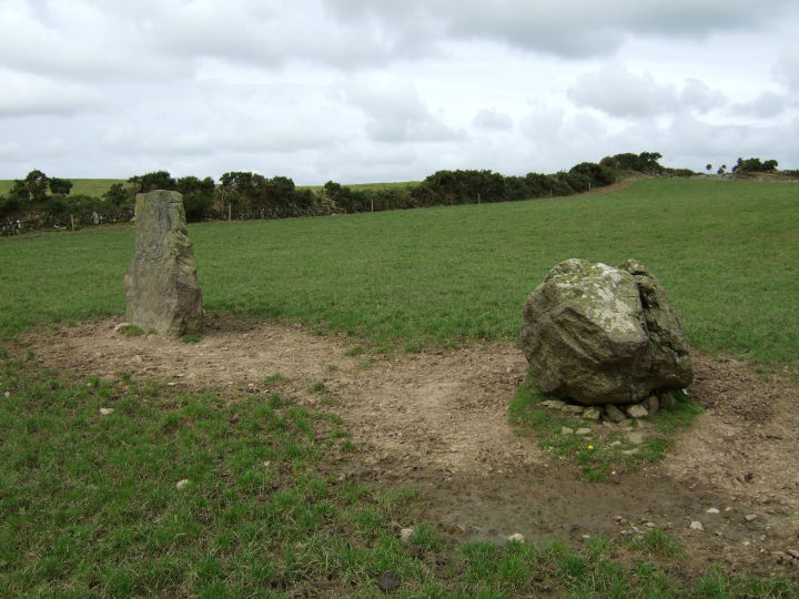
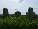
Three, maybe four stones, situated slightly back from the summit of a low hill; the view is considerable to the north and east, but bounded to the south by the proximity of higher ground at Knocklady/Clasharusheen and to the west by the field boundary hedge and the rise to the hilltop - another example of an Argideen/Rosscarbery row being unable to 'see' as much as it could if situated a short distance away.
Like Knockawaddra E the blindfold is partial (the Carrigfadda peaks are still visible), but in its apparent direction of indication. A look over the fence, on a roughly projected line southwestward from the row, reveals a glorious field-patch view, across the Argideen valley, to a point somewhere on the high ground at Clashatarriff. Visible with the naked eye, if you know where you're looking, are the row at Knocks and the circle at Knocks S.
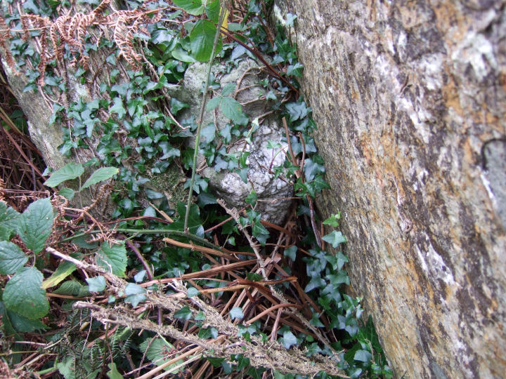
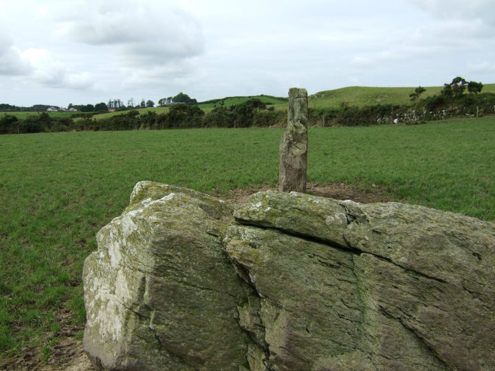
The alignment, as it originally stood, would have been a close, though oppositely focused, relation to Knockawaddra W; a swan guiding her cygnets in gliding procession or a tall sail in the bow - a huge 3m pillar to establish the direction for the line. There is a curious little additional block rooted in the ground just beside this fallen stone and mentioned in the Inventory, but it's difficult to guess at its purpose if it was an original feature.
Best to ask at the farmhouse at the end of the track, running up straight from the right angle bend on the by-road, for directions and access details. He's not the owner but he was kind enough to point me in the right direction.
Archaeological Inventory of Cork, 1992; No.156, 36
|
       
|
At least a couple of interesting features here:
There seems to be either two or four stones missing; the northern portal, the stone that would have been immediately to the south of the axial and perhaps two more set opposite each other on the north and south sides. The remains of Templebryan and Knocks S pose the same reimagining problem.
Of the remaining stones, all except the southern portal have, to some degree, flattened smooth tops. It's not unusual to come across a stone or two like this at any site, but all? Either there was a pressing ritual need for the elaboration or else this building group took particular pride in their work. The second orthosatat to the south of the axial, like that at Knocks N, is the most table-like.
The axial stone is almost a straight lift from Bohonagh; an inward-leaning, smooth top, bisected on its length by a seam and ending on its northern side with a downward slope.
The entrance stone is radially set, a feature shared by Bohonagh, Knocks N, Knocks S, Carrigagrenane S and Maulatanvally - all local circles in the Argideen/Rosscarbery group. Templebryan, Drombeg, Reenascreena, Ahagilla and Lettergorman S have their portals set on the circumference.
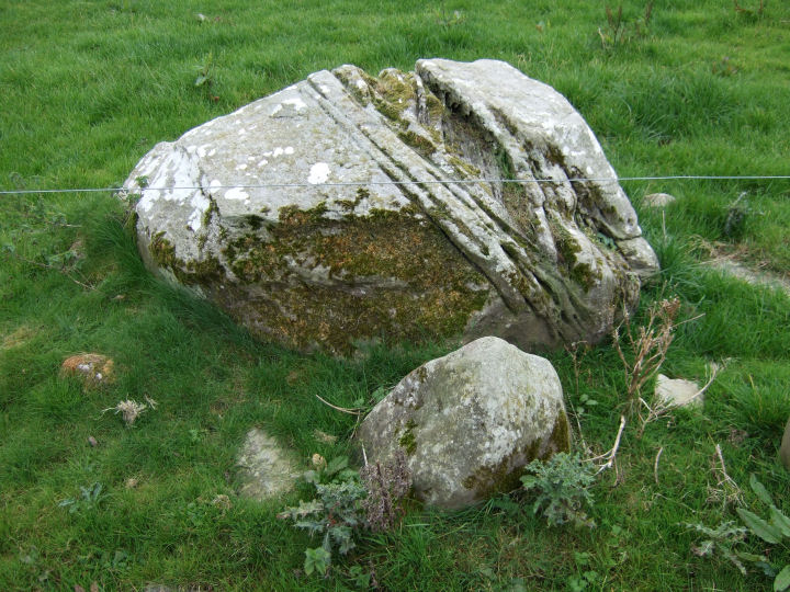
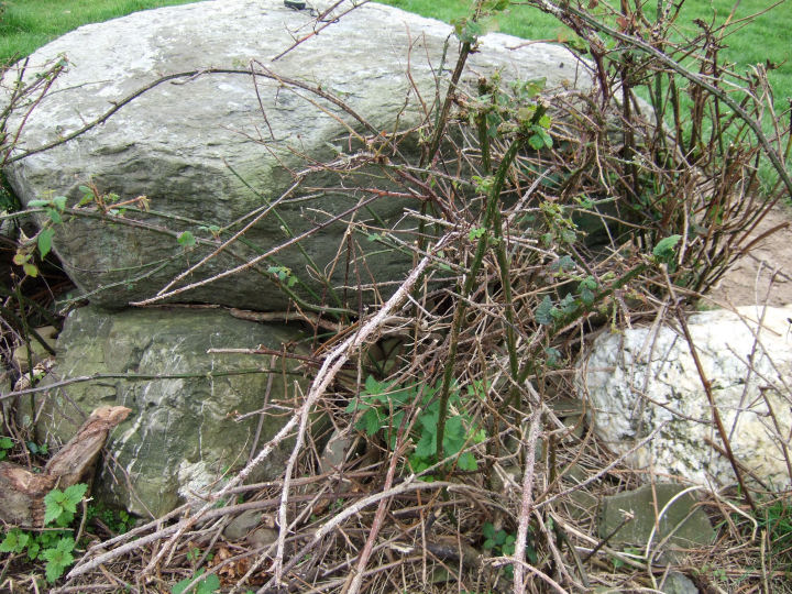
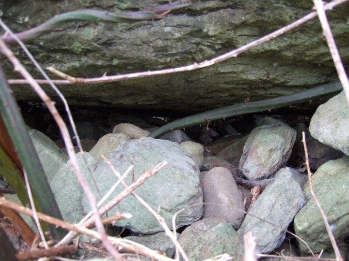
The large, clam-like stone, to the north of the circle, is listed in the Archaeological Inventory as a boulder-burial, though qualified in the midst of their description with a 'possible'. There is no sign of any support stones and the accompanying standing stone is also missing. This may now be the half-covered, ground-level flag on the western side - it would originally have stood only 50cm high.
The landowners live in the farmhouse on the opposite side of the main road, to the south.
Archaeological Inventory of Cork, 1992; No.43 (Stone Circle); No.99 (Boulder Burial); No.242 (Standing Stone)
Cope, 'The Megalithic European', 2004; 252
|
     
|
       
|
The term used for this class of monument; 'Boulder-Burial', is not exactly a misnomer although no human remains were found by Dr. William O'Brien in his excavation of three sites at Ballycommane and Cooradarrigan (dated from charcoal fragments to 1426-1266 BC). A token amount of cremated bone was found in the Bohonagh excavation and the acidic soil conditions may have been sufficient to destroy any similar evidence at the former three sites. I tend to think, though, that there is a sort of graceful beauty and fit to Somerville's suggestion, borrowed from the North-West of Ireland, of 'Clochtogle/Clach Tógáil' or 'Lifted Stone'.
Fahy, E., 'A Stone Circle, Hut and Dolmen at Bohonagh, Co. Cork', JCHAS 66, 1961; 94
O'Brien, W., 'Boulder-Burials: A Later Bronze Age Megalith Tradition in South-West Ireland', JCHAS 97, 1992; 11-35
Somerville, B.T., 'Prehistorics', JCHAS 33, 1928; 66
|
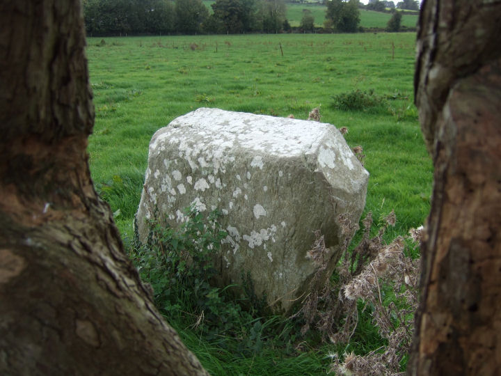
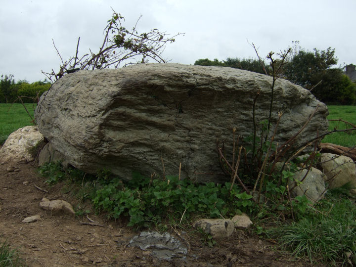
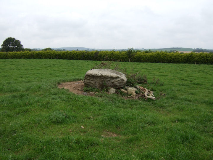
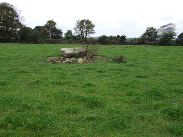
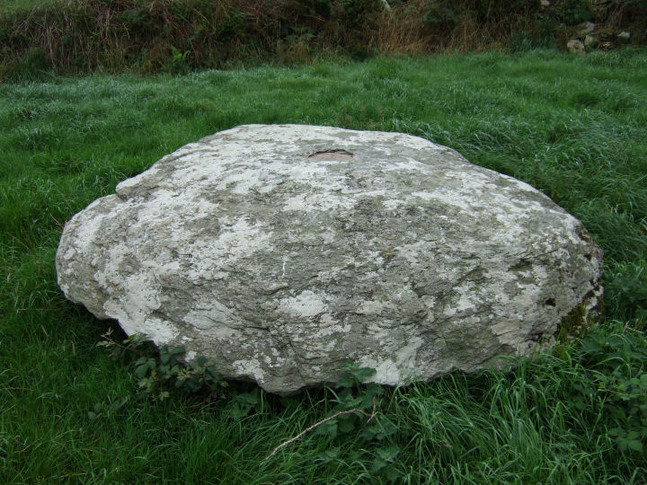
A typically impressive disc, set on the southern valley slope of the Argideen river; over two metres in diameter and almost a metre thick.
The measurements provided by the Archaeological Inventory for the immediate area are:
Caherkirky - 2.4m by 2.2m; 1m thick / 1.7m by 1.3m; 0.8m thick
Knocks (East) - 1.8m by 1.7m; 0.9m thick / 2.4m by 2.4m; 0.6m thick / 2m by 1.3m; 0.65m thick
Letter - 2.3m by 2.1m; 0.8m thick
One almost wonders if there was a form of Bronze Age grading in effect - an upper limit beyond which the stones would prove too cumbersome and a lower limit to ensure an impact on the landscape. The only significant deviations from this size are in the boulders accompanying the stone circles around Kealkil, although similarly connected sites, such as Gurteen and Kenmare, further north in Kerry, have the typical stand-alone dimensions:
Mill Little - 1.5m by 1.3m; 1.25m thick / 1.9m by 1.5m; 1.3m thick / 1.35m by 0.85m; 0.9m thick
Cappanaboul - 1.6m by 1.5m; 0.7m thick
Breeny More - 1.4m by 1.35m; 0.5m thick / 1.3m by 0.8m; 0.7m thick / 1.8m by 1m; 0.8m thick / 1.7m by 1.2m; 0.9m thick
Maughanaclea - 1.5m by 1.05m; 0.6m thick / 1.5m by 1m; 0.6m thick
It's an interesting question - did these smaller monuments reflect local restrictions on availability of suitable stone, or was the construction more affected by other factors such as inter-site influence, or local tradition?
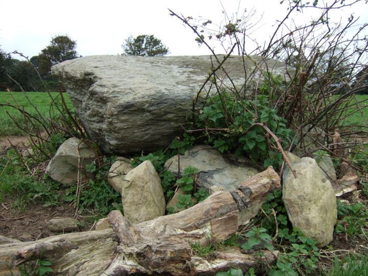
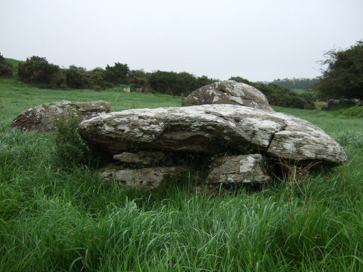
Dr. William O'Brien's excavation at the Cooradarrigan boulder-burial uncovered intriguing evidence of a wedge-shaped post-surround, widening towards the entrance feature on the northern side, which was in turn 'blocked' by another post. The open side of the boulder-burial at Bohonagh was found to contain a stone socket with uprooted slab which the excavator, E.M. Fahy, proposed as defining an entrance gap to the north-west. Though possibly not a universal rule, the arrangement of support stones underneath the cover often leaves one side open, varying in orientation from monument to monument.
The structure at Letter opens slightly west of north, tilted upwards like a cannon on just two forward supports, the western of which is further elaborated, double-portal fashion, by a large pyramidal quartz block. If a target was intended, it would seem to have faced directly toward a broad rise in a valley, across the Argideen at Knockea. Visible on the western horizon, but not indicated, is the Carrigfadda range.
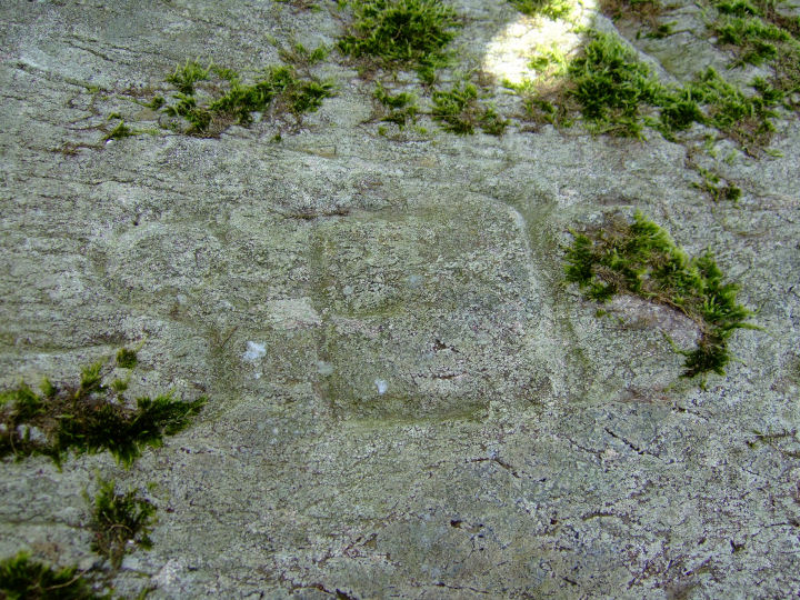
Three letters (M/A/T) are roughly scribed on the western side; presumably an acronym or abbreviation left behind by someone as a mark of their presence and noted by Jack Roberts in his 1988 survey.
The owners of this site, which can be easily accessed from an adjacent farmyard, live in the bungalow at the south-eastern corner of the field.
Archaeological Inventory of Cork 1992, No.125; 32
Fahy, E., 'A Stone Circle, Hut and Dolmen at Bohonagh, Co. Cork', JCHAS 66, 1961; 94
O'Brien, W., 'Boulder-Burials: A Later Bronze Age Megalith Tradition in South-West Ireland', JCHAS 97, 1992; 11-35
O'Nuallain, S., 'Boulder-Burials', PRIA 78 C, No.22; 92
Roberts, J., 'Exploring West Cork', 1988; Ch.1. No.21; 35
|
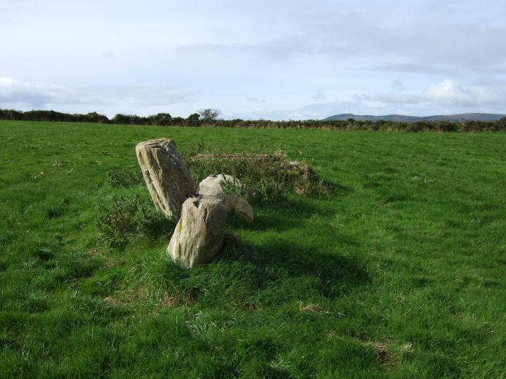
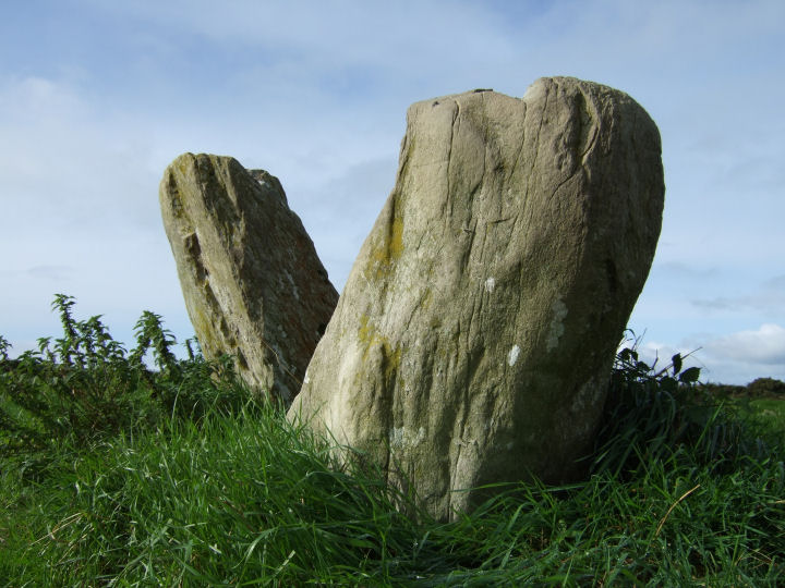
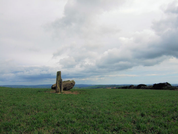
A bit of a conundrum this one. Jack Roberts mentions a standing stone and boulder/'cromlech', but the Archaeological Inventory has a stone pair, one fallen. O'Nuallain doesn't include the site in his survey of Stone Rows.
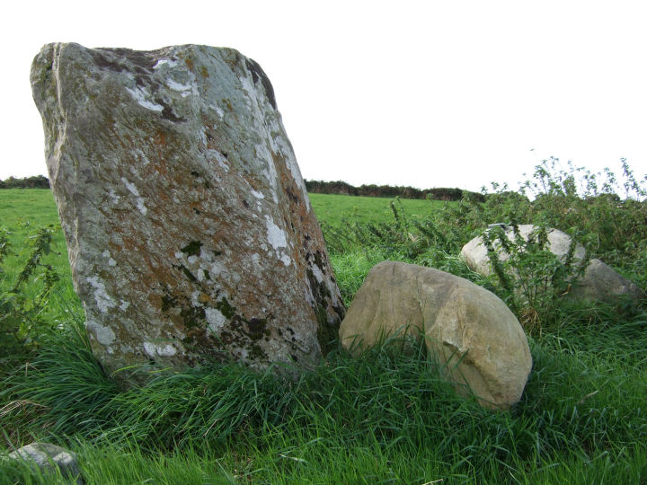
If it is a stone pair then the northeastern stone would seem to have fallen in such a way as to send its base back up the slope, although it's possible that it may not originally have stood in line with the flat face of the southwestern stone. This standing stone is slab-like, arrow-tip shaped. The prostrate one is a thick, heavy bludgeon - the demise of older technology mimed in stone. Both stones are substantial, broad on the land.
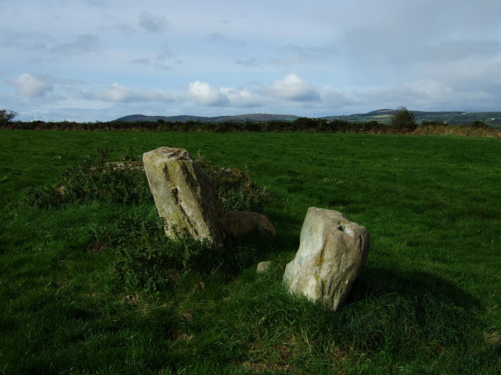
Certain characteristics, beyond the obligatory NE-SW orientation, are shared with the other local stone pair at Knockawaddra; both sites are screened by a rise to the north - a short distance would have carried them to a position with extensive views in most directions; and both sites are situated on the north side of a tributary of the Argideen, on a line roughly adjacent to the run of the stream. If the row at Knocks really is a pair it would complete the set, to the north of the Argideen itself.
It could presumably be argued that if the rivers were a focus of the monuments, then any other positioning - with a greater view of near-by landscape features, would dilute the desired effect. However the rivers themselves are not visible from the monument platforms. Perhaps the pairs could have represented the water, when seen from above, or have been a destination to walk up to from the river below? The flat face of the standing stone here is aligned on an obvious 'u' on the southwestern horizon and may merit further investigation.
The site is located in the second field up, to the right of an old track-way extending straight from the newer road. This road splits at the joining point and permission to visit may be obtained by following the right-hand section, to the farmhouse at the end. Small bit of electric-fence vaulting but no major problems.
Roberts, 'Exploring West Cork', 1988; Ch.6 No.14; 134
Archaeological Inventory of Cork Vol. 1, 1992; No.200; 42
Just a slight addition here:
In relation to the blinkered aspect of the two rows, Fourwinds has suggested that a position on the crown of the hill, as opposed to the summit, would make them more visible to people living close-by and from below. To be seen, rather than to see. Tiompan takes a slightly different tack, moving away from considerations of vision, and suggests a 'protecting' effect in having the rim above, or that the pairs may have marked a boundary, delineated by the river below.
Thank you both very much.
|
     
|
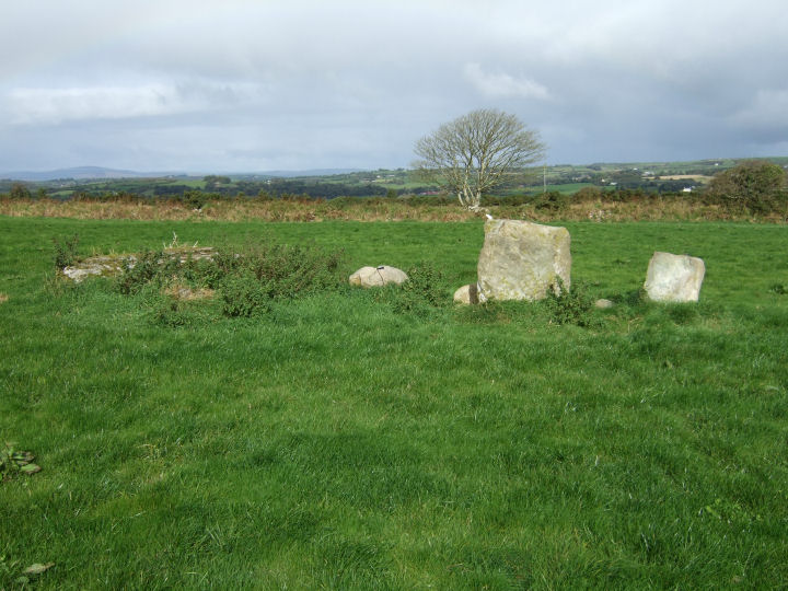
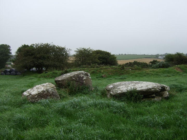
An interesting combination of features are present at this site, set by a minor junction to the Clonakilty-Enniskeane road, though the town-land name may prove confusing to those of you more familiar with the Knocks stone circles or row - located in an identically named area about 6km southwest, on the other side of Rossmore.
On the left-hand side as you enter the field gate is a well marked ring fort, filled and outlined with mature hawthorn, its southern arc incorporated in the field/road boundary. A slab in the interior partially covers the opening to what the Archaeological Inventory classifies as a possible souterrain, exposed after a ground collapse in 1985 and a southward-heading tunnel is clearly visible inside.(1)
Less than 10m west of the ring fort perimeter is one of the very occasional multiple groupings of Cork/Kerry boulder-burials, missed in this instance by O'Nuallain in his 1978 survey but described in the Inventory as 'Three boulder-burials set in form of triangle c. 1.5m apart.'(2)
It's curious how ordered the stone placement is in these cases; four boulders forming a square with a NE-SW axis at Breeny More, three boulders in a N-S line at Mill Little, two boulders forming a rough, yet defined, E-W avenue to a third stone here and a similar triangular arrangement punctuated by a fourth boulder at Derrymihan West.(3) There is further documentary evidence of a line of three at Lackadotia in North Cork.(4) Of course, any order may have been for its own sake rather than a product of ritual variation or necessity.
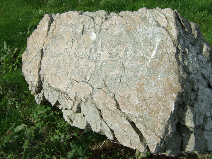
Incidentally, if you choose to see boulder-burials as mushroom-like, or if that was any part of the original intention then the southwestern capstone here was an excellent choice - it looks like someone already took a nibble out of the top of it. Permission to visit this site can be obtained from the farmhouse to the south, on the right-hand side of the main road.
(1) Archaeological Inventory of Cork Vol. 1, 1992; No.2344; 250.
(2) ibid.; No.124; 32.
(3) O'Nuallain, PRIA 78 C, 1978; No.18; 90, 105.
(4) ibid.; No.1; 83
|
   
|

|
 
|
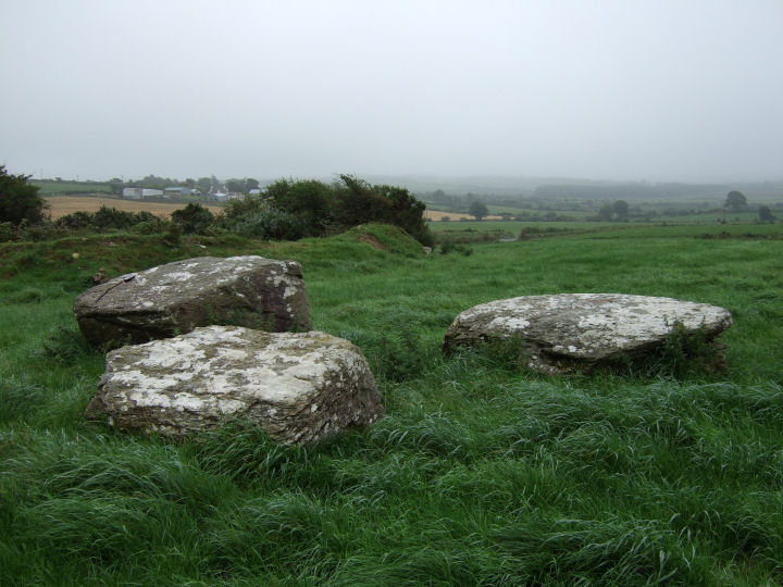
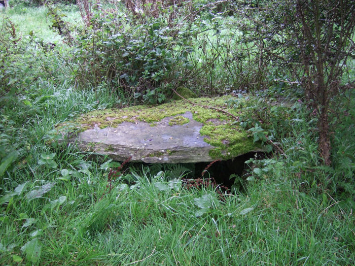
This mini-complex is set in a gradually-sloping, west-facing field with what would have been a long view, blocked now by the adjacent fence, towards the full Carrigfadda range. It comprises two boulder burials, the smaller of which is closely attended by a massive, horned monolith; 2.7m high and 1.9m wide. The larger, western boulder, tightly embraced by hawthorn, rests on three supports. The Inventory refers to one visible support under the eastern cap, but this is now concealed by overgrowth from the fence.
The line of this wall, running tangentially between the two monuments, also incorporates an interlink of two quartz blocks. These need not necessarily be original features, but the presence of similar stones at several Argideen river sites - Letter, Templebryan, Carrigagrenane N, Lettergorman S and both Maulatanvally groups - does offer strong support to the proposal.
It's also tempting, though highly speculative, to zoomorphise the suggestively-shaped pillar using later, local, bull-reference place-names as evidence. Certainly, the two extreme peaks of the Carrigfadda range, to the southwest, present an uncannily similar, horn-like appearance to the top of the roughly aligned stone.
Permission to visit this remarkable site can be obtained from the new house on the side of the road, at the north side of the field.
Archaeological Inventory of Cork, 1992; No.105, 30; No.260, 47.
|
http://antiquity.ac.uk/ProjGall/wilson/index.html
Scroll down here to get Michael Wilson's astronomical hypothesis, as it pertains to Caherkirky. He would have walked a short way north from the monument to get this clear horizon view, as far as I can make out. My picture was taken on the other side of the fence, to the south.
You can make up your own mind about the conclusions.
|
"Can this be death?" thought Prince Andrew, looking with a quite new, envious glance at the grass, the wormwood and the streamlet of smoke that curled up from the rotating black ball. "I cannot, I do not wish to die. I love life - I love this grass, this earth, this air..." He thought this, and at the same time remembered that people were looking at him.
Leo Tolstoy, 'War and Peace', Book Three, Part II, 36.
|
|