|

|
The following is a list of town-land names that I have translated from the map (in 'images') above. In order to keep clutter on the (small-scale) picture to a minimum, I have only inscribed those town-lands that contain megalithic remains. For this same reason I have omitted two standing stones from the sketches in Coolnaconarty. The topographical names appear in bold print on the map and are listed in the second section.
I
Reavouler; Baldir's Plain; Standing Stone
Killinga; Church of the (Finger) Nail; Standing Stone (Possible Stone Pair)
Curraghnaloughra; Moor of the Rushes; Standing Stone
Garryglass; Green Moor; Stone Circle
Tullig; Gentle Hill; Standing Stone
Reanascreena; Plain of the Shrine; Stone Circle
Milleenagun; Hillock of the Hounds; Standing Stone, Wedge Tomb
Lettergorman; Gorman's Hillside; Standing Stone, Four-Poster, Stone Circle
Knockawaddra; Hill of the Dog; Stone Pair, Stone Row
Maulatanvally; Hillock of the Old Town; Anomalous Stone Group, Stone Circle
Glanbrack; Speckled Glen; Anomalous Stone Pair, Stone Circle
Carrigagrenane; Rock of the Sun; Two Stone Circles
Sarue; (In this case; the Blind) Stream; Stone Pair
Inchinattin; Meadow of the Furze; Standing Stone
Coolnaconarty; Corner of the Hounds; Five Standing Stones (inc. Possible Anomalous Stone Pair)
Knocks; Hills; Standing Stone (Possible Stone Pair), Stone Pair (Possible Stone Row), Two Stone Circles
Derreen; Oak Grove; Standing Stone
Caherkirky; Fort of the Moors; Standing Stone, Two Boulder Burials
Knockatlowig; Hill of the Host (of People); Stone Row
Ahagilla; Field of the Standing Stones; Stone Circle
Coolcraheen; Crahen's Corner; Standing Stone
The area included is approximately 14km from east to west and 9km north to south; the western Argideen river-valley, the hills around Carrigfadda and "a remarkable concentration of recumbent stone circles, Five-Stone rings and Four Posters."* The relevant name-translations are based on information provided at http://www.logainm.ie, with the exception of the following; Reavouler, Garryglass, Reanascreena, Carrigagrenane, Sarue, Caherkirky, Knockatlowig, and Ahagilla.**
*Burl, "A Guide to the Stone Circles of Britain, Ireland and Brittany", 2005; 227.
**Reavouler; "Mowler's Plain" in logainm.ie. The 'v' sound in the name and the presence of a 'd' in the earliest examples (Revaldir etc.) inclined me instead towards the use of Baldir or Balder, similar to the translation of Carhoovauler in the same resource; "Boulder's Quarter".
Garryglass; "Green Garden" in logainm.ie. Although this is a perfectly valid translation, with precedent elsewhere in the country, the local pronunciation of the name and the type of landscape, have inclined me towards "curry" (marsh/moor), rather than "garry".
Reanascreena; Not translated in logainm.ie; "Ring of the Shrine" in Burl (2005); According to P.W. Joyce "Reidh" is a coarse mountain flat (plain), which makes sense in the context of this town-land's location.
Carrigagrenane; "Rock of the Bower/Arbor" in logainm.ie; "Rock of the House of the Sun" in Burl (2005); Local pronunciation drops the final syllable of the town-land's name and the area is referred to by the older generation, in English, as "Sunny Rock". At the risk of being romantic, I followed this convention.
Sarue; "Overpowering, Profaning" in logainm.ie. According to Joyce "Sruth" is a stream.
Caherkirky; "The Hen's Stone Fort" in logainm.ie. "Corcach" meaning marsh or moor seems more plausible than "Cearc" as a basis for "Kirky", yet the pronunciation of that term, as evidenced in other local names, is not exactly like that found here. Not sure about this one.
Knockatlowig; Not translated in logainm.ie. According to Joyce "Sluagh" is a host or great grouping of people.
Ahagilla; Not translated in logainm.ie. According to Joyce "Achadh" is a field and "Gall" a standing stone, or foreigner.
II
An tAirgidin; Silver River
Carrigfadda; The Long Rock
Loch Atarriff; Lake of the Bull
Glashagleragh; Noisy Stream
Clashatarriff; Furrow of the Bull
Blind Stream
Corran Lake; Lake of the Cairn
Curraghalicky Lake; Lake of the Flagstone Moor
An tSaobhnósach; River of False Custom
http://www.themodernantiquarian.com/forum/?thread=48142&message=600210
http://www.themodernantiquarian.com/forum/?thread=23046&message=615648
|
 
|
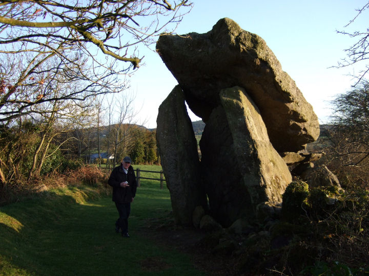
The Titan, Atlas, was ordered to stand and support the high heavens on his shoulders, a comparison that often comes to mind at portal tombs; all those vast blocks held from plummeting by ancient limbs and ingenuity. None is held higher than here, the tallest (portal tomb) portal stones in the British Isles; 3.6m and 3.5m from the ground and capped by a great horned firmament, starred, appropriately, with blazing quartz.
Equally impressive is the symbiosis between this primus and the secondary capstone. Neither, being otherwise supported on just one side, would stay aloft without its companion. The former rests on one portal and the doorstone, then pins the latter onto the backstone and a pad on one sidestone. Have a look at Ryaner's photograph, from behind the monument, for a partial illustration.
*Measurements taken from the (very, very thorough): Kytmannow, 'Portal Tombs In The Landscape', BAR 455, 2008, 37. Great book.
|
  
|
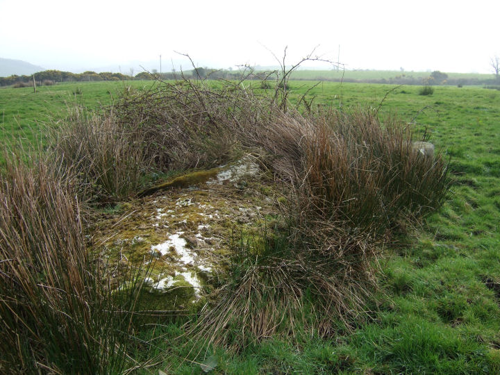
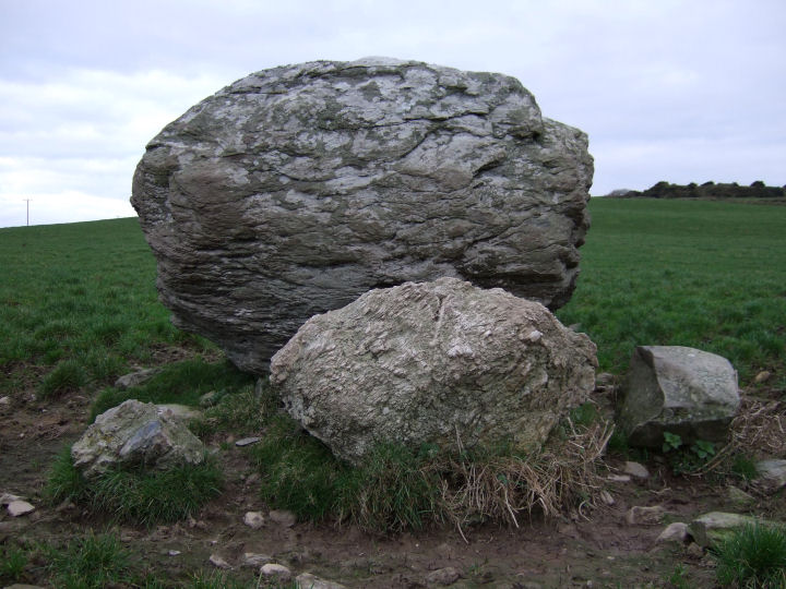
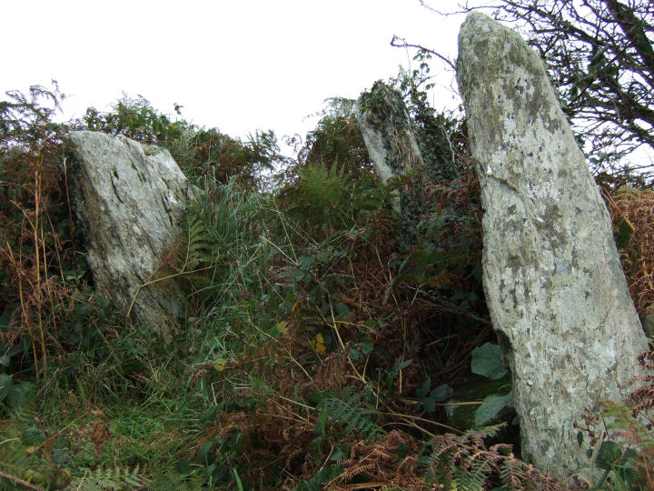
A low, upright pillar, jutting from the rushes and bushes. Then, behind this growing screen, a vast recumbent slab; 2.7m long, 2m wide and 1.45m thick*.
Recorded in the Archaeological Inventory, following local tradition, as a mass rock, it may eventually provide an interesting comparison to a similarly classed and cup-marked boulder at Coorleigh South. Due to the heavy scrub on the south-eastern side of the stone, Jack Roberts' sketch remains the only visual record of the marks or 'circular depressions'**.
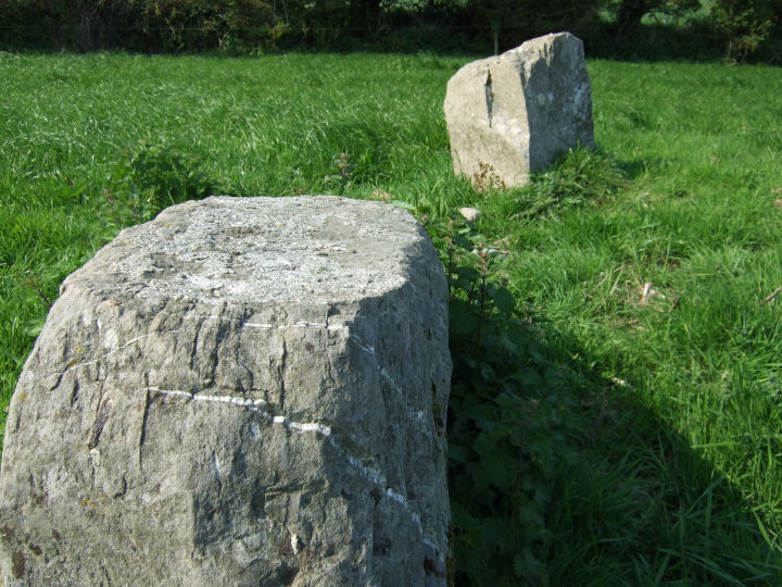
The fallen part of a NE-SW stone pair, if position and local morphology (Knockatlowig, Knockawaddra W) are taken into account.
*Archaeological Inventory of Cork, 1992; No.3271, 354.
**Roberts, J., 'Exploring West Cork', 1988; Ch.2, No.12, 53.
|
  
|

|
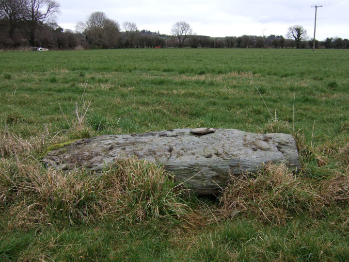
A couple of fields east of the cross at Killmeen Creamery and a short distance south of the road, are two stones, recorded separately in the Archaeological Inventory*. Only 26m divides them - a unique stretch if they initially formed a stone row, but uncommonly close for individual standing-stones. Both were knocked accidentally, by a reversing trailer, some time before the compilation of the Inventory records.
The northern slab has been partially re-erected and the stone on which it balances, though tall, may be an original support. There is no guarantee that the southern stone is exactly at its original position. A shallow depression in the ground, a couple of metres to the east, could as easily be the source. The present positions seem to roughly agree, however, with those shown on the early 20th century OS map - forming an inter-stone alignment running NNW-SSE. This, given human error, would match the N-S upright-slab orientation recalled by the landowner. The direction is, again, of course, unusual for a local stone row, but may not rule out the remains of some large free-standing monument or habitation.
Permission to visit may be obtained from the farmhouse on the opposite side of the road. One for the obsessive, perhaps.
*Archaeological Inventory of Cork, 1992; No.302, No.303, 51
|
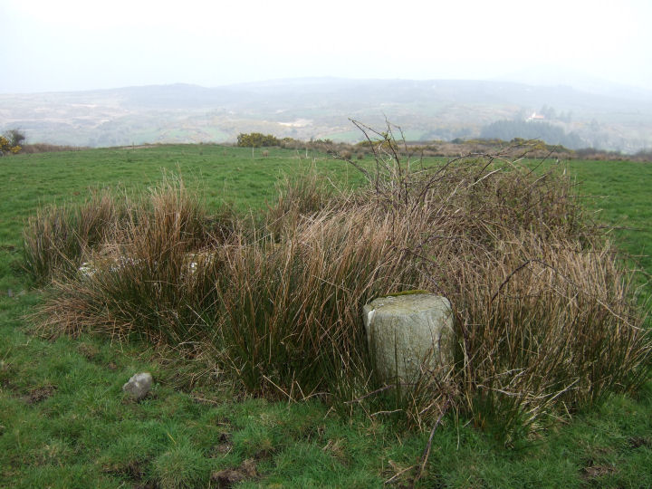
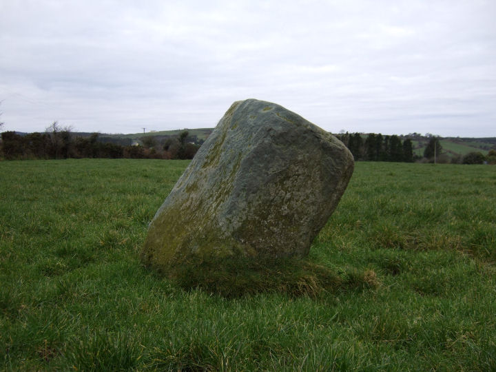
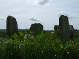
Visible on the rise to the west of the road between the circles of Knocks N and Knocks S is this leaning pillar; 1.25m high* and intermittently pocked, as if by wormholes, on its flat top surface. Its longer axis is oriented NE-SW. The 1st Edition OS Map indicates an accompanying stone, most likely a paired continuation of the orientation.
*Archaeological Inventory of Cork, 1992; No.427, 61
|
  
|

|
Laid close to the summit on the eastern side of Burgatia hill and obvious in a field to the left of a road junction as you drive north, is this striking egg-shaped cap-stone; 2.25m by 1.7m and 1.4m thick*. It is lifted and supported by the inside edges of two blocks, the eastern and larger of which is a quartz conglomerate. Clearly visible at the next junction and almost disconcertingly close across the valley to the east, is Bohonagh stone circle.
This is an area, associated with St. Fachtna, where historic and early Christian curl tightly with the prehistoric. Immediately across the road are the remains of Lisfachtna and Templefachtna.
*Archaeological Inventory of Cork, 1992; No.104, 30
|

|

|
'They have made themselves an image of a bull-calf, they have prostrated themselves before it, sacrificed to it and said, "These are your gods, O Israel, that brought you up from Egypt."'
Exodus 32, 8.
'Can brazen cymbals clashing, pipes with curving horns, trickery and magic have an effect so great…?'
Ovid, Metamorphoses, Penguin, 1955, trans. Mary M. Innes, Book III; within 518-555.
'When morning came, the men of Ireland saw the Donn Cuailnge coming westward past Cruachan with the mangled remains of Finnbennach hanging from his horns.
He brandished them before him all that day, and at nightfall entered the lake near Cruachan.'
The Táin, translated from the Tain Bó Cuailgne by Thomas Kinsella, Oxford, 2002, 252.
|
"There was an ancient forest which no axe had ever touched, and in the heart of it a cave, overgrown with branches and osiers, forming a low arch with its rocky walls, rich in bubbling springs. Hidden in this cave dwelt the serpent of Mars, a creature with a wonderful golden crest; fire flashed from its eyes, its body was all puffed up with poison, and from its mouth, set with a triple row of teeth, flickered a three-forked tongue."
Cadmus, son of King Agenor of Sidon, struggled with and defeated the monster...
"Then Pallas, the hero's patroness, suddenly appeared, gliding down through the upper air. She told him to plough up the earth, and to sow the serpent's teeth, as seeds from which his people would spring."
from 'The Founding of Thebes'; Ovid, Metamorphoses, Book III.
|
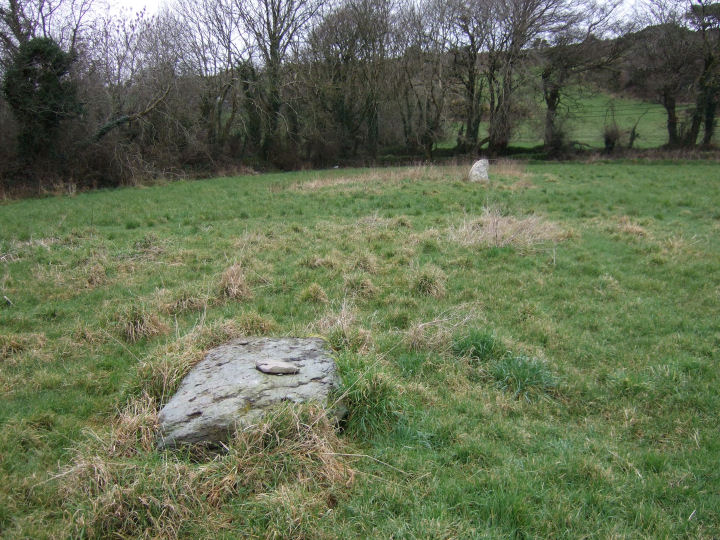
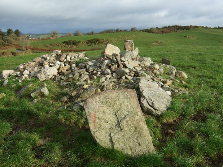
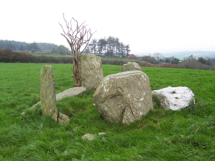
A daunting puzzle, but the pieces may still be there - six or seven likely stones are mixed with the still-extending field clearance fill. Three stones remain on the perimeter. The two to the northeast; one intact and flat-topped, one a stump, look likely to be portals but the third survivor; the axial-stone, is set on a line to the north of the complete pillar and its companion.
It seems probable, given its disposition, that this stone has been pushed south a full quarter-turn and would have originally featured an upper internal concave area (22cm wide in this case), similar to Lettergorman S. A revised mid-portal-axial line would strike a notch in the high ground across the valley, about five degrees further north.
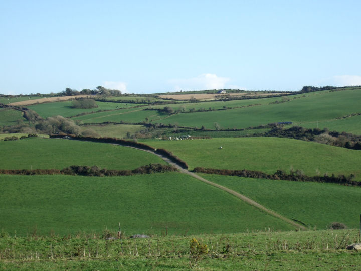
The circle is set just north of a low knoll. Only brief glimpses of distance are available between hills to the NE and ESE, but a wide vista, with a well-marked horizon, is provided to the SW.
The very obliging owner of this land lives in the farmhouse on the same by-road, immediately to the west.
|
   
|
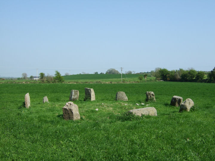
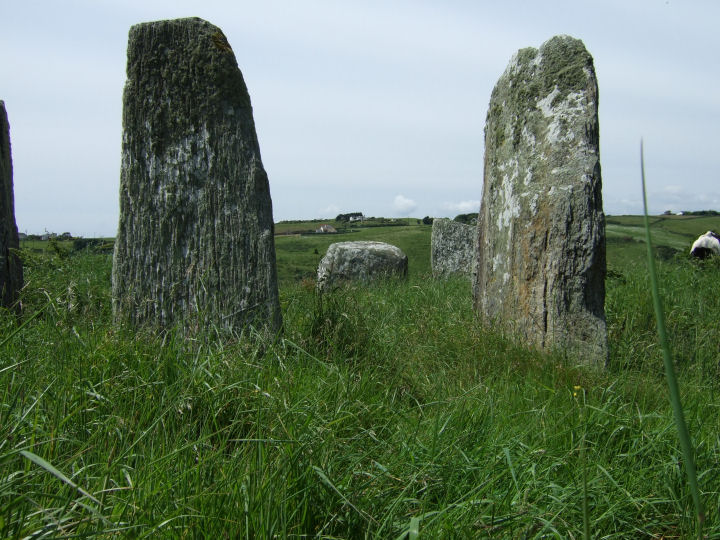
Possibly the most intriguing site in the whole Argideen/Rosscarbery area - four stones, three of quartz; a unit of two sets of parallel pairs, rising from the spine of the hill. Two of the quartz stones, the southernmost of each pair, are included in the fence. The western rock is recumbent but the eastern is standing, 2.3m distant*. The third juts 1.4m north of and parallel to, the western stone.
The remaining slab, of sandstone, was recently tumbled (by cattle) from a position 1m north of the eastern rock and its southern tip now points to the base of its partner in the wall. All, assuming the recumbent quartz is fallen, would have stood in an ENE-WSW arrangement of fairly uniform appearance - each around 1m in height.
The slope is east facing but, at this particular location on the hill, it is possible to see clearly to the north, east and south. The view is only restricted to the west. It is also a position in which the monument itself could be seen from many directions, but from a distance. If the quartz boulder at Lettergorman S is an original feature its placing may reflect this - the white stones of Maulatanvally are bright on the horizon if you gaze out from the circle and over the top of the rock.
*All measurements taken from Archaeological Inventory of Cork, 1992; No.921, 112.
|
 
|

|
 
|
  
|
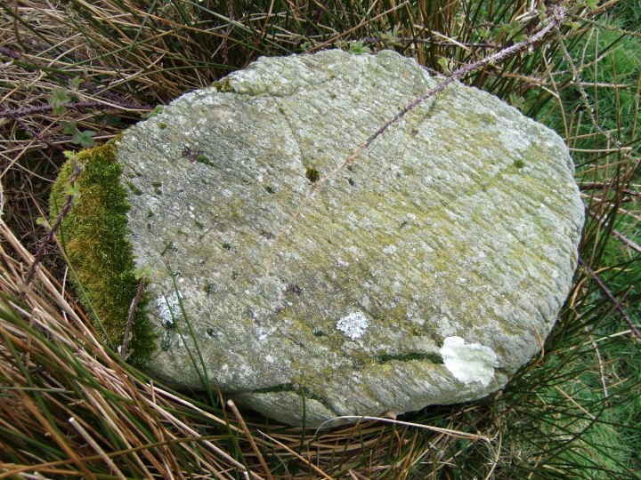
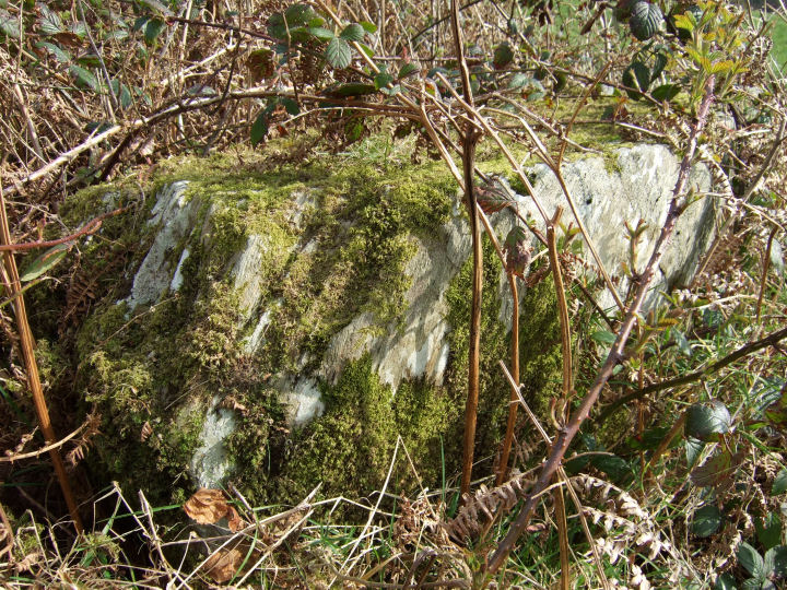
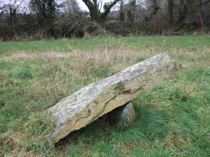
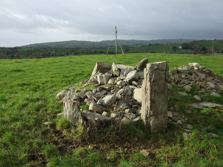
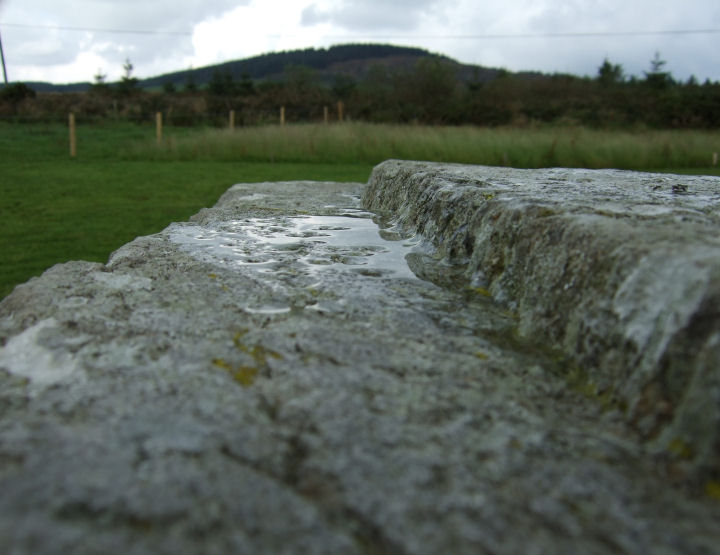
This carved and cup-marked boulder, classified by the Archaeological Inventory as a mass-rock, is raised on the north-eastern side of a shallow basin, with mid-range views to the south and west. Cup-marked rocks are not plentiful in this area but there is a light scattering along the south coast, between Clonakilty and Rosscarbery.
The boulder is imposing, coffin shaped; 2.08m long, 1.42m wide, 0.57m thick (measurements from Archaeological Inventory), shouldered by two blocks - each placed centrally under a flank - and what appears to be a mound of smaller stones under the north-eastern, quartz-tipped end. It is aligned, along its longer axis, NE-SW. While it looks like a possible (south-west opening) boulder-burial, its traditional reputation as a mass-rock could point to a more recent, early 18th Century origin.
The top surface contains eleven cup marks, 3cm to 5cm in diameter and grouped on a raised shelf; part of a defined central rectangle. This shape is lightly marked on the longer sides, just inside the width of the stone, but deeply trenched where it separates from the main body; grooves 7cm wide and 3cm deep, 1.1m apart and parallel. The exterior of the rectangle is 1cm lower that the interior.
While tempting to imagine the entire assemblage as some prehistoric magnum opus, it seems more likely that the outline carving was done at a later date, possibly as an altar elaboration in penal times. The cup marks, gracefully curve-patterned, must be part of a much older - Bronze Age, at least - design on the same feature.
Just over 1km north-east, in the town-land of Gortnascarty and immediately to the rear of the ruins of Kilkerranmore church and graveyard, is another possible boulder-burial - classified in the Inventory as a "megalithic structure" (W36351 38865). No support stones are visible underneath. Two jagged upright slabs, perhaps the remnants of a NE-SW alignment or, less likely, part of a kerbing arrangement, lead from the south-eastern end of the monument. Given the proximity of the graveyard, these could be ancient grave-markers but, if so, they would have been placed unusually close to its side.
The boulder at Coorleigh South is not marked on the OS map so it may be best to just plot these GPS coordinates and look out for it on the south side of the road. The very obliging landowners live in the farm-buildings on the same side of the road, on the rise to the east.
Thanks to Reg for pointing this one out to me.
Archaeological Inventory of Cork, 1992; No.3263, 353 (Coorleigh South); No.934, 114 (Gortnascarty).
|
 
|
    
|
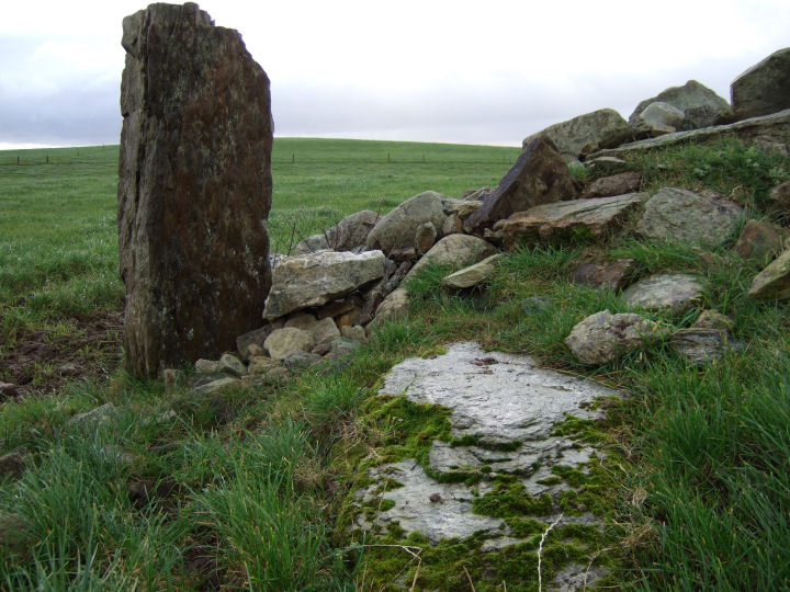
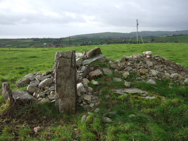
Mired in the remnants of a junction of field fences, on a low rise above a by-road and about 1km ENE of the four-poster at Lettergorman N, this is the only wedge-tomb in the Argideen/Rosscarbery area. It is located a considerable distance south and east of the general concentrations of its class, at the northern edge of the circle/row/boulder-burial 'complex' that dominates the land east of Carrigfadda. Views from this position are long to the east, north and west, but bounded to the south by the rise to Knockawaddra. The tomb itself opens out (roughly) WSW, towards a point north of Kippagh.
Only three standing slabs, of the four mentioned in the Inventory, are visible. One to the north of the gallery and two, of the recorded three, at the southern side. These two stones form the shade of what must have been a substantial double-wall. At least a couple of small boulders, one ended in quartz, are wedged tightly between them, but it's unclear whether or not these were original fill. All three side-stones lean over to the north and a large block props the southernmost slab at its base.
A stout quartz-ended boulder at the eastern tip of the monument is surely too low to be the 'displaced backstone' and there is no sign of the prostrate 'displaced sidestone or roofstone' in the heavy surrounding growth.
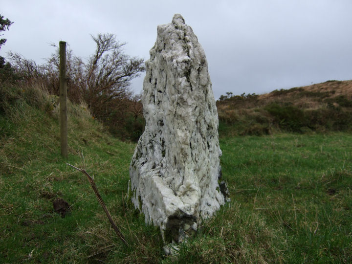
Beyond the north-eastern corner of the field, on the other side of an old track that leads east from the by-road, is an enigmatic, blade-like standing stone; 2.25m high and aligned NNE-SSW, called 'The Pillar'. If the intervening hedges were removed the two monuments would occupy, but at a polite distance, the same space; a juxtaposition similar to the circle/row and wedge-tomb at Glantane N.
Given Dr. William O'Brien's discovery of a prolonged use-history at Altar wedge-tomb, it may be worth considering the possibility that this pillar was a Late Bronze Age attempt to share what must have been judged an important, unique location. Or, perhaps, to link it with the ritual-centres on the other side of the hill. A line projected SSW from its main axis cuts east of the Knockawaddra rows, across the Glashagloragh valley towards Glanbrack.
Archaeological Inventory of Cork, 1992; No.34, 18 (wedge-tomb); No.452, 63 (standing stone).
|

|
"Can this be death?" thought Prince Andrew, looking with a quite new, envious glance at the grass, the wormwood and the streamlet of smoke that curled up from the rotating black ball. "I cannot, I do not wish to die. I love life - I love this grass, this earth, this air..." He thought this, and at the same time remembered that people were looking at him.
Leo Tolstoy, 'War and Peace', Book Three, Part II, 36.
|
|