The Modern Antiquarian
Log in
|
Register
Home
Latest Posts
Forums
Maps
Help
Browse Sites
News
Blog
Contributors
The Books
Select
-
Belgium
Denmark
Eire
France
Germany
Greece
Italy
The Netherlands
Norway
Portugal
Republic of Malta
Spain
Sweden
Switzerland
United Kingdom
Scotland
Highland (Mainland)
Loedebest
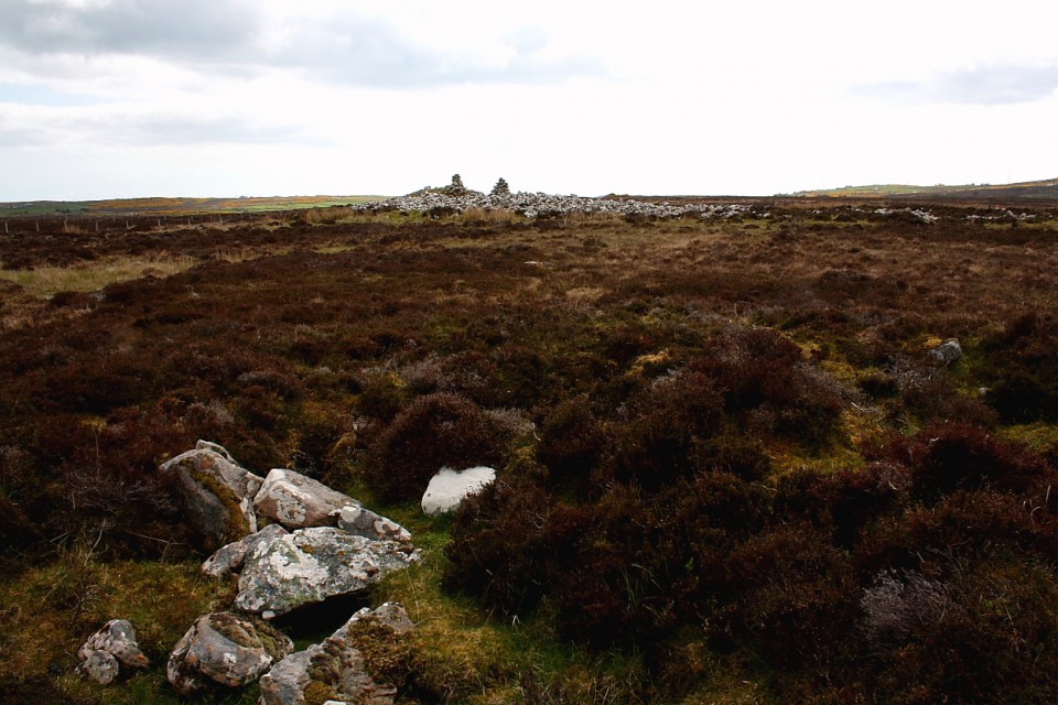
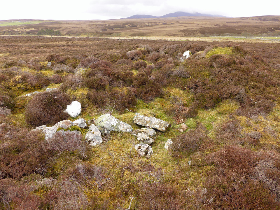
Chambered Cairn
Loedebest (Chambered Cairn) on The Modern Antiquarian, the UK & Ireland's most popular megalithic community website. 2 images, plus information on many more ancient sites nearby and across the UK & Ireland.
Image © thelonious
Nearest Town:
Wick (29km NE)
OS Ref (GB):
ND14003209 /
Sheets: 11, 17
Latitude:
58° 16' 9.1" N
Longitude:
3° 27' 58.2" W
Added by
thelonious
Images (2)
0 discussions
Start a topic
Show |
Hide
Web searches for Loedebest
Flickr
Google
Google Images
MAGIC
The Megalithic Portal
Bing
Stone Pages
Streetmap.co.uk
Wikipedia
Show map
(inline Google Map)
- Sites within 20 km -
-
Carn Liath (0.05km ESE) (13 posts)
Loedebest Wood (0.38km S) (5 posts)
Loedebest West (0.65km W) (8 posts)
Cnoc Na Maranaich (1.24km WNW) (6 posts)
Cnoc Na Maranaich (1.32km WNW) (6 posts)
Cnoc Na Maranaich (1.34km WNW) (15 posts)
Balantrath (1.42km SE) (4 posts)
Buoldhu (1.63km NE) (3 posts)
Dunbrae (1.68km ESE) (2 posts)
Cuag (1.68km NE) (4 posts)
Burn of Houstry (1.72km ENE) (5 posts)
Dunbeath Broch (2.25km ESE) (15 posts)
Minera (2.84km NE) (6 posts)
Houstry Broch (South) (2.92km NE) (3 posts)
Tiantulloch (3.32km NNE) (7 posts)
Knockinnon (3.69km E) (4 posts)
Upper Latheron (4.14km E) (6 posts)
Guidebest (4.99km ENE) (15 posts)
Upper Borgue (5.24km SSW) (4 posts)
Upper Borgue (5.6km SSW) (5 posts)
Buldoo (6.16km ENE) (18 posts)
Wag of Forse (6.97km ENE) (9 posts)
Forse House (7.15km ENE) (2 posts)
Forse House (7.59km ENE) (1 post)
Forse, Latheron (7.95km ENE) (6 posts)
Golsary (8.4km NE) (5 posts)
Rumster (8.74km ENE) (3 posts)
Loch Rangag (10.39km NNE) (13 posts)
The Great U of Stemster (10.72km NNE) (37 posts)
Achkinloch (10.77km NNE) (8 posts)
Borgue Langwell (10.96km SSW) (9 posts)
Langwell (10.96km SSW) (7 posts)
Backlass (11.91km WNW) (5 posts)
Rangag West (13.29km NNE) (11 posts)
Allt Preas Bhealaich (13.49km WSW) (3 posts)
Ousdale Burn (14.92km SSW) (22 posts)
Dirlot (16.53km NNW) (5 posts)
Hill O'Many Stanes (16.68km ENE) (29 posts)
Camster Stone Row (16.72km NE) (4 posts)
Grey Cairns of Camster (16.86km NE) (81 posts)
Green Table (16.87km SSW) (0 posts)
Tulach Mor (17.28km N) (12 posts)
Tormsdale Stone Rows (17.59km N) (1 post)
Tulach Beag (17.67km N) (5 posts)
Lower Camster (18.17km NE) (9 posts)
Bruan (18.42km ENE) (6 posts)
Carn na Mairg (Carn Merk) (18.9km NNW) (11 posts)
Kenny's Cairn (19.04km ENE) (14 posts)
Caen Burn, Strath of Kildonan (19.14km SW) (35 posts)
Warehouse S (19.18km ENE) (14 posts)
Warehouse N (19.29km ENE) (8 posts)
Garrywhin Stone Rows (19.44km ENE) (5 posts)
Garrywhin (19.44km ENE) (29 posts)
Garrywhin Cists (19.44km ENE) (10 posts)
Carn Laggie (19.44km SW) (12 posts)
Garrywhin (19.53km ENE) (9 posts)
Kilphedir (19.62km SW) (16 posts)
Kilphedir (19.64km SW) (9 posts)
Warehouse E (19.68km ENE) (10 posts)
South Yarrows S (19.69km ENE) (16 posts)
Salscraggie Cairn (19.74km SW) (9 posts)
Tulach Buaile a'Chroic (19.74km NNW) (6 posts)
Watenan South (19.8km ENE) (7 posts)
South Yarrows N (19.86km ENE) (6 posts)
Tulach Lochain Bhraseil (19.92km NNW) (4 posts)
Tulach an Fhuarain (19.96km NNW) (2 posts)
- Add -
-
Add news
Add an image
Add fieldnotes
Add folklore
Add miscellaneous
Add a link
-
Add a site
Add a nearby facility
Add an alternative name/spelling
Images
(click to view fullsize)
Add an image
 Image © thelonious