The Modern Antiquarian
Log in
|
Register
Home
Latest Posts
Forums
Maps
Help
Browse Sites
News
Blog
Contributors
The Books
Select
-
Belgium
Denmark
Eire
France
Germany
Greece
Italy
The Netherlands
Norway
Portugal
Republic of Malta
Spain
Sweden
Switzerland
United Kingdom
Scotland
Perth and Kinross
Lettoch
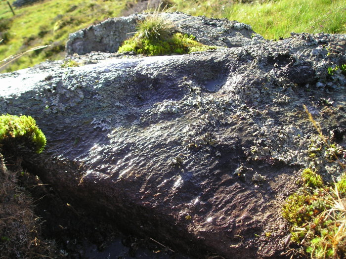
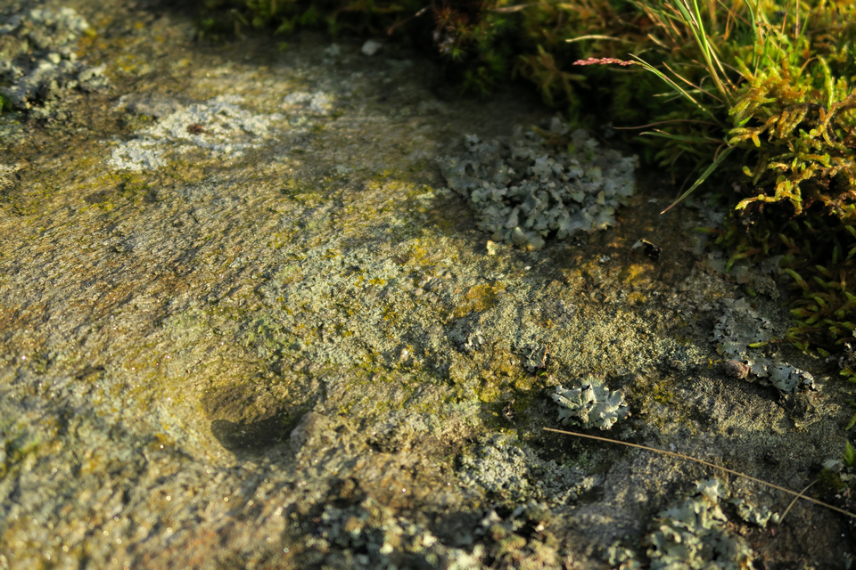
Cup Marked Stone
Lettoch (Cup Marked Stone) on The Modern Antiquarian, the UK & Ireland's most popular megalithic community website. 6 images, 1 fieldnote, plus information on many more ancient sites nearby and across the UK & Ireland.
Image © tiompan
Nearest Town:
Pitlochry (7km SE)
OS Ref (GB):
NN9106164289 /
Sheet: 43
Latitude:
56° 45' 26.81" N
Longitude:
3° 46' 55.24" W
Added by
thelonious
Images (6)
Fieldnotes (1)
0 discussions
Start a topic
Show |
Hide
Web searches for Lettoch
Flickr
Google
Google Images
MAGIC
The Megalithic Portal
Bing
Stone Pages
Streetmap.co.uk
Wikipedia
Show map
(inline Google Map)
- Sites within 20 km -
-
Killiecrankie (1.12km S) (17 posts)
Sithean Na Cluana (1.37km W) (0 posts)
Strathgroy (1.55km W) (7 posts)
Glen Clune (1.64km N) (3 posts)
Old Faskally (1.88km E) (4 posts)
Glen Clune (1.96km NW) (5 posts)
Old Faskally (1.96km E) (4 posts)
Ardtulichan (2.05km SW) (3 posts)
Ardtulichan (2.15km SW) (3 posts)
Ardtulichan (2.37km SW) (6 posts)
Strathgarry (2.51km WSW) (6 posts)
Glen Fender (3.01km N) (5 posts)
Creag Odhar (3.44km WSW) (4 posts)
Clach na h' Iobairt (3.59km W) (9 posts)
Dundavie (3.75km WSW) (3 posts)
Fincastle Farm (3.94km WSW) (5 posts)
Tulach Hill (4.89km WSW) (7 posts)
Craigiedun (5.16km SE) (8 posts)
Baledmond (5.18km ESE) (7 posts)
Faskally - Pitlochry (5.75km SE) (34 posts)
Dane's Stone (5.8km ESE) (27 posts)
Balnakeilly Stone (6.02km ESE) (19 posts)
Queen's View (6.32km SW) (5 posts)
Cnoc Dubh (6.4km ESE) (2 posts)
Balnakeilly (6.82km ESE) (10 posts)
Na Carraigean (7.49km WSW) (40 posts)
Badyo (7.96km E) (6 posts)
Dunfallandy (8.13km SE) (6 posts)
Clachan An Diridh (8.58km SSE) (65 posts)
Clach Na h-Iobairt (9.07km W) (14 posts)
Balnabodach (9.33km WSW) (11 posts)
Dalnavaid (9.83km E) (4 posts)
Lurgan (9.92km WSW) (42 posts)
Tomintianda (10.03km WSW) (4 posts)
Pitcastle (10.08km S) (3 posts)
Creagan Fheadaire (10.08km S) (4 posts)
Clach Na Buidseach (10.18km SSE) (3 posts)
Tullypowrie (10.18km SSE) (8 posts)
Pitnacree (11.11km SSE) (22 posts)
Haugh of Grandtully Farm (11.11km SSE) (15 posts)
Balendune (11.28km S) (7 posts)
Middleton of Derculich (12.02km S) (6 posts)
Lurgan Farm (12.09km SSW) (6 posts)
Clach Na Croiche (12.67km SE) (24 posts)
Straloch Stone (12.7km E) (19 posts)
Craigbea (12.75km ESE) (3 posts)
Tigh Na Ruaich (12.78km ESE) (33 posts)
Cumin's Cairn (13.29km NE) (1 post)
Witch's Stone, Straloch (13.39km ENE) (7 posts)
Glen Derby (13.4km E) (4 posts)
Kinaldie (13.61km WSW) (1 post)
Tom-an-Droighne (13.91km SSW) (0 posts)
Lundin Farm (13.96km S) (43 posts)
Glassie (14.01km SSW) (8 posts)
Boltachan Burn (14.16km SSW) (0 posts)
Gleann Fearnach (14.2km ENE) (5 posts)
Carn Tulach (14.24km SSW) (8 posts)
Tulliemet (14.32km ESE) (2 posts)
Tulloch (14.33km E) (11 posts)
Lundin (14.38km S) (5 posts)
Croft House Stone (14.62km E) (20 posts)
Grantully Hill (14.81km S) (2 posts)
Wester Enochdhu (14.94km E) (18 posts)
Clach Glas (15.11km ESE) (8 posts)
Tombreck (15.19km WSW) (1 post)
Giant's Grave, Enochdhu (15.25km E) (8 posts)
Haugh Cottages (15.26km ESE) (2 posts)
Knoc-Na-Eaglais (15.39km S) (2 posts)
Tombreck (15.48km WSW) (0 posts)
Calamanach (16.08km ENE) (5 posts)
Kilmorich (16.26km ESE) (14 posts)
Kindallachan (16.28km ESE) (8 posts)
Balvarran (16.42km E) (5 posts)
Faire Na Paitig (16.48km ENE) (20 posts)
Upper Gaskan (16.61km WSW) (27 posts)
Creag Na Larach (16.95km SE) (4 posts)
Castle Menzies Cursus (16.98km SSW) (1 post)
Pitcarmick Burn 4 (17.07km E) (5 posts)
Pitcarmick Burn 3 (17.12km E) (8 posts)
Pitcarmick Burn (17.15km E) (0 posts)
Pitcarmick Burn 2 (17.18km E) (8 posts)
Balhomais (17.19km SSW) (17 posts)
Over Bohespic (17.19km WSW) (6 posts)
Pitcarmick Burn (17.24km E) (6 posts)
Craig Kynachan (17.48km WSW) (4 posts)
Whitefield (17.52km E) (6 posts)
Balchrochan (17.9km E) (6 posts)
Nether Tullicro (17.93km SW) (0 posts)
Braes of Foss (18.17km WSW) (24 posts)
An Torr (18.23km SSW) (11 posts)
The Appin of Dull (18.43km SW) (12 posts)
St. Anne's Well (18.46km ESE) (1 post)
Urlar Burn (18.5km SSW) (2 posts)
Clachan More (18.63km ESE) (8 posts)
Coilleaichur (18.91km SSW) (5 posts)
Carse Farm I (18.95km SW) (26 posts)
Carse Farm II (19.2km SW) (11 posts)
Glengoulandie (19.29km SW) (21 posts)
Balnabroich Stone (19.46km E) (16 posts)
Balnabroich Two Poster (19.54km E) (20 posts)
Balnabroich standing stone (19.55km E) (5 posts)
Tullichuil (19.63km SW) (4 posts)
Black Burn (19.95km SSW) (46 posts)
Dalnabreck (19.95km E) (7 posts)
- Facilities within 20 km -
-
Faskally Caravan Park (Camping Site: 4.5 km SSE)
The Moulin Inn (Hotel: 6.1 km SE)
Pitlochry Backpackers ... (Youth Hostel: 6.7 km SE)
House of Bruar (Restaurant: 9.3 km W)
Loch Tummel Inn (Pub: 10.1 km SW)
Struan Inn (Hotel: 10.9 km W)
Tulloch Guest House (Bed & Breakfast: 14.6 km E)
Black Watch Inn (Pub: 16.2 km S)
Breadalbane Arms Hotel (Pub: 16.2 km S)
House of Menzies (Cafe: 16.6 km SSW)
- Add -
-
Add news
Add an image
Add fieldnotes
Add folklore
Add miscellaneous
Add a link
-
Add a site
Add a nearby facility
Add an alternative name/spelling
Images
(click to view fullsize)
Add an image
Fieldnotes
Add fieldnotes
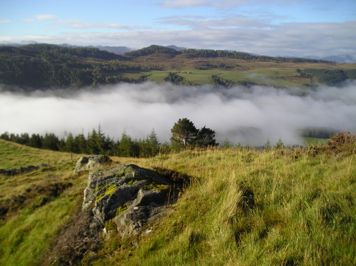
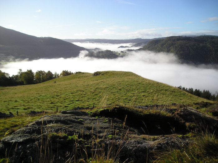
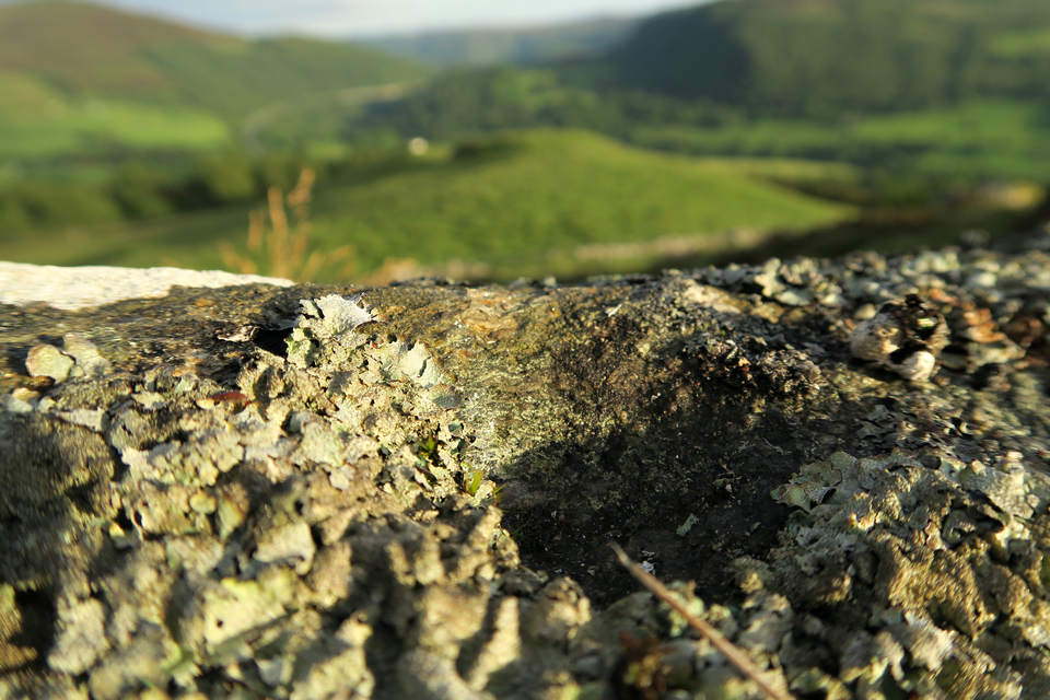
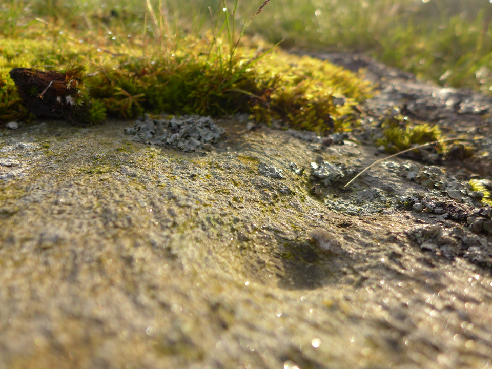
26/06/2015 - Possible cup marked rock (NN 91061 64289) above Lettoch. Rock is about 100m to the south and downhill from a hut circle (?) (NN 91065 64401). If you are passing I would be interested in another opinion :-)
Fine area for a walk.
Comments (0)
|
Add a comment
|
Permalink
Posted by
thelonious
28th June 2015ce
Edited 2nd July 2015ce

 Posted by thelonious