The Modern Antiquarian
Log in
|
Register
Home
Latest Posts
Forums
Maps
Help
Browse Sites
News
Blog
Contributors
The Books
Select
-
Belgium
Denmark
Eire
France
Germany
Greece
Italy
The Netherlands
Norway
Portugal
Republic of Malta
Spain
Sweden
Switzerland
United Kingdom
Scotland
Central Scotland
North Ayrshire (incl. Arran)
Arran
Creag Dhubh
Hillfort
Creag Dhubh (Creaghdhubh) (Hillfort) on The Modern Antiquarian, the UK & Ireland's most popular megalithic community website. 4 images, plus information on many more ancient sites nearby and across the UK & Ireland.
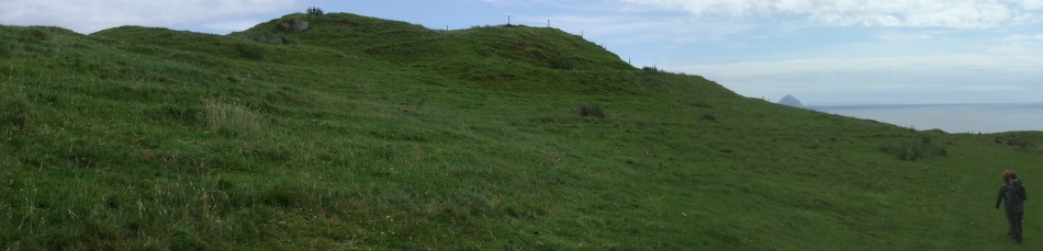
Image © Howburn Digger's 2017 Arran Jaunt
Also known as:
Creaghdhubh
Nearest Town:
Campbeltown (28km WSW)
OS Ref (GB):
NR99872122 /
Sheet: 69
Latitude:
55° 26' 37.66" N
Longitude:
5° 9' 52.07" W
Added by
Howburn Digger
Images (4)
0 discussions
Start a topic
Show |
Hide
Web searches for Creag Dhubh
Flickr
Google
Google Images
MAGIC
The Megalithic Portal
Bing
Stone Pages
Streetmap.co.uk
Wikipedia
Show map
(inline Google Map)
- Sites within 20 km -
-
East Bennan (0.77km SW) (8 posts)
Black Cave (1.17km SSW) (7 posts)
Baile Meadhonach (3.06km NE) (2 posts)
Kildonan (3.93km E) (9 posts)
Aucheleffan (4.29km WNW) (14 posts)
Torrylin (4.35km WSW) (24 posts)
Dippin (4.59km ENE) (4 posts)
Ossian's Mound (4.83km WSW) (1 post)
Cleiteadh (4.95km WSW) (3 posts)
Largybeg (4.96km ENE) (15 posts)
Carn Ban (5.02km NNW) (4 posts)
Torr an Loisgte (5.44km NE) (13 posts)
Giants' Graves (5.63km NE) (40 posts)
Oscar's Grave (6.05km W) (3 posts)
Allt Cul Corriehiam (7.51km WNW) (7 posts)
Allt Cul Corriehiam 2 (7.59km WNW) (3 posts)
Sliddery (7.63km W) (4 posts)
Allt Cul Corrriehiam (7.72km WNW) (3 posts)
Monamore (7.77km N) (16 posts)
Torr a Chaistell (7.89km W) (2 posts)
Kingscross Point (8.46km NE) (4 posts)
Monamore Glen (8.65km N) (1 post)
Kilpatrick Dun (or Cashel) (10.48km W) (1 post)
Cnoc Ballygown (11.09km WNW) (1 post)
North Blairmore (11.96km N) (2 posts)
Dunan Beag (12.08km N) (12 posts)
Dunan Mor (12.11km N) (13 posts)
Lamlash (12.32km N) (27 posts)
Shiskine (13.33km WNW) (3 posts)
Glenrickard Chambered Cairn (13.36km N) (3 posts)
Clauchlands (13.46km NNE) (1 post)
Tormore I (13.71km WNW) (5 posts)
The Doon (13.76km W) (5 posts)
The Doon (13.76km W) (4 posts)
Machrie Moor (14.23km WNW) (107 posts)
Tormore II (14.33km WNW) (4 posts)
Moss Farm II (14.36km WNW) (5 posts)
Moyish (14.39km N) (7 posts)
Moss Farm (14.4km WNW) (15 posts)
Moss Farm North (14.56km WNW) (14 posts)
Allt Mor (14.88km NNW) (3 posts)
Moss Farm Road (14.95km WNW) (22 posts)
King's Cave (14.95km WNW) (19 posts)
Machrie Moor chambered cairn (15.06km WNW) (2 posts)
Stronach Wood (15.16km NNW) (66 posts)
Monyquil (15.17km NW) (7 posts)
Stronach (15.38km N) (16 posts)
Machriewater Foot (16.24km WNW) (9 posts)
Deer Park (16.26km NNW) (21 posts)
Machrie Burn (16.54km WNW) (8 posts)
Auchagallon (16.94km WNW) (28 posts)
Merkland (17.92km N) (11 posts)
Druid Auchencar (18.47km WNW) (20 posts)
- Add -
-
Add news
Add an image
Add fieldnotes
Add folklore
Add miscellaneous
Add a link
-
Add a site
Add a nearby facility
Add an alternative name/spelling
Images
(click to view fullsize)
Add an image
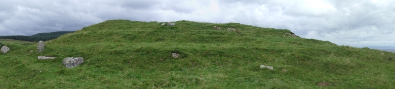
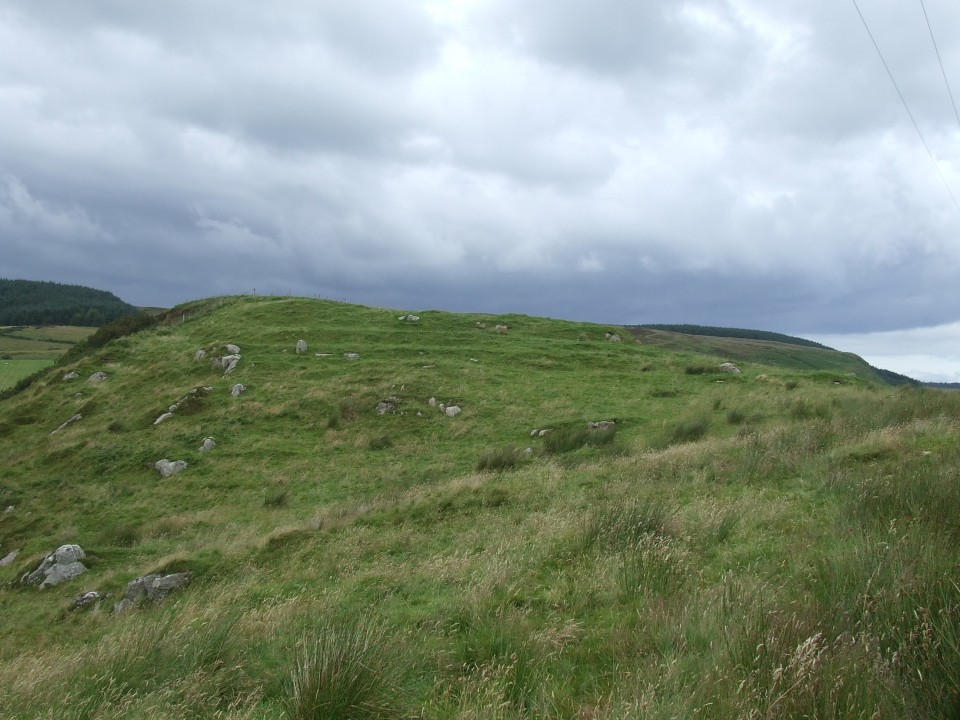
 Image © Howburn Digger's 2017 Arran Jaunt