The Modern Antiquarian
Log in
|
Register
Home
Latest Posts
Forums
Maps
Help
Browse Sites
News
Blog
Contributors
The Books
Select
-
Belgium
Denmark
Eire
France
Germany
Greece
Italy
The Netherlands
Norway
Portugal
Republic of Malta
Spain
Sweden
Switzerland
United Kingdom
Scotland
The Shetland Isles
Bays Water
Chambered Cairn
Bays Water (Chambered Cairn) on The Modern Antiquarian, the UK & Ireland's most popular megalithic community website. 4 images, 1 fieldnote, plus information on many more ancient sites nearby and across the UK & Ireland.
Image © thelonious
Nearest Town:
Lerwick (29km SE)
OS Ref (GB):
HU33486737 /
Sheets: 2, 3
Latitude:
60° 23' 21.66" N
Longitude:
1° 23' 33.16" W
Added by
thelonious
Images (4)
Fieldnotes (1)
0 discussions
Start a topic
Show |
Hide
Web searches for Bays Water
Flickr
Google
Google Images
MAGIC
The Megalithic Portal
Bing
Stone Pages
Streetmap.co.uk
Wikipedia
Show map
(inline Google Map)
- Sites within 20 km -
-
Culsetter (0.15km WNW) (10 posts)
Skeo Of Gossaford (0.84km ESE) (5 posts)
Islesburgh (1.06km NNW) (10 posts)
Mavis Grind (1.23km NNE) (4 posts)
The Busta Stone (1.32km ENE) (10 posts)
Hill of Burravoe (2.91km E) (7 posts)
Yamna Field, Gluss (9.9km N) (2 posts)
East Burrafirth (10.12km SE) (6 posts)
Gravlaba Knowe (11.59km S) (1 post)
Laxo (11.67km E) (1 post)
South Hill of Lunna (13.67km E) (1 post)
Ernes Ward (15.28km SSW) (1 post)
Weisdale Hill (15.66km SE) (4 posts)
Loch of Breckon (16.03km WNW) (1 post)
The Giant's Stones of Hamnavoe (16.05km WNW) (2 posts)
March (16.11km WNW) (1 post)
Sae Breck (16.32km WNW) (3 posts)
Ronas Hill (16.35km NNW) (9 posts)
Staneydale Cairns (16.88km SSW) (1 post)
Scord of Brouster (17.55km SW) (8 posts)
Skellister (17.63km ESE) (4 posts)
Loch of Flatpunds (17.71km SW) (1 post)
Stanydale Temple (17.78km SSW) (21 posts)
Cattapund Knowe (18.02km SW) (1 post)
Beorgs of Housetter Cairn (18.19km N) (9 posts)
Gallow Hill (18.2km SSW) (1 post)
Hard Knowe (18.23km ESE) (1 post)
The Beorgs of Housetter (18.28km N) (8 posts)
Trowie Knowe (18.3km N) (6 posts)
Sandness Hill (18.4km WSW) (5 posts)
Gallow Hill Cairn (18.41km SW) (1 post)
Benston (18.78km ESE) (1 post)
Loch of Huxter (19.22km WSW) (5 posts)
Seli Voe (19.34km SSW) (1 post)
Skelberry (19.72km N) (1 post)
- Add -
-
Add news
Add an image
Add fieldnotes
Add folklore
Add miscellaneous
Add a link
-
Add a site
Add a nearby facility
Add an alternative name/spelling
Images
(click to view fullsize)
Add an image
Fieldnotes
Add fieldnotes
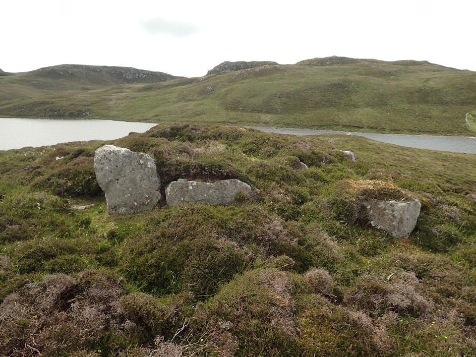
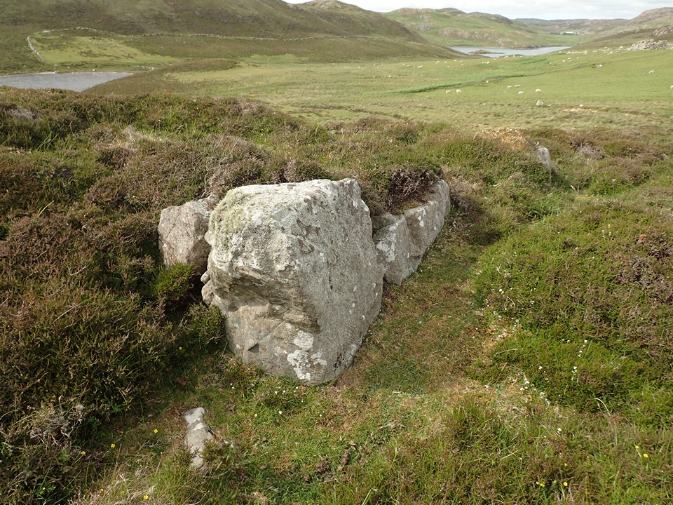
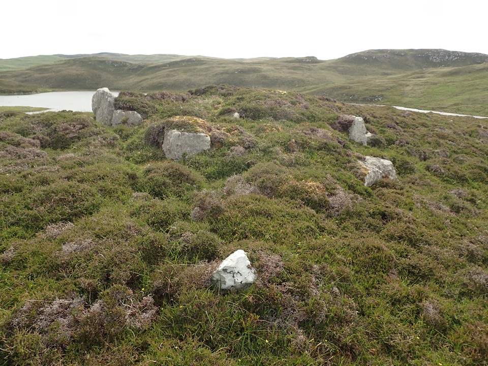
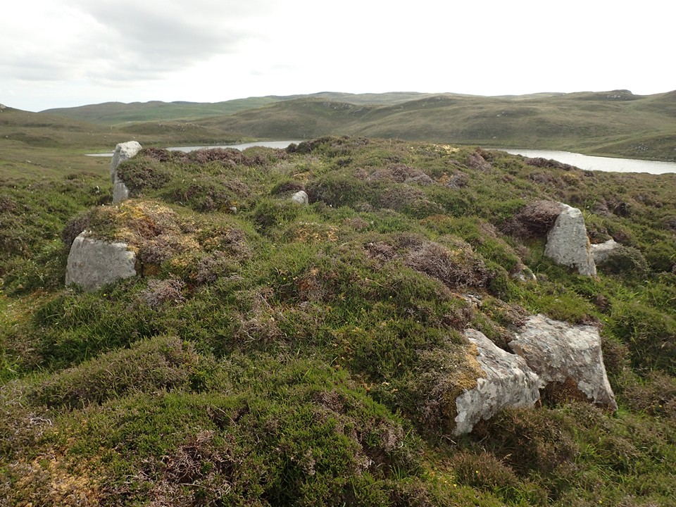
24/06/2023 - A nice heel-shaped chambered cairn on a rocky knoll just above Bays Water loch. The slightly concave front of the cairn faces SE. A fantastic Neolithic settlement just beyond.
Comments (0)
|
Add a comment
|
Permalink
Posted by
thelonious
7th July 2023ce

 Posted by thelonious