|
|

|
|
Barmekin HillHillfort
|
||||||||||||||||||||||||
|
|
|
Images (click to view fullsize) |
|
|
Fieldnotes |
|
|
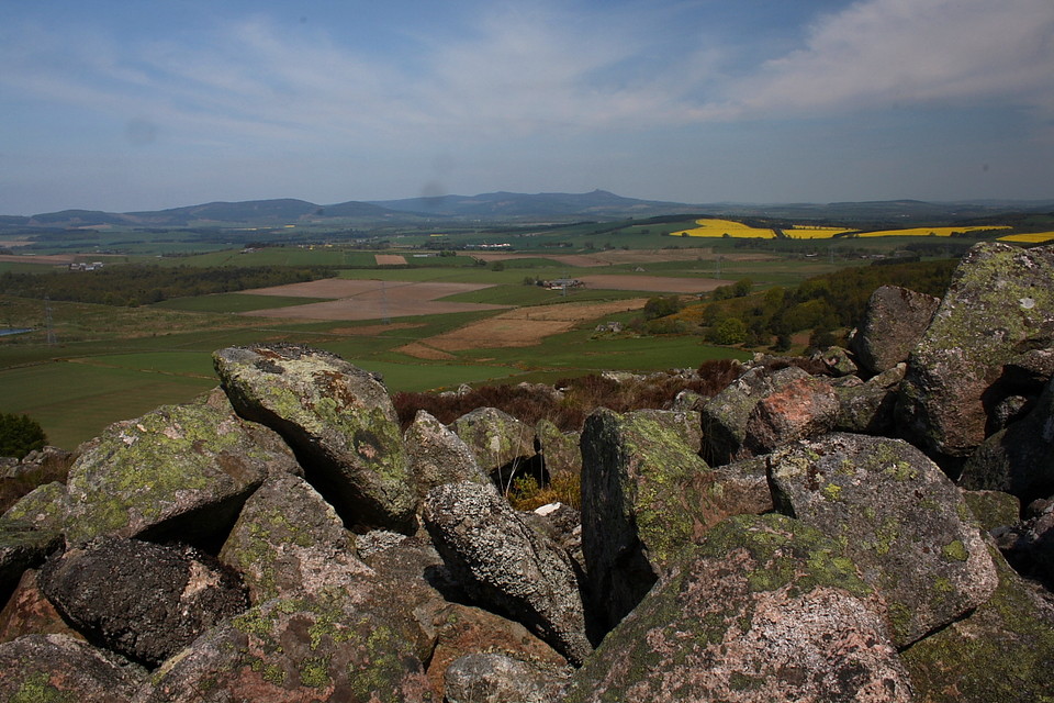
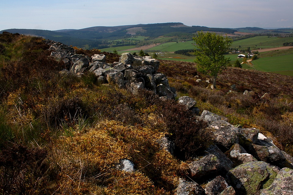
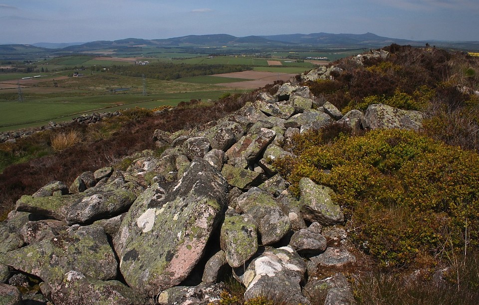
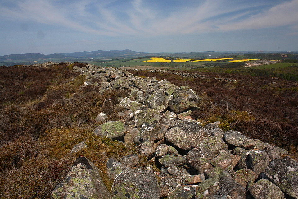
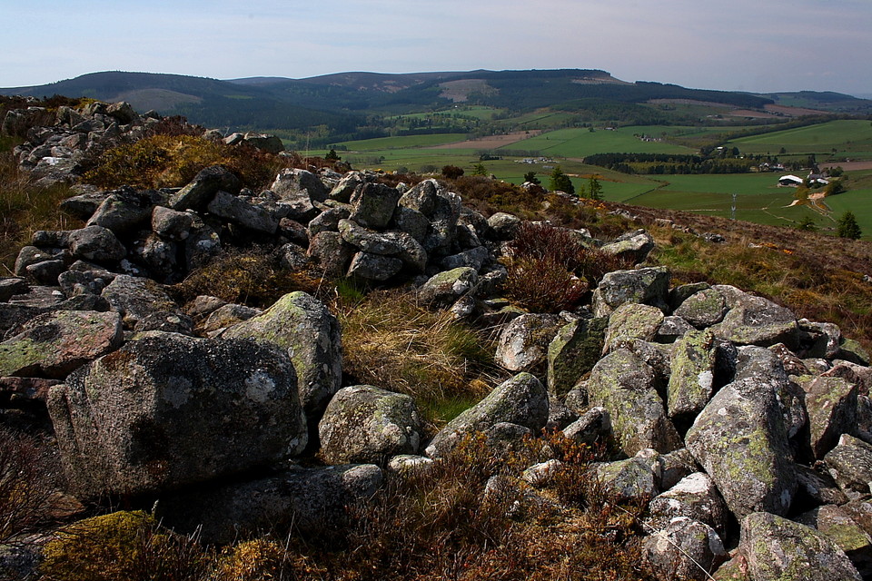
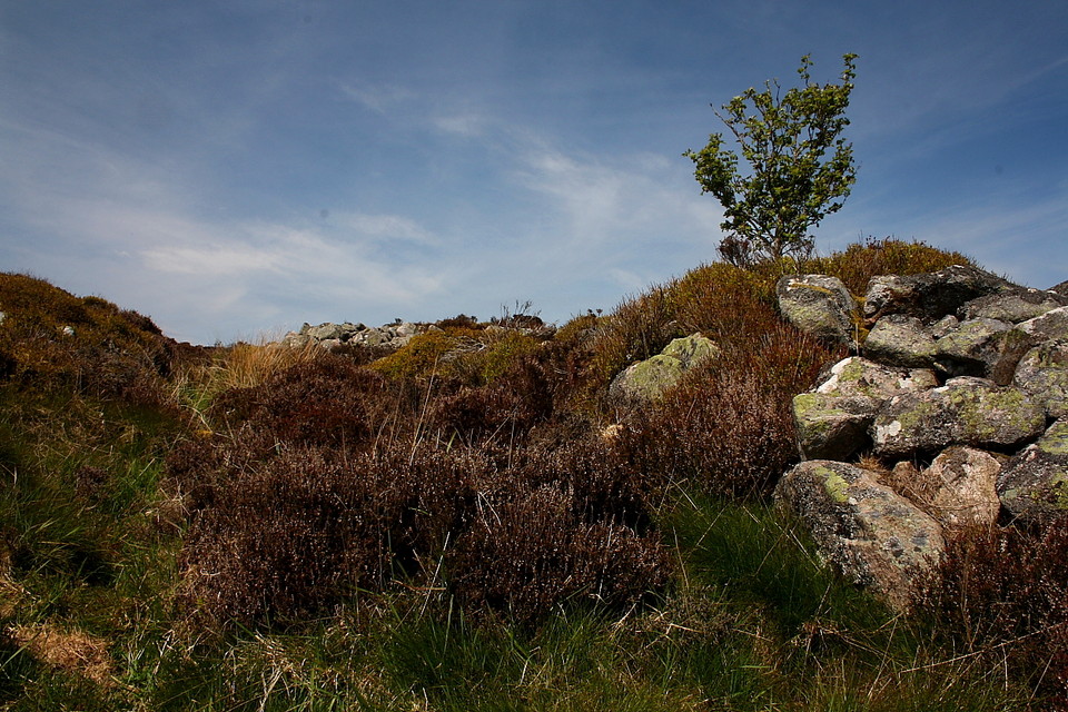
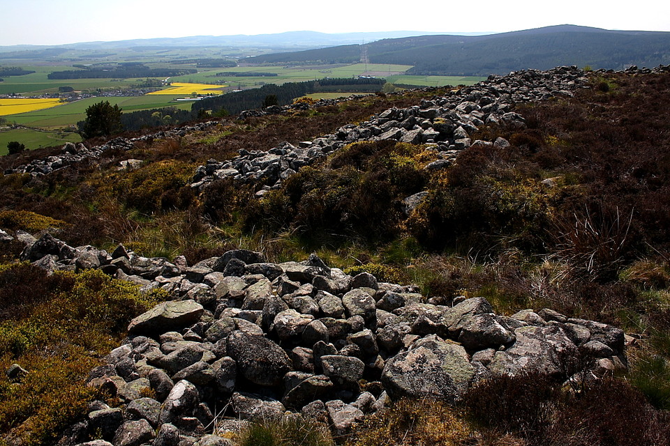
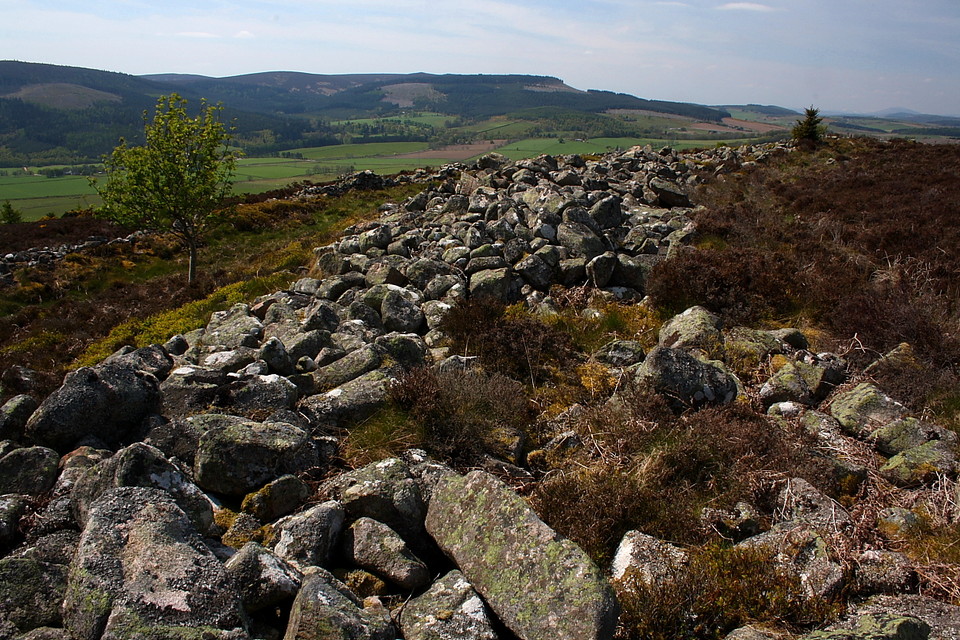
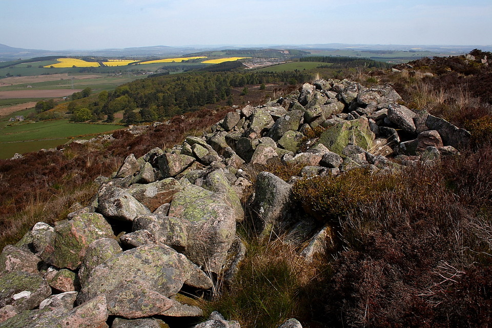
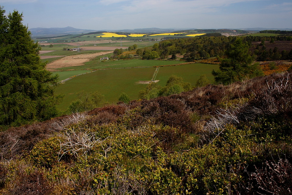
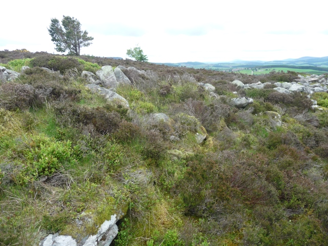
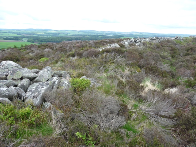
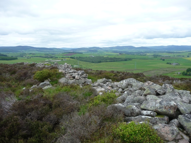
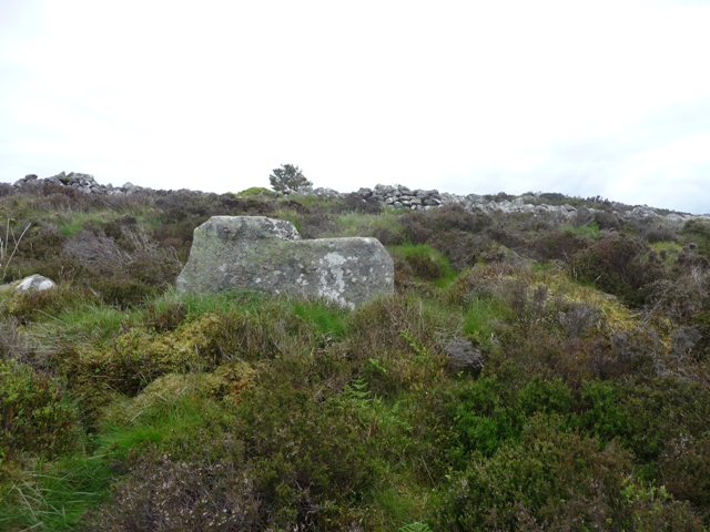
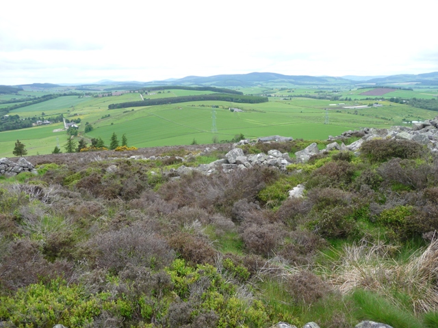
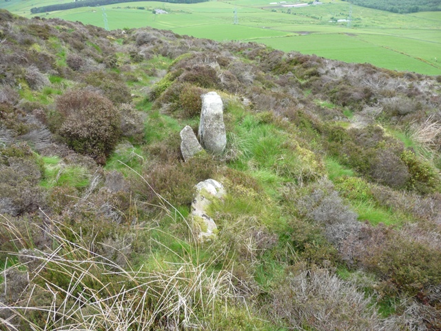
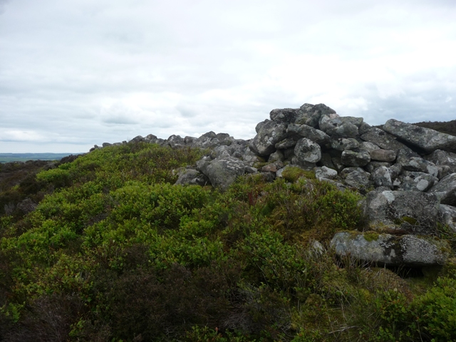
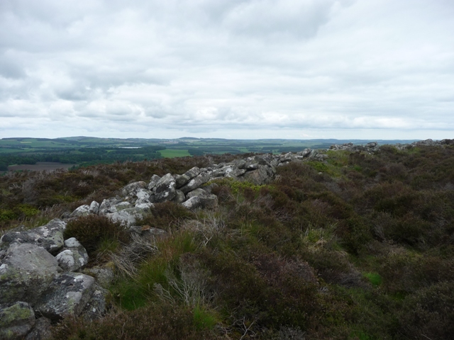
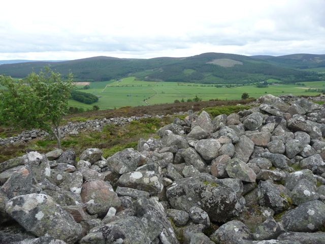
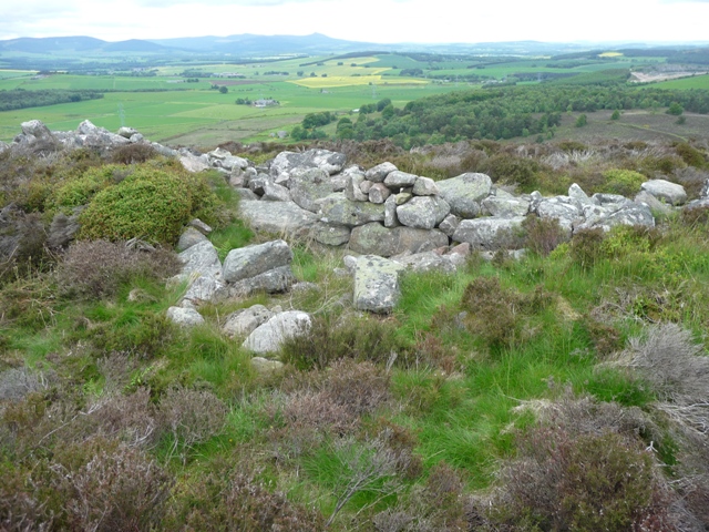
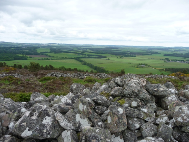
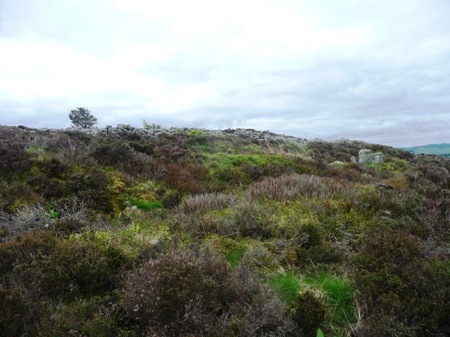
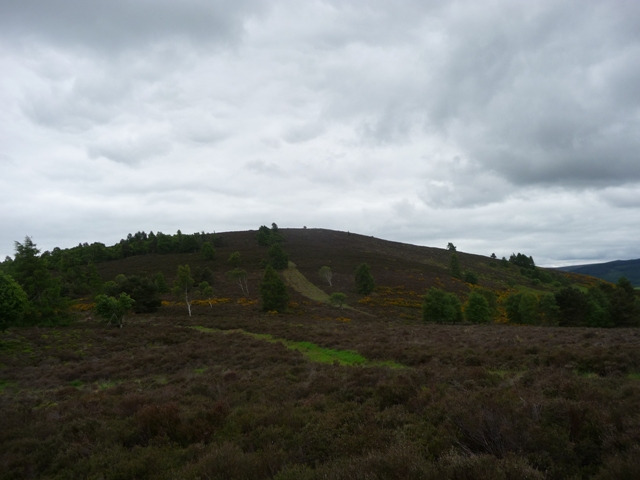
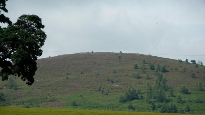
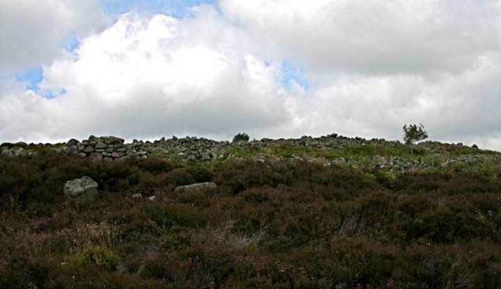
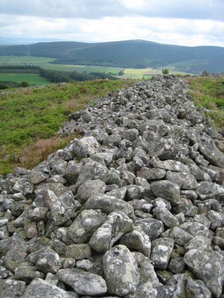
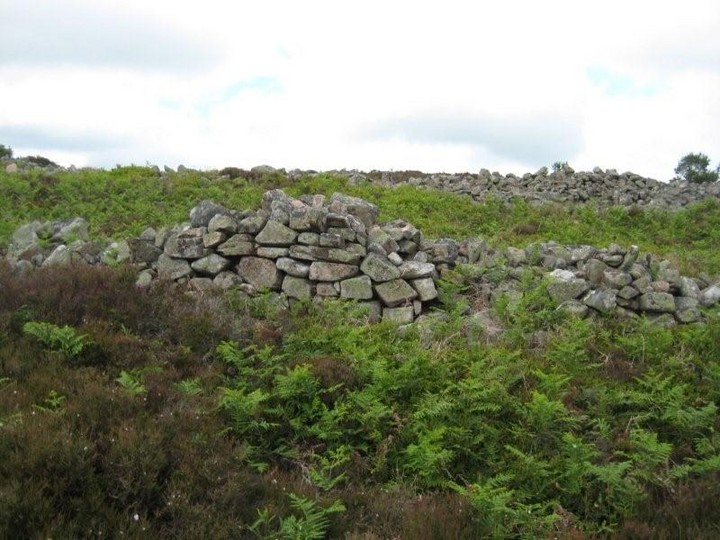
I make it as far as Middle Broomhill farm before becoming sufficiently concerned with the deteriorating track - and thus my poor car's nether regions - to seek local advice. As it happens the gentleman who answers my knock is a true Scot, if ever I did encounter one. Looks one, too. A credit to old Alba. In actual fact it is 'probably' (he says) possible to drive to Upper Broomhill - depending on your car's clearance - although I would say the best bet is to park off track, to the left, a little beyond Middle Broomhill and not be so bloody lazy. No, on second thoughts the best bet is to park and have a chat with the local dude.... you might learn something, as I did. Such as the existance of a standing stone at the corner before the previous farm, which I subsequently completely forget about! Anyway, I discuss the hillfort with the chap... 'nothing much remains', apparently. A matter of interpretation, perhaps... but, as Harry Hill says, there's only one way to find out! So, after promising 'I'll be back', in my best Schwazenneger, off I go into the blazing heat of this May morning. Yeah. I know. In Aberdeenshire. Passing the seemingly deserted Upper Broomhill the track terminates.... Barmekin Hill lies dead ahead and, in retrospect (what else?) the best idea is to head up hill and approach through woodland to the ascend the left hand end of the site. Needless to say the right hand looks the easier to me... however this means negotiating several tough barbed wire fences. Jeez, how I hate the stuff! And when that is done there's the not insignificant matter of the steep, heather clad slopes of The Barmekin itself. Hey, why the need for stone ramparts when you have virtually impregnable Scottish heather? Nevertheless I persevere and in due course the hidden magnitude of the fortress is revealed. And then some! I concur with Drew and Bill..... five - count 'em - concentric ramparts still girdle the hillside, the inner two as substantial as you could wish for, with a complex entrance to south. Bennachie and the wondrous Mither Tap rise upon the northern horizon... and the traveller can't help wondering if the multitude of defensive lines upon Barmekin Hill represented a touch of 'bling' to boot.... 'hey, those guys may have occupied Bennachie, but just look at our defences!' Yeah, there is a case for arguing that 'five' was simply taking the piss. Whatever, all is now silent. A place to ponder 'stuff', to pick out the locations of the wondrous RSCs of Sunhoney and Midmar Kirk far below to the approx south-west. Eventually I descend and head through the woodland back to Middle Broomhill. I talk with 'the wife' this time... she reckons the blistering weather will last into next week... what a contrast to the 100mph gales of this time last year. Yeah, tell me about it. |
 Posted by GLADMAN
8th June 2012ce Edited 20th June 2012ce |
|
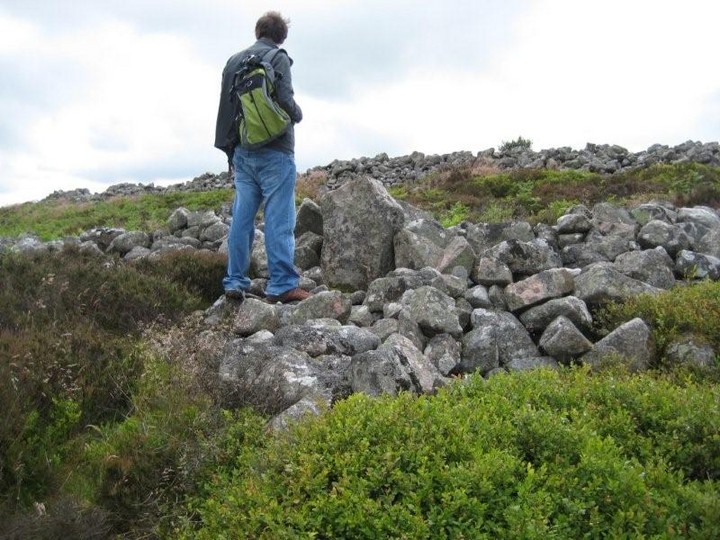
From Upper Broomhill the Barmekin is a fairly steep climb. I headed cross country from the track, a mistake, and headed for burnt heather which led part of the way up the hill. After this ran out the real fun began no paths, as Bill Watt said, knee deep heather and unseen holes at least two at waist deep. For quite a few yards I was able to sing in a much higher key. It is steeper than it looks but 3/4s of the way I found the/a path which led to the top. It must be said that this path is hardly ever used but at least there are no holes. After a steepish climb the walls suddenly come into view. This is quite simply a magnificent site, one of the best (in Britain I'd say) with its 5 walls. The top two walls can be seen quite clearly all round the hill with many parts of original building remaining. It has to be said that the three other walls can be seen but are grass and heather covered but they are complete and also circle the hill entirely. Big stones can be seen dotted up and down the slopes which made me wonder if they were used for hidden bow/spearmen. Still they made a handy seat. I've often wondered if the various tribes were allied as the fort at Mither Tap is quite clearly seen as can some of Dee forts. More astonishingly Durn Hill at Portsoy can just be made out some forty miles to the north. Beacons, warnings of attack who knows? One thing I do know is that aerial photos would be the ideal here. It made the sadness, about the condition, of the Broomhill and Orde sites go away a little bit. Luckily for me I'd found a path and followed it as zig zagged to the bottom of hill. This path would lead to Culfosie Farm, two weeks earlier the farmer here said that it was nothing but a pile of stones.............wrong!!!!!!!!!! So I headed back north following the track back to Middle Broomhill. On the Sunday thunder and lightning had attacked Bennachie, even the phone was affected, but by Monday the rain had gone. However Mr Watts advice in his fieldnotes hold good, water proofs are essential when visiting this wonderful site. Visited 13/06/2010. |
15th June 2010ce Edited 15th June 2010ce |
| Barmekin of Echt is an astounding Hill Fort with five dry stone walls and ditches surrounding the top of the hill. Getting to the top of Barmekin is for dry days, the heather is knee deep and the dense ferns are over 6 feet in places, not an easy climb, if you can find a path you are one of the lucky few. |
Posted by billwatt 11th July 2008ce |
Folklore |
|
Very dubious sounding but there you are.The etymology of Echt is not known with certainty. An old tradition refers it to the Gaelic word "Each," which signifies a horse. It bears that a division of an ancient Caledonian army having encamped in this parish, the officers and men, in the time of a severe drought, were reduced to great straits for want of water, when a horse which had been brought to the camp was seen to gallop to a spot where he had been accustomed to drink; and that, by pawing and scratching with his feet, some signs of water were discovered; in which spot, a well having been dug, afforded relief from thirst to the army. In memory of that event, this particular district, and afterwards the parish, is said to have been designated by the above term.This from the New Statistical Account, by the Rev. William Ingram. |
 Posted by Rhiannon
27th November 2009ce |
Ghostly drumming, from Gordon's History of Scots Affairs, from 1638 to 1641, vol i, pp56-68 (1841):That country is hilly and mountainous, and there is a hill, distant about a mile westward from the manor place of Eycht: the hill bears the name of Duneycht, (or, to write it truly, Dun Picte). Up on the top of this swelling hill.. there are to be seen old ruined walls and trenches, which the people, by a received tradition, affirm to have been built at such a time as the Picts were masters of Marre.And from 'Douglas's Description of the East Coast of Scotland', p254 (1782): ..over [the Barmkin of Echt] which if tradition may be believed, many armies were seen, many drums heard, adn many an aerial bloodless battle fought, before the troubles in King Charles the First's time.These are quoted in the notes of 'Illustrations of the Topography and Antiquities of the Shires of Aberdeen and Banff' By Joseph Robertson (1847), which is on Google Books. |
Posted by Rhiannon 4th August 2007ce Edited 4th August 2007ce |
Links |
|
Barmekin Hillfort (Echt) filmed from the airBarmekin hillfort filmed from a helicopter 2006-11-09 (my birthday) by Bill Watt. Part of a longer film showing some previously unrecorded anomalies in the North East of Scotland near Echt. |
Posted by billwatt 3rd March 2008ce |
ARCHwayAn account of the Hill Fort of the Barmekyne in Aberdeenshire. By James Skene of Rubislaw, Esquire. Archaeologica Scotica: transactions of the Society of Antiquaries of Scotland Volume 2 (1822) An antiquarian article most notable for the super drawings of the fort. |
Posted by Rhiannon 5th April 2006ce |