Showing 1-50 of 880 posts. Most recent first | Next 50   
|
The Ridgeway National Trail 50th Anniversary 2023
A series of events are taking place this year to celebrate the 50th Anniversary of the Ridgeway being designated a National Trail. These kicked off last Friday with an event at the Sanctuary, Avebury WHS .... plus a walk from Avebury and back.
https://www.nationaltrail.co.uk/en_GB/ridgeway_anniversary2023/
|
"....I pointed to the slope of Oiseval that rears up into the sky like a great snub-nosed whale, cut off cleanly by the cliffs all around. The turf there was poor and thin, studded with humps of stone cleits that looked in the distance like barnacles on the head of a leaping whale. So I told them all that Oiseval had indeed once been a giant whale, far, far bigger than any that the Norway men leave in the bay to take to Bunavoneader in Harris. How the giant whale came to St.Kilda meaning to eat up little Stack Leveish, but Herta saw the whale just in time and cast a spell from the waters of the hill of blessings and just as the whale rose up it was turned into stone, its great open jaws turned to cliffs. Grass grew on its back, and the sheep went up there to graze, but if you looked sideways with your eyes hal closed you could still see the barnacles on its back and the shape of its big head when it opened its mouth wide.
"I can se it, I can see" said Callum and the others were agreeing.
"And one day a year, you must be careful not to climb it, for it will turn back to a whale eat anyone who climbs it." ..."
Passage taken from 'The Lost Lights of St.Kilda' by Elisabeth Gifford
|
'Ways of Seeing Wiltshire' exhibition at Wiltshire Museum
I visited this rather lovely exhibition yesterday - lots of quite old paintings of Stonehenge and Avebury plus other aspects the Wiltshire landscape, such as the white horses, which make Wiltshire a unique county.
Definitely worth a visit - very quiet when I visited but booking ahead is advised. Ends 30th August 2021.
https://www.wiltshiremuseum.org.uk/?exhibition=ways-of-seeing-wiltshire
|
Visited 12th May 2021 as part of what had meant to be circular walk from Carn Euny and Sancreed church. The weather was wet, not blustery showery wet as the previous day but set-in, hanging-around-all-day wet. We approached the stone circle from a pull-in off the A30 and walked along a well trodden track. The circle seemed smaller than I remembered it when I visited in 2010 by bus to St Buryan, then foot. Still a wonderful 'sun-dial' stone circle though with its slanting central stone. The track from the A30 also takes you a high outcrop of flat rocks from which the stone circle and surrounding land can be viewed. Standing up there it felt like it may have been some sort of 'look out' point.
Returning from Boscawen-un we stopped off at the nearby Blind Fiddler standing stone - walking through long wet grass as we did earlier to get to Carn Euny, my feet were now very wet indeed. So it has to be said my first visit back in April 2010 (when the sun miraculously shone in a cloudless blue sky) remained unsurpassed.
|

|

|

|
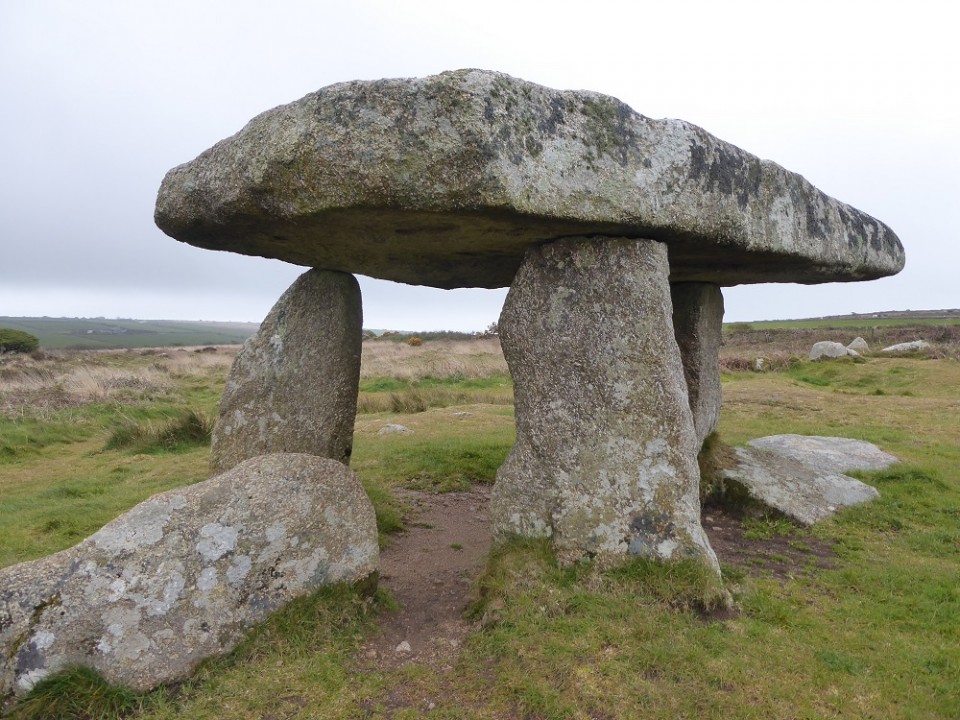
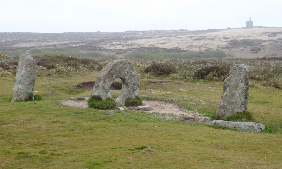
Visited 9th May - again using Ian McNeil Cooke's great little 'Guides to the Antiquities of West Cornwall'. It had been raining heavily the night before though at the time of our visit it was just very windy and quite chilly. A straight forward walk to the stile marked for Men-An-Tol, as we stopped to climb over we heard a distant cuckoo which seemed to bode well. A fabulous much photographed site and one I wasn't able to get to when visiting by bus and foot a decade earlier.
We also walked over to the Men Scryfa 'inscribed stone' which stood alone in a field on the other side of the track. I believe the inscription (now no longer legible) is a Latinised form of the native Celtic language.
|

|

|
|
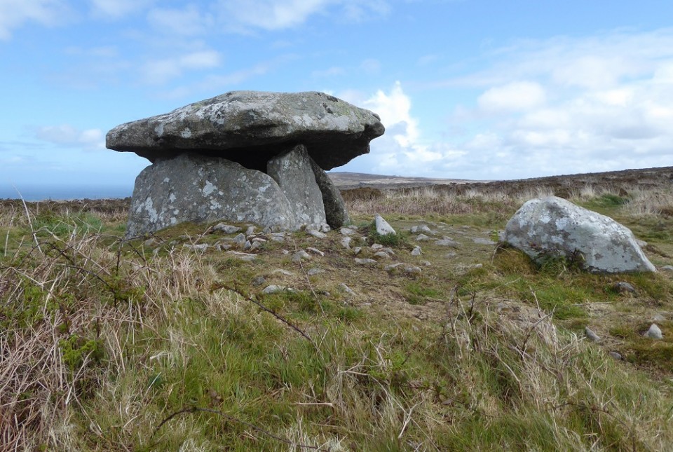
Parked on the A30 at more or less the same place as the previous day when visting Men an Tol and walked along a single track road for about 15/20 minutes. Just as we reached an old farm building a hail shower blew across - we sheltered in the lea of the building seriously considering turning back. The shower blew over; around the corner of the farm house and uphill a bit was the marker pointing up to Chun Castle. A steep uphill climb brought us to Chun Castle which is Iron Age though quite possibly built on an older site given its proximity to the Neolithic Chun Quoit. Reaching the Quoit was a breathtaking experience as it overlooks the sea. Once again I found myself making comparisons with the sites on the Beara Peninsula in West Cork where these ancient sites almost all look westward over the sea. There seems to be something intangible and forever just out of sight connecting these remote south westerly peninsulas.
|

|

|
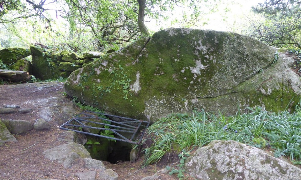
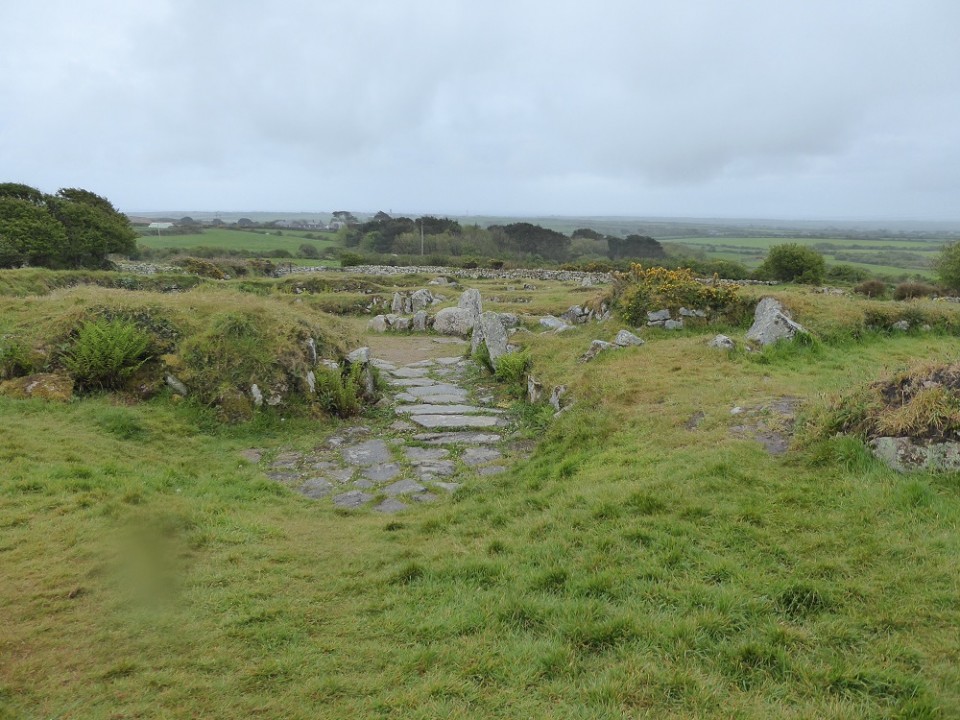
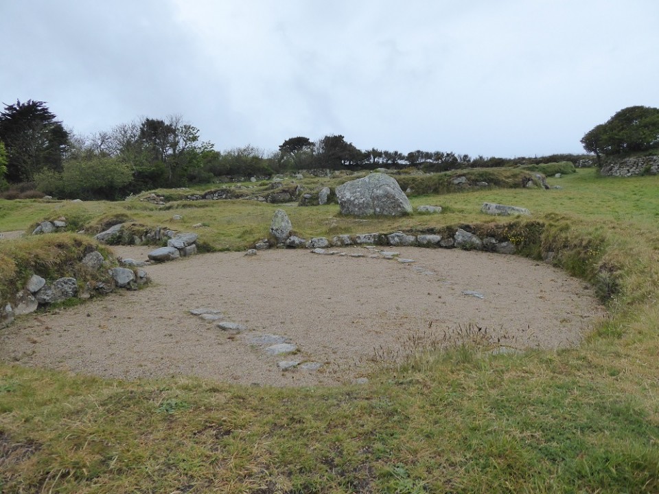
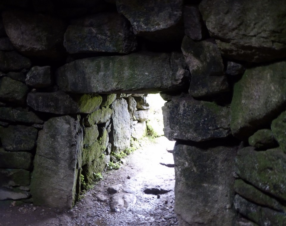
Visited this fabulous site on 12 May 2021 as part of 'postponed from last year post pandemic trip'. The archaeology of West Penwith silently endured throughout - this was one of the sites I didn't manage to get to when I visited back in 2010 without a car. This time fortunately I had access to a car but Ian McNeil Cooke's 'Guides to the Antiquities Of West Cornwall' still proved invaluable and contain a wealth of information.
It is hard to describe the experience of visiting a place like Carn Euny in the pouring rain or the quiet sanctuary of the amazing Beehive Hut contained within fogou. Although Carn Euny is Iron Age there was something about the place that made me think of Orkney (the stone no doubt).
|
  
|
Man thrown down steep bank after altercation with off-road drivers in Wiltshire
Rogue 4x4 drivers a hazard at Avebury again.
Police are appealing for witnesses following the incident, which took place on a byway near Avebury.
At around 3.30pm on Sunday January 24 a man in his 50s - out walking with his family - was verbally and physically assaulted by another man belonging to a group of off-road drivers.
Following an altercation with the group, the victim was thrown down a steep bank and forced into a puddle; both he and his family were then verbally abused by members of the group. Fortunately, the victim was not seriously injured. The assault took place on the top of the byway which runs from Avebury Trusloe to the trees by Windmill Hill. Police are now hunting for a man they believe is responsible. He is described as white, in his mid-late 20s, 5ft 10ins tall, of heavy build with light brown hair, a goatee beard and moustache.
It's believed he was driving a Land Rover with customised wheels. There were other vehicles involved, some of which did not have registrations plates. However, police believe that one of the registration plates contained the numbers 141 and letters BRM. PC Angela Holden said: "Despite the remote location we are asking if anyone out for a walk or run in this part of rural Wiltshire heard or saw anything suspicious during this afternoon.
"Perhaps you saw a convoy of off-road vehicles in the area or recognise the descriptions given.
"Please contact us on 101, quoting crime reference number 54210008149, if you can help."
You can also report anonymously via Crime
stoppers on 0800 555 111.
......
https://www.gazetteandherald.co.uk/news/19064478.man-thrown-steep-bank-altercation-off-road-drivers-wiltshire/?ref=ebmpn&fbclid=IwAR1wLDHQ8pwhW4K-ZZgEsE2adbO4ahgFTssjjXcY-ZiLtIi3pvSe1kZxxyI
|
England's Rock Art (ERA) website to close
The Scottish Rock Art Project have issued the following statement on their Facebook page:
Today we have had the astonishing news that the England’s Rock Art (ERA) website is going to be closed down on 15 January, with no warning or explanation. Those of you that are familiar with the ERA website https://archaeologydataservice.ac.uk/era/
will know that, since its launch in 2008, has been the key source of detailed information and images of rock art in England. These detailed records were compiled by trained community teams during the Northumberland and Durham Rock Art Project (NADRAP) and Carved Stones Investigation: Rombalds Moor, and built on the pioneering work of Stan Beckensall and many others, including the Ilkley Archaeology Group and Paul and Barbara Brown. The ERA website also incorporates the digital Beckensall Archive, produced by Aron Mazel of Newcastle University. With the closure of the website, this wealth of information will no longer be publicly accessible.
Let us know what you think, and we'll keep you posted!
|
From "Wisdom of the Ancients" by Neil Oliver
Rousay locals have mostly never been inside the tombs. They say when you grow up surrounded by them, the tombs are of no more interest that the ruined, abandoned cottages that also dot the fields. I think this is just what they say to strangers. I think it is more likely those folk were raised to respect the tombs, maybe to fear ghosts so kept their distance. As recently as 1911 an Orkney farmer reported how he had been digging into a burial mound on his farm when there appeared beside at his side an old man, grey-bearded, in tattered clothes. He had a warning for the farmer:
“Thou are working thy own ruin, believe me, fellow, for if thou does any more work, thou will regret it when it is too late. Take my word, fellow, stop working in my house, for if thou doesn’t, mark my work fellow, if thou takes another shuleful, mark my word, thy will have six of thy cattle dying in thy corn-yard at one time. And if thou goes on doing any more work, fellow – mark my word, fellow, thou will have six funerals from the house; does thy mark my word: good-day fellow."
According to the tale, the deaths of six cattle duly follow and the funerals of six members of the household.
|

|
Avebury byways becoming impassable ...
... Rogue 4x4 drivers are blamed.
https://www.gazetteandherald.co.uk/news/18287094.avebury-byways-becoming-impassable-rogue-4x4-drivers-blamed/?ref=fbshr&fbclid=IwAR2CVZyr_8DWkTnWjz7cEzCyM2AnhksJfRSpOKjSJ3VeZHrRtlSUJl1sNyY
AVEBURY is leading the charge to get damaged byways fixed and protected.
Routes around the village, and the nearby ancient historic site of Windmill Hill are now so badly damaged that they have become impassable.
Rogue 4 x 4 enthusiasts - some who travel from as far afield as Germany to drive some of Wiltshire's 695km of by ways - are being blamed for the damage.
The campaign is being supported by the countryside charity CPRE. Anne Henshaw, the Wiltshire representative said:
"I am trying to form a charity/community not for profit group of parishes and other interested parties to set up something similar to the Cotswold Warden scheme," she said.
This could see some of the byways closed to traffic at certain times of the year to protect them from heavy traffic use.
Stephen Stacey, chairman of Avebury Parish Council said:
"These by ways are for everyone's use, but the actions of a few selfish people have made them inaccessible.
"We would like interested parties like ramblers, horse and bike riders and other local authorities to work together, and perhaps work with Wiltshire Council to see if we can come up with a solution between us."
Some of the byways are so badly damaged that tree roots are exposed, and the ruts are more than two feet deep in places.
Solutions, he said, could include a volunteer force using council equipment and materials to make repairs as he says cut backs at Wiltshire Council are to blame for the disrepair.
Contd.
|
I recently came across a collection of essays about Wiltshire by John Chandler called The Day Returns - Excursions in Wiltshire's History (published 1998). This one is from a previous publication called 'Life in the Bus Lane'. The bus in question no longer runs on the route described.
The Source of the Kennet
It is a crisp March Monday and we are sitting on a bus in Marlborough High Street facing the college, and waiting for 9.35. It is that time in the morning which is common to all small towns, when those who have to be there have arrived and are at work; those who don’t aren’t, or if they, they can still drift along the capacious street to find a parking space.
While we are waiting I should tell you one thing that any intending bus passenger must understand. Buses (and I mean the ordinary country buses which we all used before we bought cars) – buses like this do not take you from A to B. They take you from A to Z, via B, C and D, not to mention W, X, and Y. This bus may say it is going to Swindon, if we persevere with it and have plenty of time. But Swindon is merely a by-product of the journey.
Let’s face it. If anyone is desperate to go from Marlborough to Swindon and they have a car, they will be there in 15 minutes. This bus takes over an hour. And one reason for the discrepancy becomes apparent as soon as we set off. We are going the wrong way! Swindon is due north and we are heading west. We are, in fact, embarking on a trip to the source of the Kennet, and on the way we shall call on most of the sixteen villages which grew up alongside the meagre waters of its upper reaches.
First above Marlborough is Preshute, its church hiding beyond the trees of the college. But Preshute is really part of Marlborough. The first real upper Kennet village is Manton, and here we leave the main road to make acquaintance with the river itself. It is lively here, eager to resume its old job of splashing over the millwheel, a teeming artery of winter rain surging bankful among its meadows.
In front of us are some six miles of Kennet valley and seven more villages before we reach Avebury. We cross and re-cross the river to visit them all. This is the land of the sarsens, the alien stones, the Saracens. At Piggledene and Lockeridge Dene they masquerade as drab sheep and lie asleep in flocks. From West Kennet to Avebury they march along upright like soldiers. In the villages they have been tamed and squared to serve as walls - incomparable walls of mottled silver, pink, and greenish-grey. And in Fyfield churchyard lie the men of the Free family, who tamed them and squared them, and who died prematurely from their dust.
The bus climbs from Lockeridge to West Overton, and at the crest of the hill a fine view is revealed. In the foreground Overton church, dressed in sarsen, looks down on a field of village earthworks. To our left the view is to Tan Hill, the highest place in Wiltshire; to our right the barrows on Overton Hill mark the line of the Great Ridgeway. And between them, in the far distance, we glimpse the Lansdowne monument above Cherhill. The bus winds down into Overton, slowing for an old border collie who is sauntering deafly along the road.
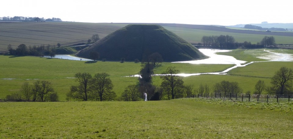
Now to East Kennet, where I have often admired the sarsen garden walls. But only from upstairs on the bus is their secret revealed, that behind them is hidden a swimming pool. On sultry summer afternoons, I daydream, some bronzed bodies laze by the water, and reach discreetly for their towels when the double decker trundles by. But no time now for daydreaming. The Kennet’s proudest moment is about to be revealed. We are back on the main road and approaching Silbury Hill. After a wet February the river has collected every drop it can muster from its downland springs and streams, to form a silver moat around the hill. It is a spectacle purely for the locals which the Kennet never repeats for the summer tourist trade.
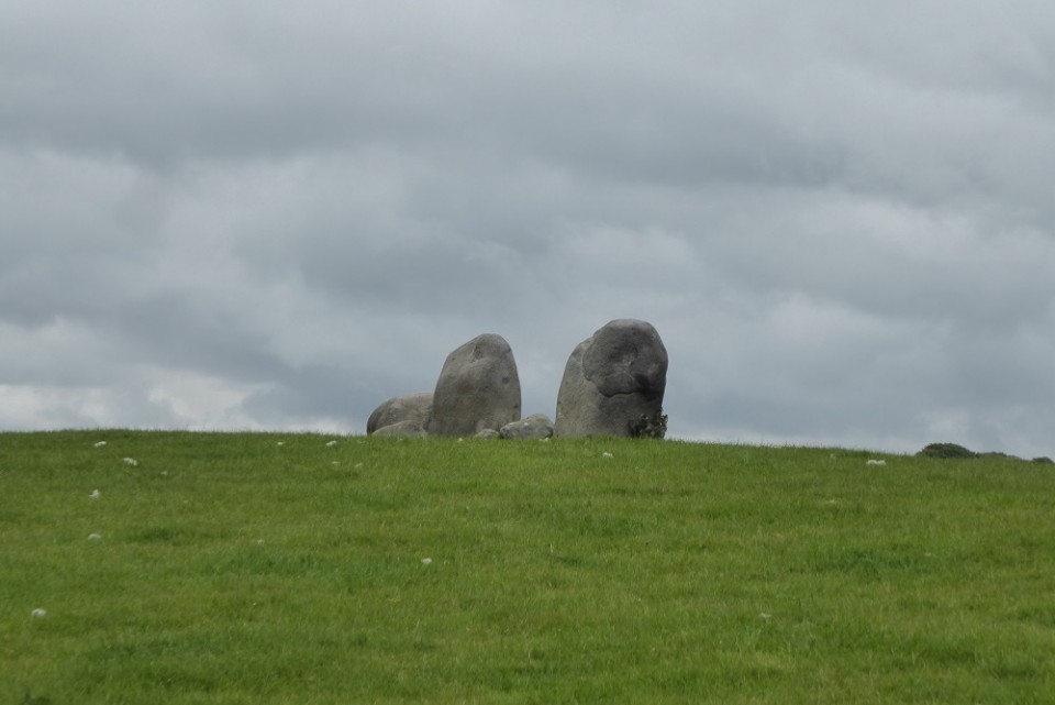
At Beckhampton Roundabout we must give up this self-indulgence, and do our duty at last and go to Swindon. The northward turn up to Avebury Trusloe is surprisingly hard work for a bus. I glance across to Adam and Eve, the two solitary sarsens behind the stables. But I am thinking of breakfast. I heard a man interviewed on the radio, a manufacturer I think, about marmalade. He was talking about customer’s preferences. “Thick cut marmalade”, he said, as if had just thought of it, “Is essentially a male preserve.”
Avebury’s present appearance owes a great deal to marmalade – far more than it owes to the National Trust. It was Scottish marmalade that enabled Alexander Keiller, heir to family business to indulge a passion for archaeological excavation, first in the twenties at Windmill Hill nearby, and then during the thirties in Avebury itself. He drew on his wealth to buy much of the village and as building within the circle became vacant he demolished them, displacing the villagers to new house at Avebury Trusloe. He excavated the ditch, re-erected the fallen stones, and established a museum which still exists. He died in 1955.
Beyond Avebury we settle into a different landscape. The bus is heading north now, so the Marlborough Downs are to our right. They have formed themselves into a steep escarpment which rises green to sky. Here and there ribbons of white climb the hill, remnants in sunless holloways of last week’s snow. Against the snow the grubby chalk horse on Hackpen is a miserable creature. To our left now there is no corresponding hillside, just undulating farmland which teeters to the edge of a second escarpment unseen from here, then suddenly down to the clay. Above Silbury the Kennet loses its vigour and has not the strength to form a valley. It has become seasonal, gratefully receiving whatever normally dry tributaries can offer, and flowing only after winter rain – a true winterbourne.
John Chandler ends his passage (which I haven't reproduced in its entirety) with a quote from Richard Jefferies’ book ‘The Story of my Heart’ and the observation “Such a man would never have understood a bus timetable.”
‘It is eternity now. I am in the midst of it. It is about me in the sunshine; I am in it, as the butterfly floats in the light laden air. Nothing has to come; it is now. Now is eternity; now is the immortal life …. For artificial purpose time is mutually agreed on, but there is really no such thing. The shadow goes on upon the dial. The index moves round upon the clock, and what is the difference, none whatever. If the clock had been never set going, what would have been the difference? There may be time for the clock, the clock may make time for itself: there is none for me' (Richard Jefferies)
|
Bush Barrow dagger studs - gold analysis
https://www.wiltshiremuseum.org.uk/2019/11/18/bush-barrow-dagger-studs-gold-analysis/?fbclid=IwAR1GLNV8PO8NeavNneSH01aG5p1Ca9Zjtk1CCty2GNkhjtC_Ck4ee16n1eU
The results are now in! Did the Bronze Age gold, found in a burial close to Stonehenge, came from Britain, Ireland or Brittany.
Located close to Stonehenge, Bush Barrow is Britain's richest Bronze Age burial. The most remarkable discovery was a gold-studded dagger pommel, set with thousands of microscopic gold studs thinner than a human hair. Using a recently developed scientific technique, Dr Chris Standish of Southampton University, has identified the most likely source of the gold used to make this amazing object - answering a question that has puzzled archaeologists for decades?
Dr Standish has developed a metallurgical technique that analyses the proportions of different isotopes within the lead impurities in the gold. These proportions were compared with information about gold from known sources in Ireland, Cornwall, Wales and Brittany. A single gold stud was used for the analysis using X-ray Fluorescence - a non-destructive technique.
The blade of the Bush Barrow dagger is of a type found in both Brittany and Britain and gold-studded pommels have been found on both sides of the English Channel. Some archaeologists have thought that the dagger pommel was made in Brittany as more have been found in Brittany but the craft skills needed to make the dagger pommel are higher than used in any other goldwork in either Britain or France at this early date.
The dagger was buried with a Chieftain who died in about 1950BC at a time when Stonehenge was at the centre of an internationally important ceremonial landscape - the sarsen stone trilithons were erected in about 2,500BC and the bluestones from Wales were placed in their final positions at the site in about 1,600BC before Stonehenge finally went out of use in about 1,500BC.
Analysis undertaken 30 years ago of gold objects from burials in the Stonehenge landscape suggested that the gold used came from Ireland. Analysis by Dr Standish of gold objects found in Ireland has shown that many are made of gold from Cornwall (see this article in the Independent by David Keys) and gold from Cornwall was also used in the famous Nebra Sky Disk found in Germany and displayed at the State Museum of Prehistory in Halle (see this article about the analysis of the Sky Disk).
|
Robert Macfarlane's excellent book 'Underland' has a chapter on Red Dancers. In the opening passages he talks about the rarity of northern latitude painted cave art but goes to makes specific mention of the astonishing concentration of work in Alta, northern Norway.
Quote:
"The main reason for this scarcity of painted art at higher latitudes is that much of this landscape was buried under glaciers until the end of the last Ice Age. 20,000 years ago, when the seventeen-foot long red aurochs was being painted in the Hall of the Bulls at Lascaux, in what is now the Dordogne, all of Scandinavia and most of Britain and Ireland was still glaciated. As the ice slowly retreated, it left behind a shattered landscape scoured of life. Northwards human colonization of this barren terrain happened only slowly.
Geology also has a role to play in the rarity of surviving northern-latitude painted cave art. Cave chambers form the most secure gallery sites for such art, and such chambers form most naturally in limestone: Lascaux, Chauvet, Altamira, - all of the most celebrated prehistoric art works were made in and on limestone. Limestone has the added curatorial power of often running a film of transparent calcium carbonate over wall paintings, which then sets and acts as a preservative varnish mitigating degradation of the pigments. Northern Europe is sparser in limestone than Spain and France, though, and richer in igneous and metamorphic rocks. Where caves or overhangs form in such rock types, they do so by the erosive forces of ice or sea water and as such tend to be shallower and rougher-sided. Their interiors lack the inviting canvasses of water-smoothed limestone. A jagged granite cavity does not offer the same pictorial possibilities as a limestone chamber pillared with stalactites. Artic-latitude prehistoric rock does exist in Europe, including the astonishing concentration of work at Alta in far northern Norway, where more than 6,000 images – predominantly petroglyphs – depicting reindeers, bears, humans, hunting scenes and the aurora borealis where made between c. 7,000 and 2,000 years ago on glacier-polished rock. But painted art – far more vulnerable to damage and weathering than incised imagery – is scant."
|

|
 
|
 
|
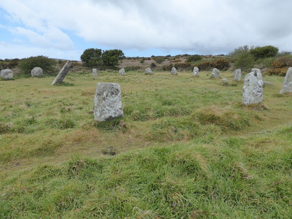
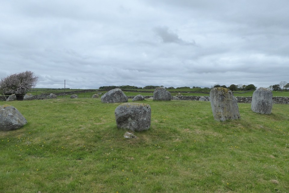
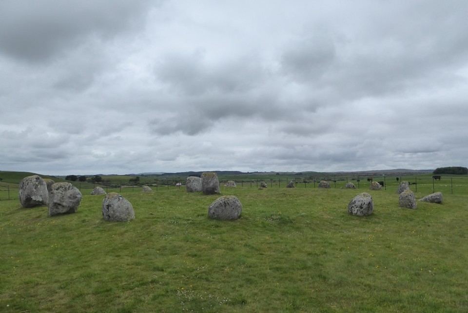
Visited Saturday 18th May 2019: On a different sort of day, one of light and shadow perhaps, this would be a great site to visit. As it was we went there on a dull overcast day more or less filling in time until we went to catch our ferry to N.I. Having said that it was a planned visit. The previous evening we found Cairn Holy by accident and had an almost transcendental experience. I feared Torhouse would be an anti-climax but that is unfair.
Very easy to find from Wigtown, one of the friendly people in their little Saturday Market gave us clear directions. Near a road though suspect mainly farm traffic. Probably Bronze Age, this 'dumpy' stone circle is comprised of 19 outer stones, 3 central stones (the central one being smaller than the other two). There is a set of 3 stones in a nearby field on the other side of the road set on higher ground than the circle. The is also a single stone nearby. From the positioning of the central stones it is easy to imagine sun or moon alignments. The information board said the most likely one was midwinter sunrise. Also that these type of stone circles are most common in N.E. Scotland and Ireland. It suggested that Torhouse may represent movement of migrants or at least ideas.
On a non-archaeo note, this was the only place we heard a cuckoo on this trip.
|
  
|
I must start this field note by acknowledging "Monu-mental About Prehistoric Antrim" by Tom Fourwinds
(ISBN: 9781845889210). The archaeology of Antrim seems is much harder to find than anywhere I've been before so this publication was invaluable.
Visited Monday 20/5/19:
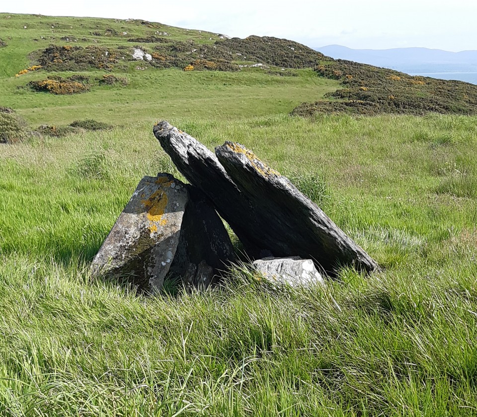
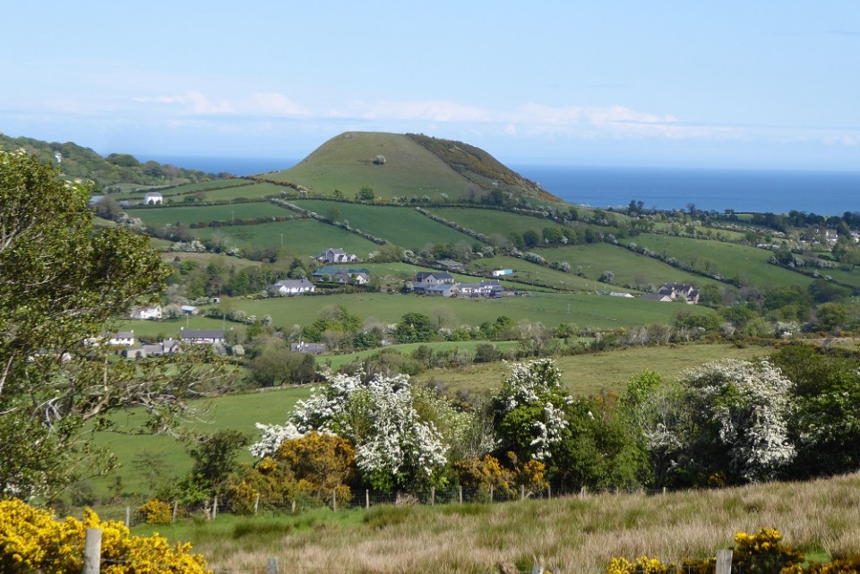
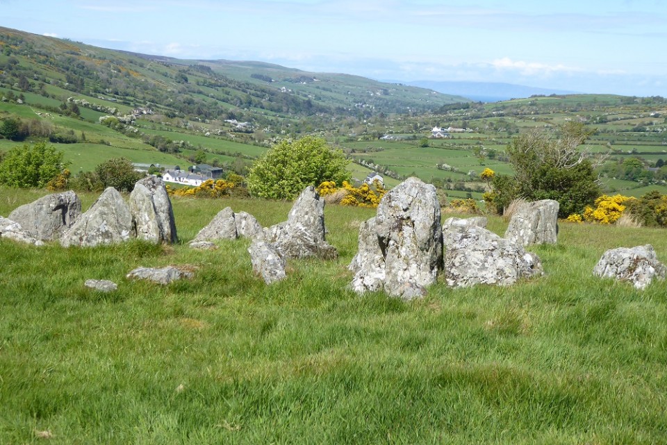
A very good day, visited Glenariff in the Glens of Antrim in the morning.
The clouds cleared after lunch so headed for Cushendall in search of Ossian's Grave. We had identified it from the OS map where it is shown by name. No signposts but following the map we walked up a steep track where eventually we came to a small gate. Amazing views towards the strangely shaped Hill of Tievarah on the way up. The grave itself seemed to have been almost wilfully neglected and has fallen into disrepair. What is most stunning about this site is the views on clear day - especially towards the Hill of Tievarah.
|
  
|
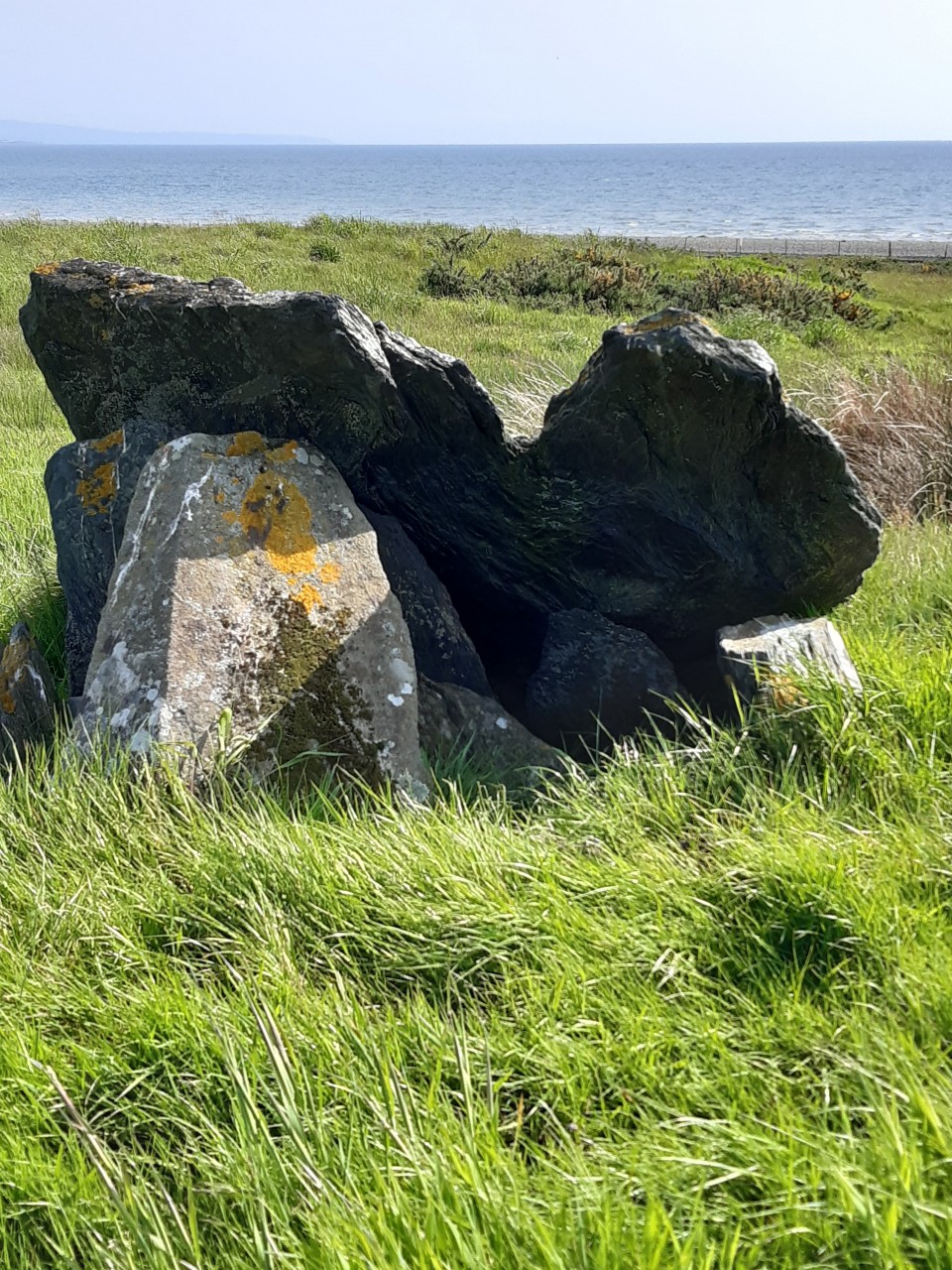
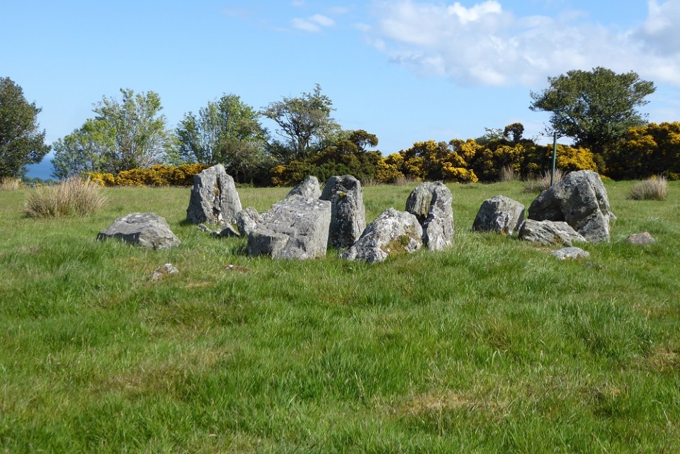
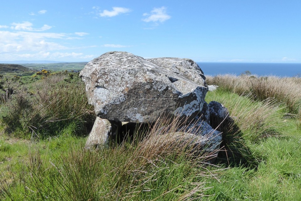
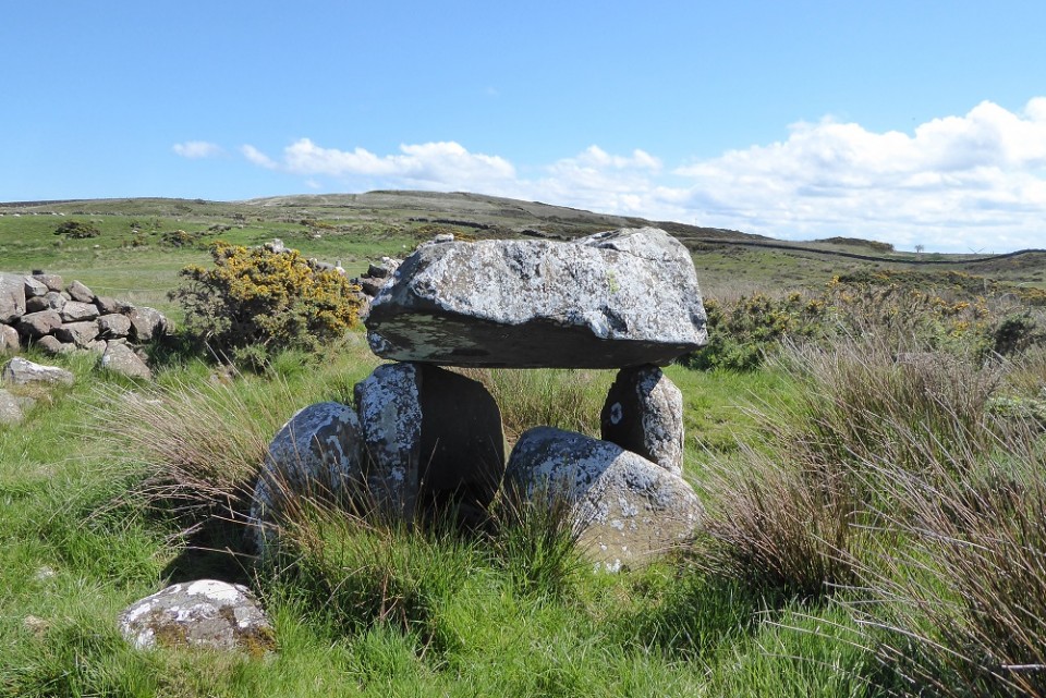
Tuesday 21/5/19: I loved this little tomb - perhaps because it reminded me of a smaller version of Devil's Den back home. It is mentioned on an information board at White Park Bay which can be seen as you walk uphill to this site. The information board calls it Druid's Altar and informs us that the bones of three epi-palaeolithic (post glacial hunter gathers) women were excavated there - thought to be aged 16, 20 and an adult.
The site is marked on the OSNI map though not named so the lane leading to it is easy enough to find. A rather magnificent view to be had down to White Park Bay. It took three attempts and a lot of determination to find this site. after the second attempt we asked a local horse rider if he knew of it, he didn't but made a quick phone call - confirmed it existed and gave us some basic directions. So we clambered uphill from the lane again - this time braving our way through the gorse bushes. There was some evidence of people having walked through the gorse before us. My companion fortunately is quite a bit taller than me so spotted the capstone just about at the same level as the gorse.
It was very satisfying indeed to find this site after being disappointed at the first two attempts.
|
|