The owners' webpage for this hillfort.
|
The Norfolk Archaeological Trust bought this hillfort in 2003 to save it from any further damage by the plough.
Nowadays it is grazed by sheep and has a dedicated carpark.
Apart from that, I agree with the previous visitors; sadly, it has been almost completely flattened.
|
Webpage describing the latest discovery.
|
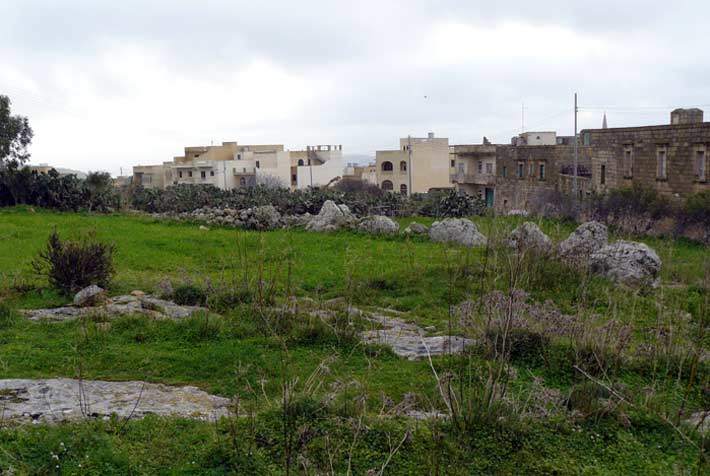
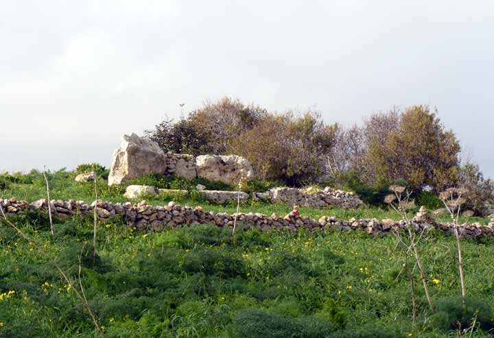
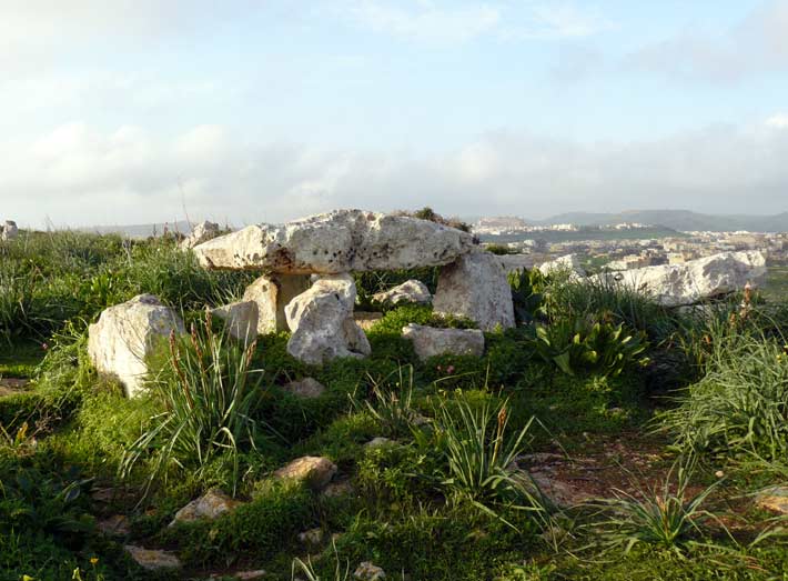
Only after visiting the stones in Oxfordshire for some years did I finally bother to pull off the A361 down the quiet lane which passes Knollbury.
I'm glad I did.
I like this place.
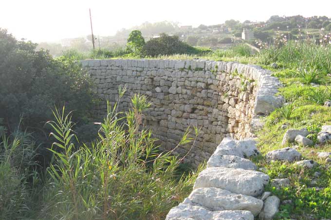
Its steep-sided banks are easily seen from the road which runs parallel to the north-west side. In fact, the road is so close that the ground underneath it is scheduled as part of the monument.
Don't stop the car until you come to the bottom corner; park up and go through the gate. You can see two openings in the south-eastern side; only one is original and that's been enlarged.
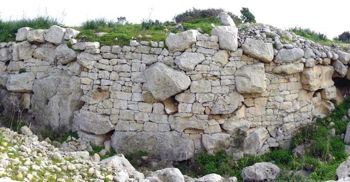
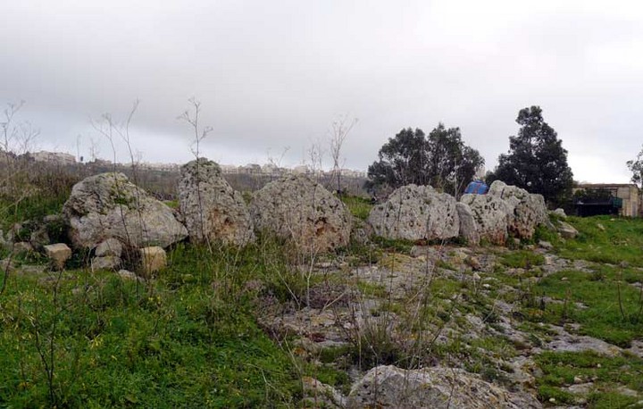
Knollbury is classified as a hillfort, like many other similar univallate enclosures in Oxon. This one lies on a gentle slope, nowhere near the top of a hill.
The walls are steep-sided because they are made from stone. Walk along the outside of the north-eastern side and you will see.
Nowadays, when I'm in the area, I like to come back to Knollbury.
It's my kind of place.
|
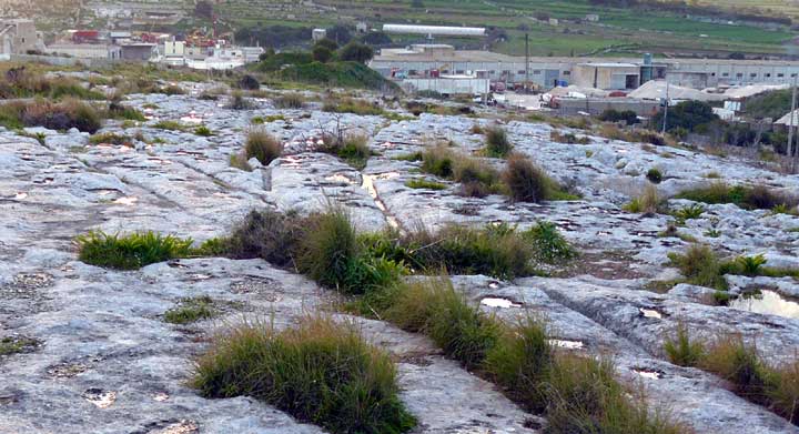
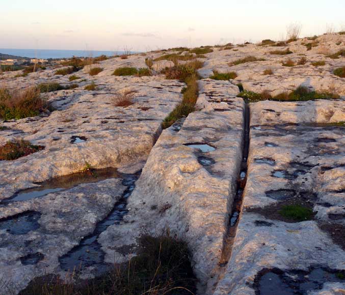
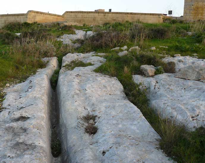
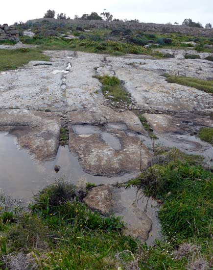
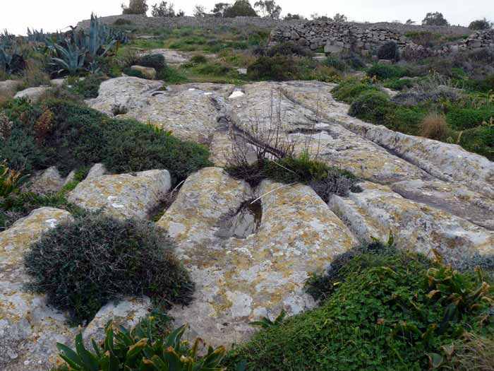
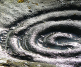
Cart Ruts Mystery Solved
From The Portsmouth News:
Researchers at the University of Portsmouth believe they have solved an ancient Mediterranean mystery.
The mystery of how 2ft deep tracks were cut into the rock of Malta has been a puzzle for years.
Now Professor Derek Mottershead, of the university's geography department, has followed generations of scholars to unravel the mysteries of the Maltese landscape.
The tracks, or ruts, were almost certainly caused by carts because the rock was not strong enough to support the wooden wheels of loaded carts.
They are up to 2ft deep and more than 30km of them run in pairs criss-crossing the island.
Professor Mottershead's team came up with a design of a cart to fit the field evidence, estimated its weight and calculated the stresses involved.
They discovered that in some places the rock was so soft that after heavy rain a single passage of a cart could cause the rock to fail.
Professor Mottershead said: 'The ruts have been studied and talked about for centuries and though it is obvious they are related to vehicles nobody understood how they were made or even when.
'The underlying rock in Malta is weak and when it's wet it loses about 80 per cent of its strength.
'What is unique to Malta is the sheer number of ruts. For years they have attracted the attention of archaeologists but until now we didn't have a convincing explanation of the mechanics of how they could have been formed.'
The team included Dr Alastair Pearson and Martin Schaefer, also of the University of Portsmouth. Their research was published in the journal Antiquity.
|
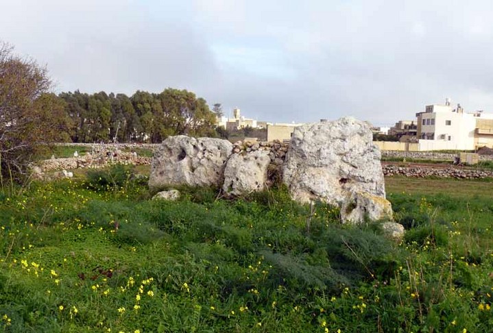
Photo of the site by Olaf Tausch.
|
Horses domesticated 1000 years earlier than previously thought
From the Natural Environment Research Council:
"The earliest known evidence of horse domestication has been unearthed in Kazakhstan in central Asia. New research suggests the Botai Culture have been riding horses and using their milk for the last 5500 years.
This is around 2000 years before horses were domesticated in Europe and 1000 years earlier than previously thought for Kazakhstan.
The findings could point to the beginnings of horse domestication and the origins of the horse breeds we know today. Archaeologists argue that it was the domestication of horses that opened the way to trade, warfare, transportation, agriculture and many other aspects of human civilisation."
Full story
|
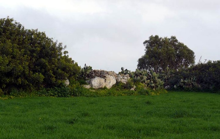
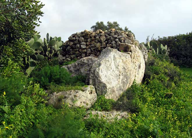
Sadly, this cluster of seven round barrows have been destroyed in the process of gravel extraction.
They were excavated prior to destruction, with six satellite barrows providing little of interest.
However, the largest barrow proved to be rather extraordinary, producing a massive amount of cattle bones. Further details can be found on the link below.
|
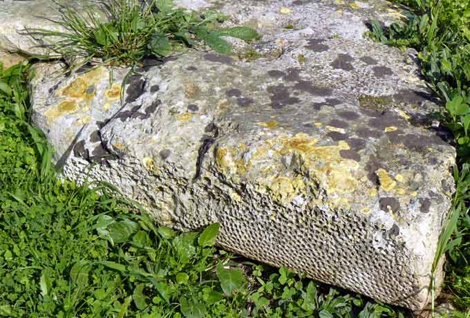
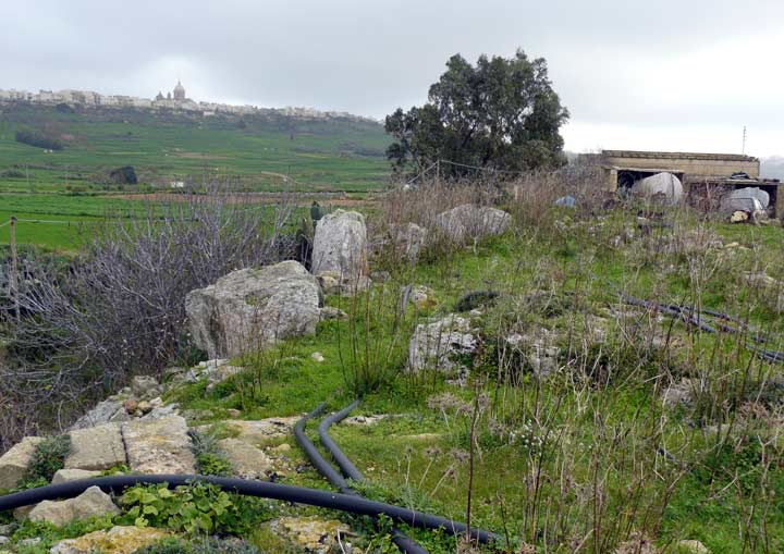
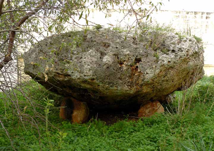
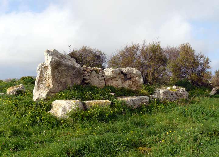
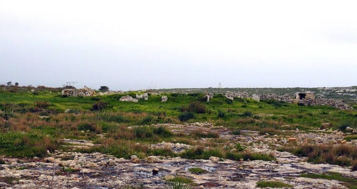
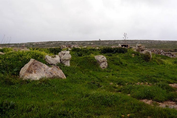
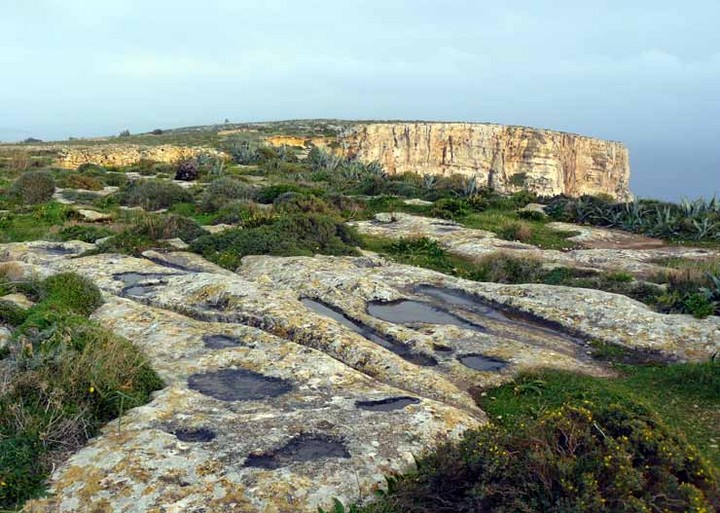
When I visited the nearby Borg in-Nadur temple I must have walked past these without knowing they were there.
There's only a short length of ruts to see, but what makes them of particular interest is that they run straight into the sea.
|
| |


