|
The mound is now on the edge of the new housing development
|
|
The burnt mound is on the LH side of the road onto the new Hatston pier amongst the new industrial development. Unfortunately it is now fully enclosed by a fence with not even a gate for access. An opportunity for excavation missed.
|
|
NMRS record no. HY31NW 38 at HY32321741 in an area also known as Noltland. From Noltland 'cattle land' Hedges suggests that the original name comes from Nolt+Clettr 'cattle rock'.but is unable to come up with anything in the vicinity that would have given rise to this name. I would suggest that perhaps the Vikings saw the broch mound as having been 'calved' by the burn. At the end of a long walk I wasn't up to making my way to the broch but made observations from various places. To see the interior good views can be had from the Howe road that runs beside the Harray Manse. Going back onto the main road I first saw the broch by looking straight across from the site of the Knowe of Brinnanea where the burn meets the road. I find it difficult to realise that I must have been looking directly at it several times previously. Eye unaided I would have seen it as simply a fieldwall of white stones like shiny pearl teeth. Admittedly there is such a wall beside it, but with camera and binoculars the stone is truly monumental, much bigger in size and more regular in shape.
|
|
Covering the site for next year was well in hand on Thursday, with the building in the far corner already fully blanketed in black plastic. So I had a bit of a race against time. Actually as far as making sense of the site is concerned it is much easier to make out the structures, especially the walls, with the plastic sheet laid on the floors ! After photographing all you would need to to do is 'photoshop' the black for a less obtrusive contrast in colour. Today another big deep hearth stood out. Very close to it are two large slabs on edge making a likely corner. The hearth seems a little close to be connected or respecting it (though it could mirror the hearth's far left corner). One side is a thick rectangular slab and the other is thinner and has one angled end. On the other hand the latter also looks to line up with an edge of a thick tall-ish ortostat. Both have narrow horizontal slabs by them at ground level (that at the orthostat resembling part of a standing stone socket) and another in the space between them. From the orthostat another much lower orthostat runs to the wall of a structure, and by its RH side a small paved area [?entrance] ends at another wall. In the photograph I can see a slighly angled orthostat built into the ? far wall of the structure. Of course even looking from other directions perspective might be misleading me. But a diagram to help you see would fall foul of ORCA's no image policy. There are at least two fallen rectangular stone near all of this, one of which might well have formed a wall with the rectangular and another abutting the angle of the corner to its left. I had a look at the drain exposed below the paved circular passage near the viewing platform. It is not much wider than a small soil pipe and bounded by a mostly thin coursed wall, though there is one stone on its long edge I can see. All over the site there are the tops of walls and fallen slabs, the latter as likely isolated as not. Unlike the north end (I can even make out the N/S baulk in one image) the view from the west end spoil heap is really a mish-mash at this stage in the cover-up. Along the south end the tapes were gone. So I finally had a chance fror a peak from this direction, treading carefully like the seasoned digger I had been. I am particularly struck by a horizontal lang stane, virtually by itself, closely parallel to what was/is the E/W baulk about half-way along the east 'arm'. What is visible is mid-brown, five to six feet long and about the thickness of a brick wall course. The long edge facing me seemed to have a square cut running along the top but I see it is simply that this is a roughly flat edge [??natural]. From here I can see that my corner is less so - there is a gap before the angled slab, which is thin, and the other two stones are the true corner. But all of it is on the same 'grid', with at least another three walls on the same alignment [NW/SE if the baulks do run cardinally] between the walls/structure directly ahint the corner and the site's east end by the north end of the platform. Nick Card has noticed where I am and calls me out as this part of the site is still sacrosanct. I try to see the lang stane from the viewing platform ramp but cannot, though a digger near to it is working close to it and in front of her may be another one [?? or the same], for I can see a big long block with a horizontal split hard against the baulk. Leaving I take a gander at the finds 'trays' outside being packed. I see that large potsherd with deep ribs and two of the smooth stone balls, one an oblate spheroid and the other an almost complete ovoid with a linear crack running around it (and a piece from elsewhere detached on it, sandy coloured inside).
|

Reached the Ness of Brodgar around dinner-time, in between the guided tours, so decided not to ask to look at the finds. Re Brodgar Boy what in one view did look idol-like (despite that lop-sided third 'eye') in another was distinctly a broken-off top with a short 'stem' at the bottom. Now that the rest has been found the object is two-and-a-half times as long and looks like a mini-staff (a symbol of authority and/or for ceremonies, or a representation of one ?). Including the 'neck' and that stem there are three circumferential grooves that might have been for rope - you can easily imagine it with tassels ! In digging the midden of Structure Eight they have found a stone incised with an earth sign [Pars Fortuna]. . Structure One has so far produced several dozen incised stones, the last what what they take for a representation of a comet (but a circle with three trailing lines has other meanings). But the most common symbol is what they are calling a double-triangle and associating with a bee, though these also been 'read' elsewhere as butterflies (over at Banks Chambered Tomb there are vees/chevrons, which are seen as birds). Pre C14 dating one at Stonehenge was wrongly identified with the Cretan labrys (double-axe). Much has been made of Stenness infuence on the Avebury area, so is this another indicator ? Finally on site the Neolithic roof tiles were removed, only for more to be revealed at the same place after further digging - the imp of the perverse wonders if this is a dump rather than collapse in sensu strictu.
Despite the very strong wind the first thing that I did was go up the viewing platform. The lighting being distinctly flat all structures tended to merge - in these conditions what is needed for photographing features is a little light rain I recall. First new item to 'pop out' the monumental hearth in Structure Ten. ImmediatelyI thought of the one in the Stones of Stenness circle, though I think comparisons will instead be made with Barnhouse 'village'. Next I saw a long slab with ends framed by angle topped orthostats. This must be the probable Structure Ten entrance they have found - having been caught out before by dodgy contexts they are holding back judgement until they can be certain it does not belong to another period or structure (I saw what could be another rectangular feature [or part of a passage/'street'] directly in front of it). Coming down again it did not surprise me that nothing further has happened to the NE corner that took my fancy when I came here with Orkney Blide Trust the previous week (not realising we would stay for the whole 90 minute tour I'd had to come back for The Work photography) as it is at the very edge of the dig. The day I came seemed to be dedicated to cleaning and recording several parts of the site so I tried to avoid getting in their way. Nothing major looks to have appeared in the sides overlooked by the spoil heaps - I would dearly love to find out where that drain goes to in the piece by the western edge. Filling the appended SW corner Structure Twelve still sits in splendid isolation from the rest of the buildings as far as I can tell. Either that will change in future seasons or it is telling us something. Going round the final side and that massive squat standing stone still has pride of place in the SE corner. Does it extend much below what we see now or will it prove as shallow rooted as the red orthostat they have recently removed ?
Last year they lterally got to the bottom of the Lesser Wall of Brodgar, only to find that it stood on paving and possibly earlier structures. This year geophysics has confirmed that it bridges the ness and it is back to being part of a wall circuit encompassing the site they are investigating (could the paving be an extended base ??). The Kockna-Cumming chambered mound still lies outside the whole and the Brodgar Standing Stone Pair straddle the wall. Are the stones from a prior age or were they put there later than the wall, either much later to show where it was or immediately after to mark it out ? Don't be misled by its narrowness in comparison to the Great Wall as only a ditch seperated the 4m thick Great Wall from one ouside of it 'only' 2m thick. Still thicker though - might there be a presently unlocated other Great Wall in parts still virgin to excavation ?? If the remains below the Lesser Wall are from an earlier period then might we re-interpret the putatative structures and likely hearth found in testing outside the Great Wall as coming from that time too instead of post-dating the wall as originally theorised? Certainly the public perception of the wall's primacy needs revising. Indeed it is my opinion the that the Great Wall (and possibly the circuit) comes yet later in the scheme of things than first thought.
|
|
From the main road about one field west of the Stenness Kirk junction you can see that the profile of the Ness of Brodgar follows that of the Black Hill of Warbister in view behind it, or rather the sub-hill which the Bookan Tomb presides over.
|
A long and lovely ride up hill and down dale into the South Parish. Before getting to the branch road there is the one that passes the post office where you need to go for the key to the church (along the road to Burwick) that now holds the Ladykirk Stone (a.k.a. St Magnus Boat) once in another now gone. This stone has two foot hollows. A sandstone block bearing the 'impression' of a right foot alone was found in St Andrew's in the area where you find Mine Howe [Stoney Howe], Round Howe and Long Howe so is likely to have been similarly in (St Ninian's) Chapel.
Going by road it is not difficult to miss the turn-off for the Tomb of The Eagles despite the direction marker. Should have one opposite the junction as well. Once on the right road you then need to make sure to take the correct piece for the Banks Bistro rather than that for Liddel/Liddle and the Isbister tomb. To the right of the final stretch I see a large conical mound, too large to have been missed before now and too clean-cut to be prehistoric (unlike CANMAP on the newer Canmore Mapping they do mark the Banks tomb). On leaving the bus the horizon presented several panoramas; long lines of cliff and Muckle Skerry with its lighthouse. Nearer to my left I saw a section of cliff lit up on the far side of a narrow inlet. At its far end the earth dips down and there is what I take for a mound though my photo only resembles two horns of stripped turf. Further away and near the horizon there is a wall of weather coming in across the waters to my right. The 'Tomb of The Otters' is slap bang by the customer car park. Only now do I find out none of my companions had realised about the tomb being here, they've come for the culinary experience after their walk. My gaffe. The weather arrives light summer rain. Decide it would be a good idea to check whether I can publish photos to the Net. A young lady passes me on to the finder, Hamish Mowatt, who guesses that I am Wideford but has no firm opinion in response to my question.
The mound is said to be low. It actually stands a couple of feet proud of the surrounding land, which is nae bad really. We decide that I shall concentrate on the recently restored chamber that first brought attention to the cairn - you can still see a circle above the top of the rock-cut rear wall where he frst peered in. Last year he found a long heavy slab buried alongside the damaged chamber. All that had been above ground had been a few inches of litch covered corner. On the edge facing into the ground Hamish found a host of markings made in antiquity. An attempt was made to downplay its relationship to the tomb itself - ah, that sacred phrase "in situ" is being applied way too restrictively here, because not only had the stone been buried alongside the disturbed chamber but it also slots into place to complete the capping in the chamber's restoration, not merely somewhere in the vicinity as "not in situ" implies. In April the owner and a Rousay mason affectionately known as Colin 'Bin Laden' followed Orcadian tradition and sensitively restored the damaged chamber. The stones added to complete the passage were keyed into the existing stones at two key points. To roof the chamber they put back the slab hit by the digger and placed the buried stone over the front of the chamber, where the way that it slotted in confirmed the original fit. In between was filled in by a new slab taken from the shore below. Altogether, even using the digger, it took two days to finish the job - from seven in the morning to seven in the evening of the first day and until four in the afternoon of the second day. The final result justifies the decision to ignore the archaeological authorities leave the capstone over the eastern chamber in place, giving the public a proper idea of how the tomb looked - the purpose of a capstone is to stop the whole falling apart. It is interesting to speculate about when the tomb was 'decommissioned' by the removal of that roofing slab, especially in relation to the otter incursions chronology.
The man's a gae good yarn teller, can tell you all kinds of stuff to do with the locality and his experience of the archaeologist in the field. Could have listened to him until the cows came home, as it were. Only the truth of it comes from him, though a visiting archaeological student will give good tours when he comes to work here. Hamish mentioned that he had more marked stones in a shed. Whilst he answered the phone I took my photos of this end of the tomb as agreed - unfortunately my foties of the chamber's actual insides weren't up to snuff, but the important ones were. When I moved away his work on the phone came to a close and he was gracious enough to show me the writings. The shed turned out to be a fair sized new wooden rotunda that acted as his peedie interpretation centre, with info around the walls and a camera feed to the chamber at the other end of the long axis. On a table in the middle are three stones full of promise. One is dominated visually by a single vee of large size and broad lines upside-down at the edge [from a larger slab I would hazard]. Some authority tried to claim that this sign owes its existence to contact with the digger, which is bull (as you can see by comparing its mark on the roofing slab with this, no comparison at all !). Indeed along the left channel you can see the individual tool marks made in gouging the channel in antiquity. Lines criss-cross other two stones, both singletons and simple sets. The next day I visited St Magnus Cathedral and noticed some of the blocks have thin straight lines of crystal inclusion gathered in similar groups, imitation using grooves the sincerest form of flattery possibly. If the vees are seen as chevrons it brings up the thorny question of which came first, scribed stones or decorated pot. Of course this assumes that all the 'inscriptions' are art rather than palaeoepigraphy [pre-writing].One of the stones seems to me to distantly foreshadow the Pictish symbol stone as it is more a geometrical shape than a split slab or found rock.
Next week Alice Roberts will be followed by 360 Production as they continue their behind the scenes look at "Digging for Britain". Perhaps Sigurd Towrie could use the opportunity to bring the story up to date from material gathered since his last report. Hamish Mowatt had been hoping to start up a webpage but a family death and pressure of work have meant that this has had to be put on the backburner, for this year at least. Though not wishing to be involved with material remains such as bones it is possible that he might eventually follow further in the steps of Ronnie Simison (though not alone) if he ends up in the same position - several times in the local papers from 1825 on I have come across reports where the excavator stated his intent to dig the next year or come back for a continuance, and then decades or even a century later still nothing has happened. Of course the modern reasoning is that these sites are being left to posterity and its advances rather than in reality lack of funding or the search for the next big/new site. He has learned about the different factions amongst the archaeologists, and having found that there are still digs in Orkney where finds are collared by those who did not find them now only has faith in ORCA and the County Archaeologist, like Ronnie having been disparaged by some who should know better.
Speaking of which I was surprised to learn that John Hedges is still renting a nearby cottage, over towards Liddle, as he further investigates the prehistoric landscape brought to light by Ronnie Simison. 'Wedgie' would love another major site to crown his life's work, after an hiatus due to debilitating illness, but apart from one eventually disappointing 'settlement' has been unlucky thus far. Apparently the great man has made many reports and such on his work at this time. However I must imagine this has been in the nature of what they call 'grey literature' as apart from a initial outline in "The Orcadian" things have been quiet [one would dread it going the same way as the digs at Skaill in Deerness]. We would love an interim 'work in progress' article in the paper guv.
Came time for lunch. Gourmet meals for £10.95 pretty as a picture and filling too. Half the price for a light meal, say £3.50 to a fiver. Had a toasted sandwich - they also do ordinary ones, paninis and baked tatties. Ignored the lovely sounding home made desserts and plumped for a clotted cream tea for four pounds fifty. Gosh it did me grand.
The Blide Trust were making enquiries about a fishing trip. Then on the skyline Hamish showed me the mounds Ronnie had investigated between here and the Tomb of The Eagles, and described one in particular, inviting me back to the neighbourhood to see more. I had to be virtually dragged away. Ah, if I had money or transport. Closest are four turf-covered mounds that may be natural. Next comes a group of six low stone cairns averaging 28 feet across and two high, with the largest a fraction over half as high again and forty-eight feet in diameter. These are now described as disturbed - in 1973 Ronnie had trenched two and it is easy to imagine him having gone on to the rest next. The NGR is given as ND46128326 but a 1997 survey gives this as ND460432 with additionally a possibly prehistoric mound at ND462833. Ronnie is known two have dug two mounds with drystane wall kerbs and the O.S. thought one might be linked by a causeway to yet another [double BA house ??]. Further along a probable animal pound (a term almost as useless for dating as "enclosure") had been formed by walling off the SW end of a promontory an area some sixty by forty metres, and has another kerbed cairn within (at ND46338323) that he was investigating at the time of the O.S. visit [is that what I saw on first alighting ?? Too big]. Underneath a cairn of more recent vintage grass covers a mound 2' high and about 8m diameter. There ws a double kerb found at the south around a body of stones with some earth, with small horizontal slabs between the twa kerbs - a trench at the SW, then unfinished, found two stones of purpose unknown but larger than the fill. The inner arc seemed to be drystane walling but the outer had been made from larger blocks, both being in courses. If you do go this way to the Tomb of The Eagles don't forget to go back by way of the burnt mound to the Simison's museum and cafe so you can pay the tomb's entrance fee. Fair do's.
Starting for Kirkwall the massively ugly tires at Burwick are offset for me by the sight of the grass dressed iron age fort (though you have to know where it is to see it).
Any errors and omissions are mine
|
Coming from South Ronaldsay after the 4th Churchill Barrier where the A961 turns sharp left to Burray village instead take a right turn onto the Ness road, signposted for the cemetery. Upon reaching Leith the cemetery road goes down directly by Leith's east side. I had thought to look for any remains that might have survived from the earlier church, but as I passed along to the shore it became obvious that before the Viking estate a broch had stood here. No reference exists to one here, but my fellow Brochaholic Dave said he always thought there should be many more in these South Isles than hitherto suspected. Perhaps this is because despite the monumentality of the mound/s there is a distinct lack of stonework (hopefully because still covered over), though when you think many stones must have been removed before kirk was built the landowners have kept it rather well preserved. It has elements reminding me of three other chapel brochs; the old Holm parish church and Warebeth in Stromness and Overbrough in Harray. The roofless church sits on top of the broch tower mound and the majority of the outer settlement looks to be between it and the nearby burn [to my eyes that is]. For the most part the broch surrounds the kirkyard on the north and west over to the path to the shore. The 17thC church appears to be towards the edge of the tower, either because the old kirkyard has gone or because an early chapel was attached to a Norse hall. It sits in ground above the rest of the kirkyard as there is a two foot deep rectangular cut through the mound. The old wall at the east end looks deeper and a little different in character also.
And the church is worth a visit for itself !
|
|
Taking the road to Deerness, after the St.Andrew's School junction you come to the Stembister junction in the Upper Sanday district. This road you then follow all the way to the Stembister millstream. Once over this you should find a place to park your vehicle before going on to the farm. Be careful not to disturb the ducks and geese as you pass through farmyard. The stone is on the northern end of the wifey's drying green a short distance in front of the house.
|
|
This can easily be seen on the northern half of the Loch of Swannay side of Costa Hill when coming up from Evie, a mound with two layers of vegetation. However even when you know where it is it is a far harder spot from the road below, as the photo shows. My theory to explain this is that the barrow has a ditch and a [?low] bank, and that these survive best above and below as a person coming up or down a hill would avoid such big bumps along the way. Unfortunately being on my way to Birsay I did not go up and investigate. The hardy may choose to climb the wearyall to the viewpoint on top of the hill, where amongst the WWII radio station remains you can see for vast distances across Mainland and over to several of the other Orkney Isles.
|
|
This time young kie present so kept out to avoid the curious creatures trampling the evidence as they followed (as is their wont)
|
|
Take the road that lies west of the Loch of Bosquoy that runs from opposite the Shunan lochans past the Merkister Hotel to end near the Harray post office. Approaching the bend at Mill Cottage looking due south the broch lies on a promontory sticking west into the Loch of Harray.
|
|
Several weeks ago taking the Work road I saw one or more folk [bobble-hatted] acting suspiciously over on the scheduled monument with some kind of structure on top with them. They were still there when I turned back, the light starting to fade. Last week I finally went to the headland and a new profile was very evident, the long cairn with the round cairn above that and then a new pimple.on top. Once there I could see that someone had been messing with the recorded chamber and the 'structure' was the pimple. This profile results from a rigid stacking of the stone slabs above the back of the chamber, though I cannot tell if this includes slabs that were within the chamber before. I know that snow causes damage but the north side may have been investigated too, to a lesser extent, as amongst other things there is an enlarged/new exposure. Hopefully the visitors were either here only a day or are following some official program.
|
|
In the 1930's Marwick spotted settlement remains at the Point of Quoyelsh. During visits in 1989-1990 D.Lynn and B.Bell found pottery and stone finds there, with a body sherd giving the site a date likely to be no later than the Iron Age, and found the surviving corner of a (?domestic) structure (RCAHMS NMRS record no.HY20NE 73 ). Dave describes the site as about two-thirds of the way up a cliff section below a slight surface rise, adding that there is also grassed mound set back from the cliff edge nearby. From my photos he believes that the deeper masonry [closeup 1] is 'newly' exposed and suggestive of better survival than originally thought. Along the southern side of the Point itself there may be other archaeological traces as by the base there is a long white something I only spotted on a photo that looks good for Marwick's find - could be mediaeval like Head of Houton carved stone or there is a slim possibilty that it came from White House around the corner as I have known whole sections of brick wall to be washed up on the shore in Orkney. A little further north along this half of the Bay of Navershaw another settlement is partly exposed cliffside (HY20NE 24 at HY268092 probably Neolithic) but I did not know this at the time
|
Armed with the new information I walked the Grimeston road, which is basically a broad U-shape. Coming up the northern leg you come to a T-junction. Here a short stretch of road goes north to the Stoneyhill Road. At the end of it is the field of the 'Feolquoy' mounds with another such to its north and that containing the Staney Hill long cairn to thats north. The field above this short piece [i.e to its east] has the Staney Hill standing stone itself. At this junction the main portion of Henge is in the field on the right, though of course this would have been one with the standing stone field before the'modern' road. In the near (SW) corner I could see a very well defined feature, a circular bank not many yards across around a flat depression full up with flat stones or slabs. When you are almost at the highest point of Staney Hill there is a very large curving ridge running across, with the supposed entrance a few yards wide clear to see. It is most definitely the line of an old track. Which isn't to say that this could not have been placed along a causeway which its construction destroyed. Turn your eyes to the other side of the road and at the highest point there is a distinct low mound that Dave said would originally have been the place to which all eyes were drawn, rather than the common idea that such heights are for looking down on folk and other sites. Looking downhill/W I could now make out another ridge. This is lower to the ground. Which is another reason to suspect we are dealing with natural features, for one would expect this to be the henge's higher standing section of bank (as with, say, the Hillhead enclosure). The whole of the Staney Hill and Grimeston area is covered with the likes of surviving and dead burns, rocky outcrops, marshy bits. Which would explain why the tracks shown in 1882 are very far from straight. Unfortunately there were several pockets of sheep preventing my closer viewing of the uphill part. Also if there is archaeology here it would probably need pointing out by those with the knowledge. At least I now know why there were so few photos - even my sites have to have something to them ! I did, however, investigate the [as it were] 'ringwork'. Definitely in need of a tidy up. As well as the slabs a lot of the central depression is taken up by a part-buried piece of modern machinery. There are a few visible voids, including one I could see inside. Kneeling down for a closer look in this latter there is about a foot of space into which a short piece of the machinery's cable projects. There was a possible large stone forming the bottom. Sticking my hand inside I unprofessionally tried to lift this. It broke in two and seems to be simply a clump of earth.
On another visit looking from a point S of Henge across from the south bit of road I could see the land distinctly drop off, and this edge is a very smooth curve visible on the 1:25,000 as a contour line. Roughly West of of Henge is the Staney Hill standing stone. Then there is that 'viewpoint' mound, maybe a couple of feet high. Come clockwise and further down is where Andrew extracted a piece of portable art from ploughsoil by the layby, the Grimeston Girlie http://www.themodernantiquarian.com/img_fullsize/90302.jpg having similarities to the Westray Wifie found this year. Unless O.A.S. publishes the chap's doctoral thesis we shall probably hear no more of Henge's real archaeology as an SMR seems unlikely.
|
The Tingwall mound is in the form of a figure-of-eight or else two mounds of disparate sizes have been joined together, the larger and more mutilated at the west end and the smaller at the east by the farm. Using the 1st O.S. to look at the brochs from Dishero to Burgar you find the broch depicted as not quite circular except for the east end of this mound where its circle is a geometric circle. Which seemed strange. Then I had reason to ponder whether the sluice behind had been made using stones from the broch and the light went on - the sluice makes the burn behind a millstream and so this is a strong candidate for being a mill mound. Which isn't to say that it had no prior use [unless the mound had been constructed specifically for the mill]. The early map isn't as detailed as that for Dishero, showing a bank occupying the inside of the west circle's western half and orthostats on the south periphery (seven shown).
On a modern-day aerial view [192.com IIRC] this is generally confirmed, with little appearing at the east quadrant and the stones part of the plant-covered ditch obscuring it from a roadside view. The view from above shows the large irregular pit seen roadside as coming from the south edge of the circle, a little right of centre, up to the broch tower marks with a small circle where it contacts. There are several pits inside the broch tower area. These are probably from antiquarian investigations. To my mind these would post-date the 1880 survey or more detail would be shown on the 1st O.S. (like Dishero). The photo shows a circular ditch on the west side and inside this the broch tower wall in the W-N quadrant with what appears to be an out-turning at the north end, perhaps a gateway or the east side of an external cell. I imagine the ditch to be is connected to the substantial rampart fragment referred to in the NMRS. Virtually nothing can be seen at the east side of the broch circle over or from there to the mill-mound.
All of the foregoing I learned after this particular visit. Coming from the harbour I first came to the eastern end. Looked across this end from the east it is the south side that has been touched by man, at the base on the left what appears to be a low bank across this end, then an apparently manufactured curve to the top and an equally low rise or foundation from whose north side the mound slopes gradually down seemingly naturally. To the right of the 'foundation' you can see the top of the broch in the distance. Along the side facing the road a few stones of different sizes are exposed, though truth to tell if they have a pattern it is a line rather than a curve. Even in winter the gouge of a ditch cutting in front of the west end and up into this end of the mound like a stairway to heaven is heavily fringed with dock. Exposed in the cut above are a mix of small thin slabs and blocks. All are still where placed by man, but only in one spot are you priveleged to see a tiny section of plain to see walling. This horizontal block with a slab coming onto it I had previously believed to be part of a small passage entrance but later close inspection reveals a vertical surface behind and below the slab, probably one block and part of another - it feels different from the rest and I would like to think this is the outer face of the broch tower wall.
Up at the crossroads the west end presents the multiple levels now familiar from Dishero. After entering the field I am about halfway to the mound when to my surprise I see a deep ditch cut into the ground by this end just beyond a sharp bend in the burn, and the broch sits on the other side. Up on the mound the bank/s on this end are easier to see. From the top it is more obvious how regular the east end is and there may be another bank between. Spot another interesting thing to my left as I look past a pit to the mound (or top of the mound)'s edge, a broad but very shallow concave curve and what might be slight bumps at either end. Could this be an entranceway ? And if so to the broch or something else ?? I was also surprised by how far back the big 'hole' at the south side was from the central broch tump. Beneath the plants at the bottom are some larger stones/slabs. Not sure if these are in situ or whether part of flooring if so. On the west side are fewer stones but there is that 'wall'. On the east side there is more of a continuity though after several metres it does broaden out suddenly, might be another chamber or whatever. Further down near the lip of the 'hole' on this side is something definitely different, a saw-edged orthostat (just visible from the road with magnification) with its face towards me. More like a tomb than broch - though it is considered that this is not a 'greenfield site', however the arrow is considered to run forward to Viking times rather from the IA back. Lastly I walked over the the other end down a shallow slope, still above ground level, then up more steeply. Nothing to add to my first observation about the seaward end.
|
|
At the south end of the Gorseness road is the sign for the Rendall Doocot. Follow the signs to this and the Knowe of Dishero 'mound enclosure' can be seen on the coast from the track that runs from the Hall of Rendall to the South Ettit graveyard [the slabs by a water trough are froman empty cist excavated in 1969]. The site has a new fence around it and no easy access evident - if there had been more time I would have snuck under as there looks to be no ground-level wire. Coming from the end facing the 1738 kiryard I can make out one big broad stone about halfway up that looks to be in a depression I think lies just outside the broch tower. On the side facing the old manse is a broad ditch that seems quite deep and heads for the cliff-edge. It is from this direction that you can make out the various levels i.e. the ditch, the outer broch, and the broch tower [possibly a fourth can be made out]. From here through the clifftop undergrowth you can see what looks to be a mix betwen a sea-wall and a structure back against the cliff, age unknown.
|
|
From the A966 head down towards Tingwall pier but take the LH road at the junction before this. By Midland looking to the near shore there is a long mound with a much smaller one a distance to its left. These are the Knowe of Midgarth (and cairn) and the Midland tumulus. There's only a field or two between shore and road but I was on a tight schedule because of the time of year and having already spent ages at Tingwall. Also all I saw through binoculars was sere grass and turf - if I had seen the prominent stonework the camera saw and this had been summer I would have been in like a shot.
|
|
Coming up on the road from south to Stem Howe with a low autumn sun delineating the various shapes made by the knowes and picking out features on them. The whole is so much sculpted that it is no longer a moraine, if ever it was. Seem to be various levels too. Thought this to be only the upper part but this is an ilusion of time passing sentence on the steeper bits. Partway up the southern edge where it nears the the road the harsh sunlight brings into relief a low ridge, only a couple of feet across a few inches high, forming an edge to the mound as if to stop visitors falling unawares. This looks to stop just where the most man-alters bit starts. I notice it begins at the top end of a twisted rectangular hollow or depression, which doesn't look to be from antiquarian investigation, though possibly a long scoop.
|
|
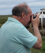
Unemployed and so plenty of spare time for researching contributors' questions and queries and for making corrections. Antiquarian and naturalist. Mode of transport shanks's pony. Talent unnecessary endurance. I love brochs.
|
