|
|

|
|
Hampshire
|
|
|
|
Sites in this group:
|
4 posts
Abra Barrow Barrow / Cairn Cemetery |
4 posts
Andyke Ancient Village / Settlement / Misc. Earthwork |
3 posts
Angle Down Barrow Round Barrow(s) |
|
2 posts
Ashleys Copse Hillfort |
8 posts
Ashurst Lodge Enclosure |
4 posts
Balksbury Hillfort |
|
4 posts
Barrow Field Clumps Barrow / Cairn Cemetery |
1 post
Barton Stacey Barrows Round Barrow(s) |
26 posts
Beacon Hill Hillfort |
|
4 posts
Beaulieu Heath Barrow / Cairn Cemetery |
5 posts
Beaulieu Road Round Barrow(s) |
3 posts
Bevisbury Plateau Fort |
|
1 post
Black Bush Plain Barrow / Cairn Cemetery |
20 posts
Bokerley Dyke Dyke |
6 posts
Bratley Plain Barrow / Cairn Cemetery |
|
3 posts
Breamore Down Round Barrow(s) |
5 posts
Bridles Copse Dyke |
1 post
Brockwood Park Round Barrow(s) |
|
12 posts
Buckland Rings Hillfort |
15 posts
Bullsdown Camp Plateau Fort |
5 posts
Burnt Axon Round Barrow(s) |
|
20 posts
Bury Hill Hillfort |
4 posts
Butser Hill Ancient Village / Settlement / Misc. Earthwork |
1 post
The Butts (New Forest) Barrow / Cairn Cemetery |
|
5 posts
The Butt (Fritham) Round Barrow(s) |
8 posts
Castle Hill (Burley Street) Hillfort |
2 posts
Castle Piece Hillfort |
|
4 posts
Cheesefoot Head Barrows Round Barrow(s) |
7 posts
Cheriton Long Barrow Long Barrow |
1 post
Chilbolton Down Long Barrow Long Barrow |
|
1 post
Chilbolton Round Barrows Round Barrow(s) |
2 posts
Chilworth Ring Hillfort |
6 posts
Cold Pixie's Cave Round Barrow(s) |
|
1 post
Collins Grave Bowl Barrow Round Barrow(s) |
1 post
Cranbourne Wood Long Barrow Long Barrow |
3 posts
Crawley Clump East Barrows Round Barrow(s) |
|
4 posts
Crawley Clump West Barrows Round Barrow(s) |
1 post
Creek Bottom Barrows Round Barrow(s) |
43 posts
Danebury Hillfort |
|
7 posts
Danebury Long Barrows Long Barrow |
1 post
Danebury North-East long barrow Long Barrow |
1 post
Danebury Round Barrows Round Barrow(s) |
|
8 posts
Devil's Ditch Dyke |
5 posts
Dibden Bottom Round Barrow(s) |
2 posts
Dibden Inclosure Barrow / Cairn Cemetery |
|
4 posts
Dirty Mount Round Barrow(s) |
8 posts
Duck's Nest Long Barrow |
2 posts
Dunwood Camp Hillfort |
|
1 post
Elkham Grave Barrow Round Barrow(s) |
9 posts
Farley Mount Enclosure Enclosure |
5 posts
Flex Ditch Dyke |
|
15 posts
Flowerdown Barrows Barrow / Cairn Cemetery |
2 posts
Frankenbury Camp Hillfort |
1 post
Freefolk Wood Barrows Round Barrow(s) |
|
6 posts
The Frith Hillfort |
2 posts
Furze Down Barrow Long Barrow |
2 posts
Gander Down Round Barrow(s) |
|
6 posts
Giant's Grave Long Barrow |
1 post
Gorley Hill Hillfort (Destroyed) |
7 posts
Grans Barrow Long Barrow |
|
7 posts
Grim's Ditch (Cranborne Chase) Dyke |
1 post
Hamble Common camp Hillfort |
1 post
Hatchet Pond Round Barrow(s) |
|
1 post
Heardulfes Hlaewe Round Barrow(s) |
1 post
Hinton Ampner Park Round Barrow(s) |
1 post
Holbury Purlieu Barrow / Cairn Cemetery |
|
2 posts
Holden's Firs Barrows Barrow / Cairn Cemetery |
1 post
Holman's Bottom Barrows Round Barrow(s) |
5 posts
Ipers Bridge Road Round Barrow(s) |
|
2 posts
Itchen Stoke Down Barrows Barrow / Cairn Cemetery |
1 post
Ivyhouse Farm Round Barrow(s) |
4 posts
Jacob's Barrow Round Barrow(s) |
|
1 post
The Jumps Round Barrow(s) |
3 posts
Kilmeston Round Barrow(s) |
1 post
Kitson’s Clumps Round Barrow(s) |
|
7 posts
Knap Barrow Long Barrow |
2 posts
Knoll Camp Hillfort |
9 posts
Ladle Hill Hillfort |
|
4 posts
Ladle Hill Disc Barrow Round Barrow(s) |
2 posts
Lamborough Long Barrow |
1 post
Laundry Bungalows Round Barrow(s) |
|
1 post
lbsley Common Round Barrow(s) |
1 post
Leckford Barrows Round Barrow(s) |
2 posts
Littleton House Bowl Barrow Round Barrow(s) |
|
1 post
Little Somborne Hillfort Hillfort |
1 post
Lockerley Camp Plateau Fort |
3 posts
Longsdale View Barrow Round Barrow(s) |
|
6 posts
Longwood House Long Barrow Long Barrow |
7 posts
Long Barrow Lane Long Barrow |
3 posts
Love Lane Round Barrow(s) |
|
1 post
Lower Bordean Farm Round Barrow(s) |
4 posts
Lower Exbury Promontory Fort |
11 posts
Magdalen Hill Down Barrows Barrow / Cairn Cemetery |
|
1 post
Malwood Castle Hillfort |
4 posts
Marchwood Inclosure Round Barrow(s) |
2 posts
Martin's Clump Long Barrow |
|
1 post
Martin's Clump Mine Ancient Mine / Quarry |
6 posts
Martin Down Round Barrow(s) |
1 post
Martin Down Camp Enclosure |
|
2 posts
Merdon Castle Hillfort |
13 posts
Micheldever Woods Ancient Village / Settlement / Misc. Earthwork |
5 posts
The Millbarrows Barrow / Cairn Cemetery |
|
1 post
Monarch Way Round Barrow(s) |
2 posts
Money Hills Round Barrow(s) |
2 posts
Moody's Down Long Barrow |
|
2 posts
Moody’s Down Farm Long Barrow |
1 post
Moorgreen House Round Barrow(s) |
1 post
Netley Hill Round Barrow(s) |
|
2 posts
Newton Down Farm Round Barrow(s) |
1 post
New Farm Round Barrow(s) |
5 posts
Norsebury Ring Hillfort |
|
5 posts
North Yew Tree Heath Barrows Barrow / Cairn Cemetery |
24 posts
Old Winchester Hill Hillfort |
3 posts
Oliver's Battery Hillfort |
|
7 posts
Oliver's Battery Ancient Village / Settlement / Misc. Earthwork |
2 posts
Oram's Arbour Hillfort |
6 posts
Owslebury Long Barrow |
|
38 posts
Petersfield Heath Barrow / Cairn Cemetery |
10 posts
Popham Beacons Barrow / Cairn Cemetery |
5 posts
Pudding Barrow Round Barrow(s) |
|
5 posts
Quarley Hill Hillfort |
6 posts
Salt Hill Long Barrow Long Barrow |
5 posts
Sarsen Stone (Martin) Standing Stone / Menhir |
|
6 posts
Setley Plain Round Barrow(s) |
5 posts
Setley Pond Round Barrow(s) |
9 posts
Seven Barrows Barrow / Cairn Cemetery |
|
3 posts
Shirley Holms Round Barrow(s) |
8 posts
Silchester Ancient Village / Settlement / Misc. Earthwork |
2 posts
Slap Bottom Round Barrow(s) |
|
2 posts
South Wonston East Long Barrow Long Barrow |
6 posts
South Wonston Long Barrow Long Barrow |
3 posts
South Wonston North Long Barrow Long Barrow |
|
5 posts
South Wonston South-west Long Barrow Long Barrow |
8 posts
Stagsbury Hill Barrow / Cairn Cemetery |
2 posts
Stockbridge Down Round Barrow(s) |
|
3 posts
Stock's Farm Long Barrow Long Barrow |
22 posts
St Catherine's Hill Hillfort |
5 posts
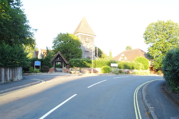
St Mary's Church, Twyford Christianised Site |
|
1 post
Suddern Long Barrow |
2 posts
Tatchbury Mount Hillfort |
7 posts
Telegraph Hill Barrow Round Barrow(s) |
|
2 posts
Tenantry Farm Long Barrow |
1 post
Testwood Lakes Ancient Village / Settlement / Misc. Earthwork |
5 posts
Texas Barrows Round Barrow(s) |
|
1 post
Three Barrows (Laverstoke) Round Barrow(s) |
5 posts
Tidbury Ring Hillfort |
2 posts
Tidpit Common Down Long Barrow |
|
4 posts
Toothill Fort Hillfort |
2 posts
Tourner Bury Plateau Fort |
2 posts
The Turret Round Barrow(s) |
|
3 posts
Twyford Pumping Station Barrows Round Barrow(s) |
2 posts
Upper Woodcott Farm Long Barrow |
8 posts
Vales Moor Round Barrow(s) |
|
5 posts
Vernditch Chase Long Barrow |
6 posts
Vernditch Chase North Long Barrow |
2 posts
Wallers Ash Barrow Round Barrow(s) |
|
1 post
Warhill Cottage Round Barrow(s) |
1 post
Watership Down Round Barrow(s) |
1 post
Waters Down Farm Round Barrow(s) |
|
1 post
West Meon Round Barrow(s) |
7 posts
West Wood Round Barrow(s) |
2 posts
Weyhill Round Barrow(s) |
|
1 post
Wheely Farm Round Barrow(s) |
2 posts
Whitefield Moor Round Barrow(s) |
2 posts
Whiteshoot Hill Round Barrow(s) |
|
8 posts
Whitsbury Castle Ditches Hillfort |
2 posts
Whitsbury Down Long Barrow Long Barrow |
2 posts
Wilbury House Round Barrow(s) |
|
1 post
Windmill Hill (Tournerbury Wood) Round Barrow(s) |
3 posts
Winklebury Hillfort |
6 posts
Withering Corner Barrows. Barrow / Cairn Cemetery |
|
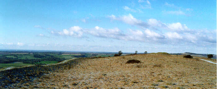
11 posts
Woolbury Hillfort |
1 post
Wyke Green Farm Round Barrow(s) |
1 post
Yew Tree Heath Barrow / Cairn Cemetery |
Sites of disputed antiquity:
|
4 posts
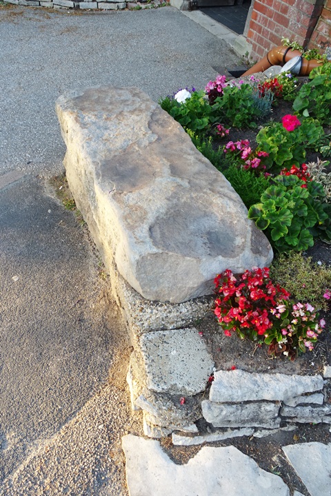
Cheriton Church Mound Christianised Site |
5 posts
South Baddesley Stone Standing Stone / Menhir |
6 posts
St. Peter's Church, Farnborough |
News |
|
|
Silchester dig hints at larger Iron Age Town http://www.timesonline.co.uk/tol/life_and_style/court_and_social/article6833081.ece |
14th October 2009ce |
Marine Mapping Helps Uncover the Past in the New ForestHampshire, UK, 08 September 2009 - The New Forest National Park Authority is using detailed marine mapping from SeaZone to undertake an archaeological assessment of its coastline in response to changing sea levels... continues... |
 Posted by UncleRob
14th September 2009ce Edited 6th January 2016ce |
New Forest discovery thought be one of oldest ever made in UK(With thanks to Ocifant for sending me this) TWO 6,000-year-old tombs have been unearthed in Hampshire in one of the biggest archaeological finds for years. The discovery, thought to be among the oldest ever made in the UK, is set to shed new light on the life led by the county's earliest settlers... continues... |
 Posted by goffik
5th June 2009ce Edited 6th January 2016ce |
|
Stone head found in Hampshire "A retired fisherman has discovered an ancient stone head which experts say could be 24,000 years old - the oldest found in Britain." The five-inch stone head was found off Long Island in Hampshire and according to archaeologists could be a piece of Neanderthal art. "A similar stone head was found in a Neanderthal cave in northern France and was dated back to 28,000 BC." Full story and photo appear on page 7 of The Times, 2 October 2004. |
 Posted by Littlestone
2nd October 2004ce Edited 17th July 2005ce |
Axe on the beach from 8,500 years agoDog-walker Jamie Stevenson took a stroll along the beach – and stumbled across an axe head dating back to the stone age. Mr Stevenson, a Radio Solent newsreader, said: 'My dog Woody likes chasing stones when I skim them on the water, and so I just happened to pick it up. 'It felt different and looked different... continues... |
 Posted by Jane
27th March 2004ce Edited 27th March 2004ce |
|
Oldest bridge found. Whilst constructing a reservoir at Testwood just outside Southampton, Southern Water uncovered the remains of a Bronze Age bridge. http://www.wessexarch.co.uk/projects/hampshire/testwood/index.html |
 Posted by jimit
30th October 2003ce |
Royal Navy to aid search for Solent archaeologyOk, so they're doing it for their own ends, because they might have to dredge some of it. But they could find all sorts of Prehistoric Stuff. http://www.royal-navy.mod.uk/rn/content... continues... |
 Posted by Rhiannon
4th September 2003ce |
Iron Age coin-die found in HantsAn ancient British , used to stamp a horse design on Iron Age gold coins, has been found near Alton in Hampshire... continues... |
Posted by Jane 21st August 2003ce |
|
Iron Age "forger's" die found Ancient forger's coin die found - The coin die was used to make Iron Age coins An ancient British coin die - used to create the design on gold coins in the Iron Age - has been found in Hampshire. http://news.bbc.co.uk/1/hi/england/hampshire/dorset/3156829.stm |
Posted by BrigantesNation 17th August 2003ce Edited 15th February 2006ce |
Rescue begins for seabed relics from 6000BChttp://www.guardian.co.uk/uk_news/story/0,3604,722701,00... continues... |
Posted by phil 28th May 2002ce |
Links |
|
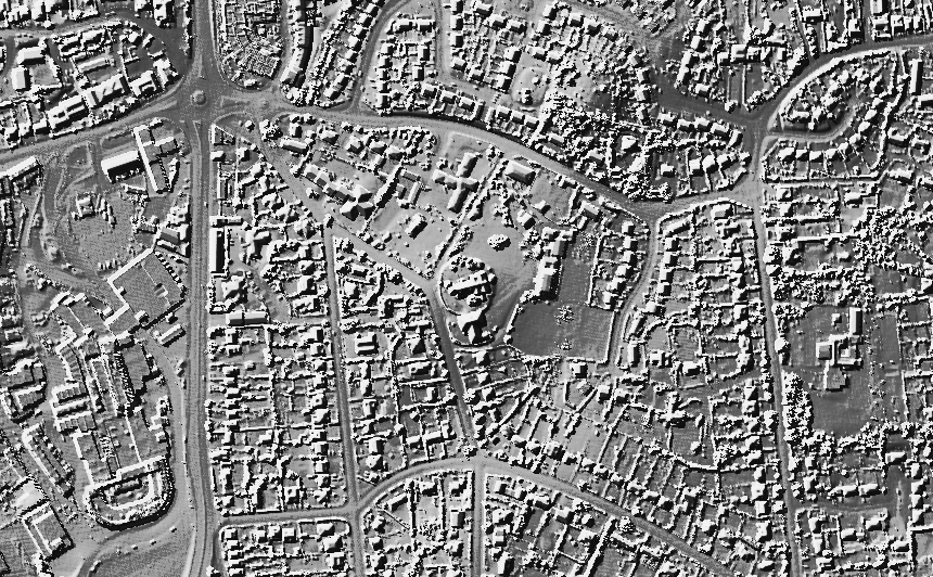
Hampshire Downloads National Mapping projectAn astonishing report compiling aerial photography and other surveys in the chalkland area between the Itchen and Test rivers. A must for the Hampshire Antiquarian! There are many possible sites in here that were never known about before! |
Posted by UncleRob 1st April 2016ce |
Hampshire TreasuresIn case you're visiting sites in Hants and wondering what formicaant, pure joy, jimit and others are referring to, this is it. Indispensible but only as good as its sources. Refers often to PHFC (Proceedings of the Hampshire Field Club, which is now published as Hampshire Studies, an annual journal), which is available at the Hants Record Office next to Winchester railway station. |
Posted by UncleRob 4th January 2009ce |
Latest posts for Hampshire |
Showing 1-10 of 827 posts. Most recent first | Next 10 
Woolbury (Hillfort) — Images (click to view fullsize) |
|
Posted by markj99 29th March 2021ce |
St. Peter's Church, Farnborough — Images |
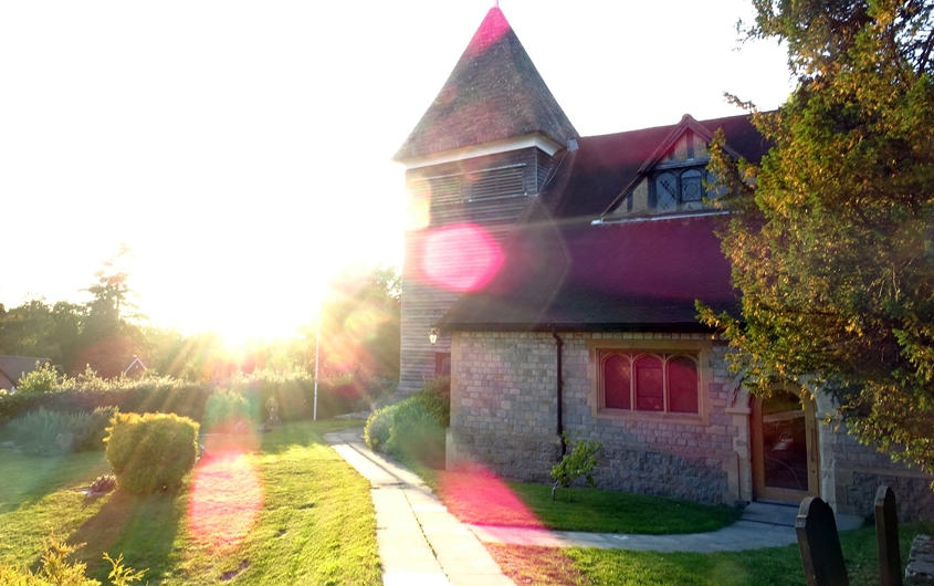   
|
Posted by Ricky Rocket 22nd February 2020ce |
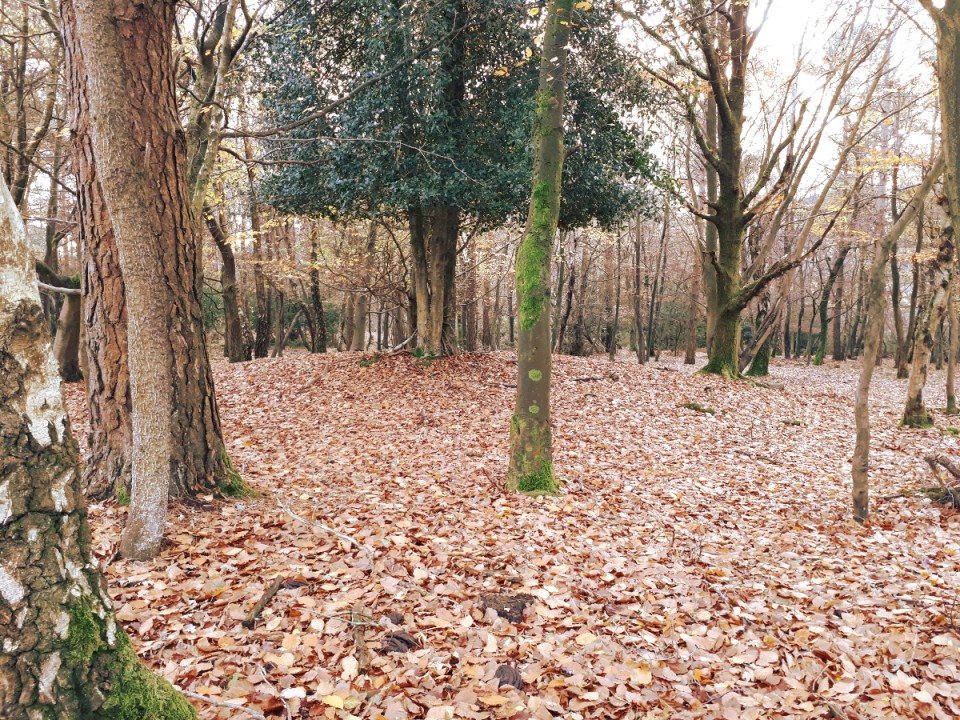
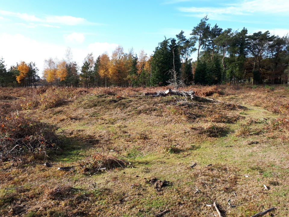
Dibden Inclosure (Barrow / Cairn Cemetery) — Fieldnotes |
| A single bowl barrow, in woodland and easily found alongside a track. This is only a few minutes from the Dibden Inclosure car park and if you are nearby, you should definitely also visit the Beaulieu Road barrows. |
Posted by UncleRob 18th November 2018ce |
Dibden Inclosure (Barrow / Cairn Cemetery) — Images |
|
Posted by UncleRob 18th November 2018ce |
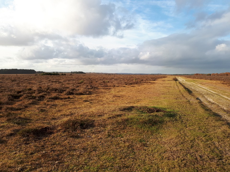
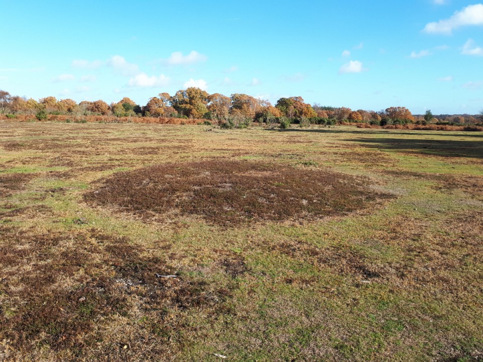
Yew Tree Heath (Barrow / Cairn Cemetery) — Images |
|
Posted by UncleRob 18th November 2018ce |
North Yew Tree Heath Barrows (Barrow / Cairn Cemetery) — Images |
|
Posted by UncleRob 18th November 2018ce |
Showing 1-10 of 827 posts. Most recent first | Next 10