The Cotswold Way IV – Dowdeswell – Cooper’s Hill 20 April 2013
Two days after a wind-driven Carneddau walk with Postman, I contemplate still-aching legs and the promise of a sunny spring morning. Promising myself not to walk far, the pull of the hills is too strong as usual and I find myself taking the short bus trip to Dowdeswell, where I finished my last section of Cotswold Way. This has the unfortunate distinction of being the lowest point of the route today, so I’m faced with an immediate climb.
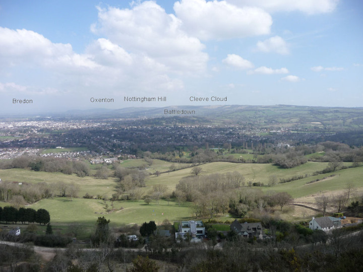
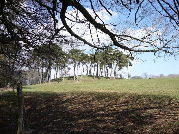
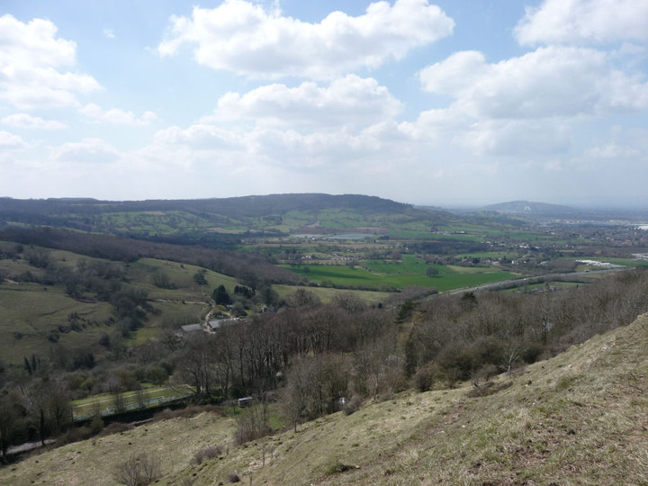
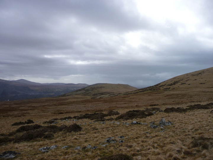
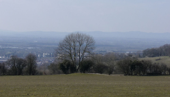
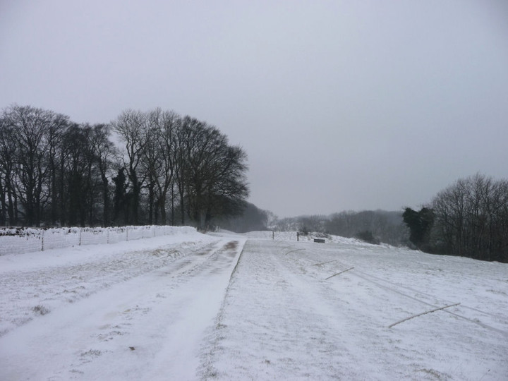
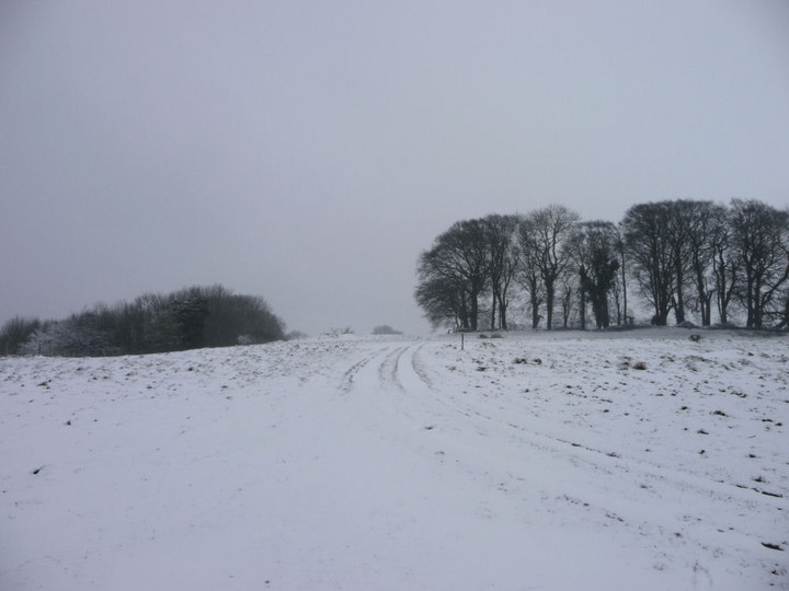
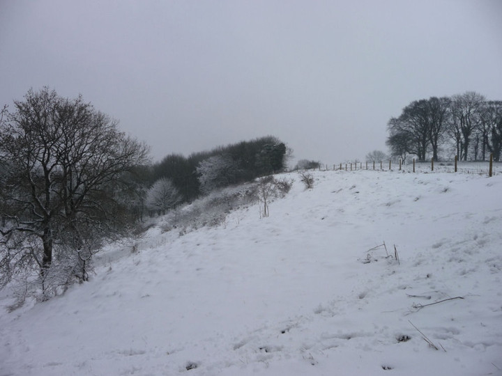
The ascent is not too steep at first and I startle a deer on reaching the treeline, a good omen for the day I think. As the path reaches Lineover Wood, one of the lovely beech hangers that characterises the Cotswolds every bit as much as the limestone escarpment, there is little noise but birdsong. Some of the trees here are a few hundred years old, ancient in beech lifespans. Aching legs begone, it’s going to be a lovely day.Reaching a field at the edge of the wood, the worst of the climb over, I leave the Cotswold Way route along another footpath, heading southwest. From here the view opens up beautifully to the north, where Cleeve Hill fills the skyline, with Cheltenham spread out below to the northwest. The reason for my temporary diversion lies just over the crest ahead of me, in the next field.
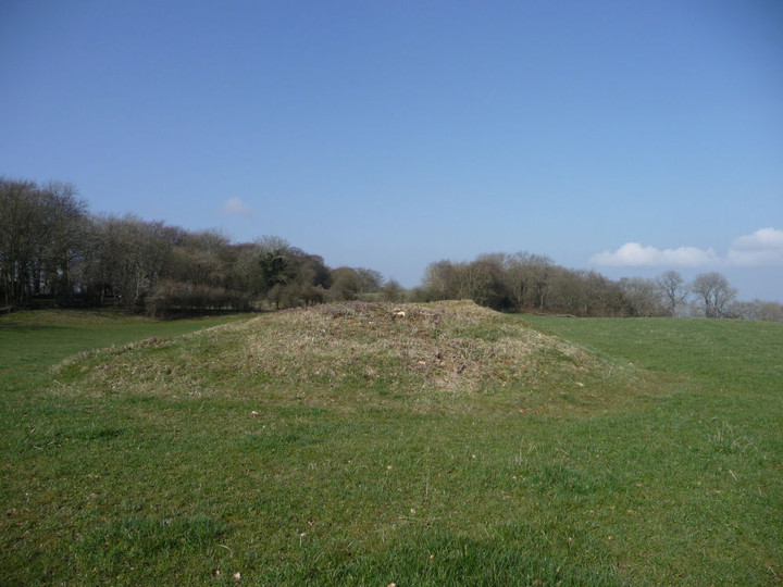
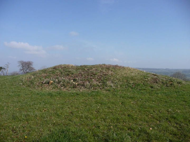
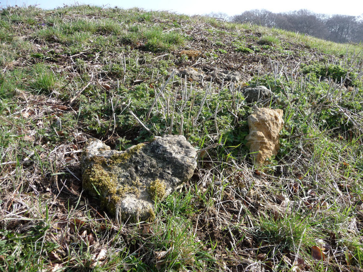
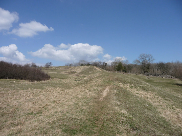
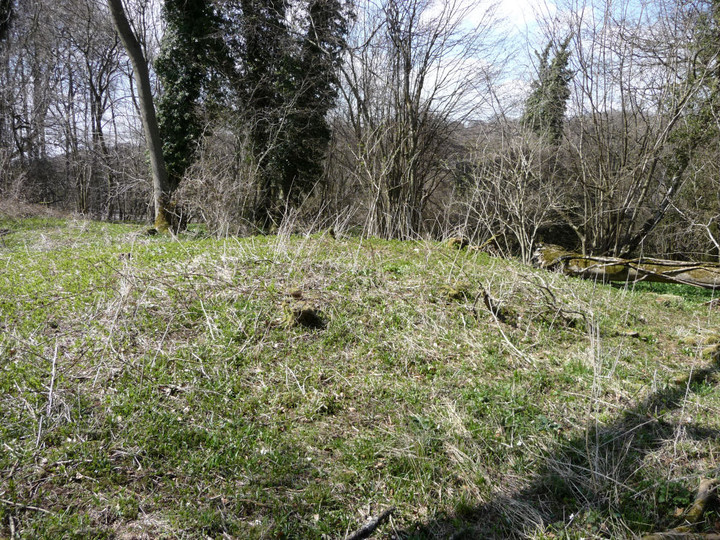
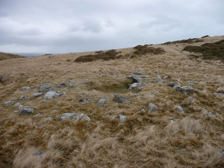
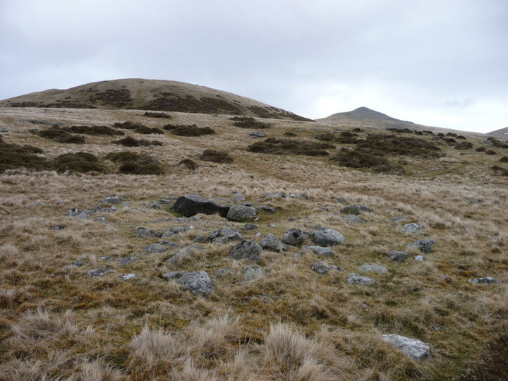
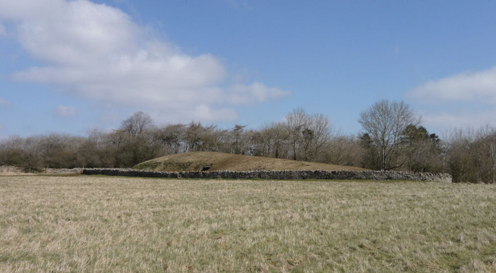
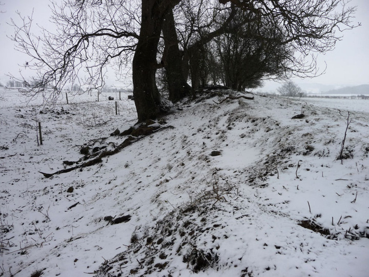
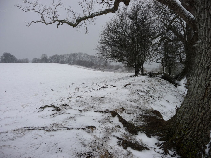
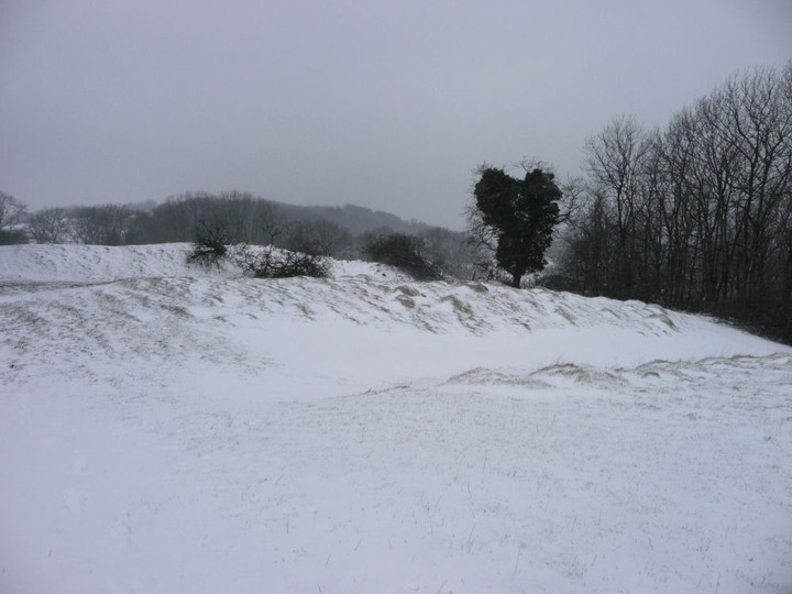
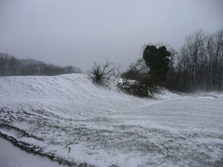
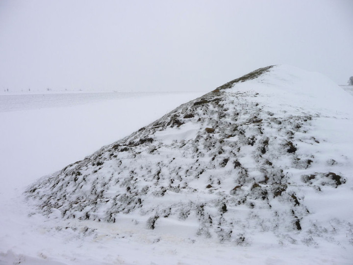
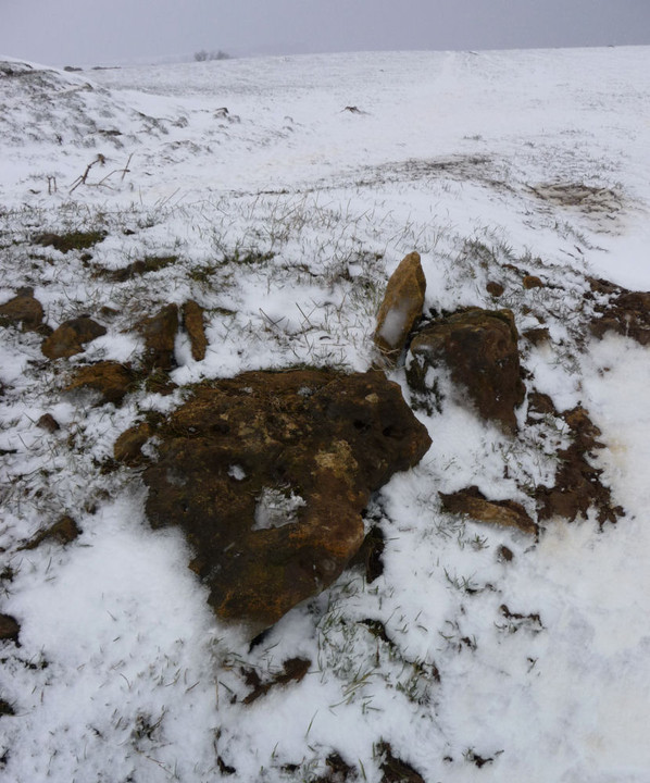
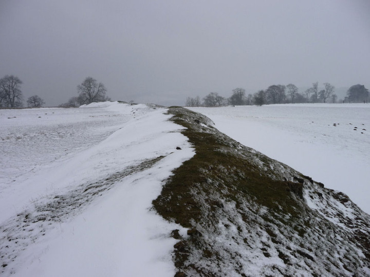
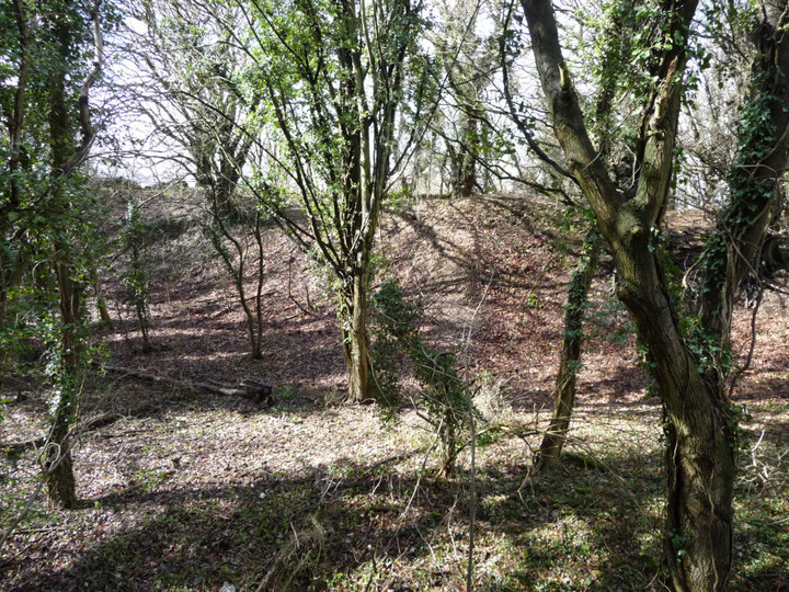
Lineover long barrow has suffered greatly over the years. Now resembling an elongated round barrow, there is little to paint an obvious family resemblance to its near neighbours at Belas Knap or Crippetts. But pause a little longer – the positioning gives away its undoubted blood ties, perched below the highest point of the hill, but enjoying extensive views over the edge of the escarpment. Typical Cotswold-Severn long barrow location in fact. I’ve not been here for about 18 months, the grass is cropped shorter than on my previous visits. The barrow still stands to a height of over a metre and various large pieces of limestone can be seen resting here and there on the mound. There is no livestock in the field today, although the hardened prints around the field edge indicate that cows are still the usual occupants. The only real detraction from a visit remains the horribly busy A436, where I doubt many of the drivers ever notice the long barrow they pass in an eye-blink. The inevitable crump of shotguns can also be heard, far off. Still a worthwhile stop-off, an old friend to revisit, renew acquaintances and share some time together.
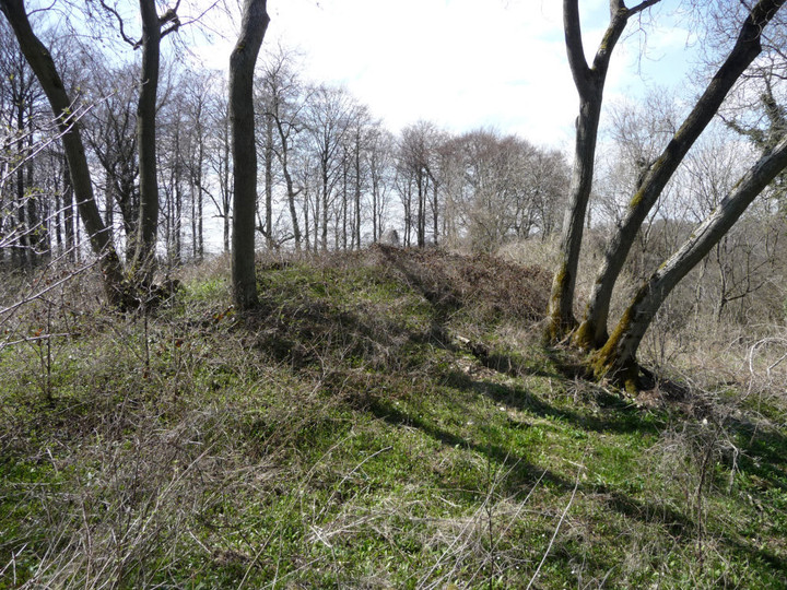
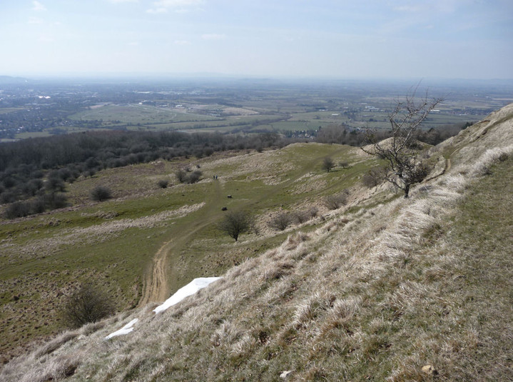
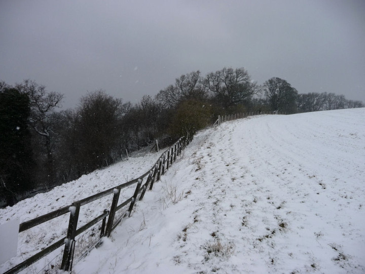
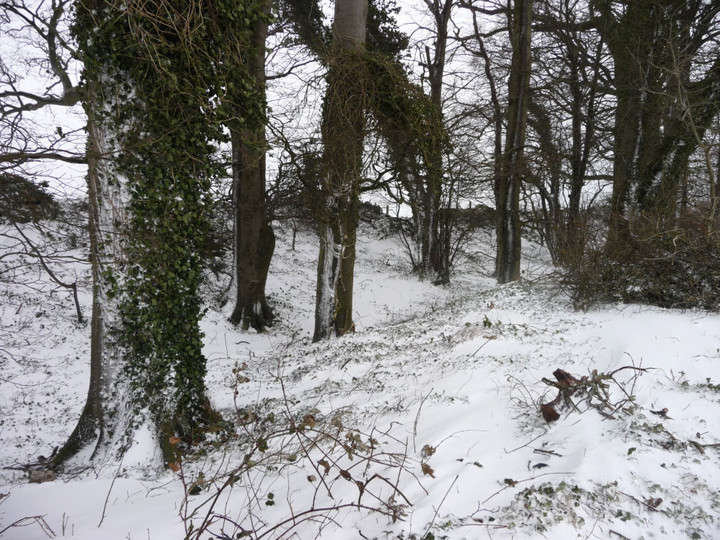
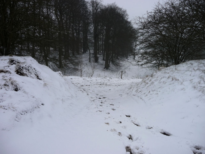
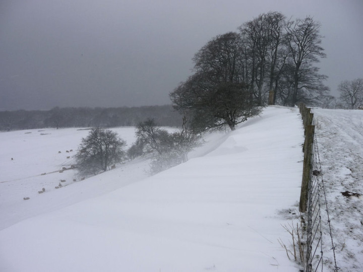
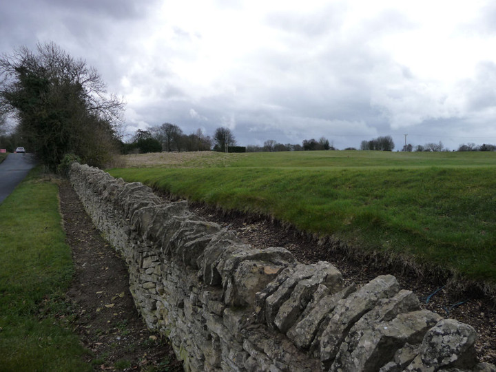
The Cotswold Way has been re-routed since my Explorer map was published, so it now comes up to the corner of field in which the Lineover barrow stands. From here it heads back into the woods, and what lovely woods they are too. Sunlight filters through the canopy, all is well in the world. Towards the southwestern edge of the wood, work on restoring a beautiful drystone wall is ongoing, a party of volunteers hard at it as I pass. The re-routing of the path means that a section across the steep slopes of Ravensgate Hill is now avoided, as the path clings to the lip of the escarpment instead. Out of the woods, the view north opens instantly. Although it’s hazy today, there is a good retrospective of my last walk over Cleeve Hill and towards Bredon Hill across the border in Worcestershire. Ahead, the steep scarp of Leckhampton Hill now looms, the easier dip slope of which will represent the next climb of the day. The Malverns are a distant smudge of blue. The top of Wistley Hill is a terrific place to stop awhile and drink in the views (and some water).
The route turns almost south, dropping fairly sharply towards Severn Springs (a place crying out for some watery folklore, I would think), where a busy road crossing over the A435 awaits. This done, I’m climbing again, more gradually this time, as the route makes its way northwards up Hartley Hill, offering yet more fine views over Charlton Common and back towards Wistley Hill. |
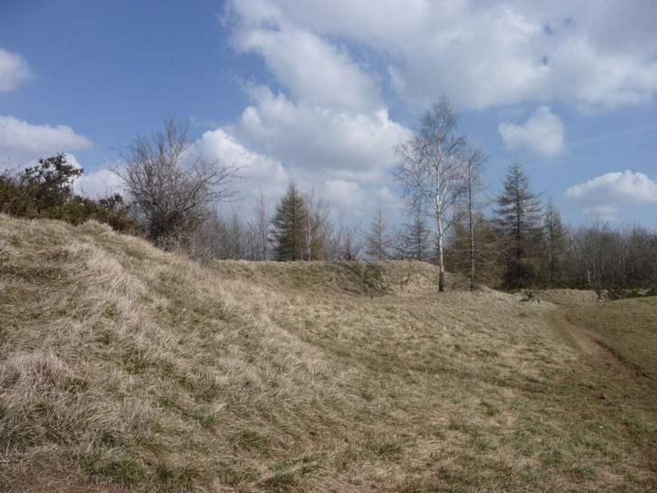
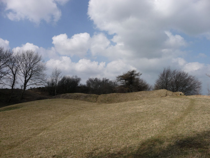
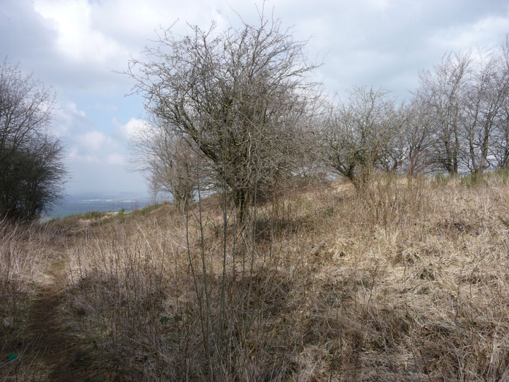
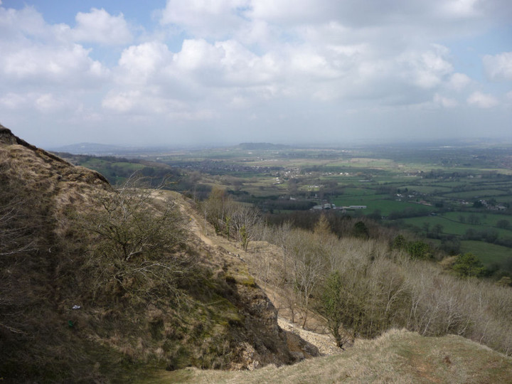
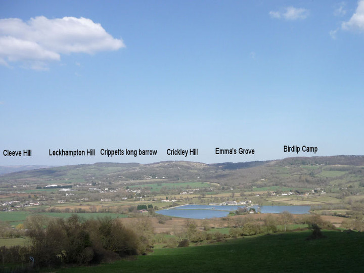
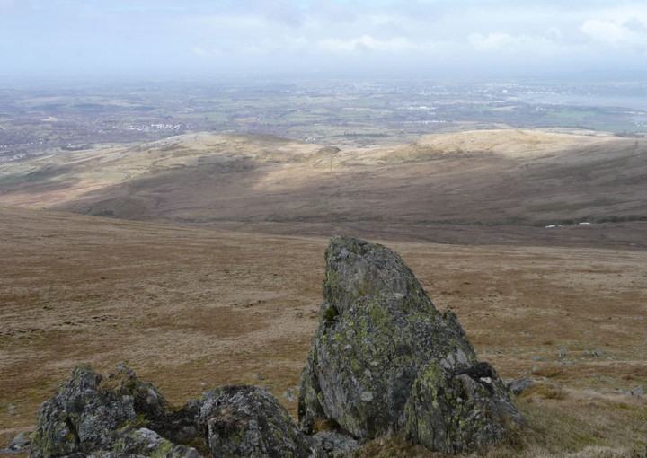
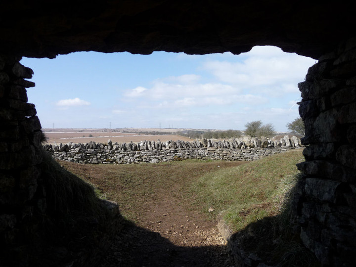
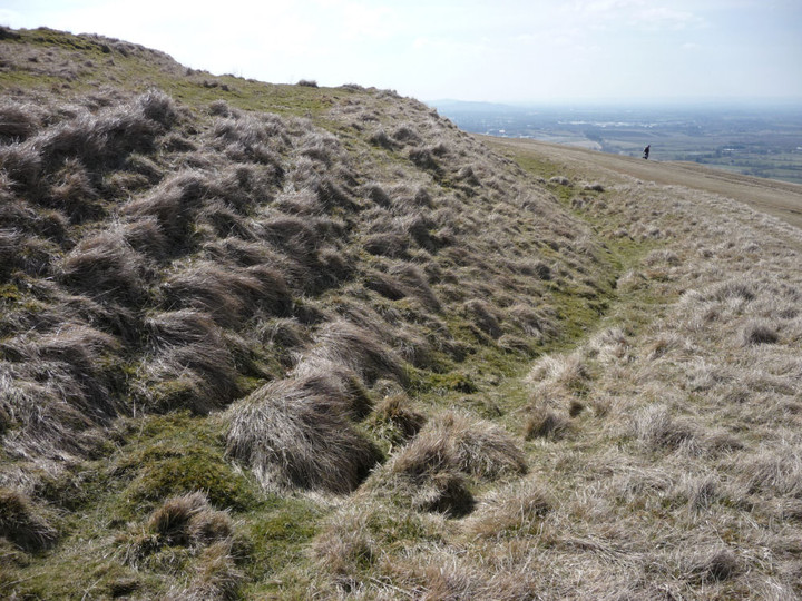
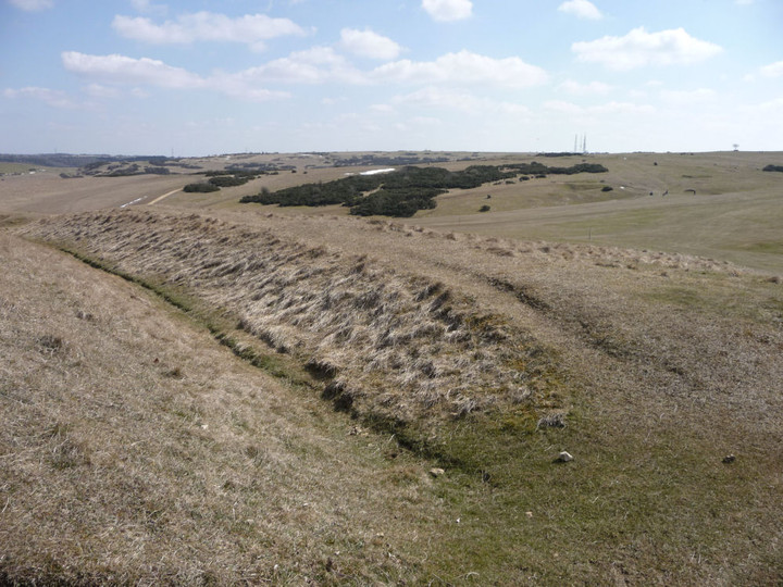
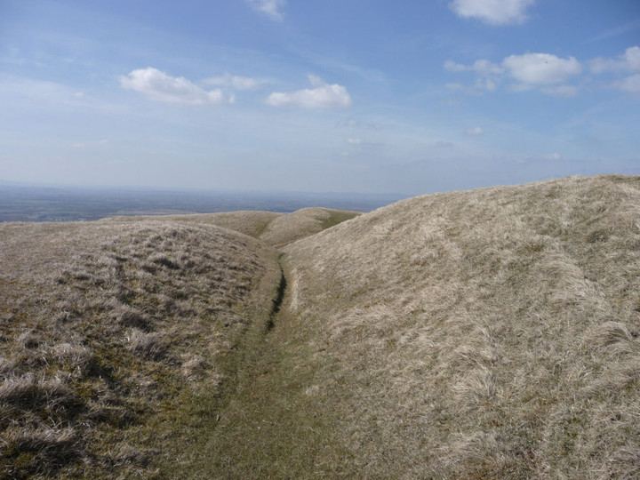
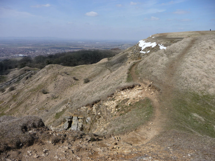
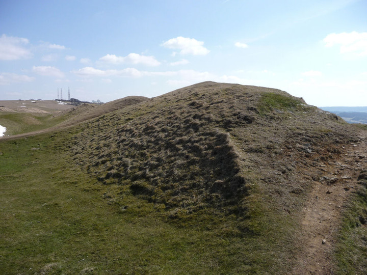
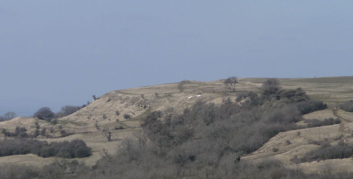
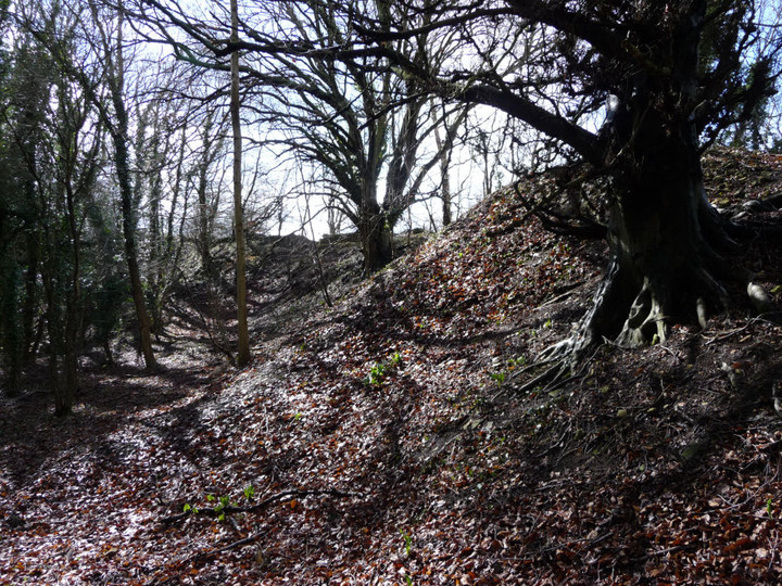
Coming from the east (unusually for me), old quarrying scars blight the first approaches to Leckhampton Hill, but the views over the escarpment are particularly fine, despite the haze today. After a couple of bridle gates, the path eventually comes to some rather enigmatic earthworks stretching away from the fort, their overall layout and purpose not really clear. Following the path onwards, it soon reaches the northern section of the ramparts proper. This is the best-preserved part of the defences, and a walk to the northern tip offers a terrific aerial viewpoint off the near-vertical quarried cliffs and across Cheltenham. I can indeed see my house from here (well, my street anyway). Although I’ve been up here many times now, there is always something new to see. In this case, it’s the northern rampart, below the lip of the escarpment, much more clear of vegetation than I have seen before.
I sit up here for a while, perched high above home and contemplate my choices. I had intended a short walk after the North Wales efforts earlier in the week, but the day is still young and the sunshine is calling me onwards. Besides which, this is one of those parts of the route where ending here would require an otherwise unnecessary climb at the start of the next walk. I decide to press on, at least as far as Crippetts.
Leaving the fort, I head down to one of the many quarries hacked into the hillside, this one serving as a carpark now. I hunt around unsuccessfully for fossils, but to my astonishment, tucked into a crevice in the limestone, I find a pile of chalk-covered flint nodules, some quite large. Nothing worked that I can see, but I have always thought that flint was alien to this part of the Cotswolds, any flint tools being imports from the eastern downs (or further afield). Not so, it seems. Well, you live and learn.
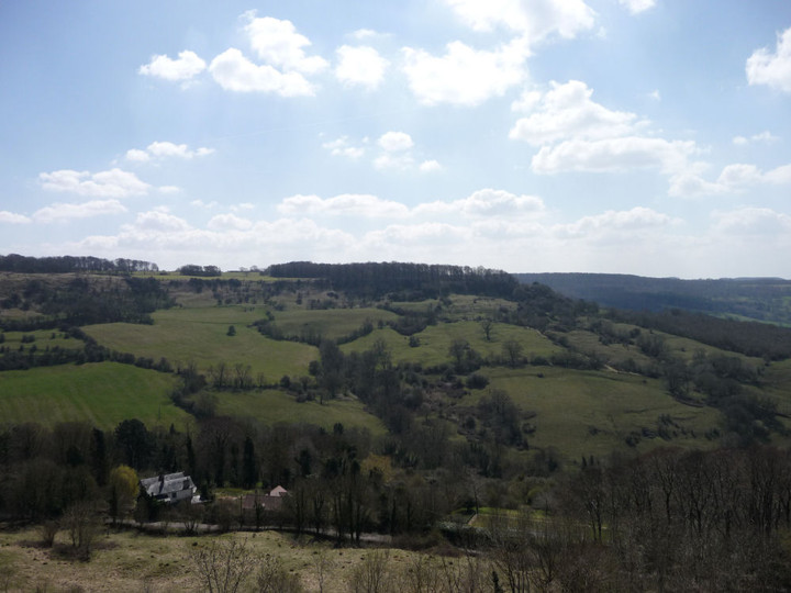
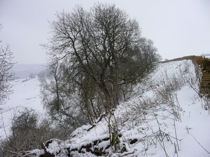
The path runs south now, then west past Ullenwood to the woods that bracket the wonderful Crippetts long barrow. I don’t stop off for long today, it’s not long since my last visit and I have decided to carry on to Crickley Hill. I’ll just say, once again, that this is a fabulous long barrow, well worth your attention. |
My last visit to this fine site was in falling snow and a black and white world. Not so today. The walk through the woods of Crickley Hill Country Park to the northeast is lovely, sun streaming down. I stop at the Visitor Centre briefly, it’s usually been closed when I’ve been here before and it’s worth a look to see the information boards, together with some prehistoric finds and a model reconstruction of the site.
The site itself is quite magnificent, probably the best hillfort encountered so far along the Cotswold Way as, unlike Cleeve Cloud and Leckhampton Hill, it hasn’t been so badly damaged by quarrying (although it hasn’t entirely escaped). The Way passes through the impressive Iron Age ramparts that cut off a large wedge-shaped promontory. Inside this, various hut circles are marked out by concrete posts, although there’s nothing else remaining of them. The main features of the view today are Robinswood Hill and Churchdown Hill, two conical outlier of the Cotswold escarpment. The Malverns are but dimly seen through a haze more reminiscent of summer.
The most enigmatic part of the site is the circular feature at the northern end of the Neolithic earthwork, although little remains of it now. The circle, 8 metres across, was enclosed by stones and had a central hearth. “Ritual” purposes abounded, no doubt. From the western tip of the promontory, my route ahead comes into view for the first time, Barrow Wake across the steep-sided valley that now houses the A417, with Birdlip Camp, Witcombe Wood and Cooper’s Hill beyond. The Mother River, the Severn/Hafren, lies broad and glinting to the southwest.
It’s busy here today, as you’d expect on such a lovely day, and before long the impulse that pushes me onwards, away from the crowds, comes back. The Cotswold Way turns back along the southern edge of the promontory, where the ground falls away most steeply, before leaving the fort into yet another delightful beech wood.  |
The peace and quiet are soon cut through by the looming prospect of two rather nasty roads to cross, the second and worst of which (over the A417) has to be made twice to allow a detour to another rather unmissable site passed by the Way, Emma's Grove round barrows.Like nearby Crickley Hill, my last visit here was in a worsening snow fall. The contrast couldn’t be more extreme today, coming to the barrows in lovely spring sunshine, every footfall releasing the scent of wild garlic.
The disadvantage of a spring visit, even after such a late winter, is that the barrows are quite overgrown and much of the vegetation is of the brambly kind, trying to trip me up and making even a walk around the two barrows quite a challenge. Don’t bother coming in high summer! Actually the barrows repay the effort, the larger of the two is as fine an example of a sizeable Bronze Age burial mound as you will find in these parts.
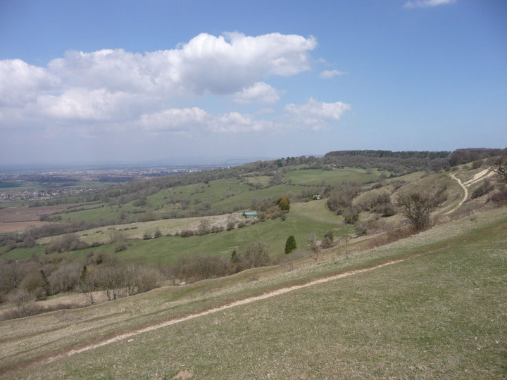
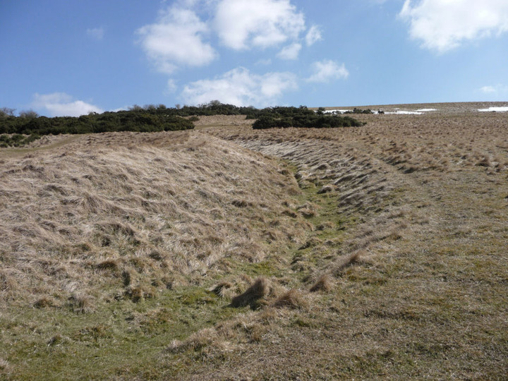
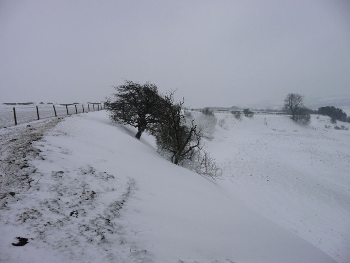
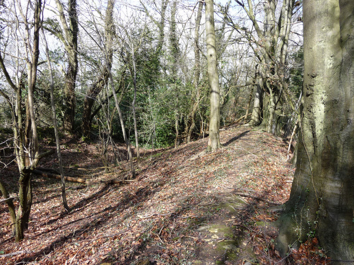
By now my path is both far from home and far from a bus stop, with Shurdington far below the Cotswold edge the only reasonable prospect if I leave the path now. I decide instead to plough on, to make the most of the lovely weather. After a second dice with death on the A417 (I’m not exaggerating this, it’s a horrible road to cross here), I leave the road and find myself back on the open escarpment at Barrow Wake, which offers fine views, especially across the valley back to Crickley Hill. My next stop-off, Birdlip Camp, is straight ahead, a jutting wooded promontory.After a rather up and down walk along the face of the escarpment, it’s something of a relief to reach the trees that mark the promontory fort, where I'm greeted by the rat-a-tat of a woodpecker looking for lunch. The Cotswold Way enters the wood at the single rampart, which is at its most impressive at this northern end. It has been damaged by quarrying; there’s a big pit across the path outside the camp. Aside from this feature, there is little visible to indicate the presence of Iron Age occupation. The interior is covered in trees, albeit a light deciduous wood that allows plenty of visibility through the site.
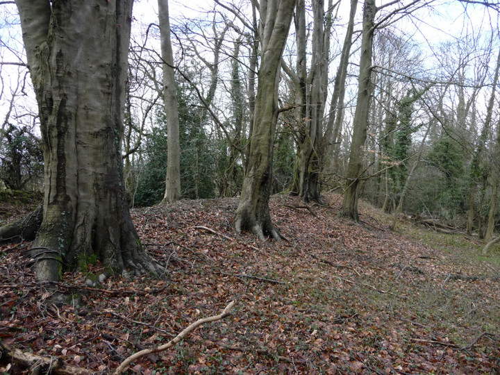
The ground falls away very steeply on the north and south sides – my path runs to the end of the promontory and then back along the opposite side. Reaching the southern end of the rampart, there is hardly anything left of the earthwork here. It’s a pleasant spot on a sunny day, but don’t expect to be blown away by the visible remains.
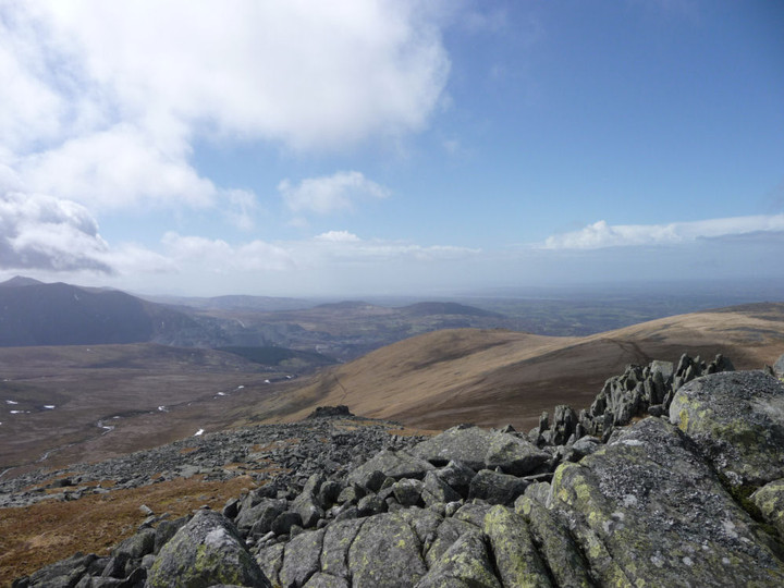
And that concludes the prehistory for the day. My earlier plan (well, about plan C or D by now) had been to leave Birdlip by the steep road off the escarpment, dropping down to Great Witcombe. But this would mean a couple of miles off the path that would have to be repeated in reverse next time. Despite rather tired legs by now, I decide to carry on round the escarpment through Witcombe Wood to Cooper’s Hill, where I will be within a spit of the bus route home. This proves to be a good choice, the sunlit woods and general downhill trend of the path making for very pleasant walking indeed. Somewhere in the woods above me is West Tump long barrow, my favourite woodland site of the Cotswolds, but she warrants her own visit and is very difficult to leave, so I eschew that option and press on.
The final flourish of the walk comes courtesy of a break in the trees above Witcombe, where a magnificent vista is revealed, from Churchdown Hill and the Malverns, across the Witcombe reservoirs back to Crickley Hill and my earlier route. I finally stumble down to Brockworth, very tired but entirely satisfied by the day spent on these pretty hills. From here on, I will be turning my face away from home, towards the Severn and the southwest. Plenty for next time then.
|
Into the Empty Quarter – Drosgl and the Berau 18 April 2013
Uneventful train journey over (why is it always raining in Stafford?), the road is hit with much enthusiasm. Today Postman and I are heading to the western Carneddau, the range’s empty quarter now, although once people lived and loved and died in the high valleys, millennia past or just yesterday, depending on your perspective of Time.
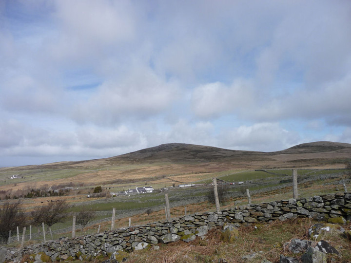
I’m nervously excited about the walk ahead, easily the biggest test of my slow-mending leg and within sight of where that happened last summer. But the pull – or is it a push? - is too great to ignore, as ever. We park up at the end of a series of prosaically named streets (Short Street, Long Street, Hill Street) in Gerlan, just uphill from Bethesda. Stepping out of the car, the wind is keen and promises to offer a stiff challenge to our progress.
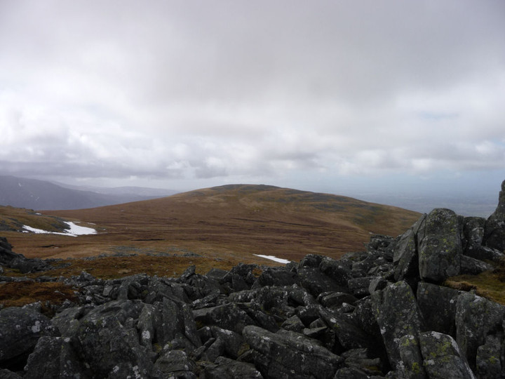
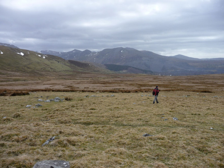
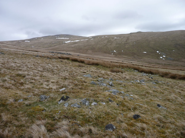
The first section of the route takes us steadily uphill, past a very ruined settlement with views of Moel Faban, then across muddy fields to Tan-y-Garth, the first and last homely house we’ll come to for a good long time today. From there it’s a matter of picking a random route up to Y Garth, where the views open out beautifully. Cwm Caseg lies below us, with the western Glyderau rising spectacularly to our south, shapely peaks marred by the enormous workings of Penrhyn slate quarries. The high Carneddau are hidden away in cloud, their slopes still clad in the last remnants of recent snow, but our first target, Gyrn Wigau, is a tantalising grassy slog away. Bearings got, we make a start on the biggest climb of the day.
It’s a tiring climb up the grassy slopes, not helped by a succession of false crests that keep the top from us – luckily the strong wind is at our backs to push us up the final climb. I’ll be honest, I wasn’t expecting much from this first summit, on the map it appears very much a trivial subsidiary of Drosgl. The reality proves immensely better, once it finally comes into sight. A long ridge, lying at right angles to our route, each end of which is topped with a lovely natural cheval-de-frise of mini-pinnacles. From the northern end of the ridge there is a fine view of Moel Wnion, with the sea beyond. The wind up here is absurd, constantly threatening to knock us over. Postie reckons it’s not as bad as it was on Foel Grach last year – we’ll see. Drosgl awaits. |
 |
 |
 |
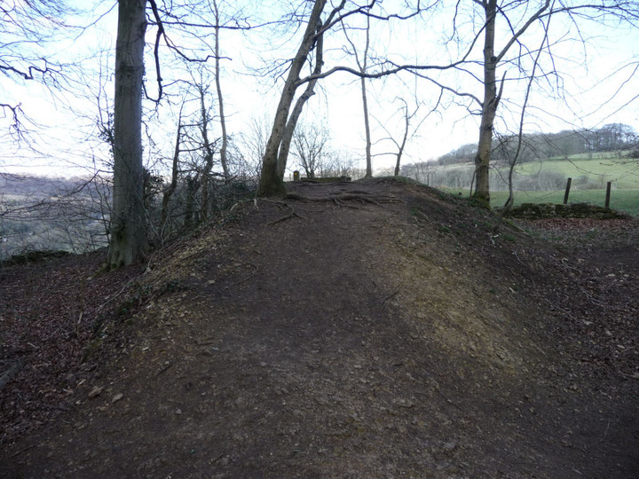
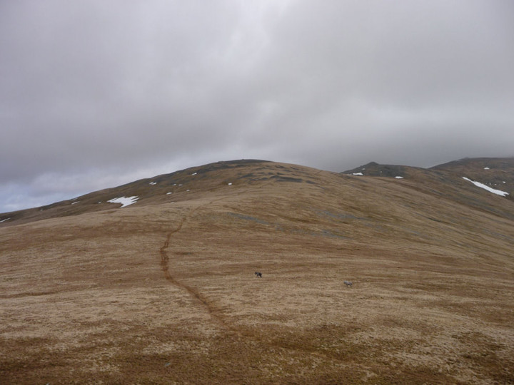
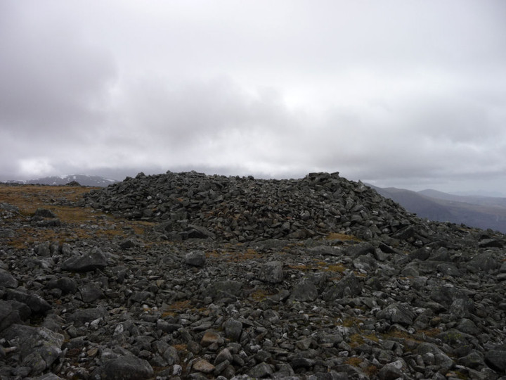
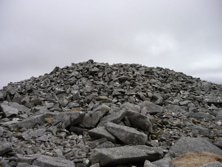
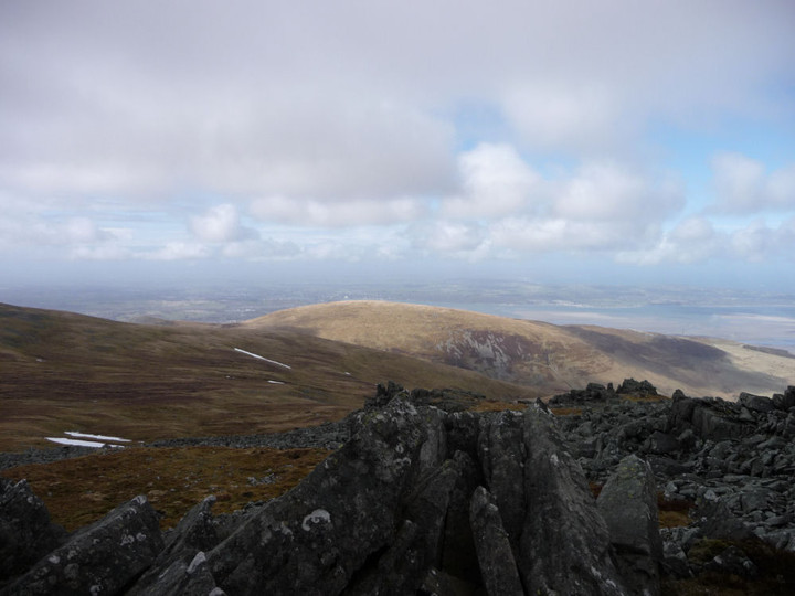
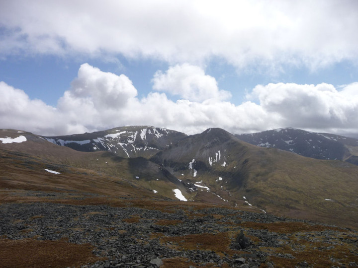
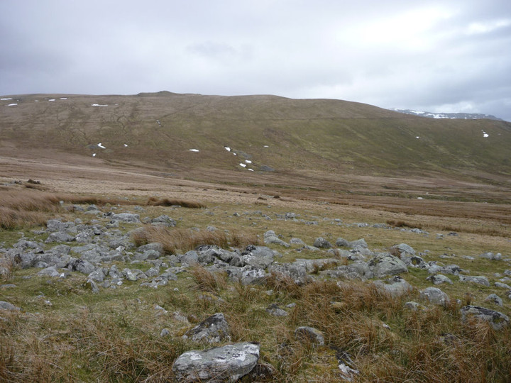
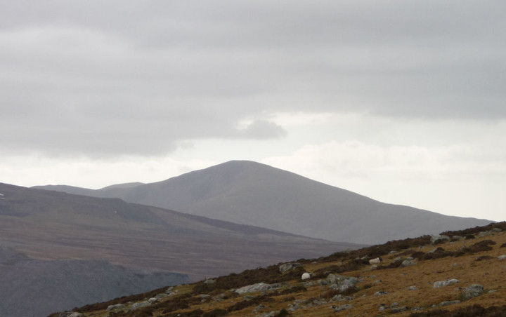
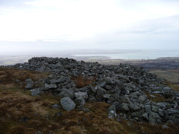
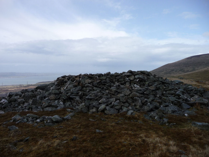
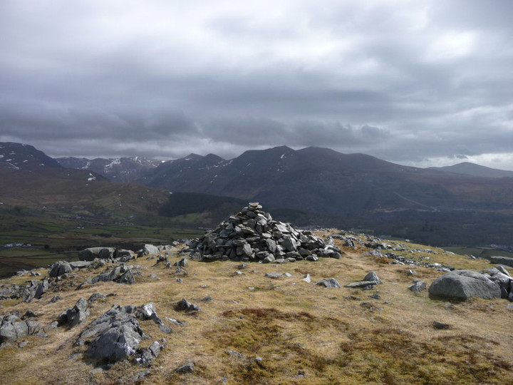
A rather narrow and meandering path heads up the slopes of Drosgl from Gyrn Wigau, fairly gentle at first then steepening after we cross a footpath running up from the direction of Moel Wnion. Rounding the shoulder of the mountain it becomes obvious that the path will not take us up to the summit, so we head off and upwards over increasingly rocky terrain. The wind that has been at our backs so far now blows across our route, trying to steer us off course and making progress difficult. At length we make it up onto the rounded summit plateau. The main prehistoric cairn here is enormous. As Gladman notes, it doesn’t crown the summit itself (that honour being left to a pointy modern effort) but instead turns its face to the northern panorama. The vista is awe-inspiring, the wonderful Ynys Mon to the northeast, with Moel Wnion in the foreground. To the north the sea stretches away, and there is a fine view of Llwytmor to the northwest with the Orme in the distance beyond. At our backs, the highest Carneddau tops drift in and out of the clouds. Oh yeah.
Just a few metres north is a smaller cairn (apparently restored after excavation) with a neat kerb of larger blocks. Plenty of suitable material to choose from on this entirely rocky summit. It’s interesting to ponder the relationship between the two cairns and the people who were lain to rest in them. Were they contemporaries? Or did hundreds of years separate their interments? Only the wind might know the answer, but it’s speaking in a language we don’t understand.
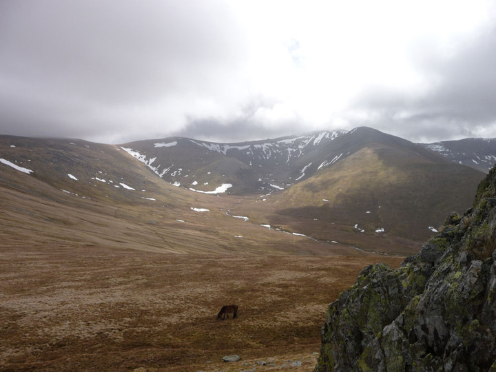
We sit in what little shelter we can find, contemplating the next move. My leg feels okay, and the rocky tops of Bera Mawr and Bera Bach look sooo close. Happily Postie is up for an extension of our walk to take them in, so we leave the cairns and head off the top. It’s a blessed relief to get out of the wind as we descend the eastern slopes to the boggy col below.
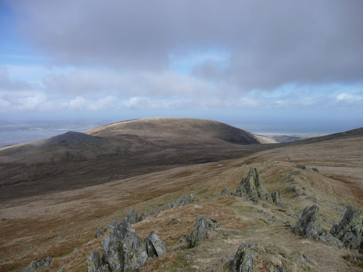
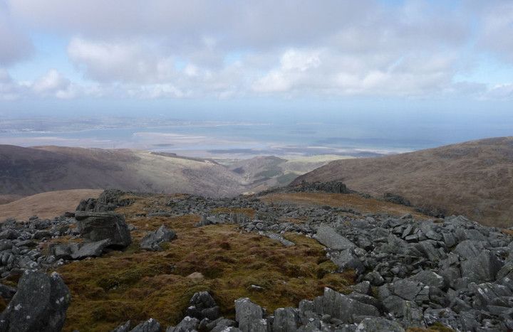
Crossing a patch of resolutely frozen snow, my foot breaks through the crust into a void below, dropping me fully up to my thigh into nothingness. Woah. Care is clearly needed up here. Bera Mawr (“Big Ricks”) is crowned with a tor of superb rock pinnacles, with two natural monoliths reminiscent of Adam and Eve on Tryfan. The whole place brings to mind an ancient fortress. A scramble up amongst the rocks provides shelter for a while, although the highest point is a bit of a scary perch in the pummelling winds. The effort is more than rewarded by the view northwards down the valley of Afon Rhaeadr-fawr (Aber Falls) and of Maes y Gaer hillfort.
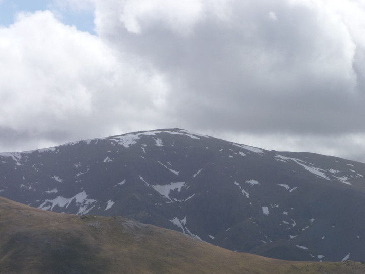
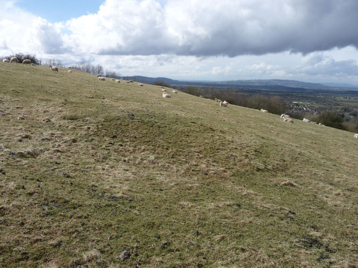
It’s a short walk onwards to Bera Bach (“Little Ricks”), which despite its name is the higher of the two summits and the highest point of our trip today at 807m. Unlike its sibling, this summit’s most compelling views are landwards, over Cwm Caseg to Carnedd Llewelyn, lovely Yr Elen and Carnedd Dafydd and south to Elidir Fawr and western Glyderau. The clouds lift on cue, the sky gods are certainly on our side today. The panorama is too much, 360 degrees of wonder. I can’t help but laugh out loud at the immensity of it all. A few months ago I had real doubts that I’ve ever make it back up into these wonderful mountains and frankly I’m overcome. Drink in the view, it really – really – doesn’t get any better than this.At length we head off the rocks, descending steeply to the west. We round the eastern slopes of Drosgl this time, passing a strange little shelter sculpted into the hillside, before carrying on round to the north, heading towards Moel Wnion. Our route crosses the small stream that, a couple of miles north, turns into the roaring water elemental at Aber Falls.
Passing a little sheepfold and weirdly splayed dead sheep (presumably a victim of the late snows), Postie spots something – “Is that a cairn?” And so it is, a little modern marker surmounting the larger circular footprint of what looks undoubtedly like an ancient one. [Coflein obligingly confirms.] Despite its position down the slopes, the cairn enjoys excellent views, particularly of Llwytmor and Bera Mawr. A fine addition to the monuments on this mountain, certainly.  |
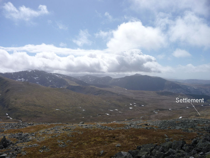
Shortly after leaving the cairn and heading to the col, the heavens open and a stinging sideways rain blasts into us. We reluctantly abandon any intention of visiting the cairn on Moel Wnion, instead pressing onwards, around the shapely cone of Gyrn. The rain finally relents as we reach the ancient settlement at Cwm Ffrydlas.
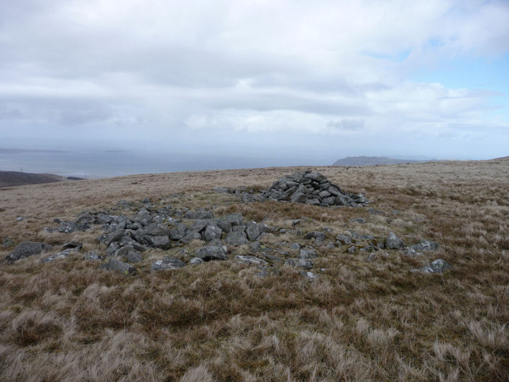
There are a couple of curving external boundaries, but the remains are pretty scanty and quite difficult to make sense of. However, the settlement is beautifully positioned, at least as far as the scenery goes, with an awesome view across the valley to the Glyderau and Moel Eilio. It’s also sheltered down here, out of the winds that have blasted us for most of the day. A remote place now, on a day when we haven’t seen a soul, but people called it home once. We continue to descend to Bwlch ym Mhwll-lle, when I spot a circular lump to our left. This reveals itself to be an apparent cairn with a central slab looking suspiciously cist-like [Coflein concurs]. A great little spot this, astonishingly not even marked on the OS map – did they not bother to come here? From here we drop down into the steeply sided Bwlch itself, which Postie quite properly notes would benefit from a little footbridge for weary travellers.
The OS’s lack of diligence also means that we don’t realise that there’s an even bigger cairn just to the north of the cist. This comes to light as we start our climb of the slopes of Moel Faban, but we’re both too weary to retrace our steps. Another visit to the Pass of No Bridge is clearly required.  |
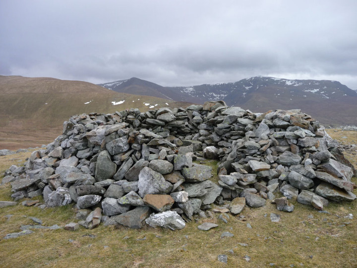
It’s a steep climb for tired legs up onto the Moel Faban summit ridge, and the horizontal rain chooses this point to restart its assault. Gladman may wish to look away now, but we take shelter in the hollowed-out centre of the northern of the summit’s sizeable cairns. This one reminds me very much of some of the big examples on the western tops of Y Mynydd Ddu in South Wales.
The rain relents a little, to the north the blue skies pretending it’s still a lovely day. We emerge from hiding and carry on along the ridge. All the cairns here are magnificent, and the views from this relatively modest hill are superb. A fine example of how a look at the map is no substitute at all for a visit. And a great finish to the day with plenty left to come back for another time.
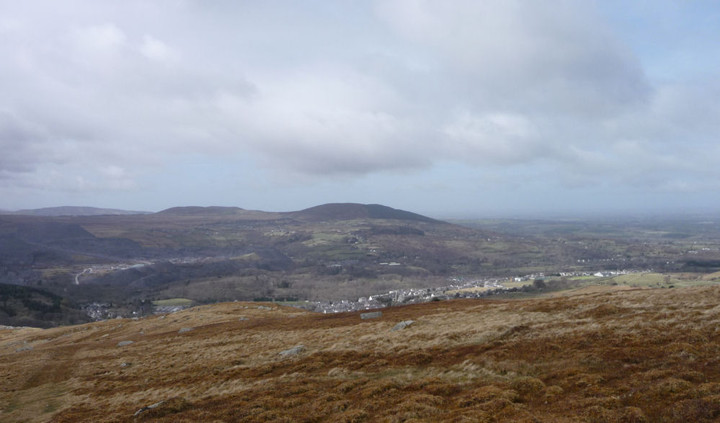
It’s with much weariness that we make our final descent past Pen-y-Gaer (Bethesda), crawling along the same prosaically named back streets that the car took us along so many hours earlier. What a day it’s been. Time has emptied the settlements of the high valleys, denuded the cairns on the peaks, leaving this quarter of the Carneddau a remote, wild landscape. But to the mountains themselves, Man’s presence has been but an eye-blink. The shattered tops and tumbling waters have seen Time immeasurable, impossible spans for the human brain to comprehend. But we are compelled to try, and so it is that we will be compelled to come back.
|
The Cotswold Way III – Winchcombe – Dowdeswell 6 April 2013
A sunny Saturday is in the offing, but I’ve got this terrible cold coming on, so decline the charms of frozen Wales for another adventure close to home. Having been misled by on-line bus timetables into being in town with an hour to spare, I find myself in an outdoor shop succumbing, finally, to Gladman’s advice and buying some walking poles, in the hope that they might help my ongoing dodgy leg. Suitably equipped, I head off to Winchcombe, a bustling little town on this spring morning.
After crossing the swift-flowing River Ishbourne, the Cotswold Way leaves the road and heads southwest. The ground is much firmer than it has been on the previous trips out, a dry week has drained much of the moisture from the mud that made walking such hard work.
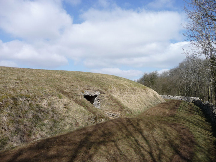
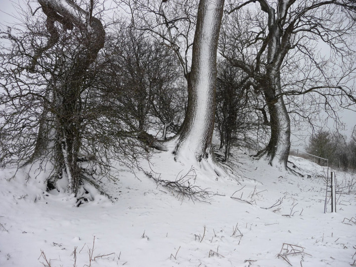
The biggest climb of the day is early on in this section, past disinterested horses and into the trees near Corndean Hall. Climbing up through the woods and fields towards today’s key site, I meet several pairs of walkers. This is obviously going to be a popular stretch; no lonely hills these. It’s quite a steep ascent up towards Belas Knap, a little more than 200 vertical metres above my start point in Winchcombe.I’m excited to be coming back to Belas Knap. It’s been over three years since I last came up here, when the mound was buried under snow as deep and pristine as Christmas cake icing. In contrast, today is a proper spring day. The late winter has left some snow in the hedges and verges, but the twitter and trill of birdsong and the sunshine slanting through the trees on the approach instils a sense of renewal and rebirth.
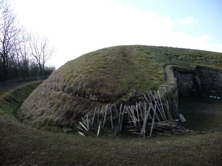
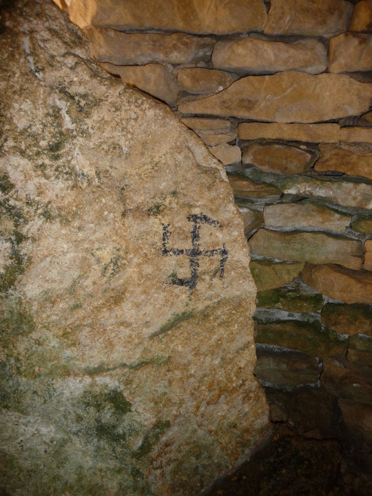
I don’t have the place entirely to myself on arrival, but the two walkers I meet are readying to leave and I’m soon alone. This is a wonderful monument; the restoration work detracts not at all from the splendour of curved forecourt, whaleback mound and welcoming chambers. What does detract however, is to be confronted with a swastika daubed on one of the stones in the NE chamber. It’s never nice to see damage of any sort at an ancient site, but the fact that some meat-headed moron has chosen to bring their far-right idiocy here is doubly upsetting. The swastika is black, it’s not clear what has been used, although it’s not paint – perhaps charcoal. Ugly, in every sense.
More people arrive, but the mound is so big that it’s possible to feel alone here even when you’re not. I come across another swastika in the western chamber, which I manage to partially wash off with water from my bottle. Looking out from the chamber, I realise that the masts on the top of Cleeve Hill are visible. The last two times I came here, visibility was reduced by hillfog, so it’s great to be able to see so far.
There is some temporary wooden fencing at the eastern tip of the horned forecourt, where people climbing up onto the mound have eroded the earthwork. It looks as though some repair work is underway here, from the little pile of stacked limestone pieces. I return to the NE chamber and find to my sadness two further swastikas that I hadn’t seen the first time. Awful.
Emerging back into the sun, I meet three guys from Edinburgh, who turn out to be actors come down to Stratford for a play. They tell me that they usually come out to the Cotswolds for a walk on their trips down here, showing what a pull this area exerts far and wide. We chat for a bit and they head off towards Brockhampton, leaving me alone in the sunshine for a while longer.
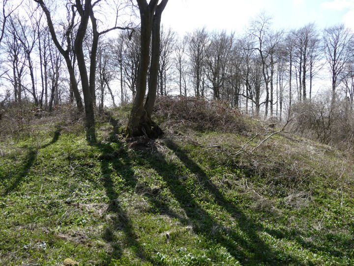
Before eventually leaving, I have a quick look at the almost-gone round barrow in the field to the WSW. Like the similarly denuded example at nearby Crippetts, it was obviously placed here in a relationship with the earlier long barrow, but is so reduced as to almost escape notice, even if you are looking for it.
Although I’m considerably saddened by the neo-Nazi nonsense I’ve found here today, I’ve nevertheless enjoyed the re-visit to Belas Knap greatly. A fine example of how sympathetic restoration can really work, I’m lucky to have such a wonderful site so close to home. Adieu, for I shall surely return.
From here, my aging map shows the Cotswold Way route heading up onto the ridge of Cleeve Hill, but waymarkers indicate that it has now been re-routed down to Postlip Manor. As this involves a steep descent through woods, I opt to follow the former route, which stays on the higher ground and will offer better views. The views open out to the north and interestingly Belas Knap stays in sight for much of the way. At 330m, the top of Cleeve Hill is the highest point in Gloucestershire, today offering good updraughts for the paragliders. I’d not realised previously that Belas Knap is still visible from here.  |
Just off the very top, I also find two low, circular mounds that look suspiciously like a pair of small round barrows in what would be a pretty typical spot for such monuments [Pastscape however reveals nothing].
I continue along the old Cotswold Way route, a steady descent past disused quarries alongside a beautifully clear stream running over the limestone, down to Postlip Warren. Here I rejoin the current route, as well as the first runners of some kind of long distance race. The path re-ascends steadily onto the edge of the escarpment, where great views of Langley Hill and hillforted Nottingham Hill unfold. |
Reaching the golf club carpark, I’m at a decision point for the day. The path intersects with the bus route at Cleeve and I’m just in time to catch the next service. This had been the plan, to keep the strain on my leg to a minimum. But the sunshine on the open hillside has its usual effect, my legs keep going on autopilot even though my head is telling me to stop. Despite the fact that I feel like Jake the bloody Peg with my walking pole, it has helped so far and the main ascents of the day are behind me. I press on.Cleeve Hill has a wealth of Iron Age remains, as well as some possibly earlier monuments. Unfortunately, much of the hill has been badly damaged by limestone quarrying, to build the pretty Cotswolds villages and towns that so attract the tourists. The northwestern part is particularly badly affected, where the quarries have dug straight into the scarp face of the hill. But there is still enough to see, including a rectilinear enclosure that shows up particularly well in today’s light.
The Ring is a small oval enclosure, set on steeply sloping ground. What function it served is unclear, maybe a stock pen or homestead site. The interior has been flattened into a platform for a now-vanished golf tee, but the surrounding bank and ditch are pretty well preserved and clear. An adjacent mound to the east has been tentatively identified as a hut circle, although there is also a possibility that it was a round barrow. The Cotswold Way passes right next to these two sites, so no excuse for not indulging in a brief re-visit. There is a very fine view of Nottingham Hill fort from here as well.
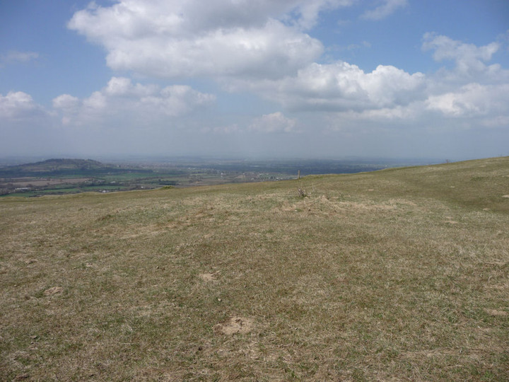
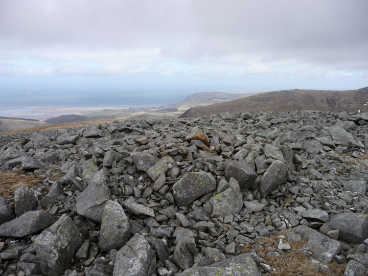
The path then steepens to approach the northern summit of the hill, which has several separate summits, strung across its mile or so of top. Although not the highest, this one provides the best views, as reflected in a topograph. The Malverns and May Hill are clear today, but the Forest of Dean and Wales beyond are reduced to hazy smudges on the horizon. It’s busy here on such a lovely day, golfers, strollers and runners vying for position. I head south, crossing the remains of the Iron Age cross dyke that encircles this part of the hill, following the contour and largely unaffected by the quarries.
The path now hugs the top of the escarpment, with artificially created cliffs dropping away vertiginously to my right. It’s quite cold up here on the edge, snow still clings to the scarps below me and the wind serves up a reminder that the late winter is only just receding. A number of the benches up here are festooned with brightly coloured ribbons, very similar to what you find at sacred wells across the country. Clearly this hilltop still represents a sacred place for locals. With the views stretching away across the vale below, to the mini-mountain range of the Malverns, it’s not difficult to understand why.
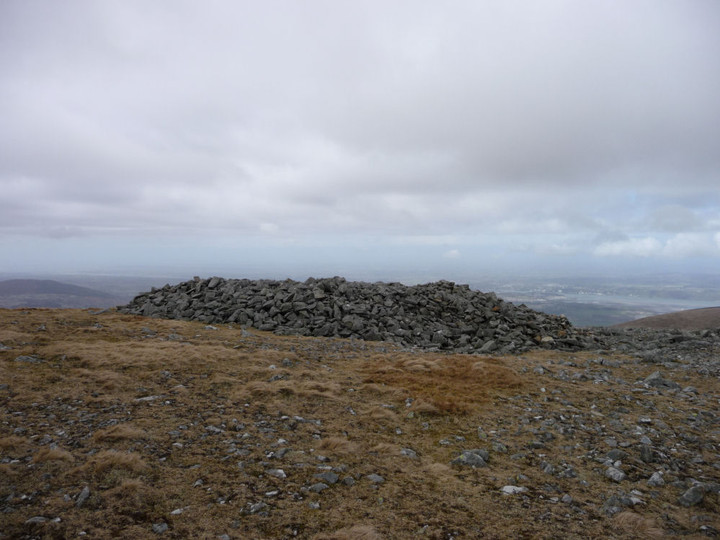
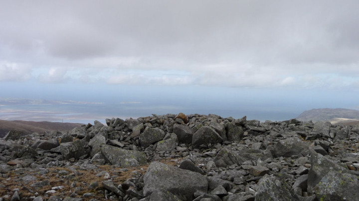
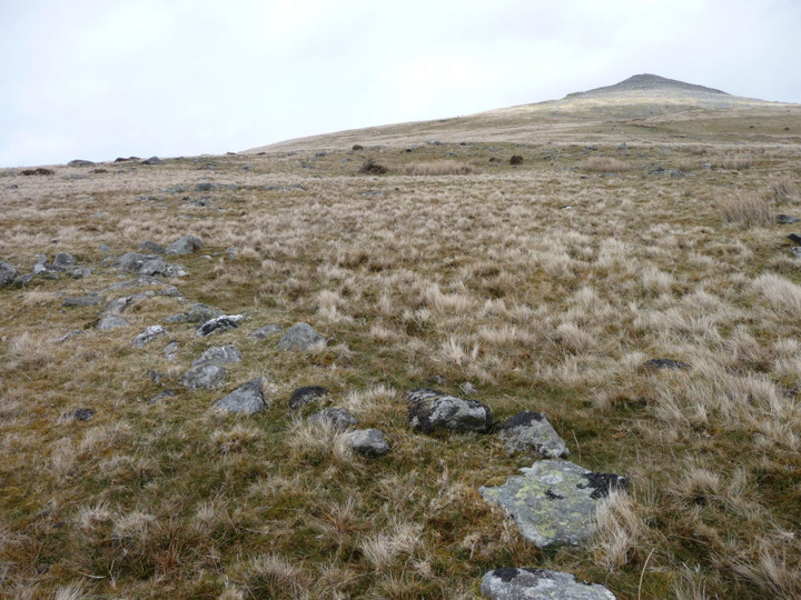
The final prehistoric stop-off of the day is the once-impressive Cleeve Cloud fort. Three lines of defensive banks and ditches cut the interior off from the rest of the hill, but sadly the western half of the fort is gone, another victim of the inexorable need for building stone. To add insult to grievous injury, a golf green has been inserted into the northern ramparts of the fort. Bah.
Despite all of this, it is a fine site still, the defences that remain are substantial and the views are immense. A good spot to stop off for a while and contemplate the route ahead, aided by what’s left of my lunch.   |
  |
At some point I will have to decide whether to abandon the path above Prestbury and drop steeply down to that village, but for now I carry on along the escarpment, past the three trees (one a spindly replacement) known as the Three Sisters and down through Bill Smyllies Nature Reserve, a haven for many rare butterflies that favour the vegetation growing up from the limestone. There’s a fine retrospective view of Cleeve Cloud fort from here.  |
I pass a beautiful sun-dappled copse of mature beach trees, sadly enmeshed in barbed wire and festooned with signs warning of CCTV and the list of possible crimes you might wish to avoid committing. Such a shame that southern England is so cursed with this need to bar and barricade, to stamp ownership and restrictions all over everything.
Looking at the map, I decide to ignore the lures of Prestbury. Stopping here would make for an unnecessary climb at the start of the next walk, which I’m keen to avoid. Instead I press on, past Wood Farm round barrow (I don’t stop today, sorry). Crossing a little lane, the route finally starts its main descent of the day, alongside the lovely Dowdeswell Wood nature reserve, to the reservoir below. By this point, I’m very tired and my leg is wishing me bad things. It’s still another two or three miles back home from here, and I’m footsore and aching when I get there. But it’s been another fine day out in the Cotswold Hills, re-visiting places that were amongst the first I came to when I moved to the area. Belas Knap, despite its temporary desecration, is the undoubted highlight, while breezy Cleeve Hill on a sunny spring day provides welcome tonic for the mind and body. The next stretch of the path will be on my doorstep, up Leckhampton Hill. I can’t wait now.
|
The Cotswold Way II – Broadway – Winchcombe 23 March 2013
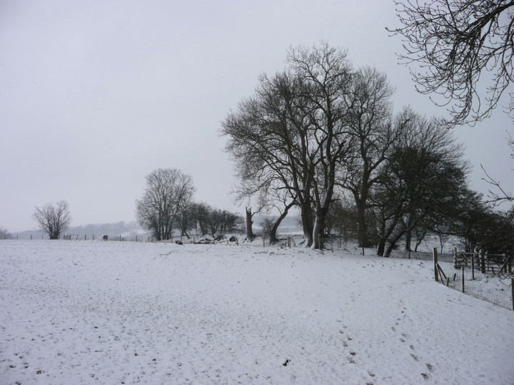
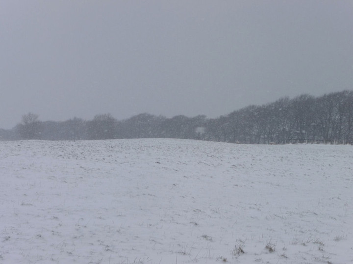
“The winter that keeps on giving”. That’s how the weatherman describes this weekend’s prospects. Last Saturday’s rain has been replaced by imminent heavy snowfall, a week before Easter. Not the weather to go too far afield, so instead I make a sooner than expected return to my new side project, the Cotswold Way. Snow is falling as I leave the house, but it’s not until the bus makes its slow way around the flanks of Cleeve Hill that I see the full scale of the winter terrain ahead.
The village of Broadway is dusted lightly, with the snow falling steadily at a sufficiently shallow angle to plaster the eastern face of the war memorial’s column. I’m in some luck, as the snowfall will be hitting my back as the route mainly heads southwest along the Cotwolds escarpment. The sky is grey in all directions, with little prospect of brighter skies ahead today.Leaving the village, the route crosses muddy and wet fields, in what is becoming the noticeable feature of the Way so far. I’m soon climbing up more steeply, into deeper snow above the 100m mark. Broadway is disappearing into the gloom below. Once through the winter wonderland of Broadway Coppice, it’s time for my first – minor – diversion of the day. Leaving the Cotswold Way, a footpath skirts the southwestern edge of the field. The rampart of the fort comes into view once the crown of the hill has been rounded.
Carl notes that there isn’t much to see here, apart from a single rampart. All true, but this is a fairly typical promontory site, with three sides defended by the natural scarp of the hill and only one rampart needed across the dip slope of the “neck”. The single rampart isn’t the most impressive you might see, topped with very mature trees and no doubt eroded from its original height. It no longer extends across the full length of the field, presumably a victim of ploughing. There is a ditch on the outer, northeastern, side. The footpath crosses the rampart at its northwestern end, and then runs directly across the featureless interior – especially featureless in the snow today! Once at the south of the fort, the ground drops away steeply and there is a good view of Buckland village below.
I walk back around the southwestern and northern perimeter. There’s little evidence of any counterscarping and the site is not the most obviously defensible. However, various recorded finds of pottery, flints and a saddle quern suggest occupation over a long period, perhaps at times where defensive capability was not the primary focus. Certainly worth the minimal effort of the diversion today.
Back on the Cotswold Way, the route follows a farm track to the muddy yard of Manor Farm. The ascent to day’s highest point ( a modest 295m) now lies ahead, a steady climb of 100 vertical metres or so, not steep but increasingly difficult in the deepening snow. My dodgy leg is starting to protest now and as I make my way past Laverton Hill Barn I’m beginning to wonder if I should consider curtailing the planned distance. I had considered a further detour to Snowshill barrows, but reluctantly decide that today isn’t the best day to see them. Instead I carry on south, along a track filled with shin deep drifts of snow, pristine and untrodden. And blooming hard work.Nearing the top of the hill, the northeast wind takes on an additional biting edge, driving snow in almost horizontally, over the edge of the escarpment. Shenberrow Hill Camp is another promontory fort, like its neighbour at Burhill Farm. Unlike that site though, the ramparts of Shenberrow are rather more powerful, with two banks protecting the approach from gentler slope to the north. On the west and south sides the steep scarp provides natural defences. I walk some way along a bridleway that follows the curve of the northern rampart, but the wind is doing its best to knock me over and I’m quite relieved to retrace my steps and enter the fort. The interior is crossed by the Cotswold Way itself, and an area below the west and south sides are access land, making it possible to get a good look at the earthworks without needing any permission. The southeastern section of rampart has unfortunately been destroyed by the construction of the farmhouse. As the strong wind and drifted snow attests, this is an exposed place and life here in the Iron Age must have been very tough, even snug under thatch behind the ramparts.
The Way exits the fort through what appears to be an original entrance at the south, from which the ground drops steeply to a wooded valley. Rather than following the path, I head onto the access land to the west of the fort, for a look at the sloping flanks below. The deep snow has the advantage of making a fairly sharp descent over thorny shrubs back to the path easier than it would be at other times.
From here the route drops quickly to the village of Stanton, another of the chocolate box places that make the Cotswolds such a tourist honey trap. Here my route nearly intersects that of the almost-due bus, and for a few minutes my aching leg tells me I should call it quits here. But there’s a stupid stubbornness at work that keeps me walking, heading out of the village and onto a path crossing two of the muddiest fields it’s ever been my displeasure to have to cross. I’m below the snowline here, and the mud is deep enough to cover my boots. Squelch.
As I make my way south across more muddy fields, the whistle of a steam train on the nearby Cotswolds railway echoes, ghostly, across the flatlands to my west. Not for the first time, I wish that the designers of the Way had routed it up on the edge of the escarpment, rather than down here in the mud. I can only assume a mud-loving lunatic had a hand in the choice. Reaching Stanway, the snow is falling more heavily, sending the neighbourhood rooks cawing and flapping. I take shelter in the church to rest my leg and eat some lunch. The stop does me good and I re-emerge into slackening snow feeling more up for the second part of the walk.After the hamlet of Wood Stanway, where a passing farmer greets me with laughter and a disbelieving “you must be mad”, the route reaches its steepest climb, up to Stumps Cross. I take the ascent rather gingerly, but it’s not a huge climb and I reach the bench at the top without any major problems, despite the mud at the bottom and drifted snow on the slopes. From here, there are expansive views across the vale to the west on a good day, but sadly little to be seen under the low cloud today.
I visited the two round barrows a little over a year ago, but neglected to write any fieldnotes. Aside from the view from the escarpment edge, which is now obscured by trees from here, there is little recommend these barrows. They have been ploughed within an inch of their lives and unless you knew they were there, you probably wouldn’t notice them at all. However, if positioning is everything, they would have been impressive in their day and can be compared with the Saintbury Barrow a few miles away along the escarpment edge. Incidentally, Stumps Cross takes its name from the base of a now otherwise gone medieval cross alongside the road junction below the barrows.  |
Leaving the junction, the Cotswold Way follows a straight track up to the top of the hill. The wind is keen, blowing the sculpted snow into flurries of spindrift. The walking is hard work, the shin-deep snow a plague for tired legs. Beckbury is another site visited last year, with overdue field notes. On that occasion, I approached from the southwest, up the steep escarpment. Today I have it easier, crossing the gentle slopes from the east. Like the other forts visited today, Beckbury is a promontory fort, with the west and northern sides relying on the escarpment for protection. Here the length of single rampart is rather longer, the curving bank on the east and south sides enclosing an area approx. 160 x 130 m.
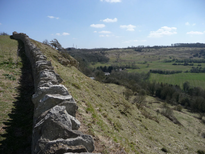
The eastern bank is rather damaged, with a gap halfway along its length that is not original but has been broken through in recent times. This has exposed some big chunks of the limestone that make up the rampart’s construction. The southern curve of the bank is topped by a drystone wall, but remains fairly well-preserved. Apart from a short section at the northern end, there is little sign of a ditch, although on today’s visit it would be filled with snow anyway!
Last time I came here there were quite a few people out for a stroll. Today it’s deserted, the howling wind the only company apart from the sheep sheltering in the lee of the escarpment. The western slopes have developed cornices of snow that wouldn’t be out of place in the Cairngorms, although obviously without the life-threatening drop below. At the northwestern corner is an enigmatic limestone monument, graffiti scratched but naming no names as to whom it commemorates. Ozymandias, perhaps?
It’s a steep descent over slippery roots off the ramparts, then something of a pell-mell downward hurry through startled sheep across the fields to the southwest. The path meets a track running into Hailes Wood, where the spun snow clings to the branches but all at once is gone from underfoot, as once more I’m below the snow line. I don’t pause to revisit Hailes Wood Camp this time (more AWOL fieldnotes) but carry on down to the ruins of the Abbey, a relic of Henry VII and Thomas Cromwell’s dismantling.
I’d love to say it was an easy stroll from here to the finish at Winchcombe, but that would be a lie. Instead, it’s yet more saturated mud and by the time I reach the intriguingly named Puck Pit Lane, I’m caked in the stuff. Luckily a fast-flowing culvert allows me to get the worst off my boots, and I can peel the splattered waterproofs off once I reach the safety of the town.
It’s been another good section, though my leg may not easily forgive me for it. The three forts seen today are all worthy of a visit and the solitude of the snowy hills never fails to lift the spirits. To the woman at Wood Stanway, mad I may be, but reminded that I’m alive as well. That’s what it’s all about, isn’t it?
Now, let’s have some sunshine please.
|
The Cotswold Way I – Chipping Campden – Broadway 16 March 2013
After ending my recent trip to Meon Hill in the pretty town of Chipping Campden, I thought it about time that I made a bit more effort with the Cotswolds again. Despite living below the edge of yellow escarpment for almost 7 years now, my gaze has tended to be drawn away to the west. Part of the reason has been the constant fascination of Wales, but it’s also partly due to the effects of farming on much of the Cotswolds’ prehistory, from access difficulties to endlessly ploughed barrows and earthworks. But there is also much to enjoy and so I thought I’d have a go at the Cotswold Way, 102 miles along the Cotswold edge from Chipping Campden to Bath. The Way passes close to a large number of prehistoric sites, some familiar to me, some not. While the Wales Coast Path is the main objective for G/F and I over the next few years, this can be my experimental side project, to dabble in occasionally. Hopefully more enjoyable than a drum opera or earnest acoustic set at least. The promise of an unsettled weekend with heavy showers sounds like a good time to get on with it.
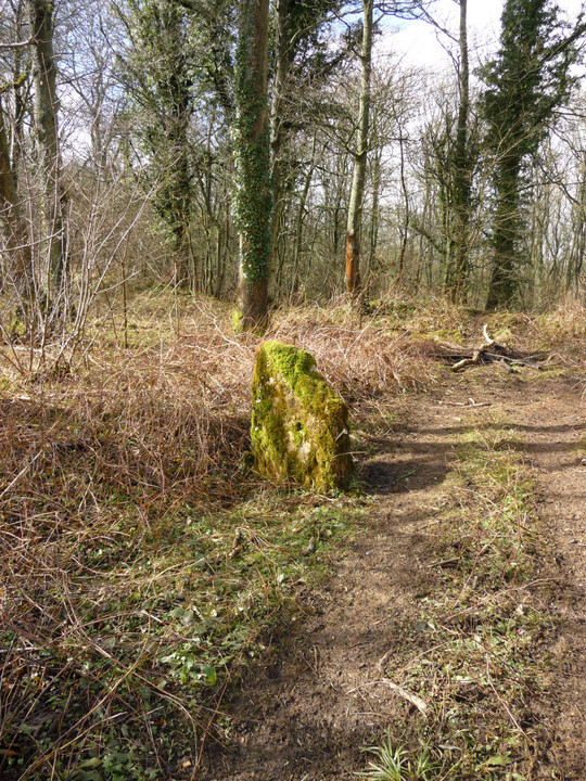
Getting to the start is a bit of a faff involving two buses, and heavy rain all the way to Moreton in Marsh. By the time the second bus drops me in the centre of Chipping Campden, it’s clearing and the sun is threatening to break cover. Chipping Campden has plenty of amenities and makes for a good start (or end) point for a walk, but I don’t linger today, hoping to make the most of the good weather while it lasts. Out of the town it’s a steady climb along a rather muddy lane to Dover’s Hill. Dover’s Hill enjoyed fame in the early 17th century when the enterprising Robert Dover instituted an annual games here, called the Olimpicks, a couple of hundred years before the better-known Much Wenlock version. There’s no games going on up here today, but there is a superb view. To the northeast, the flat-topped Meon Hill, to the west the bulk of Bredon Hill, with the unmistakeable ridge of the Malverns beyond, all topped with hillforts. To the north, the Vale of Evesham stretches away as far as the eye can see on this rather gloomy morning. There’s a handy toposcope on the highest point of the hill and a cute little limestone seat that reminds me of a miniature chambered tomb. It’s nice to back in the hills, as ever.After drinking in the views for a while, I carry on off the hilltop. Here the Cotswold Way follows a busier road and has been moved off the verge and slightly down the slope, out of sight of the road. But I choose to stick to the verge instead, because my first stop-off of the day beckons. I remember Carl having trouble finding this stone, and as I pass a locked and chicken-wired gate I wonder if it’s going to be particularly accessible. I’m therefore very pleased to see it from the road, through a little gap into the trees. Access is as easy as can be, the stone is only yards from the road (it’s quite a way northeast of the layby that Carl refers to).
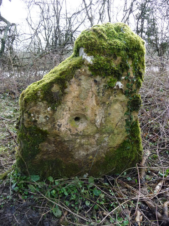
I didn’t really know what to expect from this “disputed antiquity”. It turns out to be a dinky little irregular limestone slab, heavily moss-covered and orientated with the long side SW-NE, parallel with the road. As reported, it has a (blocked) hole through it. On the NW face of the stone, the hole has the appearance of being counter-sunk, although whether this was intentional or caused by something inserted into the hole being turned and causing wear I can’t say. Apart from the hole, it’s not obviously worked, but the thick moss and the years of wear could easily mask any signs that might be there. I really like it, hidden away and passed by lots of unsuspecting drivers every day. I wouldn’t want to commit to its antiquity, but it’s worth paying your respects if you come this way. A promising start to the day, anyway. Leaving Kiftsgate Stone, the Way follows the Mile Drive, a broad, grassy path that would make for easy walking if less wet underfoot. At the end there are two fields of mud to cross (lovely), after which I take my main detour of the day, heading north alongside the Roman Buckle Street. My next site is one that I am not by any means hopeful about. Despite being a very decent-sized fort, Willersey Camp has had the misfortune of having a golf course dumped onto it, the construction of which, according to Pastscape, caused “considerable damage” to the fort. Approaching from the south, any views are obstructed by a thick screen of leylandii, that well-known native Cotswold species. A bit further along the road is the Dormy Hotel, built right on the SE corner of the fort. I walk up the drive towards the reception, hoping to get a bit of rampart action. The drive cuts through the bank and I manage to get a picture in. However, the CCTV signs don’t lie and it’s barely a minute before a uniformed functionary emerges to ask me if I need any “help”. I get the impression that the response “I’d like to have a look at the hillfort” would be as well-received as “I’ve come to steal your silver teaspoons”, so decline the offer and return to the road.
The road follows the old line of the eastern rampart, but apart from a bit of “rough” (in the golfing sense) there’s nothing to see here. A low mound can be seen silhouetted on the skyline in the middle of the course and I think this is probably the poor remains of the long barrow. Having been accosted once, I’m not keen to have another go, so I don’t follow Carl’s admirable example. In any case, I’m not acceptably attired for the course, wearing neither a turtleneck shirt, tailored shorts, or golf shoes. I imagine there would be a scene at such a blatant breach of the dress code. I carry on past the clubhouse.
As Carl said, the wooded area alongside the road is the place to come. There is indeed quite a bit of litter (tut) but the ramparts here are very impressive. The outer rampart is several metres high, with a slighter, inner rampart that hasn’t been encroached upon by the golf course. It’s a shame the rest of the fort has been so badly treated in comparison, because it must have been a fine site.  |
 |
Continuing north, I take a left (west) at the crossroads. A few yards on, a metal right of way sign points south for a bridleway and north for a footpath. I take the latter, for this leads very conveniently to the Saintbury round barrow. This could easily be overlooked as just another ploughed down barrow in the Cotswolds, but Carl’s previous notes indicate that it’s worthy of attention. He climbed up from Saintbury to the north, whereas my route takes me northwards downhill to the barrow. It’s very muddy and the hill seems to teem with springs, so I’m glad to be wearing my waterproofs, even as the sun has now come out.
The barrow is quite a way down the sloping field, and is not visible until I’m practically on top of it. Before it comes into view, there is the rather surreal sight of the top of the lofty (ha) spire of Saintbury church appearing below me. The barrow itself is small, but quite well preserved for these parts, with the possible remains of an infilled ditch around it. As Carl notes, the positioning is terrific. Perched just above the steeper part of the scarp, the views are wonderful indeed. To the northeast, trees block Meon Hill fort, but otherwise there is an expansive panorama, from Bredon Hill, the distant Malverns, across into Mid-Wales and at the furthest limit of my sight, Titterstone Clee and Brown Clee, maybe 60 miles away and near where I grew up. The darker, wooded hills in front of them possibly even include Croft Ambrey, the fort I used to visit on Boxing Day walks. Breathtaking.
Heading back up the slippery slope, I manage to fall over as the mud takes my feet from under me. Luckily it’s all very soft and squidgy, so only my dignity is bruised.
Back at the road, I cross over and take the bridleway, which runs parallel with the northern rampart of the fort. Unfortunately, a screen of vegetation and yet more golf fairways block access to this part of the fort. The bridleway is also incredibly muddy and after a while I turn back, caked in mud and feeling a bit deflated. Retracing my steps past the clubhouse, I head south again to rejoin the Cotswold Way. The trip to Saintbury barrow has provided reward enough to justify the detour, so the relative disappointment of the fort doesn’t detract too much.
It’s now clouded over again, and back on the footpath across yet more mud, the rain starts again in earnest. I stop off at the Fish Hill picnic area (tables, toilets, car park, weird arrangements of upright limestone) where there is a particularly fine toposcope, carved with a relief map of the Cotswolds and I learn that aligned with Tewkesbury (15 miles away) is New York (3370 miles away). Some ley-line that. From here the path crosses the busy A44 before climbing gently up through woods towards the highest point of today’s walk, at Broadway Tower.
The weather doesn’t lend my visit to the tower quite the views it deserves, but I do learn that there is a decommissioned nuclear bunker up here. Hopefully not something that will be needed again! From the tower it’s a very steep descent off the escarpment down to Broadway, with good views of the western flank of Willersey Camp to be had from the path. I’m quite wet and very muddy by the time I emerge onto the streets of Broadway, but nothing coffee and caramel shortbread can’t cure. It’s been a fine start to the Cotswold Way, with a good variety of sites for the TMA-er on the way. I’m looking forward to my next side project dabble.
|
|
"The fleeting hour of life of those who love the hills is quickly spent, but the hills are eternal. Always there will be the lonely ridge, the dancing beck, the silent forest; always there will be the exhilaration of the summits. These are for the seeking, and those who seek and find while there is still time will be blessed both in mind and body." Alfred Wainwright
"The movers move, the shakers shake, the winners write their history. But from high on the high hills, it all looks like nothing." Justin Sullivan
Elsewhere: Mastodon
|