Ridgeway to heaven – Barbury Castle to Avebury 21 May 2011
My first trip to Wiltshire of the year, and summer is a comin’-in. The ever-handy 49 bus drops me just north of Broad Hinton, as today I’ve decided to approach Avebury from the north along the Ridgeway, as recommended by Mr. Aubrey Burl. The quiet walk along minor roads to Uffcott reacquaints me with the joys of wide Wiltshire skies, with the downs rising over to the east, topped by the long line of the Ridgeway.  |
Walking from Uffcott gives a slow and steady approach to Barbury Castle, today’s first objective and the proper start of the walk. A week or so earlier, G/F and I had a wander round Old Oswestry, which frankly blew me away in its scale and ambition. As a result, I’m not expecting quite so much from Barbury, but you should never, ever, underestimate what you might find at a prehistoric site. You’d think I would have learned that by now.
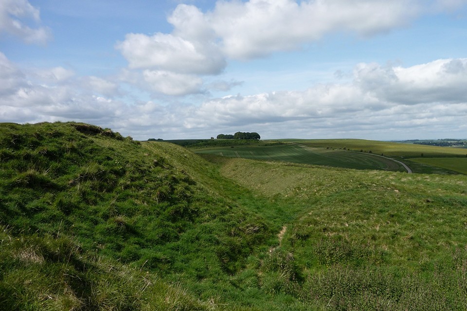
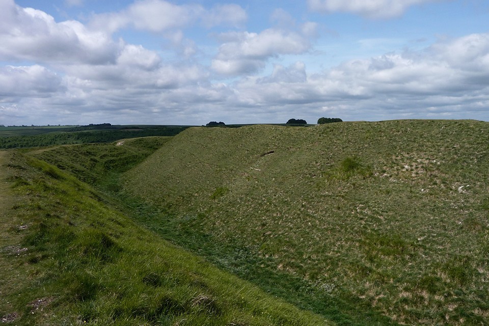
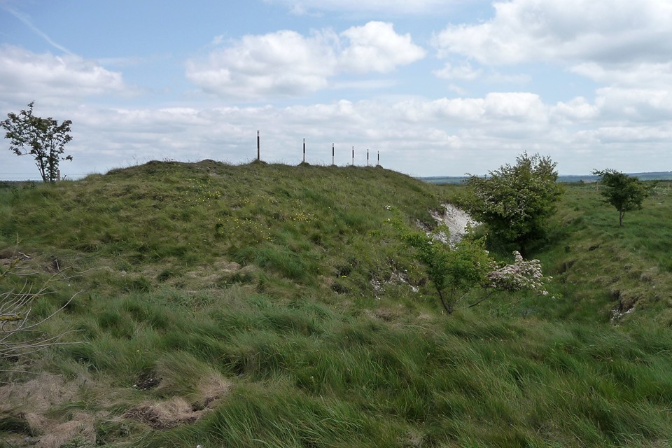
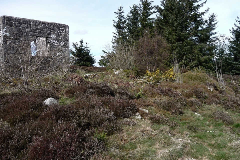
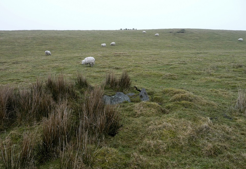
As the rampart looms above me and the climb steepens, it’s already becoming apparent that this is going to be a good ‘un. The first thing properly encountered is a fine disc barrow set below the western entrance to the site, constructed on the slope and facing westwards over the edge of the down. The disc is actually easier to see from the approach than close-up. A smaller round barrow lies to the northeast, closer to the bottom of the hillfort rampart. On another day, in another place, these two would be enough to linger over. Here though, the pull of the earthwork is too much and I make my way up onto the bank.
I make my way clockwise around the outer ditch. Up close, the earthworks really are very impressive indeed, the ditch still deep despite 2,000 years of silting. There are terrific open views from here. Liddington Castle, the next substantial hillfort to the northeast, can be seen on the horizon. Over to the east the views stretch across the Marlborough Downs, while to the south the fort commands views of anyone coming down the Ridgeway. Once inside the splendour of banks and ditches, there is little else to be seen. The real joy of the visit is undoubtedly in the perimeter and the views from it. A week after Old Oswestry, Barbury Castle is certainly holding its own. A gem of a fort, all in all.
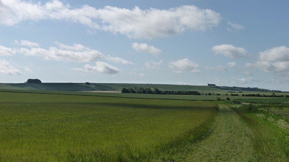
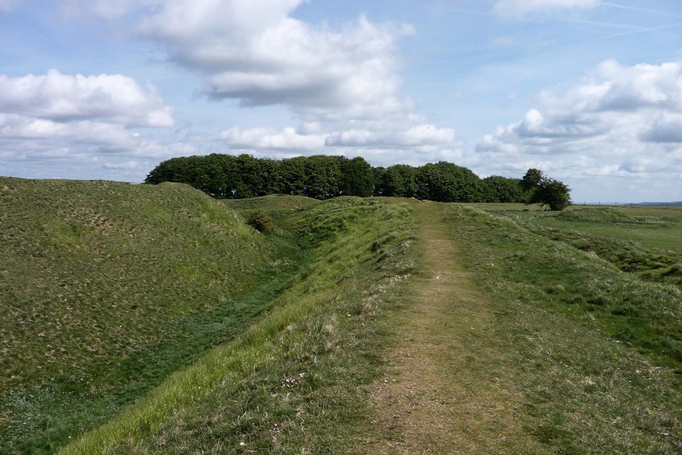
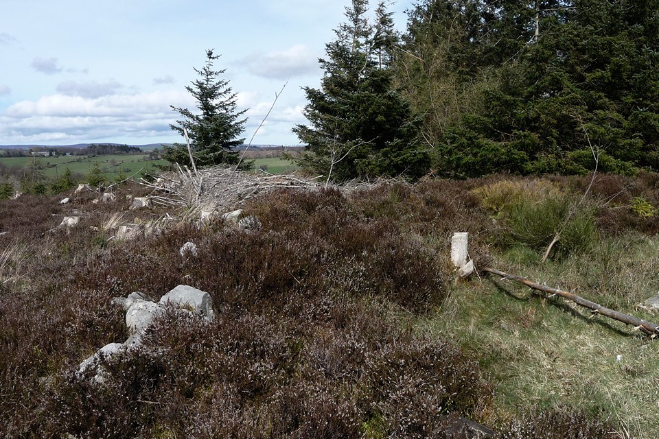
Finally dragging myself away from the wonderful fort, I join the Ridgeway as it heads southwest. After an initial drop back down the road, the gradient climbs steadily, which provides a decent retrospective view of the fort. A couple of sizeable sarsens, marked on the OS map as BSs (boundary stones) point the traveller on their way. The weather has been fairly dry and the Ridgeway itself makes for pleasant walking without huge amounts of mud. Apart from a couple of horse riders and a group walking in the opposite direction, it’s pretty quiet along here. The steady rhythm of walking, the open landscape and the tranquillity of an English summer lift the heart and clear the head. Begone dull care!  |
Just below Hackpen Hill, the other world briefly intrudes onto this idyll, with weekend traffic flowing steadily along the Marlborough road. I resist the temptations offered by various (presumably Medieval) earthworks and the Hackpen white horse, choosing instead to keep the onward progress going. Sometimes you just need to walk, really. A similar impulse keeps me from visiting a solitary round barrow at the foot of Berwick Bassett Down (Berwick Bassett, incidentally, would make a great name for a character in a 1930s pulp novel, perhaps an investigative reporter).
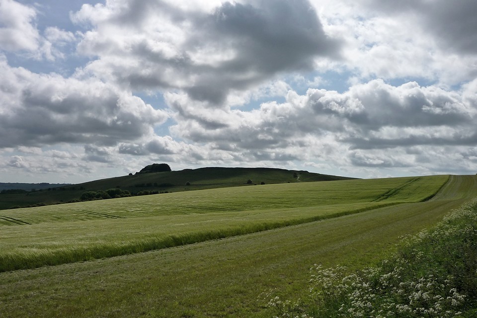
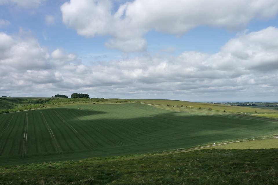
At length I reach a fork in the track. The Ridgeway carries on its stately progress due south, but I’m leaving it here and taking the other fork, the White Horse Trail towards Clatford. Not without regret, as the section of Ridgeway between here and the Herepath junction would provide the first views of my ultimate objective, Avebury. My chosen route will delay that pleasure for quite a bit longer, but there are other pleasures ahead, less well travelled than the great henge.
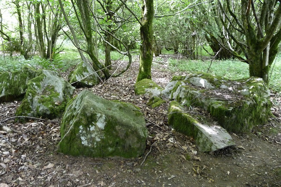
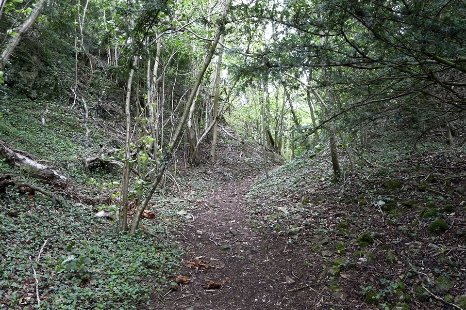
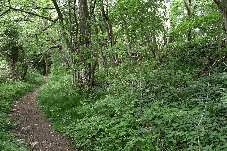
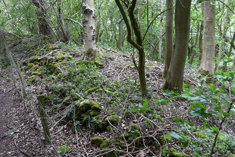
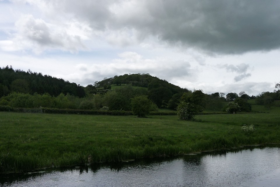
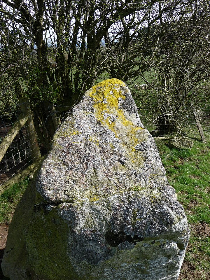
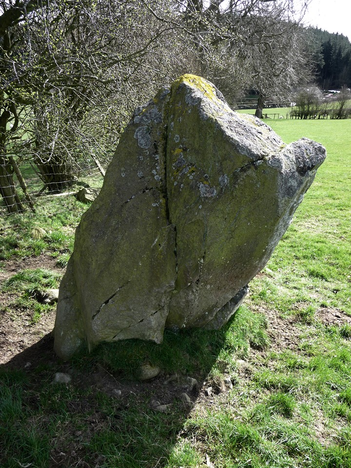
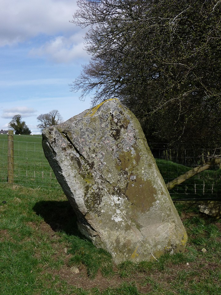
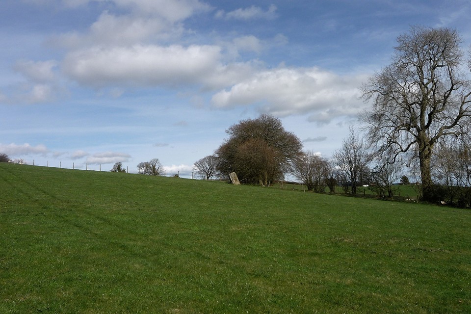
The track skirts the very edges of the Grey Wethers sarsen drift on Fyfield Down. As it passes through Totterdown wood, it becomes apparent that some of drift has been subsumed into the shade of the trees. It’s rather odd to come across the great stones here, mossy and green, when in the mind’s imagining they stand exposed to wind and weather on the open downs.Out of the woods, past more scattered sarsen, my route crosses the Herepath in a dogleg and then I’m into horse racing country at Clatford Down. After the Ridgeway and Totterdown Wood, the manicured sweep of the gallops is jarring to the senses. But better this than a golf course, I suppose. The unlikely upright of Long Tom appears a couple of fields away – it’s not on the map and I’d forgotten of its existence. I don’t approach, but even from a distance it looks oddly unprehistoric, perhaps because its slender profile is so unlike the other megaliths of this part of Wiltshire. A hundred yards or so to the east, I come across the broken stump of another sarsen upright, but I have no idea if it has any age to it.   |
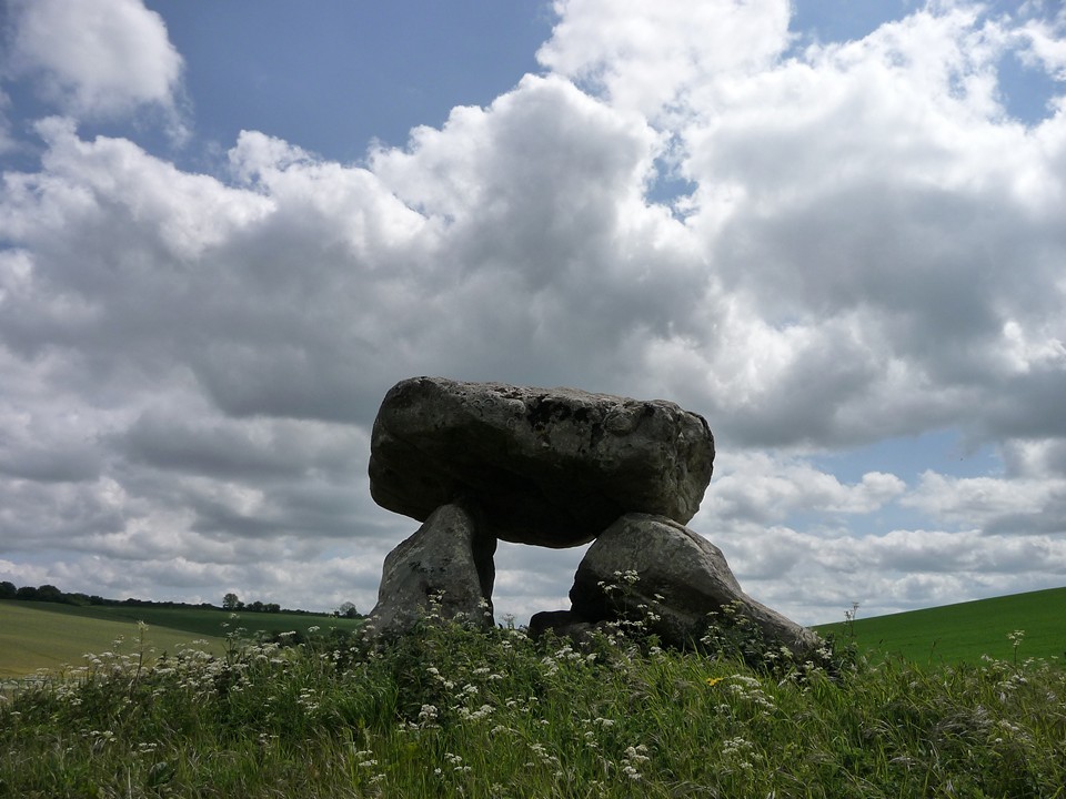
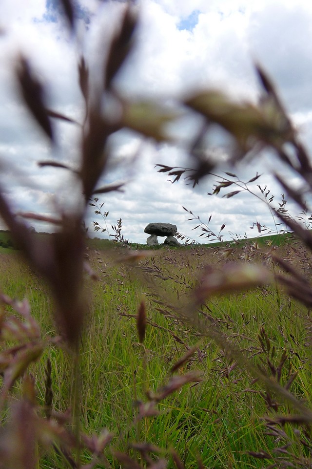
South of the Clatford Down gallops I finally part with the White Horse Trail, taking a bridleway southwest towards the second site of the day. As the path follows the contour of the hillside, Devil’s Den comes into view. This is one of those sites that you’ll already have seen, even if you’ve never been to it. Something of a celebrity, even in a county that boasts some of the biggest A-listers of them all. It’s great to see it first from afar, how it sits in its valley, tucked away below the windy downs.
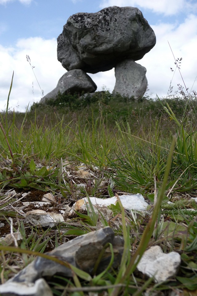
Devil’s Den is something of a triumph in another way, as although the OS map shows it standing off the right of way, the little triangle of land is subject to permissive access, which means you can go and spend as long as you like there without worrying about any confrontation. This is a relief, because it’s a site I want to savour. No rushing here. The chamber sits on top of a little mound, all that remains of a much larger structure. The field is turning to meadow, and will be a haven for chalkland flowers and insect life. Beneath the low spread of grasses, the surface is completely littered with chalk and bits of flint, presumably turned up by years of ploughing but now left discarded in the sun.
I love this site. The whole structure looks poised, as if about the march away across the Wiltshire landscape. The sky has turned somewhat cloudy now, but rather than diminishing the visit it adds an extra drama to the backdrop. I could stay here a long time, and so I do.
Time passes, not a soul approaches. Just how a site visit should be. The next part of the walk is a bit less straightforward. I’m hoping that I can find the Polisher, but I don’t actually know where it is. I know photos on TMA show a gallops fence nearby, but that’s about all I’ve got. Most significantly, I don’t know which side of the Herepath it’s on. The only thing to do is to wander.
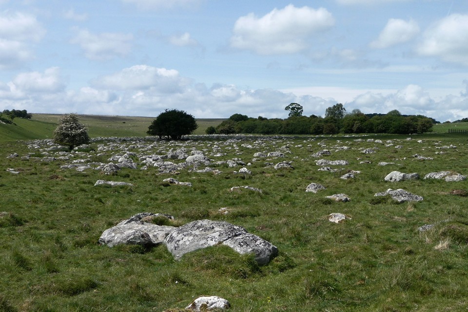
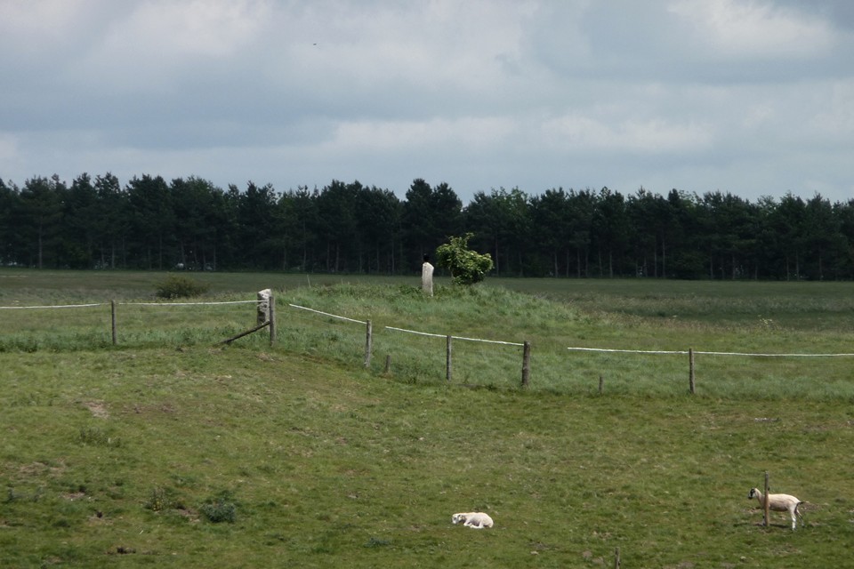
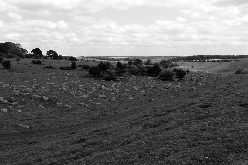
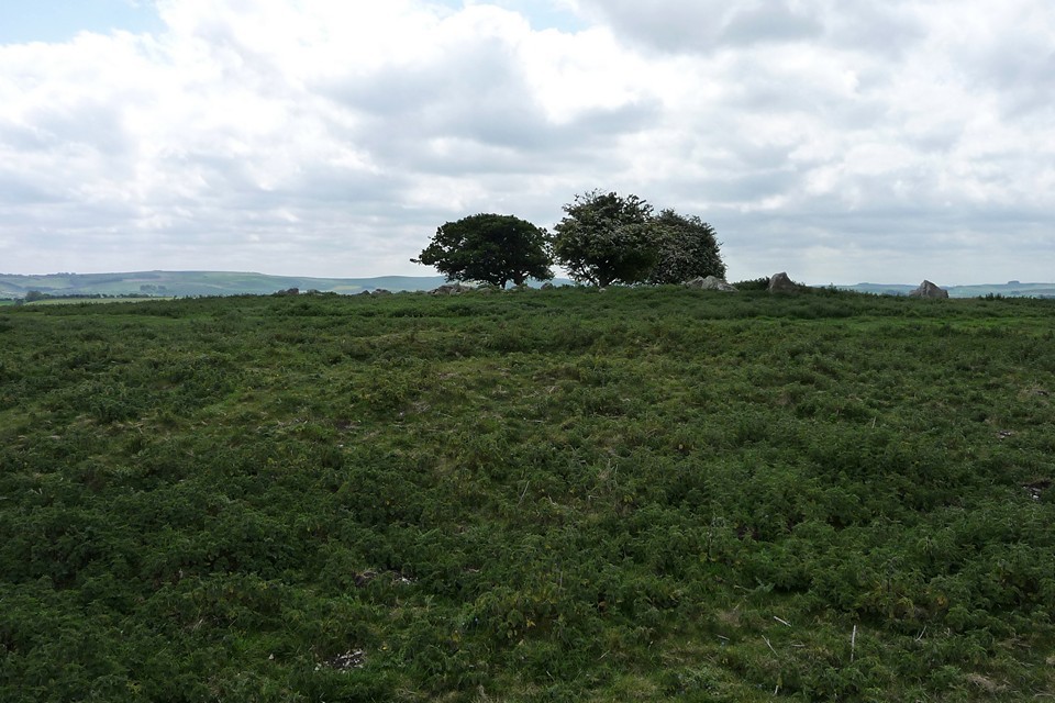
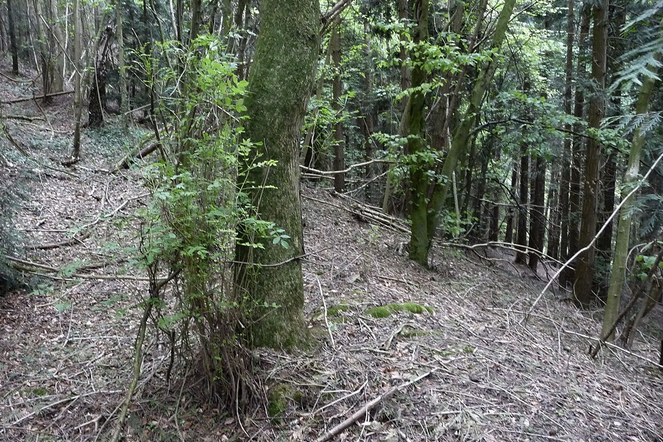
Wandering in the drifts of Fyfield Down is a good thing though. After entering the Down at its southeastern corner, I’m immediately confronted by the scale of the drift itself. I’ve never really seen anything quite like it. I have a quick look at the Fyfield 1 and 2 barrows, but really even these are overshadowed by the natural landscape here. From here I follow the ribbon of the Mother’s Jam, coming across The Monster Stone as I wander. Yep, it really is a monster. Other treats here include the experimental earthwork, slowly decaying as intended. Overton Down (south) may be just about the least impressive round barrow I’ve seen in Wiltshire, a barely-there mound under nettles – get the sheep in, someone.  |
 |
 |
 |
 |
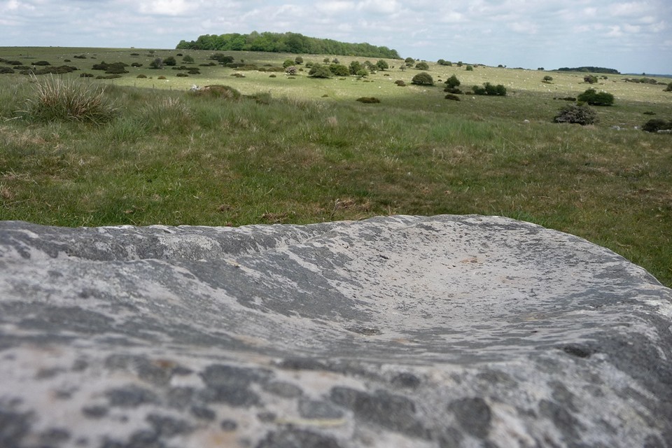
Much wandering later, just as I’m on the verge of reluctantly giving up, I spot a pointy stone, which looks familiar. And so it proves to be, the unmistakable grooves of the Polisher lying just beyond. I’ll be honest, I’m feeling a bit pleased with myself at this point, but even without the extra euphoric boost, this would be a winner all day long every day.
I won’t try to describe the stone, the pictures do that better. Instead I’m going to lie down with my head resting on its smooth surface and enjoy the peace for a few minutes.
.....
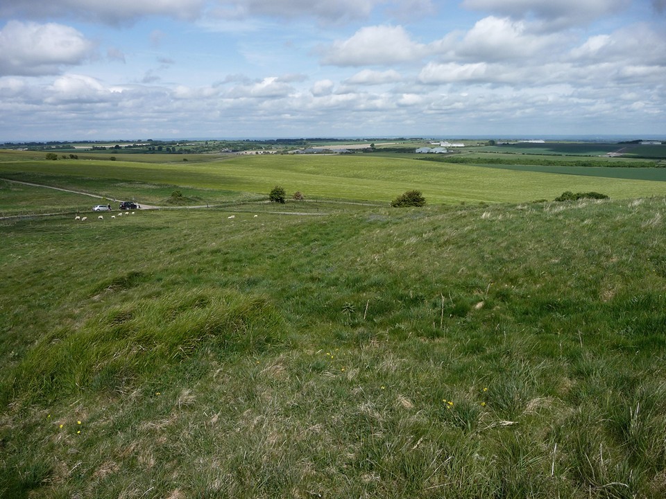
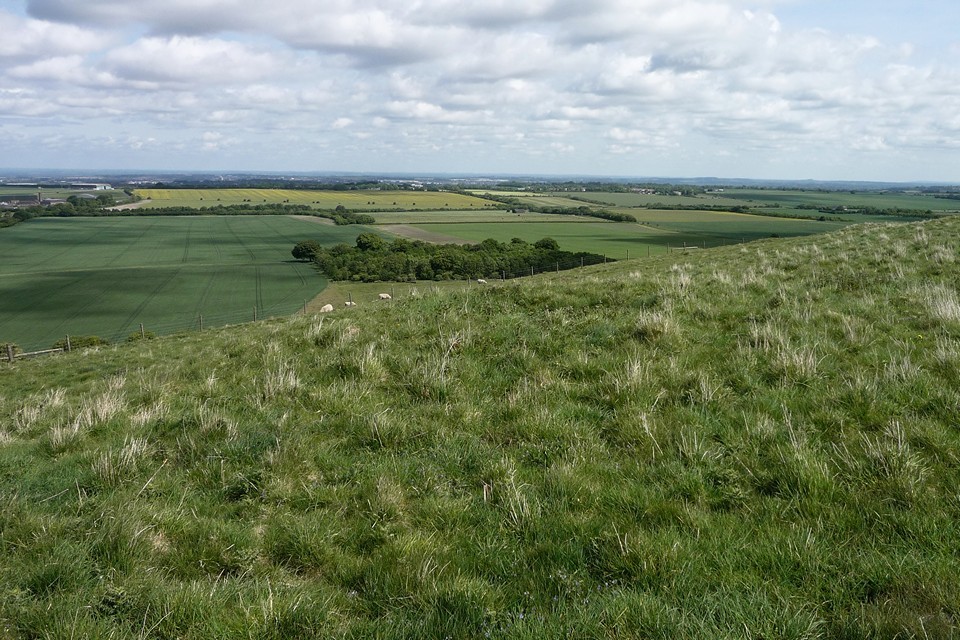
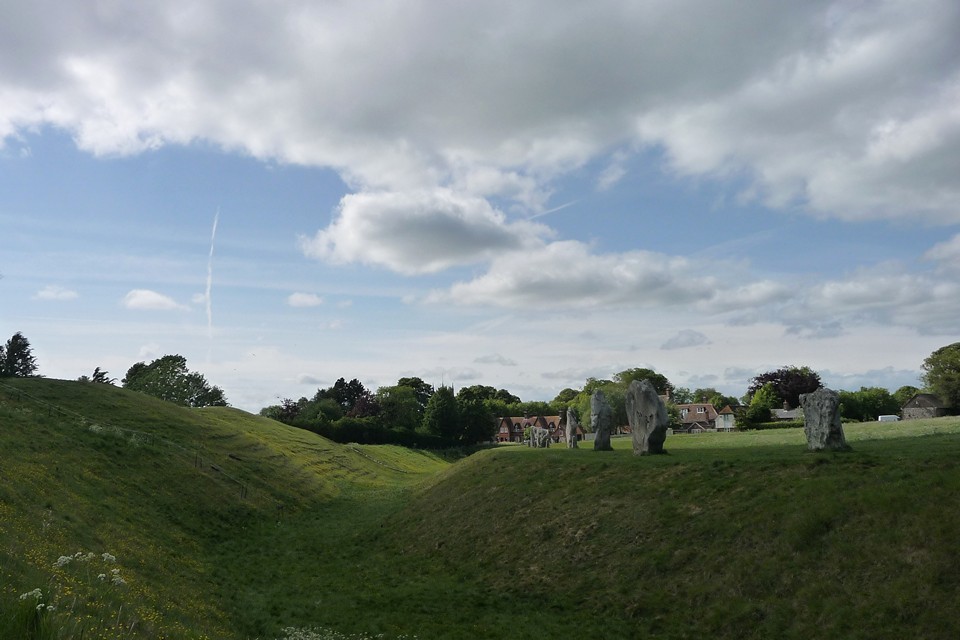
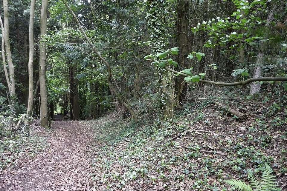
That’s better. Where was I? Oh yes, on my way to Avebury (just in case you’d drifted off too). Back on course then, after what has been quite a detour. From Fyfield Down the Herepath cuts across Overton Down and starts its descent to the great centre below. There are some decent barrows to be seen en-route, on both sides of the path. As always I get the feeling I’m only scratching a very superficial depth into the chalky surface of this landscape.By the time I reach the eastern entrance of the henge I’m tired and the sky has turned much darker. As always though, meeting the huge stones of the circle boosts my flagging energy in a way that Red Bull will never be able to replicate.
I don’t take the full tour today. Today’s efforts have been focused on getting here through the landscape, the journey being the reward for once. Instead I have a mooch to the Cove (still my favourite setting in the whole complex) and the southern quadrants. I finally take up residence on the sloping bank above the ditch of the southwestern quadrant, not quite at the bottom but on a level with the stones. Arriving at such a busy place after the quiet of the Downs would usually irk me, but today I enjoy watching the different interactions people have with the stones. Some stand in awe, some touch, some just have their picture taken. From where I sit, the voices are muted and the words don’t carry, except one who is expounding something about the electrical properties of the stones.
Ah, Avebury in the summertime. Long may it be a focal point, the builders would surely approve. |
Offa’s Dyke VII – Oswestry – Four Crosses 14 May 2011
Spring is wending its way slowly towards summer as we return to Offa’s Dyke. The last section brought us into Shropshire and we will continue to criss-cross the border between that county and Wales on this part of the route. Staying in Oswestry last night gave us a perfect opportunity to visit Old Oswestry hillfort, one of the premier Iron Age sites in the Marches, if not the country. A tremendous place, awe-inspiring in every way.
By contrast, today’s archaeology will be rather more modest, a mixture of smaller Iron Age remnants and industrial leftovers. The Path crosses an area heavily scarred by quarrying and mining, together with the means of transporting the winnings away in the form of old railway lines and the arterial Montgomery Canal. It’s thought that some of the mining dates back into prehistory, and there is certainly evidence of Roman copper and silver mining at Llanymynech Hill.
Setting off from Oswestry early, we’re up at Racecourse Common just after 9 o’clock, on what is shaping up to be a decent spring day of fast-moving cloud and patchy blue sky. A toposcope at the racecourse informs us that we can see the volcanic bulk of the Breiddins, a range of hills topped with various forts and settlements. Further away Shropshire’s spine, the Long Mynd, Brown Clee and Titterstone Clee, signpost the way to the countryside of my childhood, inching ever nearer.
The grassy folds of the hill are carpeted in a brilliant spring bloom of bluebells as we head into the shade of Racecourse Wood. The various short stretches of wood on today’s walk are lovely, mixed woodland sun-dappled and airy under the light spring canopy, yet to be filled in and darkened by the heavier foliage of summer.
Less than a mile to the west of here is the Cynynion standing stone, but regrettably it would be a steep descent and climb back to pay a visit to it today, so we have to forego the pleasure. One day…
Out of the woods, then back in again at Craig Forda, we come face to face with Offa’s Dyke itself for the first time today. It no longer forms the frontier of English/Welsh border at this point, which instead follows the Cynllaith valley some way west, beyond the nearby hillfort at Coed-y-Gaer. However, any loss of notional status is made up for by the size of the remaining earthwork as it makes its way south through Candy Woods, an uninterrupted section the best part of two miles long and standing to a height of two metres or so.
Leaving Candy Woods, the path drops very steeply to the hamlet of Tyn-y-Coed, with the fine section of dyke our constant companion. The path runs along the bank here, which won’t be helping prevent ongoing erosion of the earthwork, but does at least give an opportunity to view the impressively deep ditch on the “Welsh” side and to marvel even further at the scale of the undertaking involved in building the thing. It’s something else, well worth your attention even if very much outside TMA’s remit.
Path and Dyke part company at Fron, with our route turning westwards while the Dyke, now more fragmentary, continues its inexorable way south. The detour is hugely rewarding though, as after a gentle climb we emerge onto the open hilltop of Moelydd, one of the outstanding viewpoints of Offa’s Dyke Path despite its relatively modest height. The views stretch away in every direction, taking in the Berwyns and distant Cadair Idris, across the endless hills of mid-Wales to the west and the Shropshire hills to the south and southeast.
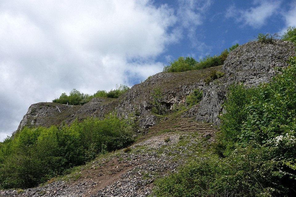
A steep descent takes us down to Nantmawr, then quiet lanes drop us towards the Tanat Valley. We will never actually encounter this particular river, reaching the end of its independence and soon to join the far broader River Vyrnwy/Afon Efyrnwy. Of interest to the TMA-er is the fact that the Tanat has been swelled on its journey by the waters cascading down the magnificent Pistyll Rhaeadr close to Rhos y Beddau stone circle.After crossing first one then another disused railway line at Porth-y-Waen, we have a view of the today’s first prehistoric site, the wooded Blodwel Rock fort. It looks like a fairly stiff climb up from the valley floor, and so it proves to be.
The fort occupies the top of the ridge, the steep scarp face of which we climb from the northwest. Offa’s Dyke has been an absent friend for the last couple of miles, but we reacquaint ourselves here. The fort is just in England, but the frontier has curved back eastwards again and we are poised on the edge of Wales here.
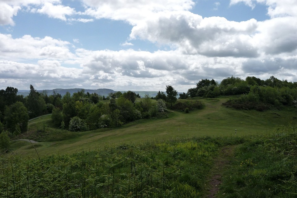
In truth it’s not the most impressive of forts, the woodland cover is quite dense and the tangled vegetation underfoot anywhere off the main paths makes it difficult to really get a sense of what’s what. This is compounded by the fact that Offa’s Dyke runs along the lip of the scarp, although Pastscape (see Misc. post) suggests that the Mercian earthwork stopped short of the fort and simply made use of what was already here and at neighbouring Llanymynech Hill. No sooner have we left the wooded cover of Blodwel Rock than we’re across the Welsh border and into Llanymynech hillfort. Sadly our emergence from the trees takes us slap into the middle of a golf course. Immediately we’re scowled at by plus-foured types and the visit becomes an exercise in avoiding plummeting golf balls rather than looking for the remains of the fort’s earthworks. The whole interior has been moon-scaped by older quarrying superimposed by bunkers and hazards. Bah.
When we get a moment to look anywhere but heavenward, it turns out that there’s a decent view of the whaleback of The Wrekin, a very fine hillfort that dominates the north Shropshire plain.
Our route ducks back into the trees and alongside Offa’s Dyke, a.k.a. the northwest rampart of the fort. As at Blodwel Rock, the tree-cover makes it difficult to really get a sense of the site. We follow the edge of the escarpment and the earthwork round to the southern tip of the hill. Here the gentle terrain gives way to the towering cliffs of Asterley Rocks, much quarried and mined over the centuries. There is a very fine view south featuring a number of neighbouring hillforts on The Breiddins, Beacon Ring on Long Mountain, and the lowland sites of Bryn Mawr and Gaer Fawr but overall the feeling from the visit to Llanymyech Hill is one of frustration, both from the general destruction caused by industry and from the irritating placement of a golf course across the interior.
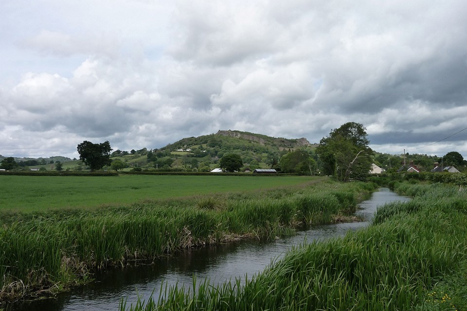
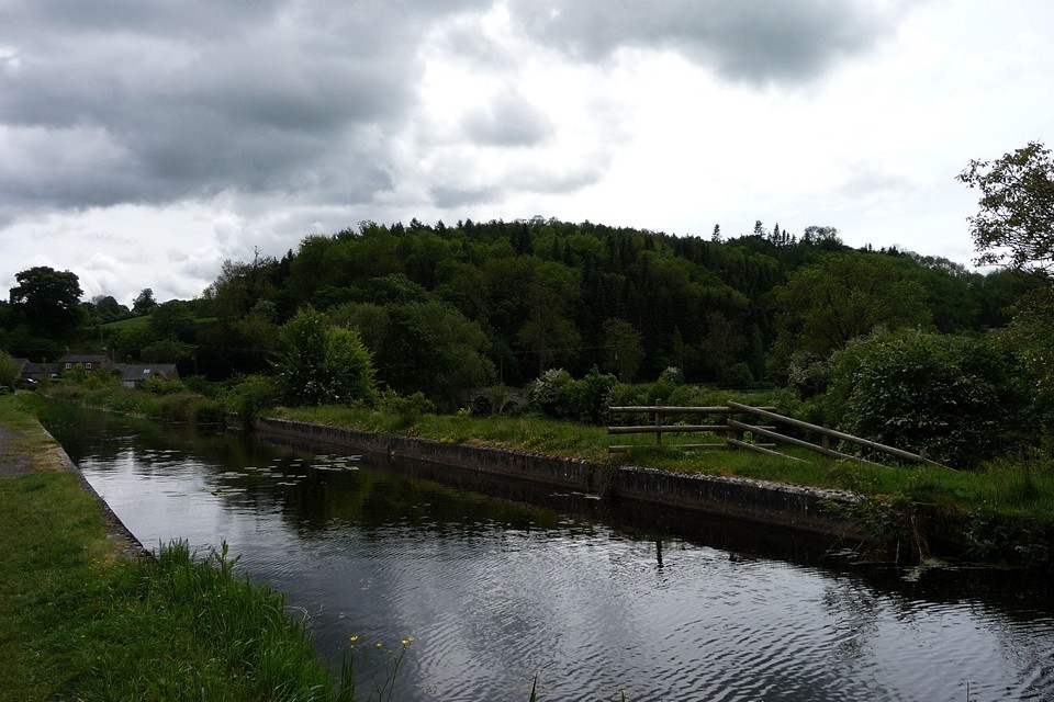
Below the fort there are extensive remains of mining and quarrying buildings and equipment, much to appeal to the industrial archaeologist. At Llanymynech we cross back into England briefly, then straight back into Wales before swinging southwest along the towpath of the Montgomery canal for the next mile or so, a pleasant if rather dull stroll which does at least offer up a fine retrospective view of Llanymynech Hill. |
The wooded slopes of Bryn Mawr appear over the canal. The hill is an obvious place for a defended enclosure or fort, a conical eminence rising sharply over the surrounding flatlands. As we draw closer the canal rises through a series of locks to an aqueduct, on which it carries us across the Afon Efynwy/River Vrynwy, the major watercourse on today’s route. Another of Wales’ important rivers, flowing almost 40 miles from its source at Lake Vrynwy to its confluence with the Hafren/Severn, it passes many prehistoric settlements and forts, which must have benefited from its waters, fishing and transport potential. Bryn Mawr will have to wait for another day, as we are tiring now and nearing the end of our walk at the Montgomeryshire village of Four Crosses. Perhaps not the most engaging section of the Path that we will walk, today’s efforts have nevertheless seen us through another 12 miles or so of this Marches borderland, following and crossing the movable boundaries on the maps that recall territory lost, won and lost again. The permanence of Offa’s Dyke itself ironically marks but one fleeting drawing of those lines, which have ebbed and flowed across it in the tides of history. Underneath the skin of politics, even the land itself has been altered, encroached upon and penetrated by the delvings of men in this much-quarried and mined landscape.
Soon it will be summer, and we will be back.
|
Offa’s Dyke VI – Chirk Castle Mill – Oswestry 2 April 2011
It seems like ages since our last trip took us across the Dee to finally meet Offa’s Dyke itself. If that river crossing represented an important landmark in our North-South crawl down the Welsh border, today will throw in a few lesser ones. For a start, we’re now on our third map (Explorer 240 – Oswestry, Ordnance Survey fans). Rather more significantly, we will leave Wales for the first time.
This is the first section of Offa’s Dyke Path we’ve attempted in a daytrip, rather than having to arrange accommodation. This is possible due to the relative proximity of the railway, so that we can get the train to Chirk and finish at Gobowen, about 7 miles plus a short bus trip at the end (albeit only 5 miles on the Dyke Path itself). Weatherwise, the contrast to our last walk, in misty February, is stark. Spring has come to the Marches and the sun is shining on semi-industrial Chirk.
We walk up from the station to the castle, as a permissive route across the grounds has just re-opened for the Spring. This takes us past an extraordinary set of wrought iron gates, then round to the castle itself, a fine example of an Edward I stronghold designed to keep the Welsh in their place. We rejoin the Path as it drops down to the Afon Ceiriog, the next in the long series of waterways that we will cross on our route.
The Ceiriog starts its journey on the slopes of Moel Fferna, the be-cairned mountain we visited on a memorable (not entirely in a good way) walk back in February. By the time it reaches us on the Path, it has flowed past numerous hilltop barrows and the hillfort at Cerrig Gwynion and will soon be joining the Dee on the other side of Chirk. For us it marks the crossing, for the first time, of the border between England and Wales.
The border follows Offa’s Dyke itself, but the frontier was contested long after the Mercian king had shuffled off. Close to our crossing, a skirmish known as the Battle of Crogen took place in 1165, when a force led by Welsh king Owain Gwynedd attacked the Angevin Henry II’s army. Henry was fortunate to escape with his life, but soon after abandoned his plans to conquer Wales and went back to dealing with turbulent priests instead. A plaque on the bridge commemorates the action.
Climbing up from the valley on its south side, a sign welcomes us into Shropshire. The Dyke forms the border all the way past Selattyn Hill, so we will be treading the frontier for a few miles now. I grew up in the Marches and crossing into Shropshire is starting to have the feel of heading home, for all that my heart generally lies in Wales these days.
Once we’ve climbed back out of the valley, there is a great view of Chirk castle behind us and also of some prominent hills to the northeast, which I think must be the Mid-Cheshire Ridge and Beeston Crag, but our way lies southwest. The Dyke here is really impressive, especially compared to what we’ve seen up until now, with a deep ditch on the west (Welsh) side. It must be said that the path would benefit from being taken off the earthwork itself though, the erosion is not good.
The Path drops steeply into Nanteris, then up stairs on the other side. Once back up onto the hillside above, there is a terrific view across North Shropshire and Cheshire, while the impressive section of Dyke continues onward. Over on a hillside to our west we can make out at least one of the cairns on Graig Wea, too distant and lacking in public access for a practical detour on this trip.
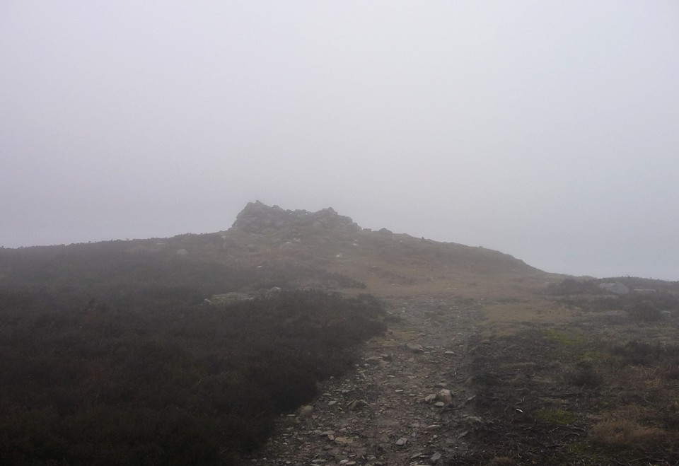
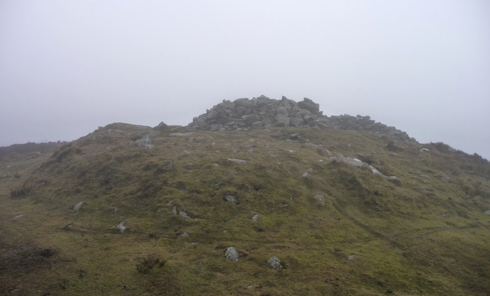
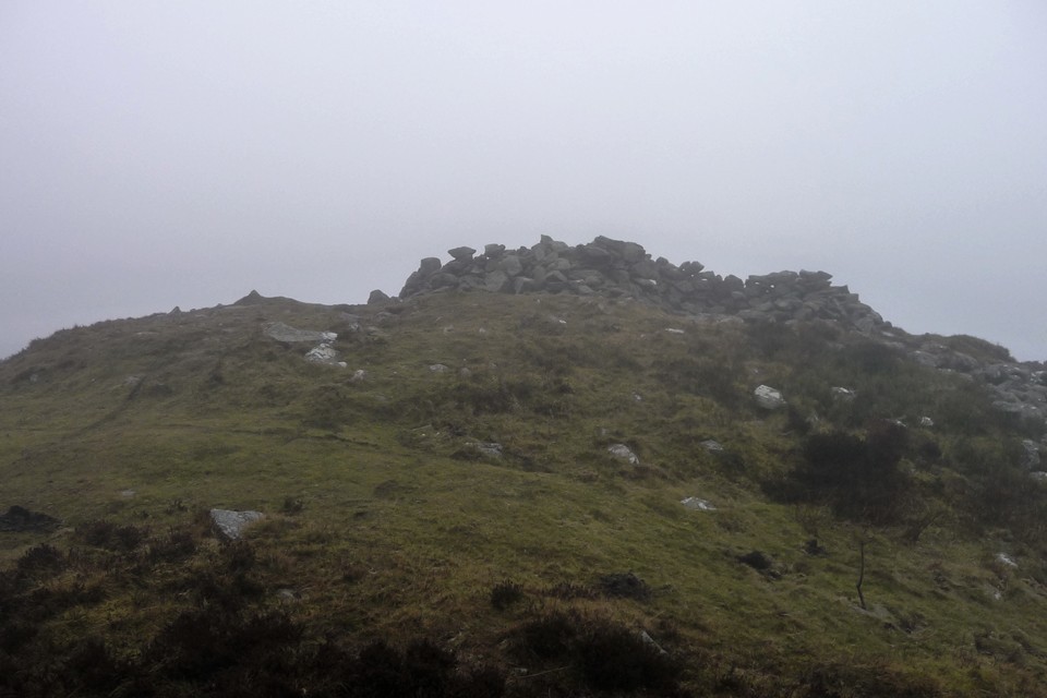
After passing Plas Crogen, the countryside ahead of us emerges as a rolling patchwork of hills and fields, with the views opening up to the southeast across Shropshire, towards the Long Mynd and Brown Clee, which must be about 40 or so miles away. We stop for lunch and metallic tea at a roadside picnic area after passing some well-preserved old lime kilns at Craignant, where the daffs are in full, splendid bloom.Now comes the biggest hill of the day, one I’m looking forward to greatly as it boasts the first prehistoric site we’ve been to since leaving Castell Dinas Bran. It only requires a short diversion off the Path to reach it, through an area of recently felled forestry. Standing at a reasonable 372m, the summit of Selattyn Hill is high enough to command excellent views into Shropshire, as well as of the Berwyns to our west and (I think) the Breiddins to the south. Seeing the former gives me much pleasure, as we sure didn’t see much when we were on them!
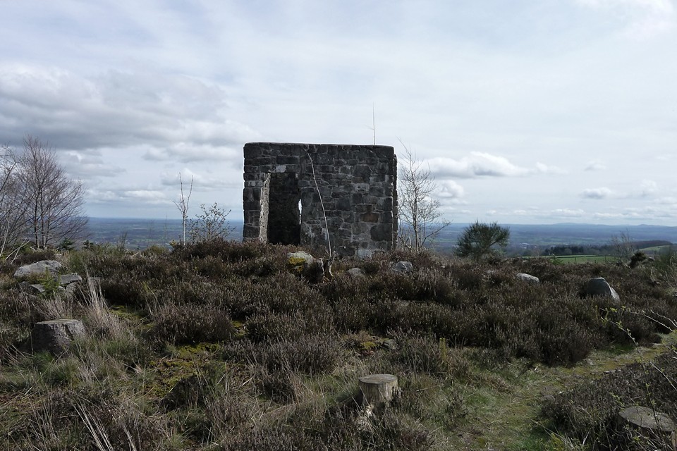
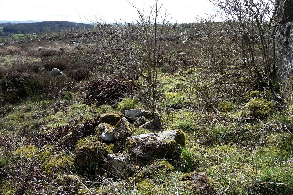
The monument here is a ring cairn, sadly much trashed by the plonking of a stupid Victorian tower (now itself ruined) in its centre. However, traces of the stonework that comprised the ring can still be seen protruding through a heather covering. The construction is a wide bank of large blocks of stone, and would have been pretty impressive without the tower. It is best seen on the northern arc, the southern being very overgrown. It’s a great spot though, now that the surrounding forestry has been felled to open up the views, and should be even better once the resulting debris has started to break down. There is another cairn ( Orsedd Wen) on the next hill to the west, but we can’t make this out today. It is also noticeable how few footpaths there are on the Welsh side of the border here.
Whatever the post-Roman politics of the Welsh border, Selattyn represents a natural frontier, as the last hill above 1,000 ft before the drop down to the Cheshire/North Shropshire plain to the east. Certainly a worthy place for the twelve urns containing burnt human bone, found here when the tower was built.
At length we head off south, alongside an ancient field boundary composed of huge boulders and an equally large field clearance heap. I find a small sliver of flint on the path, apparently worked (but broken) and certainly not native to this part of Shropshire. The Path rejoins the Dyke south of Orsedd Wen. The next section of the earthwork is once again particularly fine. Just after it passes through a little wood, a footpath heads off eastwards and will take us to the second Bronze Age treat of the day, which can be seen from the Dyke.
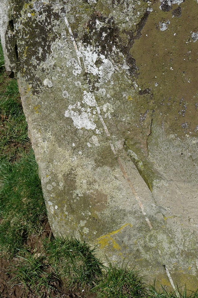
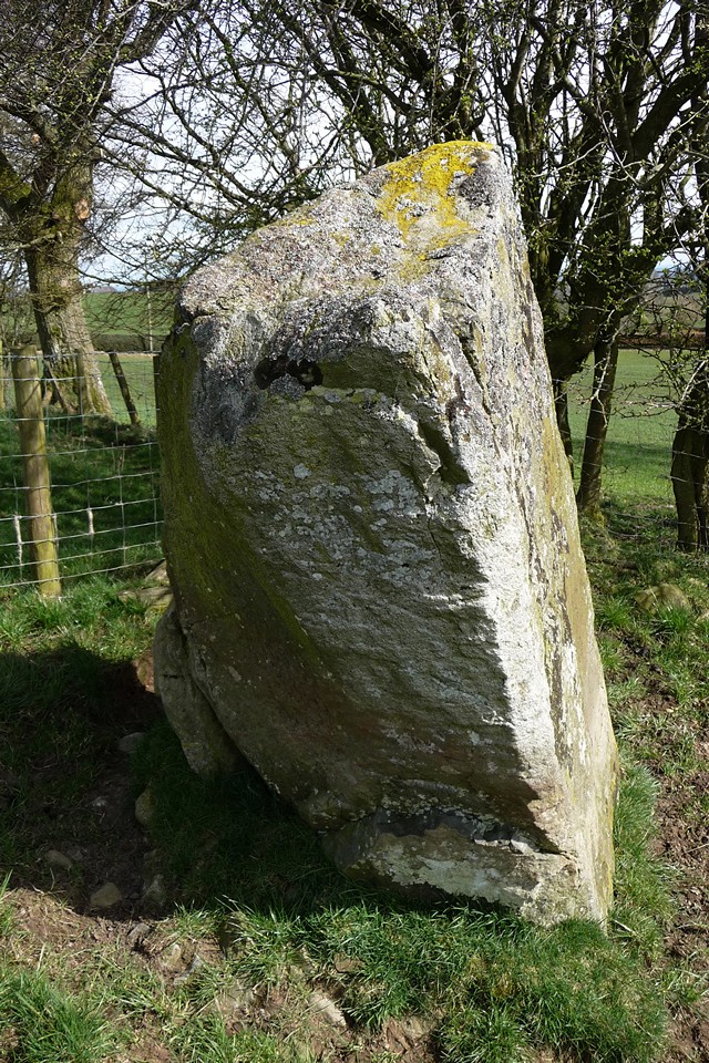
Standing 2m tall, Carreg-y-Big is probably Shropshire’s tallest standing stone, just topping the large pillar at Mitchell’s Fold to the south. The name looks like it should mean “The Big Stone”*. Damn accurate with their names, these Welsh folk (I know, it’s not in Wales). I was mainly aware of this one from Postie’s lovely snow-bound pictures from a year and a bit earlier, but it looks equally impressive in watery Spring sunlight.
I’m particularly taken with the quartz vein running through the stone, being a sucker for a bit of quartz. There is also evidence of packing at the stone’s base. The positioning is slightly obscured from the east due to a hedge, but otherwise the stone would be prominent and just the kind of thing that could be used as a way marker, perhaps pointing the way to nearby Selattyn Hill ring cairn. Cynynion, a further, very similar, stone lies a mile and a half SSW.
Although we’ve only managed another 5 miles of Path, this takes us just over the 50-mile mark overall. The southwards progress feels palpable now that we’ve reached Shropshire and are heading towards countryside I know (or at least once knew). Rather than the tail between legs retreat of Henry II, we can stride onward with renewed confidence. Our next trip will take us to one of Shropshire’s - and indeed England’s - premier hillforts, so there’s much to look forward to.
----------
*Not true, sadly. Rhiannon suggests "Peak(y)/Point(y) Stone", which seems more likely.
|
Lakeshore and dark peak – Carmarthen Fan 26 February 2011
An invite to join some friends on a late-winter circuit of the Carmarthen Fans, the most westerly of the four mountain ranges in the Brecon Beacons National Park, is one not to be sniffed at. I first visited the summits of Fan Hir and Fan Brycheiniog on a summery solo walk that took in Cerrig Duon & the Maen Mawr, but on that occasion the next summit of Picws Du looked a long way off. A month ago I made the long trek to the isolated and wonderful Nant Tarw circles, in a bitter cold that enveloped the peaks in an eerie blue and only served to increase my desire to get back out into these hills.
Visiting this area on foot is difficult, the bus routes don’t come that close and are in any case infrequent, catering for a limited amount of passengers on their way to the hubs of Llandovery or Brecon. It becomes apparent from our circuitous route to get here, via Trecastle, that even by car this is a remote place, roads into the vast tract of open countryside north of the mountains being largely absent. We park up just past Blaenau, at the end of the narrow road that follows Cwm Sawdde. This, incidentally, is the start-point suggested by Gladman, and it’s a good place to begin. From here a broad track will take us southeast then south alongside the tumbling, white-water stream that leads eventually to the first of today’s objectives, the legendary lake of Llyn y Fan Fach (“Small Lake of the Beacon”, to distinguish from its larger sibling, Llyn y Fan Fawr).
As we make our way up the track, a steady climb, the mist to our south parts occasionally to reveal glimpses of a black wall of towering rock. This is the escarpment of Y Mynydd Du, the Black Mountain, playing hide and seek with us for the moment, but revealing enough to show us that there is a formidable climb ahead. Over to our left, the unmistakable fork-tailed shape of a red kite swoops and glides as it quarters the empty moorland below the escarpment, looking for sustenance in this inhospitable landscape.
The lake itself, when at length we reach it, is grey and opaque today, not yielding any of its secrets to casual visitors. Above tower the cliffs of Picws Du, topped with a Bronze Age cairn that cannot be seen from below. So I guess we’ll have to go up if we want to see it.
From the little single-roomed stone bothy next to the lake, a slight path heads almost due east up the flank of Waun Lefrith, steepish at first and getting steeper as the top is approached. I temporarily leave my companions behind here, not for any reasons of competition or nonsense like that, just because I’m keen to get up to see the views and also to seek a little solitude in this enormous landscape. Looking back as I pause for breath, the top of Picws Du is now emerging from the mist as a flattish summit, jutting forward from the escarpment and providing a backdrop for Llyn y Fan Fach, already seeming far below me.Once the ridge is gained, it’s a much less steep stroll the rest of the way to the day’s first summit, Waun Lefrith (“Milk(y) Moor”, somewhat obscurely). This is a fairly featureless summit, with no cairn other than a small walkers’ effort. It does however boast a very good, high-level view of the massive Bronze Age cairns on the range’s most westerly summits, Carnau’r Garreg Las and Garreg Lwyd. The summits ahead of us along the escarpment to the west are also emerging from the mist, although Fan Foel is still playing hide and seek.
The walk from here to the summit of Picws Du, with its attendant cairn, is gentle enough, with little descent and re-ascent between the two peaks. The views are terrific though, especially from the cliffs of Cwar-du, where the ground drops dizzyingly to the lovely lake below. An awesome spot, especially as the sun bursts through the mist to paint a patchwork of light on the browns and greys of the uplands below us.As the Picws Du summit cairn comes into view, it becomes apparent that it has a very decent sized footprint, but is now quite low, with a smaller walkers’ cairn plonked on the top, possibly/probably made from stones from the original monument. There are some pretty big blocks in the original though and the footprint suggests it would have been a big cairn. In any case, the setting more than compensates for any deficiencies in the cairn itself. The views north over the escarpment edge are awe-inspiring, even on a day of fairly short visibility like today. And as we stop to take it all in, the mist lifts properly and blue skies open above us. Ah, what a wonderful world. And what a place to be interred.
Incidentally, the name is obscure – the Nuttalls translate it as “Black Peak”, but I’ve not managed to find a translation for “picws” in any Welsh dictionary yet, so I’m not sure of this. Any ideas? The route from Picws Du to the next cairn, on Fan Foel, is easy enough but includes a fairly steep up-and-down, via Bwlch Blaen-Twrch (“pass of the boar's summit”). Once negotiated, there is a fine high-level retrospective view of Picws Du summit before we head over to the magnificent cairn placed right at the apex of the escarpment, the point where Carmarthenshire meets Powys/Brecknockshire.
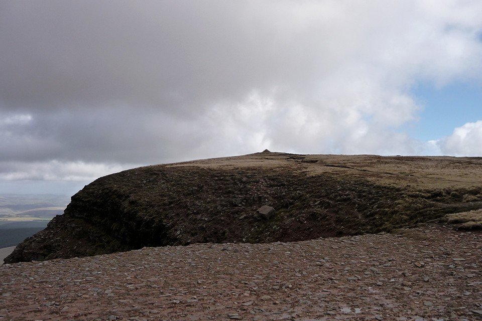
Was this always a territorial marker? If it was, it’s a high place for the people of power to agree upon their frontier. And perhaps such a person was laid to rest here, interred within a sizeable kerb of red sandstone blocks. If he or she were the monarch of all they surveyed, they certainly ruled over a far-reaching territory, for the views are extensive indeed, stretching eastwards to the twin summits of Pen-y-Fan and Corn Du then further away to the Black Mountains, with many other cairned summits in between. And yet the archaeological record reveals perhaps something rather more intriguing and human than a story of powerful warriors. A child was buried here, possibly garlanded with meadowsweet flowers. If only these stones and mountains would share the memory of that little sliver of history, what a tale they might tell.
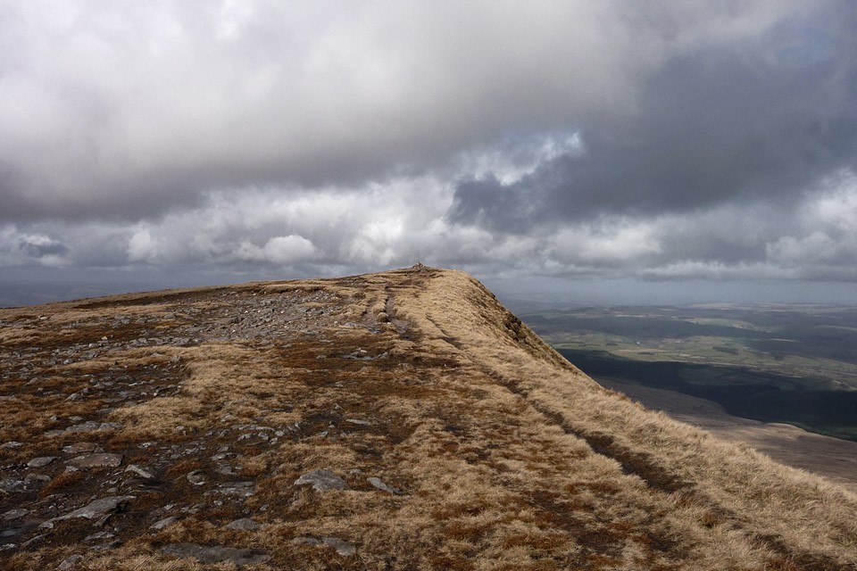
This cairn is ignored by many walkers, hurrying between the “tops” of Piws Du and Twr y Fan Foel/Fan Brycheiniog. But sadly enough come here to cause damage to the structure, which is what prompted the excavation and exposure of the magnificent kerb and half-buried cist. Probably the best of cairns on the main escarpment of Y Mynydd Du, this place will richly reward any TMAer making the trip. From Fan Foel, it’s not far at all to the next of today’s cairns, Twr y Fan Foel. Last time I came here from Fan Hir, a walk that is do-able using the Neath-Brecon bus service, but there’s no doubt that today’s approach is more satisfying. The cairn itself is a bit of a wreck, eroded at its base and piled into a silly cone. Purely as a structure of earth and stone, it lacks the charm of the wonderful ring on Fan Foel. But the view is astonishing. The ground drops away to north and east, and this is perfect viewpoint for the second of today’s mountain lakes, Llyn y Fan Fawr. From up here, it’s hard to believe that the lake itself is located at as-near-as-dammit 2,000 feet up. The cairn is at the highest point of Y Mynydd’s Du magnificent escarpment and boy, what a place for a monument. Worth every bit of energy and effort to get up here.
Sadly we don’t linger so long at this one, my companions are getting hungry and a bit further along the escarpment, at the southern summit, there is a drystone shelter that has been identified as our lunch spot. There’s nothing on Coflein to suggest that this shelter has been fashioned from an ancient cairn, so I can feel relaxed about making use of it. For all that the sun is shining, it’s still bitterly cold up here and a stop of any duration is going to see a sudden drop in body temperature. It’s here that we meet the only other people that we’ll see today. Not far to the SW of the summit is the spot where an Avro Anson crashed in thick cloud and rain, back in peacetime 1939, a stark reminder of just how bad the weather can get in and above these mountains.
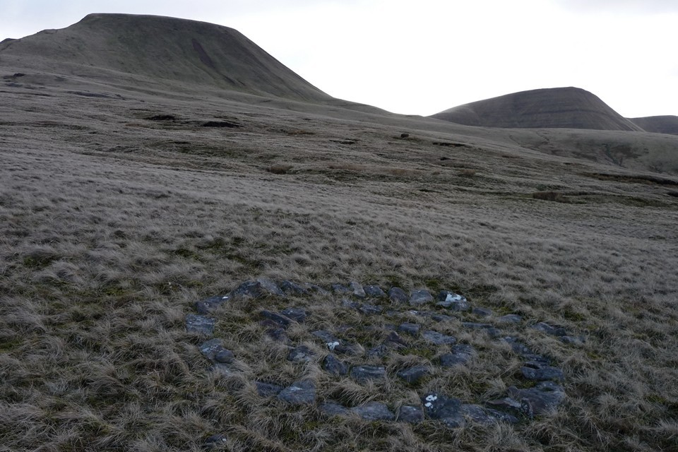
Suitably refreshed, it’s time for the big descent. We follow the escarpment down to Bwlch Gledd, from where the Beacons Way basically goes over the cliff! Luckily the path has been resurfaced recently, but this is still a tricky, slippy route that takes us, rather gingerly, down to the edge of lovely Llyn y Fan Fawr. Everyone has rubbery legs by the time we get to the bottom! We follow lakeshore and escarpment foot, basically retracing our earlier route, but 200m lower down.One of the main attractions of this walk for me, apart from the brilliance of the summit cairns, is the two stone circles shown on the OS map along our return route. The second, Bannau Sir Gaer, is the better known, already visited and chronicled by Postie. But the first is virgin TMA territory. Coflein are dismissive of the site, and on getting here it’s easy to see why.
We found the narrow track that the OS map shows as bisecting the site easily enough, but it crosses an area of plentiful small stones. Some are vaguely upright, but it would take a determined eye to be convinced that there is a circle here, unless we’ve missed something. My companions were certainly not impressed! Not far from the site, we came across a neat little spiral of blocks, half-hidden in the tufty grass. Someone has spent time here, to make that. To be fair, the setting is lovely, with the pointed prows of be-cairned Twr-y-Fan Foel and Fan Foel providing the main focal points. To the north, the land gradually slopes away towards Nant Tarw, although the circles aren’t visible from here, as far as I could tell.
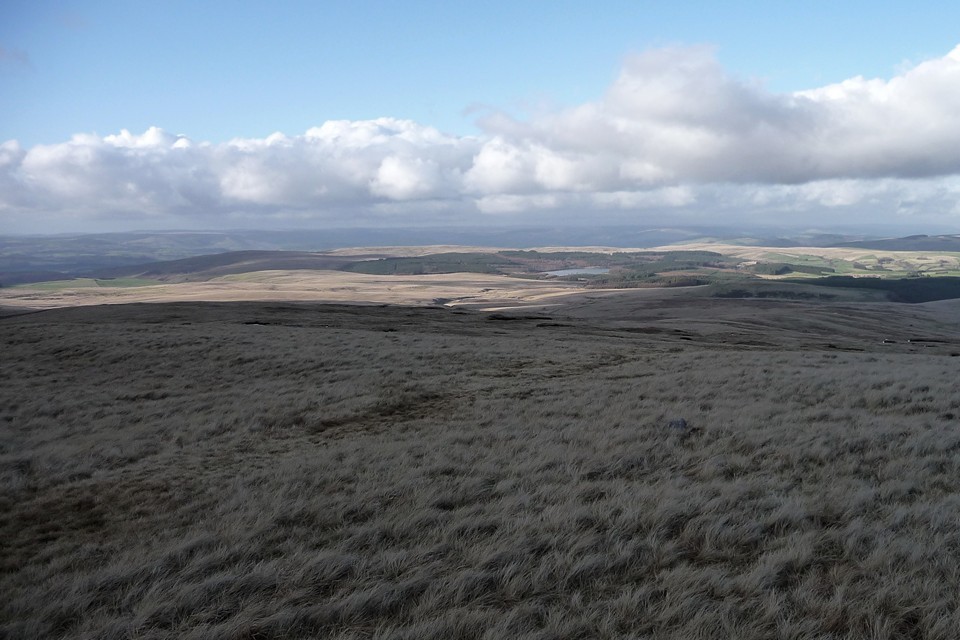
We head away from the setting across the tussocky, peaty moor of Waun Lwyd, close to the source of the river Usk/Afon Wsyg, one of South Wales' major rivers, which passes close to the Nant Tarw circles as well. It may be significant that the Tawe, another important river, rises not far away to the east, before passing Cerrig Duon & The Maen Mawr. There’s certainly plenty of scope for water-based theory and speculation about the siting of these monuments. The final site of the day proves to be a winner. By the time we reach Bannau Sir Gaer, all but one of my friends has had enough, and don’t even make the effort to leave the path the look for this. The one who is left at least comes to the circle, but isn’t massively impressed, to be honest. Which just shows that this game isn’t for everyone!
And so it comes to be that I’m left here on my own for a while, just as the sun re-emerges to illuminate the site in a golden glow, while the mountain backdrop is silhouetted into a wall of dark browns and black shadow. Spectacular. The circle is a wreck, it doesn’t matter a bit. A fine addition to the utterly compelling megalithic complex spread across these wild uplands. The final walk back to the car is by now a shattered stumble, as shadows lengthen and legs tire. But this has been a brilliant day out, eyrie-high burials, fractured circles and depthless lakes combining to make for an almost perfect TMA daytrip. It’s impossible not to feel that there is still much more to be discovered here. If I can, I shall come back one day.
|
Over the misty mountains II – Foggy, boggy Berwyns 20 February 2011
It’s day two of our Llangollen long weekend. Yesterday we undertook the important business that brought us here, completing the easy Offa’s Dyke Path section from Llangollen to Chirk Castle Mill without mishap, crossing “that old snake they call the Dee” in good order. After that largely flat route, today is a day reserved for the hills. Weather-dependent, I had a couple of options in mind, including a first-time trip into the Berwyns or a walk up Llantysilio Mountain to Moel y Gaer and Moel y Gamelin. The worse-weather option is to pay a visit to the ring cairn of Moel Ty Uchaf.
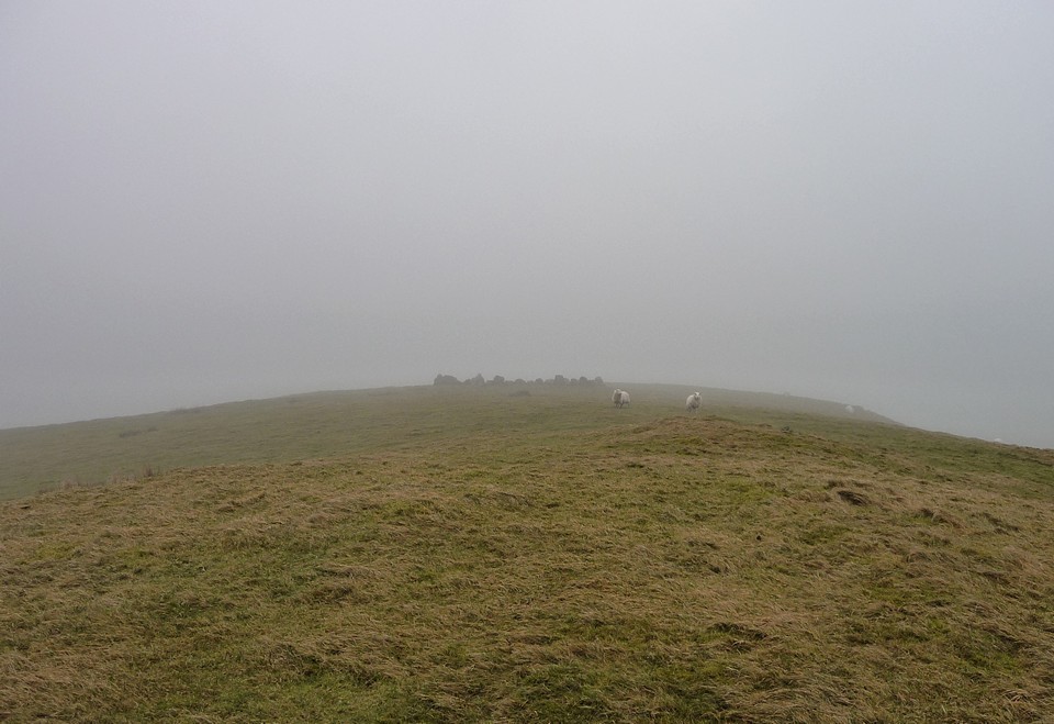
Sadly the morning opens similarly to yesterday, thick mist rising above the Dee valley. At least Castell Dinas Bran is (just) visible today, so that’s an improvement, but not really the day for the conical Llantysilio. So the plan that takes shape involves getting to Moel Ty Uchaf and then see how things are.We take the bus towards Llandrillo, passing the visible remains of the Tan-y-Coed chambered tomb. The driver very obligingly drops us off at Pont yr Hendwr (“Bridge of the Old Water”), from which a minor road takes us southeast, climbing steadily at first, then with increasing steepness up into the Berwyn foothills. By the time we reach the end of the road to join a rather muddier bridleway, we are both out of breath and overheating under our waterproof coats, while the mist has thickened into a fog that reduces visibility to a hundred yards or so. We hear rather than see some voices ahead, presumably other walkers heading off to the main Berwyns ridge, their voices brought nearer by the weird sonic effects of the fog.
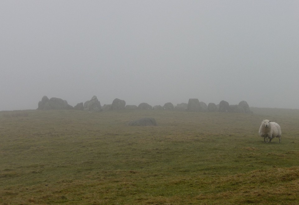
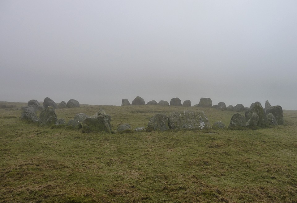
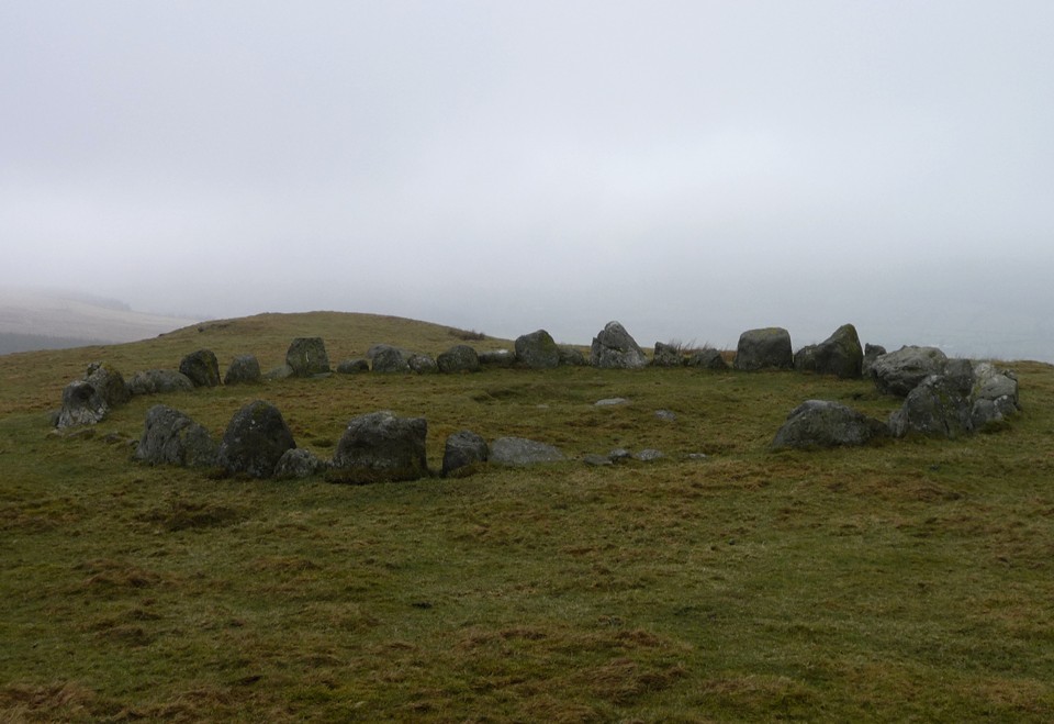
The final approach to the ring cairn is up a steep, grassy slope. The circle doesn’t come into view until we are almost at the top – luckily the fog is thin enough to at least show us where to go. The local sheep look on, bemused by the stupid humans coming into their midst in these conditions. Sadly, the far-reaching views from the ring cairn are entirely absent, but we do at least get plenty of solitude to enjoy the stones themselves.
The name, pronounced “Moil Tee Ickavv”, translates as “house on the highest bare hill”, which certainly seems apt today, when the undoubtedly higher hills normally visible in just about every direction are blanked out.
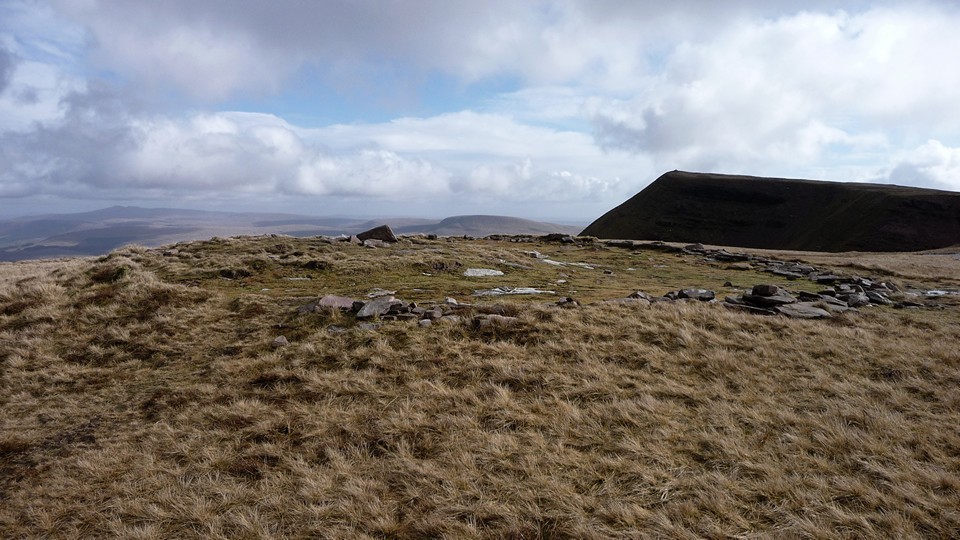
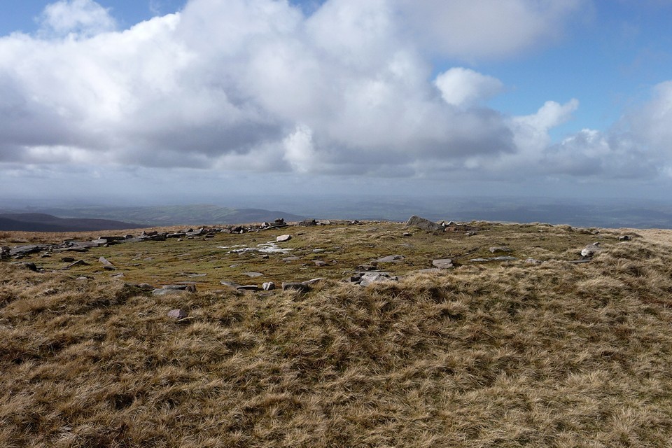
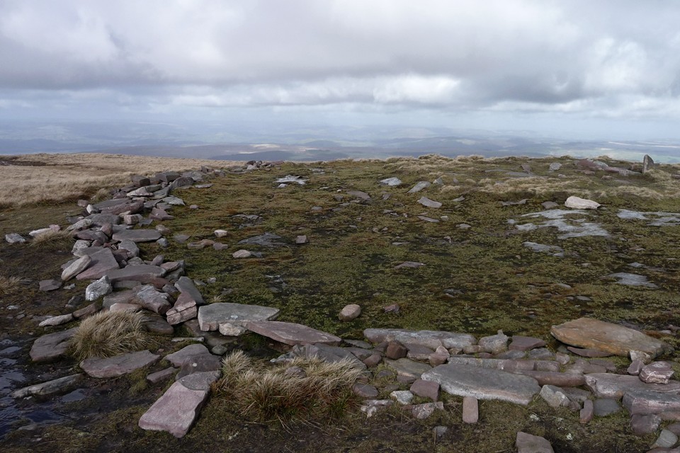
A rounded boulder lies a little way to the west, described by Burl as an outlier of the circle. The circle itself is made up of chunky stones, some round shouldered, others squared, not graded but nevertheless very aesthetically pleasing. There is a “gap” at the SSW, although the ring continues across it by use of seven or eight much smaller stones. Inside the ring are the remains of a cist or central cairn, on the largest stone of which someone has scratched a crude pentagram. Other than that, the place is devoid of signs of human intrusion, no litter or offerings (tat), just the stones on their grassy hilltop. Perfect.
The fog makes for a strangely intimate visit, not exactly claustrophobic, but there is a sense that the world may not extend much beyond our immediate surroundings. I’m reminded of the Doctor Who story “Warrior’s Gate”, where the TARDIS becomes trapped in a slowly-shrinking, featureless void between universes. A wonderful site this, but a return on a clear day is now assured.
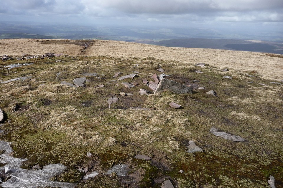
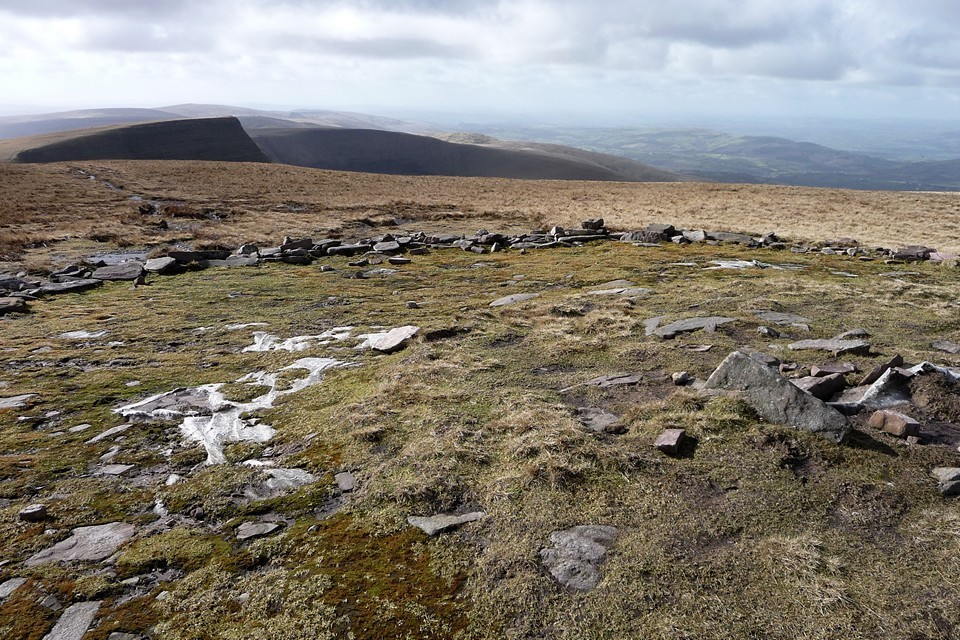
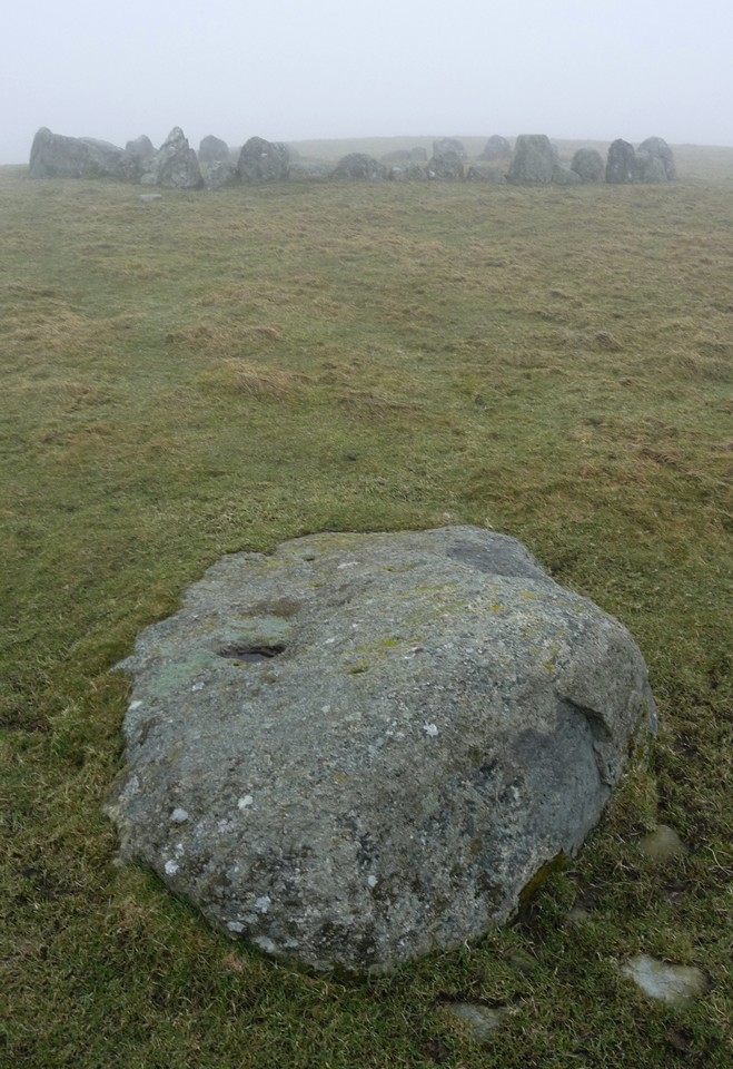
We make our own escape from the void by dropping off the hilltop to the southwest, to investigate the two cairns shown on the map, somewhat unusually placed in the saddle between Moel Ty Uchaf and the rising ground to the east. The two cairns differ greatly in construction, the northeastern being a wide, low platform, kerbed liberally with small blocks of local quartz that stands out brightly against the turf covering much of the contruction. The southwestern cairn is much smaller, covered in several flat slabs of stone and overgrown with reeds. The stones of the circle standing proud on the hill above are visible from the cairns, an obvious relationship between them all.
It’s late morning by now and the fog is showing no signs of lifting. I’m torn between a desire to climb at least one mountain and the more sensible option of heading off the hills, perhaps taking in a visit to Tyfos ring cairn. According to my little Nuttalls book, there is a one summit, the faintly ridiculously-named Pen Bwlch Llandrillo (north top), within reasonably easy reach of where we are. I suggest this to G/F as an objective and receive no objections, so we leave the cairns and join the stony track heading eastwards and upwards towards Pont Rydd-yr-hydd, an old stone bridge crossing the Nant Cyllyll that tumbles and splashes over broken rocks from the slopes above. Shortly after this we meet a group of trail riders out on their bikes, the first and last people we will encounter today.
Below Pen Bwlch Llandrillo (north top) is a memorial to “A Wayfarer, a lover of Wales”. We stop here for a snack before leaving the comfort of the track for a rougher path along the fence, heading north to the summit above us. The fog is thickening and progress is slow, but at length we reach the highest point we can find, a small pile of stones on top of an outcrop, at 621m OD. Not the most impressive for my first North Walian summit and G/F’s first Welsh mountain! Sadly there are still no views, so little to recommend this today. Not even a prehistoric summit cairn to cheer us.
From here we have to decide on a route onward, either to go back to the track and homewards or continue on to the most northerly of the Berwyns’ summits, Moel Fferna. With hindsight, the decision made here was the wrong one, but hey, that’s the problem with hindsight! We decide to go on, rather more my choice than G/F’s, it has to be said.On the map, the route looks straightforward, with little in the way of ascent or descent over the three miles or so between Pen Bwlch Llandrillo (north top) and Moel Fferna. The Nuttalls helpfully inform us “a path has developed beside the fence which runs the whole way, making walking and route-finding quite straightforward”. Sounds fine, even on such a fog-bound day as today. What neither map nor guidebook tell us is just how miserable a slog the next three miles will turn out to be. For a start, on heading northeast we have found ourselves more exposed to a wind now blowing in keenly from our front-right. The wind carries with it a stinging rain, quickly lowering our temperature and splattering my glasses to render the already limited visibility almost non-existent. Secondly, the “path” that “has developed” is barely anything more than a boggy rut cutting through heather and mud. The surface is anything but level, every few steps requiring a detour around a crumbling peat hag or muddy pool. The heather drags at our shins, making each lift of the leg a trial.
With no visibility, it becomes near-impossible to gauge how far we’ve come and how far we still have to go. Instead, we concentrate all our efforts into placing our feet and forcing ourselves on into the soaking, freezing wind. Although there is little real up-and-down, each minor rise becomes an impediment of cliff-like proportions. By the time we reach Cerrig Coediog, we’ve pretty much had enough, but we’re so close that it would be a waste of our efforts so far to turn back. We plod on down to the bwlch, from where one last climb to the summit awaits us.
At first a broad, muddy path heads away north, but soon reaches an area of waterlogged, impassable bog. The only option is to divert around to the west, but this involves leaving the path to force a way through the tough heather that characterises these Berwyns slopes. Progress is very, very difficult. G/F’s leg is playing up at the constant lifting needed to negotiate the vegetation. Despite waterproof boots, her feet are now quite wet (mine aren’t much better) and there is little in the way of enjoyment to be had from any of this. Eventually we hit a narrow path running laterally across our route, we still can’t see the summit so it’s difficult to know how far we have left to go. We take this and soon meet up with the main path again, still making its way north and upwards.
The final straw looms out of the mist in the shape of a stile. You know those stiles that you sometimes find on uphill routes where even getting your leg onto the lowest board is a struggle? One of those. I have been with my G/F for a long time, but never have I seen such an expression of “I’m going to kill you” as I do when she sees this stile. Any comment I could make along the lines of “nearly there” is unlikely to help now. But we climb the stile and plod on, across yet more featureless bog.
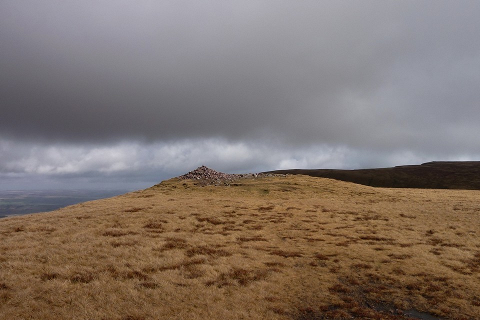
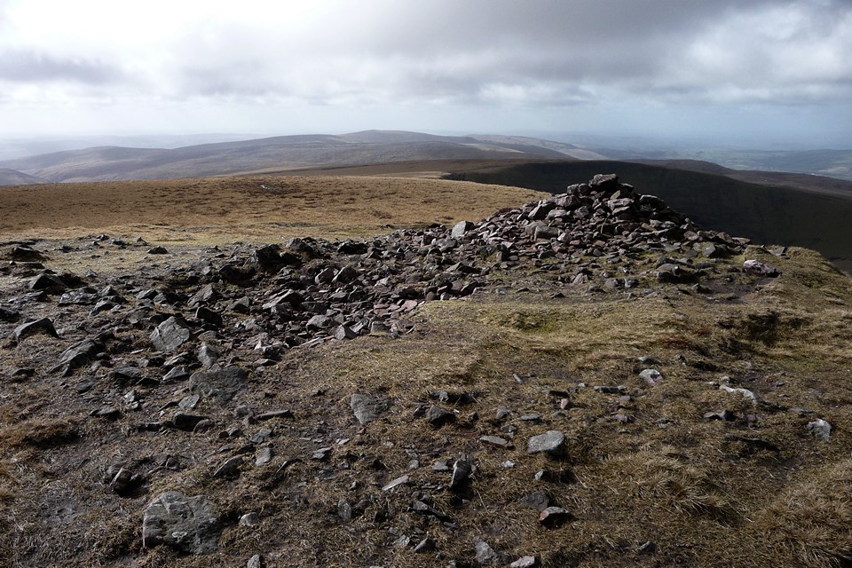
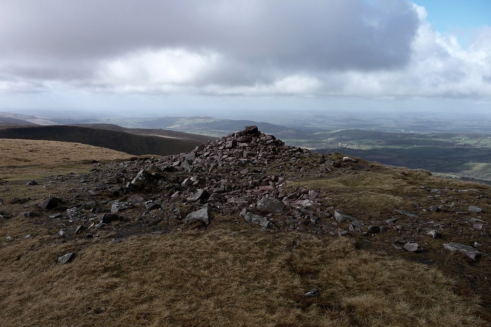
At last, a shape looms out of the mist ahead of us. The unmistakable shape of a sizeable summit cairn. We’ve made it! It’s taken us 1 hour and 50 minutes since leaving Pen Bwlch Llandrillo (north top) but it feels like several weeks have passed. Much as I dislike the idea of a Bronze Age summit cairn being turned into a shelter, we have little choice but to embrace its waiting charms. The only solution now is hot tea, and quickly.
Perhaps it’s because we’re British, but the restorative power of hot tea, even the metallic variety from a cheap flask, should not be underestimated. Out of the wind and rain, we start to feel like we may survive the walk back to the bus. Suitably envigorated, I also take some time to have a look at the cairn that we’ve come so far to see. It’s a big bugger, despite its mistreatment over the years. Slumped on one side, there is still a substantial amount of material here. Just a shame that the undoubtedly superb views are absent today. Some snow still clings to the base of the cairn, a reminder that it’s only February and we’re above 2,000 ft here.
We take our leave once we’re feeling warmer and re-energised. We head back the way we had come, but somehow manage to find a slightly easier route back to the bwlch without resorting to quite the heathery nightmare of the way up. We elect to take the easiest route we can back to Cynwyd, following a relatively easy footpath heading WNW. A few days earlier I had discovered the Nant Croes-Y-Wernen stone circle on Coflein, but although it’s only a few hundred yards away, it might as well be a thousand miles now. One for Postie to be the first to get to!
The way through Cynwyd Forest is easy, losing height rapidly along firm forestry tracks. At length and with much relief we reach the village, where we have a cold and tired 40 minute wait for the next bus back to Llangollen. Our introduction to the mountains of North Wales has hardly been auspicious, but what doesn’t kill you only makes you stronger, so they say. To misquote a certain northern singer, we can laugh about it now, but at the time it was terrible. Here’s to the foggy, boggy Berwyns.
|
|
"The fleeting hour of life of those who love the hills is quickly spent, but the hills are eternal. Always there will be the lonely ridge, the dancing beck, the silent forest; always there will be the exhilaration of the summits. These are for the seeking, and those who seek and find while there is still time will be blessed both in mind and body." Alfred Wainwright
"The movers move, the shakers shake, the winners write their history. But from high on the high hills, it all looks like nothing." Justin Sullivan
Elsewhere: Mastodon
|